


![]()
Вы здесь
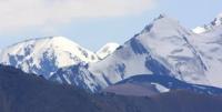
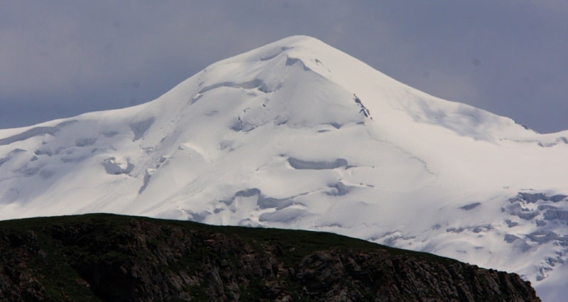
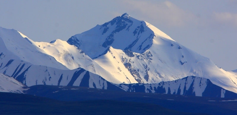
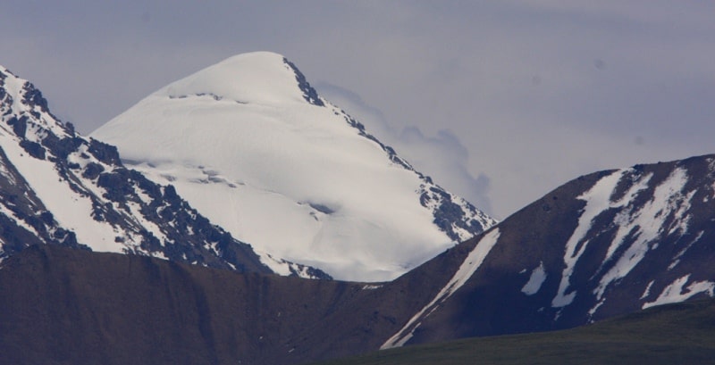
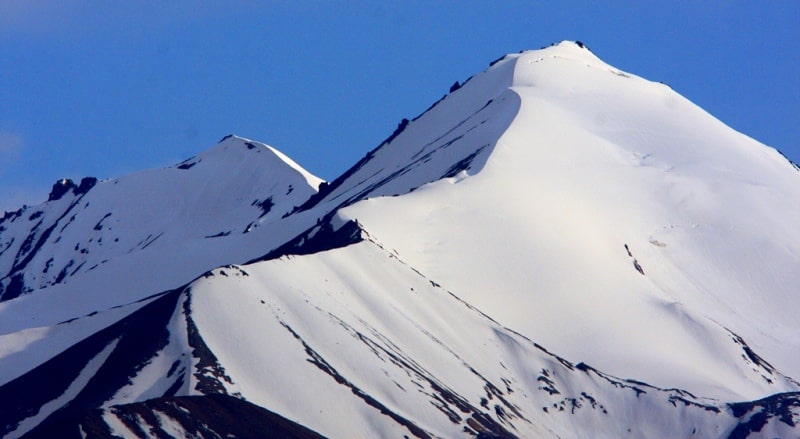
Glaciers of Kakshaal-Too ridge.
Adventures travellers in Kyrgyzstan mountains.
“Travel makes one modest. You see what a tiny place you occupy in the world”
Gustave Flaubert.
Free independent traveler in Kyrgyzstan.
The southern border of the Inner Tien-Shan is the Kakshaal-Too Range, which extends from the southwest to the northeast for almost 600 kilometers. Within the limits of the Inner Tien Shan, the western part of the ridge enters the valley of the Sary-Jaz River in the east with the highest point - Dankov peak, 5982 meters above sea level.
The northern slope is located on the territory of Kyrgyzstan ridge, southern - on the territory of the People's Republic of China.On the northern slope of the Kakshaal-Too ridge, within the indicated limits, 616 glaciers
an area of 907.6 square kilometers. Valley glaciers prevail (36% of the number and 76% of the area). In second place are the glaciers of the slopes, in third are the glaciers of flat peaks. The westernmost part of the Kokshaal-Too ridge to the gorge of the Kakshaal River in the east is a vast plateau about 4300 meters above sea level, the rest of the ancient peneplen.
Here, as well as on the small ridges of Kokkiya and Sarybeles located to the north, there are 63 glaciers with a total area of 70.7 square kilometers, of which 28 are glaciers of flat peaks, their area is 54.1 square kilometers.
The rest are small valley and caravan glaciers. A section of the ridge with a length of about 70 km between the through valleys of the Kakshaal and Chon-Uzengu-Kuush rivers is the highest (average altitude 5700 meters above sea level.
In the center of this section, in the area of Dankov peak, is located the Ak-Sai glaciation site - one of the largest in the Tien Shan. In total, there are 153 glaciers on this site with a total area of 443.4 square kilometers.
Glacier valleys predominate in number and area, with most of these glaciers and the largest of them are grouped in the central part. These are valley and complex valley glaciers, occupying the upper reaches of the meridional valleys and feeding from firn fields that stretch as a continuous strip along the axial part of the ridge, and from the gentle slopes of the lateral spurs.
The wide ends of large glaciers go into the foothills, descending to a height of 3800 - 4300 meters above sea level. The largest glaciers of this section are Komarova Glacier in the upper Kyzylunet River, Mushketov Glacier in the Ortotash River Basin, Nalivkin and Mullitsky Glaciers in the upper Aital River and others.
These are complex valley glaciers, merging from several streams with well-defined middle moraines. About 150 kilometers in the eastern section of the Kokshaal-Too ridge, 400 glaciers with a total area of 393.5 square kilometers in the Ak-Shyyrak river basin.
In the western, less high part of this section, the maximum height is 4880 meters above sea level, there are many small disconnected caravan and hanging glaciers. To the east, the height of the ridge increases to 5390 meters above sea level.
In the same direction, the size of glaciers increases and the area they occupy changes type of glaciation. Glaciers receive additional feeding by avalanches from the slopes, and the nutrition asymmetry is clearly expressed - from the western windward, more snow-covered slopes it much more than the leewards of the east.
The end parts of glaciers are covered with moraines. There are signs of degradation - fresh deposited moraines, patches of dead ice. Between the Terskey-Ala-Too ridge in the north and the Kokshaal-Too ridge in the south there are several latitudinal ranges that rise relatively low above vast expanses of syrts and intermontane basins.
These are the ridges of Jetim-Bel, Jetim, At-Bashy, Borkoldoy, Dzhangiger and others. In crest Alpine relief with ancient glacial forms - mostly occupied by modern glaciers - is developed in parts of these ranges. Icing is dispersed. Glaciers are located in the higher parts of the ranges. mainly on the northern slopes. In terms of number, hanging glaciers prevail on these ridges (65%), but valley glaciers occupy a large area (about 70%).
There are 17 glaciers larger than 5 square kilometers, but in general glaciation is represented by small glaciers. The height of the firn line is from 3900 to 4400 meters above sea level. To the north of the Kokshaal-Too ridge, separated by Chatyrkel and Ak-Says syrty and longitudinal valleys of the Muyuryum and Chon-Uzengu-Kuush rivers, they stretch from the south-west to the north-east At-Bashy, Dzhangiger and Borkolda ridges, which are a watershed between the rivers of the Naryn and Tarim depressions.
Ridge of Borkoldoy. The most significant is the glaciation of the Borkolda ridge (average altitude 4300 meters above sea level, maximum 5170 meters above sea level) - 396 glaciers with a total area of 250.3 square kilometers.
The Borkolda Range is a complex, deeply dissected system of mountain ranges about 100 kilometers. Most of the glaciers are located on the northern slope in the basins. the left tributaries of the Naryn rivers - the Karakol, Chakyrkorum and Tuyuk-Chakyrkorum rivers.
On the At-Bashy ridge, the highest point, 4786 meters above sea level, 149 glaciers with an area of 106.2 kilometers square. The area of glaciation is approximately equally divided between the northern and southern slopes, but small kar and hanging glaciers predominate on the north, and on the south, which gently slopes down to Chatyr-Kol and Ak-Say syrts, mostly valley glaciers ending at an altitude of 3900 - 4100 meters above sea level.
The largest glacier, with an area of 6.9 kilometers square, lies at the head of the Mustavas River. On the ridge Dzhangiger 164 glaciers with an area of 59.8 square kilometers. Glaciation is more intense in the eastern part of the ridge, whose height is 4500 - 4700 meters above sea level.
Hanging glaciers predominate. The largest glacier with a length of 4 km and an area of 4.5 square kilometers lies in the upper reaches of the Dzhaldzhir River. The average height of the ends of the glaciers is 4000 meters above sea level.
On the ridge Jetim-Bel, up to 4627 meters above sea level, 116 glaciers, their area is 71.5 square kilometers.
Small, mostly hanging, glaciers located along the ridge mainly in its western and central parts and occupy cars and circuses Northern exposure. On the northern slope there are more glaciers and they are larger. The average height of the ends of the glaciers is 3750 meters above sea level on the northern slope and 3900 meters above sea level on the southern.
On the ridge Jetim, altitude up to 4896 meters above sea level, 195 glaciers with a total area of 135.6 square kilometers. The degree of glaciation and the size of glaciers increase from west to east with increasing ridge height. The glaciers of the northern slope are larger.
On the Nura ridge, there are glaciers only on the northern slope - 29 glaciers with an area of 25.9 square kilometers. The ends of the glaciers descend to a height of 3740 - 3790 meters above sea level. On the ridge Suyuk 51 glacier with an area of 38.5 square kilometers.
On the northern slope, small valley glaciers descend to the surface of the Arabel syrts (3900 - 4000 meters above sea level), and on the south - hanging glaciers. The largest is the Mitor Basin Glacier, with a length of 2.6 kilometers and an area of 3.8 square kilometers in the Taragai river basin.
In the Naryn-Too mountains (average altitudes 3800 - 4300 meters above sea level, the highest point 4531 meters above sea level, 239 glaciers with an area of 69.4 square kilometers. In the northern slope, 2/3 of the glaciation area of the Naryn-Too mountains is concentrated.
Small glaciers only one glacier is more than 2 square kilometers. The height of the ends of the glaciers is 3800 - 3900 meters above sea level. Small glaciers, mostly kar and hanging, are also found in the western part of the Inner Tien Shan on the highest sections of the Kekirim-Too Mountains (17 glaciers with an area of 3.6 square kilometers, Jaman-Too (66 glaciers with an area of 19.8 square kilometers, Bai Biche -Too and Ak-Chetash (8 glaciers with an area of 4.3 kilometers square) and Kapkatas (10 glaciers with an area of 1.6 kilometers square) (Bondarev, Zabirov. 1964; Bakov. 1983).
The orography of this area (the area of Pobeda Peak) is the highest and most inaccessible part of the Tien-Shan. In the north of the Terskey-Ala-Too ridge, it is a watershed between the Sary-Jaz river basin and the rivers of the Balkhash Lake basin.
To the south of it are the latitudinal ranges of Sary-Jazz, Tengri-Tag, Engilchek-Too (Inylchek-tau), Kayyngdy-Katta and Postyshev. The southern boundary of the Central Tien Shan is the eastern part of the Kokshaal-Too ridge, which encircles the area under consideration at a distance of more 100 kilometers.
The average height of the crests of the latitudinal ranges of the Central Tien-Shan is 4,500 - 4,700 meters above sea level, the ridges rise from west to east (the highest peaks are Pobeda peak, 7439 meters above sea level, Khan Tengri peak, 6995 meters above sea level, Peak Marble Wall, 6150 meters above sea level.
The northern slopes of the ranges are short and steep, the southern longer and flat. These ridges in the east are connected by a meridional ridge stretched from south to north with heights of more than 6000 meters above sea level, from which glaciers flow west, to Kyrgyzstan, and east, to the People's Republic of China.
Northwestern slope of Kakshaal-Too ridge has about 1000 glaciers with a total area of about 1,500 square kilometers. Northern slope of Kakshaal-Too carries on northern and northwestern slope, Engilchek-Too and Kaindy ranges, about 300 glaciers with a total area of over 625 square kilometers.
Largest glaciers of Kakshaal-Too ridge.
North Kakshaal-Too.
Kaindy Glacier, with a length of 29.0 kilometers, an area of 37.2 square kilometers, located at an altitude of 3400 to 5520 meters above sea level, belongs to the Kaindy River Basin.
Zvezdochka Glacier, with a length of 17.3 kilometers, an area of 58.1 square kilometers, located at an altitude of 4100 to 7440 meters above sea level, belongs to the Engilchek river basin.
Komsomolsky Glacier, with a length of 14.0 kilometers, an area of 55.8 square kilometers, is located at an altitude of 3800 to 6090 meters above sea level, belongs to the Engilchek river basin.
Kuyukap Glacier, with a length of 12.9 kilometers, an area of 13.4 square kilometers, located at an altitude of 3800 to 5890 meters above sea level, belongs to the basin of the Sary-Jazz River.
Dikiy Glacier, with a length of 11.5 kilometers, an area of 24.3 square kilometers, located at an altitude of 4010 to 6920 meters above sea level, belongs to the Engilchek River Basin.
Kanjailau Glacier, with a length of 11.4 kilometers, an area of 17.8 square kilometers, located at an altitude of 3160 to 5700 meters above sea level, belongs to the Engilchek River Basin.
Proletarsky Tourist glacier, with a length of 11.0 kilometers, an area of 41.6 square kilometers, is located at an altitude of 3860 to 6540 meters above sea level, belongs to the Engilchek river basin.
Glacier No. 215, with a length of 8.8 kilometers, an area of 11.1 square kilometers, located at an altitude of 3800 to 5580 meters above sea level, belongs to the Engilchek river basin.
Samoilovich Glacier, with a length of 8.0 kilometers, an area of 10.1 square kilometers, located at an altitude of 3440 to 5140 meters above sea level, belongs to the basin of the Sary-Jazz River.
Shokalsky Glacier, with a length of 7.7 kilometers, an area of 7.9 square kilometers, located at an altitude of 3120 to 5440 meters above sea level, belongs to the Engilchek river basin.
Central Kakshaal-Too.
Jangart Glacier, with a length of 11.3 kilometers, an area of 15.3 square kilometers, located at an altitude of 3900 to 5160 meters above sea level, belongs to the Ak-Shiyrak river basin.
Glacier No. 217, with a length of 11.1 kilometers, an area of 12.1 square kilometers, located at an altitude of 3600 to 5148 meters above sea level, belongs to the Ak-Shiyrak river basin.
Glacier No. 219, with a length of 10.9 kilometers, an area of 15.9 square kilometers, located at an altitude of 3300 to 5390 meters above sea level, belongs to the Ak-Shiyrak river basin.
Chuloktor Glacier, with a length of 10.7 kilometers, an area of 15.0 square kilometers, located at an altitude of 3640 to 5319 meters above sea level, belongs to the Ak-Shiyrak river basin.
Zhangartyn-Bashi Zapadny Glacier, 9.5 kilometers long, 15.7 square kilometers in area, located at an altitude of 3530 to 5355 meters above sea level, belongs to the Ak-Shiyrak river basin.
Zhangartyn-Bashi Vostochny Glacier, with a length of 8.5 kilometers, an area of 10.9 square kilometers, is located at an altitude of 3630 to 4940 meters above sea level, belongs to the Ak-Shiyrak river basin.
Glacier No. 211, with a length of 8.0 kilometers, an area of 7.9 square kilometers, located at an altitude of 3,500 to 5,062 meters above sea level, belongs to the Ak-Shiyrak river basin.
Glacier Ak-Oguz, with a length of 7.4 kilometers, an area of 20.1 square kilometers, located at an altitude of 3730 to 5148 meters above sea level, belongs to the Ak-Shiyrak river basin.
Latitudinal Kakshaal-Too.
Mushketov Glacier, with a length of 13.3 kilometers, an area of 23.0 square kilometers, located at an altitude of 3940 to 5200 meters above sea level, belongs to the basin of the Chong-Uzengu-Kuush River.
Nalivkina Glacier, with a length of 13.2 kilometers, an area of 19.5 square kilometers, located at an altitude of 3960 to 5700 meters above sea level, belongs to the basin of the Chong-Uzengu-Kuush River.
Glacier No. 238, with a length of 12.1 kilometers, an area of 27.1 square kilometers, located at an altitude of 3620 to 4560 meters above sea level, belongs to the basin of the Chong-Uzengu-Kuush River.
Karagerme Glacier, with a length of 11.6 kilometers, an area of 27.3 square kilometers, located at an altitude of 3840 to 5840 meters above sea level, belongs to the basin of the East Ak-Sai River.
Komarova Glacier, with a length of 10.7 kilometers, an area of 29.3 square kilometers, located at an altitude of 3900 to 5210 meters above sea level, belongs to the basin of the East Ak-Sai River.
Mullitsky Glacier, with a length of 9.7 kilometers, an area of 14.9 square kilometers, located at an altitude of 3670 to 5010 meters above sea level, belongs to the basin of the Chong-Uzengu-Kuush River.
Glacier No. 82, with a length of 8.2 kilometers, an area of 16.2 square kilometers, located at an altitude of 3880 to 4800 meters above sea level, belongs to the basin of the East Ak-Sai River.
Korzhenevsky Glacier, with a length of 7.2 kilometers, an area of 12.8 square kilometers, located at an altitude of 3860 to 5650 meters above sea level, belongs to the basin of the Chong-Uzengu-Kuush River.
South Kakshaal-Too.
Glaciers No. 11, 12, 13, 14, with a length of 11.1 kilometers, an area of 11.1 square kilometers, located at an altitude of 4170 to 4630 meters above sea level, belongs to the basin of the Western Ak-Sai River.
Glaciers No. 29, 30, 31, with a length of 5.3 kilometers, an area of 6.8 square kilometers, located at an altitude of 3900 to 4740 meters above sea level, belongs to the basin of the Western Ak-Sai River.
Authority:
"Glaciers." L.D. Dolgushin, G.B. Osipova. Series "Nature of the world." Moscow, the publishing house "Thought". 1989.
Photos by:
Alexander Petrov.