


![]()
Вы здесь
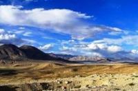
Alichur valley.

Tour to Alichur valley.
“Why do you go away? So that you can come back. So that you can see the place you came from with new eyes and extra colors. And the people there see you differently, too. Coming back to where you started is not the same as never leaving”
Terry Pratchett. “A Hat Full of Sky”.
Trip to Alichur Valley on Pamir mountains.
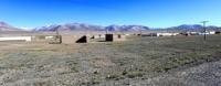
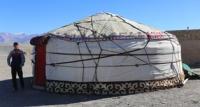
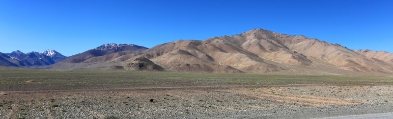
The Alichur Valley is the jewel of Murghab district, dotted with yurt encampments throughout the summer. The valley runs in an east-west direction for approximately 65 km and is bounded at its western end by Yashilkul Lake.
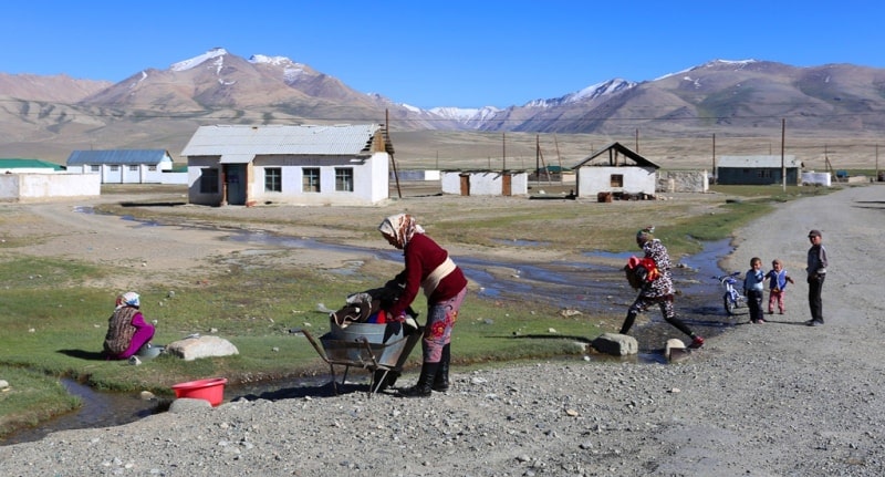
The main Khorog-Osh road runs through the valley, entering it at Alichur village. At its widest the valley is approximately 8 km. Numerous side-valleys run north and south from the main valley, and most of these are jeepable for the first several km.
Of particular interest is Bash-Gumbez, the road to which is 28 km east of Alichur village. From Bash-Gumbez village you can walk east, south or west into the Yuzhny Alichurskiy (Southern Alichur) range; the route south-east will bring you to Uchkul Lake (one day, grade 2), while the route south will lead you over the Bash-Gumbaz pass (Н-4720) to Zorkul Lake (two days) at the head of the Pamir River, the Afghan border.
Note that Zorkul lies within the restricted border zone, and to visit it you must gain prior permission from the Russian Border Forces in Khorog. 11 km east of Alichur village you can head north up the Bazaar-dara valley, and drive almost to the foot of a pass at 4,664 m. In certain years you may even be able to drive over the pass and continue on down the other side.
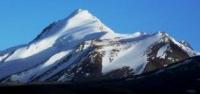
From the foot of the pass on the far side you can climb Peak Alichur (5,803 m) in one very long day. Otherwise, continue down, following the broken road to the confluence with another stream (14 km) coming in from the left (also confusingly called Bazaar-dara) - about 5 km up this valley you will find the ruins of the ancient stone settlement of Bazaar-dara.
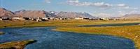
From the confluence you can continue downstream (north) on paths to the confluence with the Murghab River, see Murghab/Aksu Valley below). From Alichur village you can walk down the Alichur River, off-road (the road here swings away south to the Koitezak Pass) 26 km to the eastern shore of Lake Yashilkul 3720 meters above sea level.
The Alichur river here meanders stunningly through its valley. Just before Yashilkul, on the right side of the river, there is a hot spring and some very broken Chinese tombs. At this point you can cross the Alichur River and head south to the dust-blown village of Bulunkul (10 km) and thence a further 18 km down a road to the Khorog-Osh road.
Alternatively, you can continue walking along the north shore of Yashilkul, following a clear trail, across the Big and Small Marjenai valleys to the downstream end of the lake, over a pass at 3,920 m and on downstream (now the Ghunt, the main river of upper Shugnan district) to the confluence with the Lyangar River at the Lyangar aylaq (2 relaxed days).
At this point you can turn north and take up one of the treks to Lake Sarez (see Central Pamir, below), or continue down to the main Khorog road beyond the village of Bachor (2 days).


Authirity:
Books of: "Mountain Fanye". Authors A.S. Mukhin, V.F. Gusev: «Nature of Tajikistan » publishing house " Idea ", 1982: Pavel Luknitsky.” Travel across Pamir”, «Molodaya guards », 1955: "Pamir", publishing house " Planet " 1987, under edition of member correspondent AN the USSR M.S. Asimova.
Photos
Alexander Petrov.