


![]()
Вы здесь
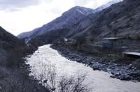
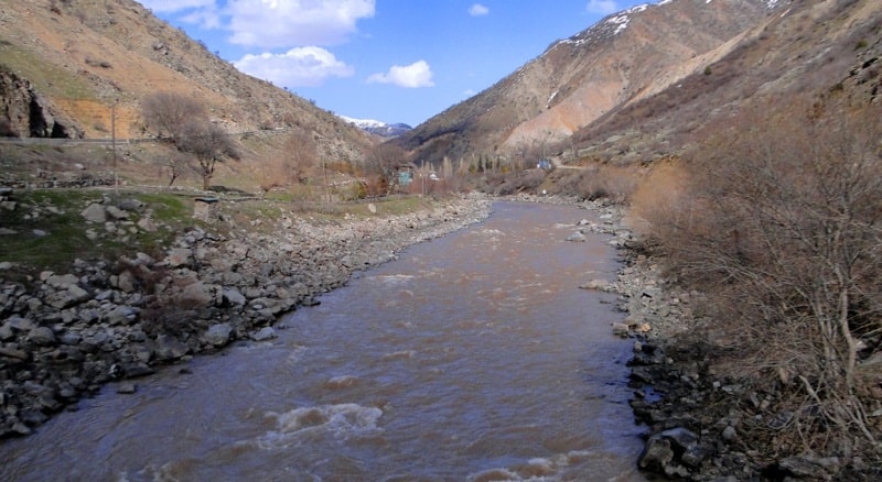
Kafirnigan River.
Mountain tours in Tajikistan.
“What is that feeling when you're driving away from people and they recede on the plain till you see their specks dispersing? - it's the too-huge world vaulting us, and it's good-bye. But we lean forward to the next crazy venture beneath the skies”
Jack Kerouac, «On the Road».
Dushanbe mountain guides.
Kafirnigan (taj. Kofarnihon; Uzbek. Kofarnihon) is a river in Central Asia, one of the main tributaries of the Amu Darya. It flows through Tajikistan, partially forms the border between Tajikistan and Uzbekistan. There are two versions of the origin of the name of the river.
The first of them claims that the given hydronym consists of two words “kofar” and “nihon”, thus: Kofarniҳon means “refuge of infidels”. According to another version, it bears the ancient Tajik name Kofurniҳon, meaning "camphoriferous river" (Tajik. "Kofurniҳon").
Kafirnigan begins at the village of Romit, on the slope of the Gissar Range, where the waters of the Sardai-Miyona and Sorvo rivers merge. A river flows through the Gissar Valley. The total length of the river is 387 kilometers, the basin area is 11.6 000 square kilometers.
The food of the river is mainly snow, then glacial. High water lasts from March to September with a maximum runoff in June (upper) and from February to the end of August with a maximum runoff in April in the lower reaches.
In the upper reaches, it flows through a granite gorge, and in the middle reaches it crosses the wide Gissar Valley, where in some places the river bed expands to 200 meters, forming a number of islands. Below the confluence of the last tributary - the Hanaki River - Kafirnigan again enters the gorge, expanding in places to 2 kilometers.
In the lower part of the stream, the river breaks up into a series of branches, forming pebble islands, sometimes overgrown with dense vegetation. Two floods are observed on the river: the first in April, from snowmelt, when tributaries with low-lying catchments (the Ilyak, Lugob, Simiganych rivers) differ most in discharge, and the second in June-July from the intense melting of high mountain snows and glaciers in the basins of its tributaries - Sardai Mien and Varzob.
The average water consumption is 164 cubic meters per second, however, depending on the season and weather conditions, the flow rate varies from 30 to 1200 cubic meters per second. The average annual turbidity in the lower reaches is over 1,500 grams per meter kudic.
In the lower reaches, the banks are covered with reeds and tugai forests. The city of Vahdat is located on the river, in its basin is the capital of Tajikistan - Dushanbe. Water is used to irrigate the lands of the valley, the river is rich in fish.
Authority:
http://www.cawater-info.net/bk/water_land_resources_use/docs/rivers.html
Photos by
Alexander Petrov.