


![]()
Вы здесь
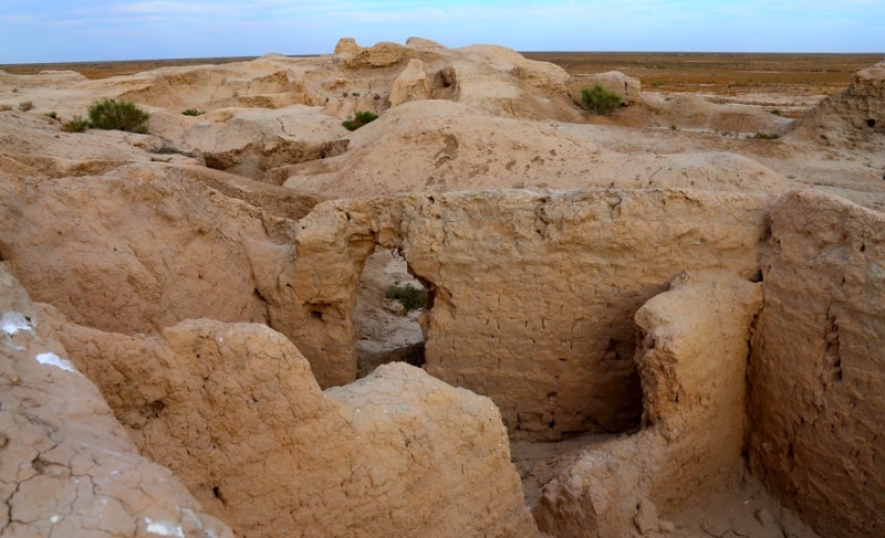
Bidaiyk-asar ancient settlement.

Tourist sights of Kyzylorda region.
"To write history in a dignified manner, you must forget about your faith, your fatherland, your party"
Pierre Bouast.
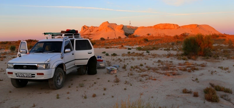
Excursion tours from Kyzylorda to Baikonur.
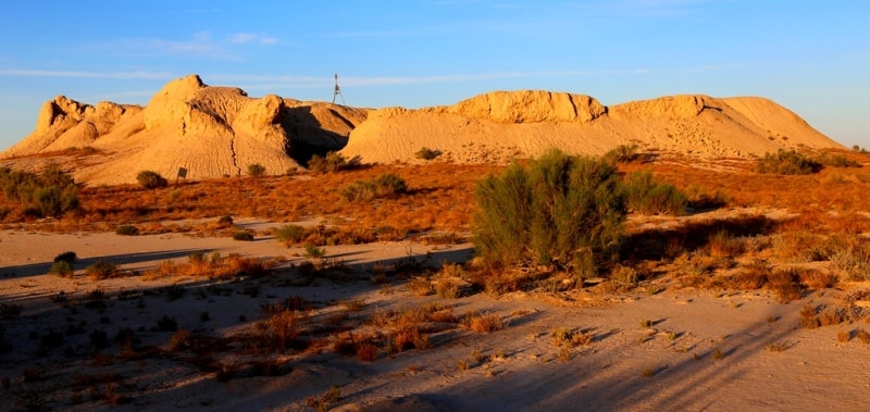
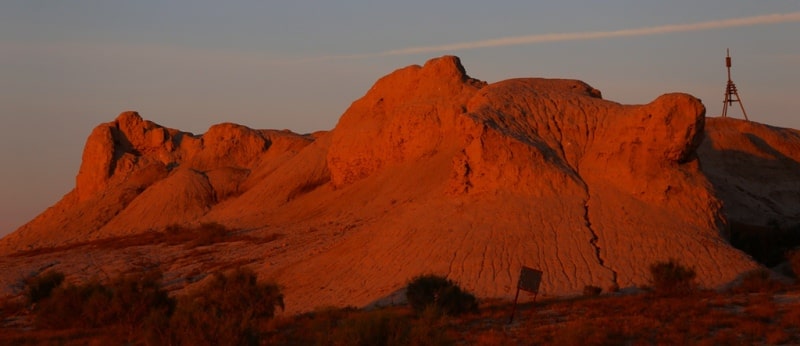
The Bidayk-asar settlement is located on a small hill Tompak-asar with a height of 106 meters above sea level in the Karmakchinsky district of the Kyzylorda region, 37.8 kilometers west of the village of Turmaganbet and 65.2 kilometers southwest of the district center of Zhosaly.
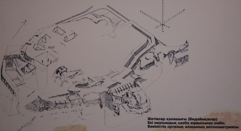
The Bidayik-asar settlement is the most western (not counting two small fortresses in the south-west) in the group of the Jety-asar settlement №2, preserved at a height of 16.5 meters above the level of the modern surface.
With an area of 220 x 110 meters, in addition to the rounded shape of the upper platform and the second platform covering the latter from three sides (up to 7.5 meters high). It also had a third part, adjacent to the central site from the north, bounded by fortress walls (up to 16 meters in height), in terms of which it looks like an irregular rectangle with an area of 65 x 53 meters.
1973, 1976, 1978 excavations were carried out on the monument by the author. For four months of work (the total length of three field seasons), the general stratigraphy of the site was outlined, at least 17 major reconstructions were identified, in which both the fortification and the plan of the fortress were affected (Levina, 1974; she, 1975; she, 1977; she, 1979).
Although in all three parts of the site the excavations were brought to the continental layers (the thickness of cultural layers is 16.5 meters). However, the lower building horizons could not be studied properly, although the materials obtained from the settlement and the burial complexes of some necropolis-mounds that surrounded Bidayik-asar make it possible to assume that in the 7th-6th centuries. BC. the settlement already existed.
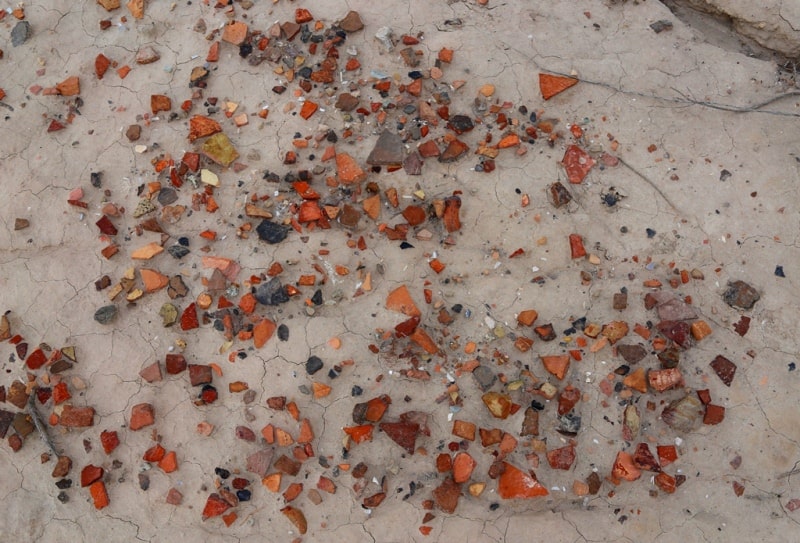
It was possible to fix the layers of widespread fires and periods of desolation. In excavation No. 2 of room No. 24 of the settlement, chalcedony clamps for attaching a sword scabbard were found, similar to those found at Tompak-asar.
In addition, among the Chinese things found on the site, a bronze mirror of the early type from excavation No. 4 should be noted. I. G. Ravich, who investigated these mirrors, believes that mirrors of this type were most widespread from the IInd century BC. BC. to II - III centuries.
AD In accordance with the dating of this type of Han mirrors given by E.I. Lubo-Lesnichenko, the dating of Chinese mirrors from the Dzhetyasar complex can be narrowed down to the IInd - Ist centuries. BC. Finds of items made of Chinese silk fabrics were made mainly in the necropolises adjacent to the Bidayik-asar settlement.
Fragments of Chinese silk fabrics are often found in the burial mounds. The burial place of a young woman in a bright red silk dress was discovered in the crypt of mound 1. Over it, the girl wore a swing-up caftan made of polychrome yellow-pink-blue multilayered silk with geometric and floral designs.
Small fragments of polychrome silk, identical to the fabric of the caftan, were found on the skull of a buried woman. L.M. Levina suggests that the caftan and cap, made of the same fabric and similarly decorated, constituted a single ensemble.
Shoulder garments often had additional finishing of collars, cuffs, vertical sides with appliqués of another pattern of the same fabrics. A sample of such decoration was found in burial 3 from the same mound.
Geographic coordinates of the Bidayik-asar settlement: N45 ° 06'16.65 "E63 ° 27'20.80"


Authority:
L.M. Levina. “Ethnocultural history of the Eastern Aral Sea region. 1st millennium BC -1 millennium AD ". 1996 year. Publishing house "Eastern Literature".
Photos by
Alexander Petrov.