


![]()
Вы здесь
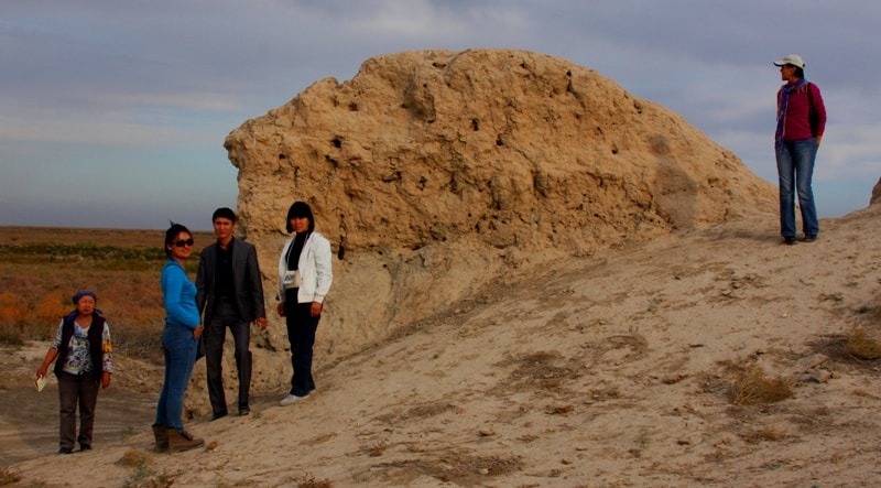
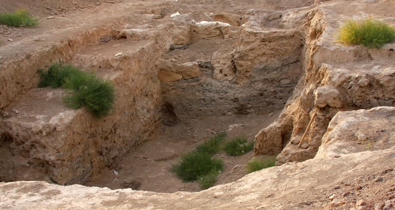
Zhankent ancient settlement.


Tours to ancient monuments of Aral Sea region.
"And purple shadows
Flowing through the fields of fire
Yes lonely settlement
They turn black terribly among the steppes:
Forgotten deeds, silent days
Indestructible cemeteries"
Maximilian Voloshin. Tashkent - Paris. 1901.
Ancient monuments of Aral Sea region.
Zhankent, or Yanykent - in Turkic - "new town". The ruins of this ancient fortress are well preserved and were visited by many travelers at the beginning of the XXth century. The ancient settlement Zhankent is located on the left bank of the Syr Darya, 2.1 kilometers south and slightly west of the Urkendeu village and 21, 7 kilometers southwest of the town of Aiteke-bi (Kazalinsk).
The Arab geographer Ibn Rust first mentions Zhankent between 903 and 912. ad. The first Russians to visit these ruins were Gladyshev and Muravin, who traveled to Khiva in 1740. Monument of the Aral Sea region Zhankent, the capital of the Oguzes (one of the Turkic-speaking peoples). In medieval Arabic and Persian written sources, this town is characterized as one of the major economic and cultural centers in the lower reaches of the Syr Darya.
The name of the medieval capital of the Oghuz Zhankent (Yangikent) is translated as "new town" or "new capital". This led us to the idea that there was once also an "old town", the former capital of the Oguzes. According to a number of medieval written sources, the town of Zhankent (Yangikent) in the lower reaches of the Syr Darya was the residence of the "king of the Guzes".
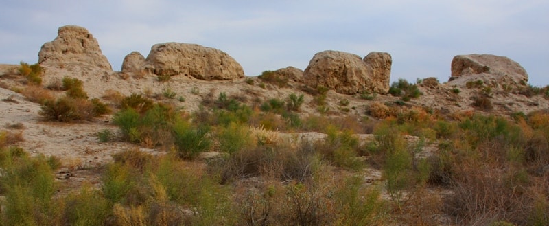
The remains of the town have been fairly well preserved to this day. The mound is almost rectangular in shape, measuring 325 x 200 meters. A well-preserved citadel is located in the northwestern part of the settlement.
On the inner side of the northern wall, there is a separate estate, which rises under a square shape. The entrance gates are located on the western and eastern parts of the settlement. The fortification of the settlement is represented by external walls with protruding semicircular towers.
From the outside, a building structure was added to the northern wall of the settlement, which survived in the form of remnants of swollen walls. The first archaeological work on the site began in 1867 by P.I. Lerh. In 1868 the monument was examined by V.V. Vereshchagin.
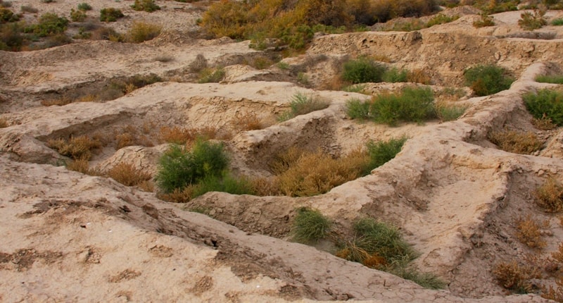
In 1946, the Khorezm archaeological and ethnographic expedition led by S.P. Tolstov. Archaeological research of the settlement began in 2005 as part of a joint expedition of the Institute of Archeology named after OH. Margulan MES RK and Institute of Ethnology and Anthropology RAS and KSU named after Korkyta-ata.
Since 2007, the monument has been studied within the framework of the state program "Cultural Heritage". At the citadel of the settlement, several rooms were examined, which are part of a large stationary dwelling.
In the interior and layout of this dwelling, the traditions of housebuilding inherent in the medieval urban culture of South Kazakhstan and Khorezm are clearly visible. Premises for utility and residential purposes are allocated
The living quarters have been identified along the walls of the sufas. The premises were heated with small hearths. A sanctuary was discovered on the citadel of the settlement, previously unknown design features in the structure of the fortress wall were revealed, a terracotta statue of a two-headed ram richly decorated with ornaments was discovered.
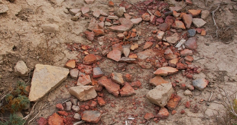
A large collection of finds was obtained, represented by copper coins, tools, bronze items in the form of earrings, rings, bells, sewn-on plaques, which are analogous to the monuments of the end of the 1st early IInd millennium AD.
Ceramics is represented by the remains of tableware and household utensils in the form of hums, jugs, mugs, bowls, dastarkhans made using the technique of hand molding and on a potter's wheel. The ceramic complex reveals cultural traditions characteristic of the sedentary agricultural and nomadic tribes of South Kazakhstan and Saryarka.
The combination of various cultural traditions in the ceramics of Zhankent is probably one of the manifestations of close contacts of the Turkic tribes within the framework of the Oguz ethnopolitical association, which included various economic and cultural areas, which is also confirmed by the data of written sources.
Geographic coordinates of the settlement of Zhankent: N45 ° 36'44.23 "E61 ° 55'17.43"


Authority:
"Monuments of Central Asia". Author M. Khashimov. Publishing house "Saga", 2001. www.farsah.kz
"Ancient Kazakhstan"
Photos by
Alexander Petrov.