Вы здесь
Ancient settlement Bayrkum.

Kazakhstan expedition.
"In this land we found countless destroyed cities, ruined fortresses and many devastated villages"
Plano Carpini, 1246.
Geographic coordinates of Kazakhstan.
The Bairkum settlement is located on a hill 223, 8 meters above sea level, 4.3 kilometers south of the village of Bayyrkum, 2.1 kilometers from the left (western) bank of the Syr Darya, 7.7 kilometers north-west of the village of Kozhatogay in the Shardara district of the Turkestan region.
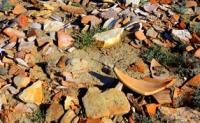
The collected lifting material allows the settlement of Bayrkum to be dated (1st century BC - VIII century AD). It was first investigated in 1900 by N.V. Rudnev, then in 1948 - 1949. Turkestan archaeological expedition led by A. N. Bernshtam.
The remains of the settlement are a quadrangular hill 1.5 meters high, stretching from the north-east, south-west 300 meters, from north-west to south-east 400 meters. The settlement is surrounded by a three-meter embankment.
Defensive walls with traces of 5 towers have been preserved in the southeast. Around the settlement a moat was dug 2 meters deep and 20 meters wide. Inside the settlement there are ruins of a citadel (a hill with a height of 9 meters) surrounded by a one-meter embankment and a moat 10 meters wide.
Geographic coordinates of the Bairkum ancient settlement: N42 ° 04'53,00 "E68 ° 08'27,00"
Authority and photos:
Alexander Petrov.


