


Вы здесь
Mushketov Glacier in Tajikistan.
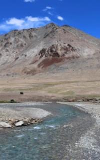
Itineraries in Tajikistan.
“An expedition is a school in which the process of knowing nature, folk experience, and the wisdom of people is endless. Travels expand the colorful fan of human knowledge”
Murzaev E.M.
What to see in Tajikistan?
Upper limit of Mushketov glacier is located at an altitude of 7105 (Evgeniya Korzhenevskaya peak) meters above sea level, end of glacier lies at an altitude of 2885 meters above sea level, glacier is located in northwestern part of ridge of Academy Nauk, in upper reaches of glacier in its western part there is one of highest seven-thousanders of Pamirs - Evgeniya Korzhenevskaya peak 7105 meters above sea level, in eastern part there is Ayudzhilga glacier, in south Moskvina glacier, in Jirgatal region of Republic of Tajikistan.
From the northern part of the glacier flows the Karasel River, 2.3 kilometers long, which is the left tributary of the Muksu River. The length of the Mushketov glacier is 14.3 kilometers, the area is 17.1 square kilometers. Moraine deposits along 5.8 kilometers before its end indicate that in the past the glacier blocked the valley of the Muksu River and Dodarek Lake, 12 kilometers long and up to 2 kilometers wide, was formed above the ice dam.
This lake had 2 levels, and on the lower one it existed for about 70 years. Then the glacier retreated and the lake was drained (Markov, 1936). The sharp movement of this glacier ccurred between 1904 and 1910, when its convex, cracked tongue crawled into the valley of the Muksu River (Korzhenevsky. 1922).
The glacier then retreated deep into the Karasel River gorge and currently ends at an altitude of 2885 meters above sea level.
Geographic coordinates of Mushketov glacier: N39°05'16 E72°02'39
Authority:
"Glaciers." L.D. Dolgushin, G.B. Osipova. Series "Nature of the world." Moscow, the publishing house "Thought". 1989.
Photos by:
Alexander Petrov.