Вы здесь
Peak Engels.


Tours in Shahdara Range.
"And the open winds
Again knocking on our lands -
To their blue-eyed mountains
Isn't it time for us to go back?"
Yuri Vizbor. 1963.
Climbing Engels Peak in Shahdara Range.
Friedrich Engels Peak, 6507 meters above sea level, is located in the central part of the Shahdara Range, in the southwest of the Pamir Mountains, in the Gorno-Badakhshan Autonomous Region in southern Tajikistan.
The latitudinal massif, consisting of the peaks of Karl Marx Friedrich Engels, breaks off to the north with a giant wall 6 kilometers long. Engels Peak is composed mainly of gneisses and crystalline schists. Friedrich Engels Peak (Taj. Kullai Engels) is an elegant pyramidal obelisk with almost sheer granite walls.
This severity is enlivened by light layers of marbles cutting through the array at various heights. To the south-west from the main ridge of the Shahdarinsky ridge of the Friedrich Engels massif, a meridional ridge with peaks of more than six and five thousand meters departs.
Engels Peak is located 3.8 kilometers northeast of Karl Marx Peak, 6723 meters above sea level. 6.8 kilometers southwest of the Friedrich Engels peak is the peak of the Tajik University with a height of 5758 meters above sea level.
.7 kilometers southwest of the Engels summit is the Komsomol of Ukraine peak, 6183 meters above sea level. 7.4 kilometers to the south and a little west of the Friedrich Engels peak, there is the top of LGU, 6222 meters above sea level.
At 960 meters from Engels Peak to the southeast, there is the peak of Engels Peak South with a height of 6312 meters above sea level. To the northwest, from the northern wall of the Friedrich Engels Peak, the Karl Marx Glacier, 5.1 kilometers long, flows down, which forms a giant circus under the northern wall of the massif.
The tongue of the glacier is located at an altitude of 4218 meters above sea level. The lower part of the glacier is closed by a moraine and stretches for 2.4 kilometers. The area of the glacier is 6.2 square kilometers.
The perimeter of the glacier is 15.47 kilometers. The tongue of the moraine of the glacier is located at an altitude of 4051 meters above sea level. To the southeast, from the southern slopes of the Engels peak, the Kishtidzharob glacier descends, 9.5 kilometers long, belonging to the Pyanj river basin.
From the northeastern wall of Engels Peak, the Naspar Glacier, 5 kilometers long, descends to the northeast. In 1895, the two highest peaks on the right bank of the Pyanj were discovered by the first Russian explorers of the southern part of the Pamirs and were named in honor of Emperor Alexander III, Tsar Peacemaker (now Marx Peak) and Empress Maria Peak (now Engels Peak).
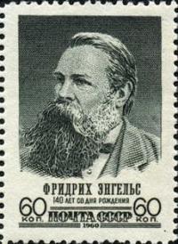
In Soviet times, the peak was renamed after the German politician, philosopher, historian, entrepreneur and founder of Marxism, Friedrich Engels.
History of first ascents to Engels Peak in Shakhdarya Range.
1954
A group of Georgian climbers led by M. Gvarlnani climbed the summit from the south, from the Kyshty-Jorob gorge. The brave four athletes climbed the couloir of the southern wall to the western ridge of the peak and from there reached the highest point along the ridge.
This ascent was significant in that it was the first wall ascent by Soviet climbers to a peak over 6,500 meters above sea level.
1963
On August 18, a combined team of climbers of the Armed Forces of the USSR climbed to the summit consisting of: P. Budanov, B. Kletsko, G. Ilyinsky and G. Agranovsky, K. Konoplev, Yu. Ustinov, V. Ovsyannikov.
Geographic coordinates of Engels Peak: N37°10'25.98" E72°31'20.96"
Authority and photos by:
Alexander Petrov.
http://www.mountain.ru/article/article_display1.php?article_id=5417


