


![]()
Вы здесь
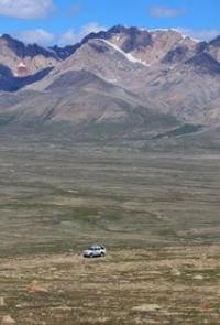
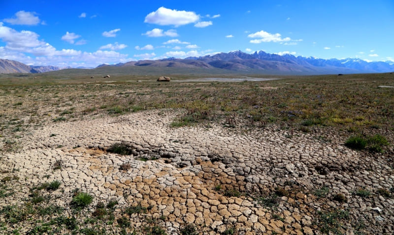
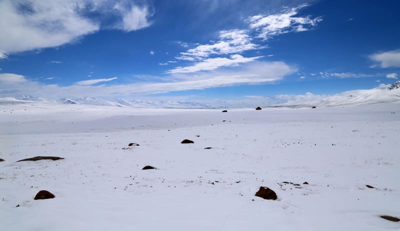
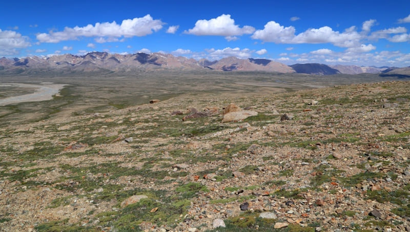
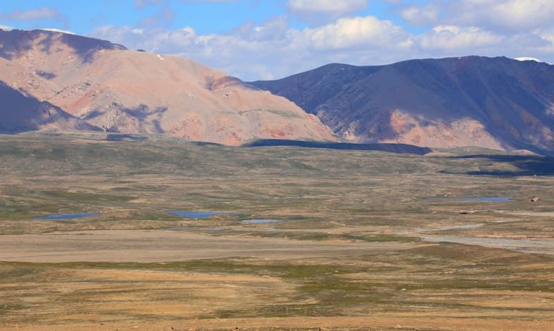
Kagalyachap watershed plateau.
Nature of Kokshaal-Too mountains.
“September 19. Kalmak-Ochak (20 versts). The terrain from Kelintaigan keeps rising. The road goes up Kubergenty, exit to table land, about 15 in. in radius; round hills lie around. This place, one must assume, lies very high; the hills and gullies are covered with snow and therefore streams flow in all directions. It serves as a watershed of the Naryn and Aksu system. One tributary of the Aksu flows to the southeast, the other to the west; our route goes along the latter. Along the left bank there are parallel snow-capped mountains of quite significant size, along the right - the same. We walked along the right bank and spent the night in the Kalmakochag tract. The path is good, only at the very ascent to the plateau on the right bank of the Kubergenty River there is a slope slippery from the snow: several camels and horses rolled down, but, however, remained alive. The ground is hard, it was even dusty. All these days the weather was clear, the winds were sharp and cold, and changeable, mostly south-westerly. They say that here, even in summer, there are snowstorms. The nights are terribly cold. It was warm up to 20 degrees, cold - up to 25. The vegetation of Syrt is very poor: one kipets is visible, already yellowed, today there were yellow bushes of hellebore*, from Kubergenty there is granite, whetstone, quartz; marble is not visible. There are an awful lot of rats, the whole crust of the earth is dug up with holes. They say there are a lot of foxes and marmots. Wolves are found - at night they attacked our rams. Judging by the skulls lying on the road (along Naryn), there must be a lot of argali here. Of the birds, crows, ducks and geese are visible, we also saw a vulture once.
"Kashgar Diary. The Top of the Zaukinsky Pass." Chokan Valikhanov. 1858.
"And in the branching of the Tien Shan to the west of Khan-Tengri into two - the Tien Shan proper and the Zanaryn syrty, accepted by Protsenko, there is also a mixture of concepts. The watershed is divided into two, i.e. to the east of Khan-Tengri there is one main watershed, between the Ili and other northern steppe rivers, and the tributaries of the Tarim, and to the west there are two: between the steppe rivers and the Syr Darya river system, and between the Syr Darya and Tarim. However, even with the inaccurate naming of the watersheds as ridges, a real and fundamental feature in the orography and hydrography of Central Asia is still expressed here; but what does the name of the exclusively Uyurmen-Cheku mountains express with the loud name of the Tien-Shan?"
"Travel through the Turkestan region and exploration of the mountainous country of the Tien-Shan." N. Severtsov. 1873.
Trip to Kagalyachap plateau from Naryn.
Kagalachap watershed plateau (Turk. "Pockmarked slope", also "tögöl achap" - in Kyrgyz "tögöl ashap" - in Kazakh - literally open a spill or open spill, or beginning of a spill) is located at an altitude: southern part is 4323.4 meters above sea level, northern part is 3097.2 meters above sea level (Kuburgenty Pass), is located north of Kyzyl-Asker massif, between the northern slopes of the western part of Kokshaal-Too ridge and southern slopes of western part of Borkoldoy ridge, in eastern part of Naryn-Too ridge in Atbashi district of Naryn region and only a small part of the plateau lies in northeastern part of Issyk-Kul region.
In the southern part, the plateau borders on glaciers flowing down from the northern slopes of the Kyzyl-Asker massif. The plateau itself is a 24-kilometer-long spur extending along the northern slope from the main ridge of the Kokshaal-Too range.
The spur begins with a ridge between the passes: in the west, Komarov Vostochny, 4969 meters above sea level, in the east, Kitaysky, 4947 meters above sea level. The spur stretches between the glaciers: in the west, Komarov Vostochny or Kyzylunet Vostochny, in the east, Mushketova (Ototash) or Kotur No. 251.
For 12 kilometers the spur is rocky and icy, the last glacier No. 252 closes the spur. At the level of the tongue of the Mushketov (Ototash) glacier or Kotur No. 25, the southern part of the spur smooths out and turns into a high-mountain szyrt, which stretches for 12 kilometers to the road.
In the vicinity of the lakes and the interfluve of the Kyzylunet and Kotur, a high-mountain plateau is formed. In the upper reaches, the spur reaches a width of up to 3.5 kilometers, limited by the valleys of the Kotur and Kyzylunet rivers. To the north, the Kagaliachap plateau widens and is more elongated from west to east up to 6 kilometers.
The northern border of the plateau is the Kubyurgenty pass, 3907.2 meters above sea level. The length of the plateau from the south to the north is 24 kilometers, the area reaches 57 square kilometers, the perimeter is 48 kilometers. There is an opinion that the Kagaliachap watershed plateau is conditional and, ultimately, is not a pronounced obstacle to the flow of rivers of western exposure to the east, and rivers of eastern exposure to the west.
We did not notice anything like this when visiting the plateau in August 2022. The bed of the Kotur River, from the tongue of the glacier of the same name, located at an altitude of 3989 meters, flows in a well-developed bed. The stream flows along the western part of the plateau and gradually turns to the west, leaving no hint that the waters of the Kotur can turn to the west.
The bed of the Kotur River west of Lake Kagaliachap is located at an altitude of 3780 meters above sea level, the lake is located at an altitude of 3789 meters above sea level. Visually noticeable tangible ratio of the level of the river and the lake.
Moreover, we took a walk from Lake Kagaliachap to the upper, southern part of the plateau. The upper, southern part of the plateau is a gentle, huge hill that breaks off to the south to the tongues of the glaciers. The tongue of the Kotur glacier is located at an altitude of 3989 meters above sea level, the tongue of the Kyzylunet East glacier is located at an altitude of 4043 meters above sea level.
At the same time, 460 meters to the south of Lake Kagalachap Severnoye, the left bank of the Kotur River is smoothed with a clear and characteristic channel, which is formed at a high water level in the river for 123 meters. The same can be observed 1.2 kilometers to the south of Lake Kagalachap Severnoye on the left bank of the Kotur River.
Here, the left bank is open for overflow into the bed of the Kyzylunet River for 106 meters. Thus, at a high level, water from the Kotur River overflows in a separate channel 5.5 kilometers long and is a right tributary of the Kyzylunet River. That is, in the case when the water level in the Kotur River increases and in the vicinity of the plateau the water flows towards the Kyzylunet River, thus it can be stated that during the period of high water in the Kotur River the plateau is no longer a watershed.
Apparently, this happens rarely, since in the vicinity of the plateau the main channel of the Kotur River is still somewhat lower than the level of the spillways. The tongue of the Kotur glacier is located at an altitude of 3989 meters above sea level, the tongue of the Kyzylunet East glacier is located at an altitude of 4043 meters above sea level.
Three lakes are located on the Kagalyachap plateau: Kagalyachap located lake Kagalyachap at an altitude of 3789 meters above sea level, Kagalyachap North located at an altitude of 3758 meters above sea level and Kagalyachap South with a height of 3781 meters above sea level.
Geographical coordinates of Kagalyachap plateau: N41°10'57 E77°23'21

Authority and photos by:
Alexander Petrov.