


![]()
Вы здесь
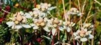
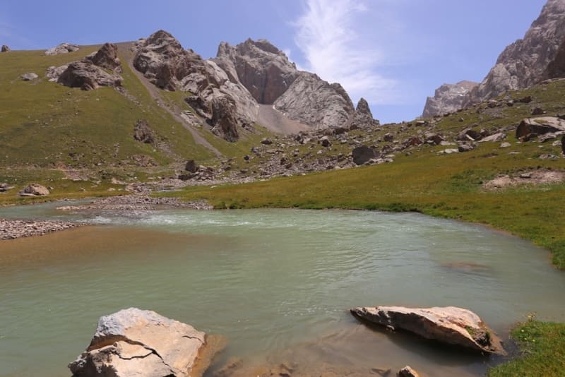
Kok-Kiya River.
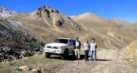
Trip from Kok-Kiya River to Lake Kel-Suu.
“To the west, this ridge becomes lower and already represents a smooth, straight ridge; from the gap between the main peaks of the Zaaksai ridge, a crack was black, the steep cliffs of its rear edge, rising above the front edge, were visible; the Kok-Kiya River flows into Aksai through this crack, giving its name to the ridge. The Kok-Kiya River flows out about thirty-five versts from its mouth from a high mountain lake, which, judging by the fall of the river, must be considered to be 12,500 feet or more likely 11,000 feet above sea level.”
“Travel through the Turkestan region and exploration of the mountainous country of Tien-Shan.” N. Severtsov. 1873.
Right tributaries of Western Aksai River.
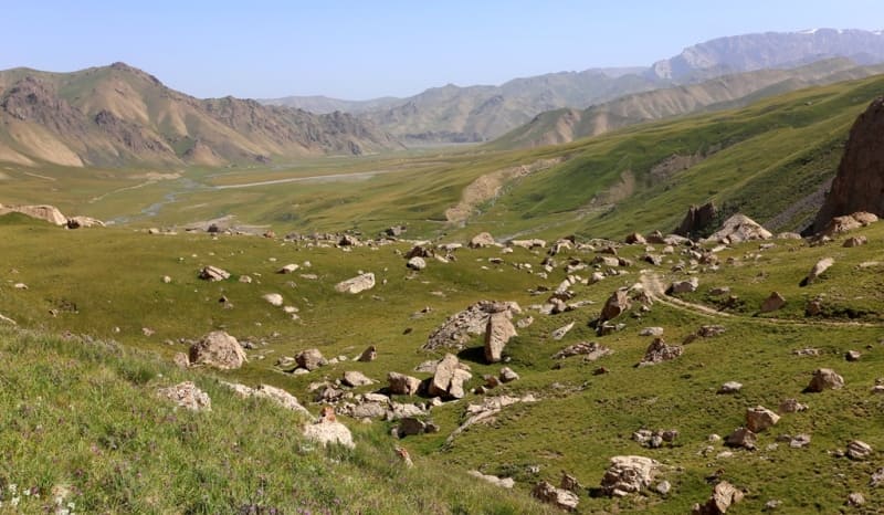
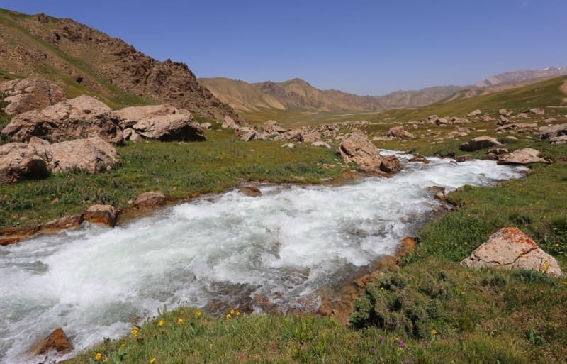
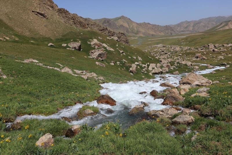
Full-flowing channel of Kekkiya River, 44 kilometers long, flows to right at 107 kilometers into Western Aksai River from beginning of its sources. River is second longest after Tekelik River, which flows into Western Aksai from right. River has complex hydrography and is one of components of Kokshaal River.
The main channel of the river is formed at an altitude of 3328 meters above sea level. On the left bank of the river there is a small shepherd's village, tent and yurt camps of tourist companies of Kyrgyzstan, which offer services for accommodation and walks to the local natural attraction - Lake Kel-Suu, located at an altitude of 3530 meters above sea level.
The river is formed from two large tributaries: the left tributary - the Kurumduk River, which flows from the western slope of the pass of the same name with a height of 3795.5 meters above sea level, located at the western end of the Kokshaal-Too ridge and flows through Lake Kel-Suu.
The Tuyuk-Botomoinok tributary, 30 kilometers long, receives the Kekkiya from the right. The mouth of the Kekkiya River is located at an altitude of 2980 meters above sea level.
Geographical coordinates of Kekkiya River: N40°51'14 E76°28'02
Right tributaries of Kekkiya River.
Suesh river.
After 10.3 kilometers from the beginning of the formation of the Kekkiya riverbed, a small tributary of the Suesh, 5 kilometers long, flows in from the right. The sources of the river are located at an altitude of 3815.1 meters above sea level. The river is located between the Sumasary and Aksayuru rivers.
Geographic coordinates of the Suesh River: N40°45'28.06" E76°25'38.37"
Tarash river.
After 7.4 kilometers from the beginning of the formation of the Kekkiya riverbed, a small tributary of the Tarash, 5.4 kilometers long, flows in from the right. The sources of the river are at an altitude of 3622 meters above sea level.
Geographical coordinates of Tarash River: N40°46'56 E76°25'46
Aksayuru river.
After 32 kilometers from the beginning of the formation of the channel of the Kekkiya river, a large tributary of the Aksayuru with a length of 31 kilometers flows from the right. The sources of the river begin from the western slope of the Chon-Uru pass, 4096.4 meters above sea level, located in the main ridge of the Kokshaal-Too ridge.
The river on the right has 19 and on the left 6 tributaries. One of the right, unnamed tributaries of the Aksayuru River originates from the westernmost glacier located on the southern slope of the Kekkyya ridge. The length of the glacier is 2.5 kilometers.
Geographical coordinates of Aksayuru River: N40°44'47 E76°32'40
Left tributaries of Kekkiya River.
Kurumduk river.
The Kurumduk River, 52 kilometers long, merges with the right tributary of the Tuyuk-Botomoinok and thus forms the Kekkiya River. Kurumduk is the longest river of the left tributaries of the Kekky. Kurumduk has 27 large and small tributaries on the left. For 13 kilometers, the river carries its waters through Lake Kel-Suu.
The sources of the river are received from the western slope of the pass of the same name located at an altitude of 3795.5 meters above sea level, which is located in the main ridge of the western tip of the Kokshaal-Too ridge. In the upper course, the river flows through the Uchchat valley.
The main channel of the river is formed at an altitude of 3328 meters above sea level. On the left bank of the river there is a small shepherd's village, tent and yurt camps of tourist companies of Kyrgyzstan, which offer services for accommodation and walks to the local natural attraction - Lake Kel-Suu, located at an altitude of 3530 meters above sea level.
The river is formed by two large left tributaries - the Kurumduk River and the Tuyuk-Botomoinok tributary, 30 kilometers long, which Kekkiya receives on the right. The mouth of the Kurumduk River is located at an altitude of 3325 meters above sea level.
Geographic coordinates of Kurumduk River: N40°51'14 E76°28'02
Tuyuk-Khodzhent river.
After 6.5 kilometers from the beginning of the sources, a tributary of the Tuyuk-Khojent, 13 kilometers long, flows into the Kurumduk River on the left. The sources of the river are located on the northern slope of the western part of the Kokshaal-Too ridge, originate from the eastern slope of the Erteke pass from a height of 4158 meters above sea level.
One of the right tributaries of the river originates from the northern side of the Tuyuk-Khojent pass, 3798.6 meters above sea level, located in the main crest of the western part of the Kokshaal-Too ridge. The mouth of the river is located at an altitude of 3716 meters above sea level.
Geographical coordinates of Tuyuk-Khodzhent River: N40°24'35 E76°23'52
Khojent stream.
After 10.5 kilometers from the beginning of the sources, a small tributary of the Khodzhent with a length of 10.8 kilometers flows into the Kurumduk River on the left. The sources of the river are located on the northern slope of the western part of the Kokshaal-Too ridge, originates from the northern slope of the pass of the same name with a height of 3962.9 meters above sea level.
At 5.5 kilometers from the beginning of the sources of the Khujand River, a tributary of Chonsu with a length of 5 kilometers flows from the right. The sources of Jeonsu lie at an altitude of 4350.2 meters above sea level. At 6.4 kilometers from the beginning of the sources of the Khojent River, a tributary of the Biyrek-Bulak, 6 kilometers long, flows in from the left.
The sources of Biyrek-Bulak lie at an altitude of 4435 meters above sea level. The mouth of the Khojent River is located at an altitude of 3873.3 meters above sea level.
Geographical coordinates of Khodjent River: N40°26'07 E76°20'47
Stream Tuyuk-Tor.
After 10.8 kilometers from the beginning of the sources, a small tributary Tuyuk-Tor, 7.5 kilometers long, flows into the Kurumduk River on the left. The sources of the river are located at an altitude of 4200 meters above sea level. At 5.7 kilometers from the beginning of the headwaters of the Tuyuk-Tor River, a tributary of the Tala-Bulak, 4.4 kilometers long, flows in from the right.
The sources of Tala-Bulak lie at an altitude of 4145 meters above sea level. At 4.5 kilometers from the beginning of the headwaters of the Tuyuk-Tor River, a tributary of the Orkash-Kakashu, 4 kilometers long, flows in from the left. The origins of Orkash-Kakashu lie on the southern slope of the pass of the same name with a height of 4189.7 meters above sea level.
At 5.4 kilometers from the beginning of the headwaters of the Tuyuk-Tor River, the Sasyk-Bulak tributary, 4.7 kilometers long, flows from the left. The sources of Sasyk-Bulak lie to the east of the Orkash-Kakashu pass, 4189.7 meters high above sea level.
The mouth of the Tuyuk-Tor River is located at an altitude of 3868 meters above sea level.
Geographical coordinates of Tuyuk-Tor River: N40°27'42 E76°20'47
Sary-Kungey river.
After 12.8 kilometers from the beginning of the sources, a small tributary of the Sary-Kungei, 5.5 kilometers long, flows into the Kurumduk River on the left. The sources of the river are located at an altitude of 4361 meters above sea level on a hill between the Western Aksai and Kurumdyk. The mouth of the Sary-Kungei River is located at an altitude of 3669 meters above sea level.
Geographical coordinates of Sary-Kungei River: N40°29'01 E76°22'08
Yugenbas river.
After 28.8 kilometers from the beginning of the sources, a small tributary of the Yugenbas, 11 kilometers long, flows into the Kurumduk River on the left. The sources of the river are located at an altitude of 4510 meters above sea level on a hill between the Western Aksai and Kurumdyk.
Throughout its length, the river flows parallel to the Kurumdyk River from the western side. The mouth of the Yugenbas River is located at an altitude of 3542 meters above sea level.
Geographic coordinates of Yugenbas River: N40°34'08 E76°24'30
Tyuzashu River.
After 31.7 kilometers from the beginning of the sources, a small tributary of the Tyuzashu, 7 kilometers long, flows into the Kurumduk River on the left. The sources of the river are from the northern slope of the Tyuzashu pass, 3933.1 meters above sea level, which is located on a hill between the Western Aksai and Kurumdyk rivers. The mouth of the Tyuzashu River is located at an altitude of 3540 meters above sea level.
Geographic coordinates of Tuzashu River: N40°35'26 E76°23'03
Stream Kosh-Zhailoo.
After 35.8 kilometers from the beginning of the sources, on the left, a small tributary of Kosh-Zhailoo with a length of 5 kilometers flows into the Kurumduk River (at this point the river flows through Lake Kel-Suu and the river flows into the lake).
The sources of the river are located at an altitude of 4269 meters above sea level, in the interfluve of the Western Aksai and Kurumdyk. The mouth of the Kosh-Zhailoo River is located at an altitude of 3530 meters above sea level.
Geographic coordinates of Kosh-Zhailoo River: N40°36'32 E76°23'33
It-Zholy stream.
After 37.3 kilometers from the beginning of the sources, on the left, a small tributary of the It-Zholy, 9 kilometers long, flows into the Kurumduk River (at this point the river flows through Lake Kel-Suu and the river flows into the lake). The sources of the river are located northeast of the Sarybeles peak, 4650 meters above sea level, and flow down from the southern slope of the Sarybeles ridge. The mouth of the It-Zholy River is located at an altitude of 3530 meters above sea level.
Geographic coordinates of It-Zholy River: N40°38'42 E76°21'54
Chon-Sarybeles stream.
After 37.3 kilometers from the beginning of the sources, a small tributary of the Chon-Sarybeles, 5 kilometers long, flows into the Kurumduk River on the left. The sources of the river are located on the eastern slope of the Chon-Sarybeles pass located at an altitude of 3590.9 meters above sea level. The mouth of the Chon-Sarybeles River is located at an altitude of 3325 meters above sea level.
Geographic coordinates of Chon-Sarybeles River: N40°44'29 E76°22'49
Authority and photos:
Alexander Petrov.