


![]()
Вы здесь
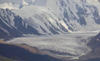
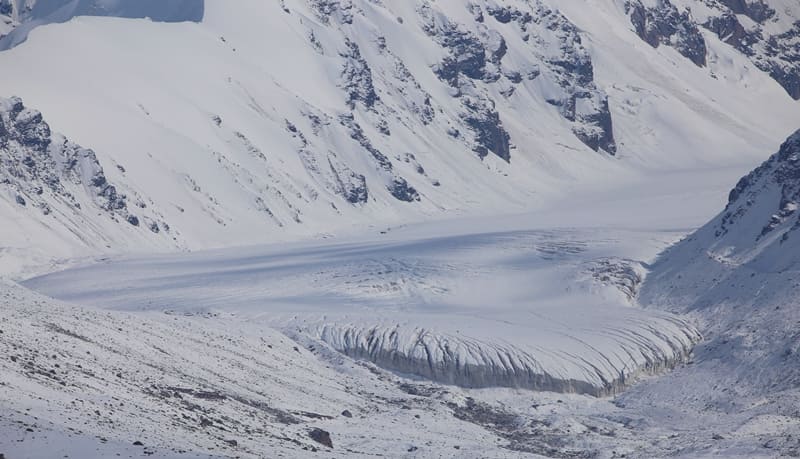
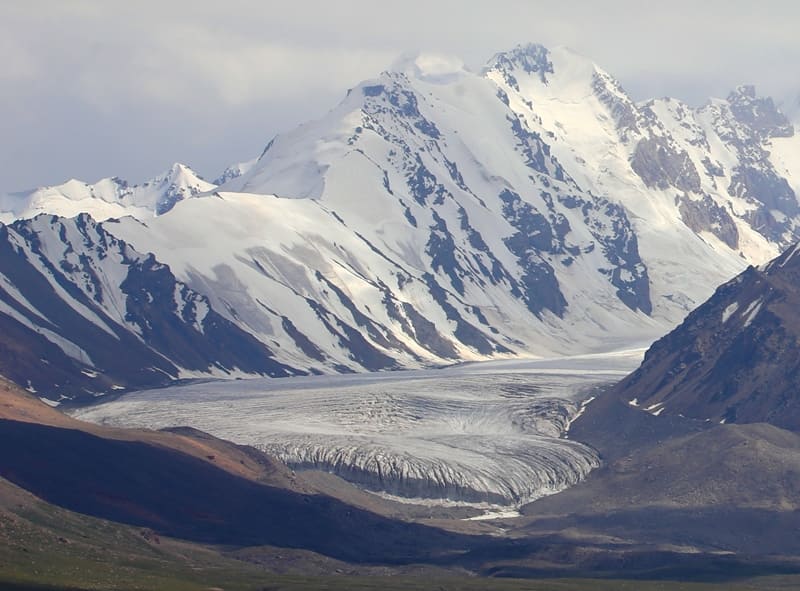
Komarov Glacier (Kyzylunet) East.
Glaciers in Kyzyl-Asker Ice Massif.
"It is interesting to note that even today, the main glacier in this region, Kizil-unet (Komarov Glacier), has a similar character. It consists of three parallel branches, each with its own feeding area. Merging, they form a massive flow 4 - 5 km wide."
A. Letavet, V. Nemytsky. "New Data on Glaciation in Chakyr-Korum, Borkoldoy, and Kok-shaal Ridges" (August 1 - September 1, 1933).
Valley glaciers in Kakshaal-Too Ridge.
Komarov (Kyzylunet) East Glacier No. 78 is located in Kyzyl-Asker mountain range, on northern slope of western Kakshaal-Too Range, at headwaters of Kyzylunet River, in At-Bashy district of Naryn region. The upper boundary of the glacier is at an altitude of 4,969 meters above sea level (Komarov East Pass), and the glacier tongue is at an altitude of 4,041 meters above sea level.
Kyzyl-Asker East Glacier No. 78 is 7.4 kilometers long, covers an area of 8.36 square kilometers, has a perimeter of 19.46 kilometers, and is widest in the central part, reaching 1.1 kilometers. The glacier is divided by two parallel spurs that extend from the main ridge of the Kakshaal-To Range and descend along the northern slope.
The 22-kilometer-long right spur is a spur of the Kagaliachap Plateau, which extends from south to north. Beyond this spur to the east lies the Mushketov (Ototash, Kotur) Glacier No. 251. The glacier extends 9.8 kilometers, covers an area of 12.85 square kilometers, has a perimeter of 26.74 kilometers, and is 1.9 kilometers wide at its peak.
Beyond the left spur lies the Kyzyl-Asker (Kyzylunet) Central Glacier, which is 9.4 kilometers long, covers an area of 9.76 square kilometers, has a perimeter of 24.68 kilometers, and is 1.8 kilometers wide at its peak. The glacier area is located along a 70-kilometer stretch between the Ak-Sai and Uzengegush River outbursts.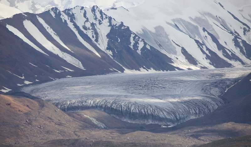
Lake Komarov East, a freshwater, moraine lake 210 meters long and 118 meters wide at its widest point, is located 130 meters northwest of the end of the glacier tongue. Its surface area is 0.02 square kilometers, and its shoreline is 0.6 kilometers long.
Geographic coordinates of Lake Komarov East: N41°06'22 E77°24'10
History of discovery of Komarov (Kyzylunet) Glacier East.
1929.
An expedition led by glaciologist Palgov was sent to study the glaciers of Western Kakshaal-Too. During his exploration of the glaciers in the Kyzylunet Gorge, Nikolai Palgov named the glacier after the renowned Soviet scientist Komarov.
1933.
In August, Professor A.A. Letavet's Moscow expedition visited the glacier.
Geographic coordinates of Komarov Glacier (Kyzylunet) East: N41°04'33 E77°24'34
Authority:
Alexander Petrov.
Zatulovsky, D.M., "On the Glaciers and Peaks of Central Asia." OGIZ, State Publishing House of Geographical Literature. 1948.
Photos by:
Alexander Petrov.