







Вы здесь
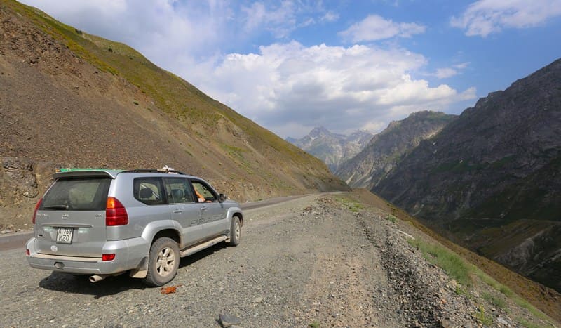
Anzob Pass.
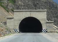
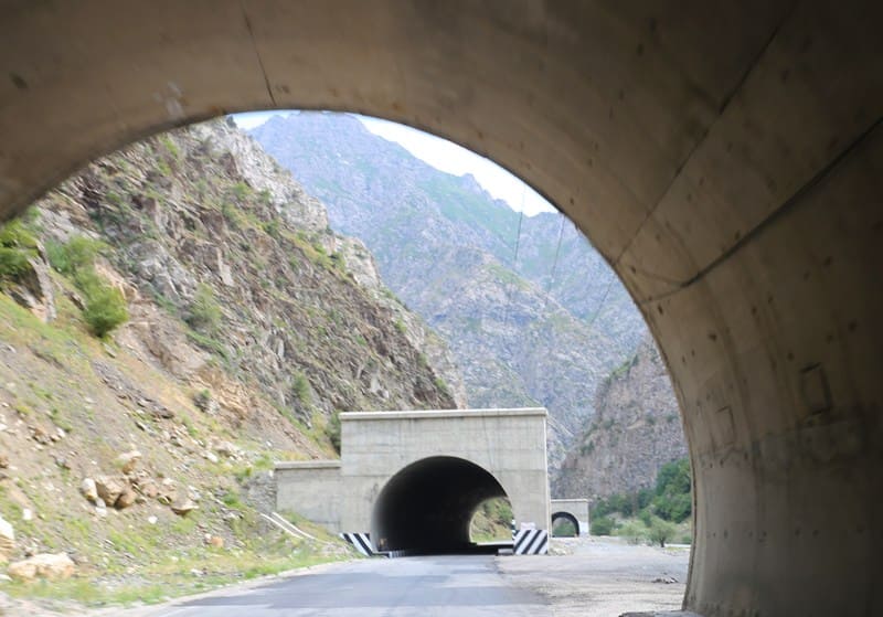
Istiklol Tunnel through Gissar Range.
"August Ivanovich Skassi and mining engineer Dmitry Konstantinovich Myshenkov surveyed the Gissar Range from the Anzob Pass (3,372 m) and discovered that it also extends latitudinally and above the Turkestan and Zeravshan Ranges."
I. P. Magidovich, V. I. Magidovich. "Essays on the History of Geographical Discoveries." 1985.
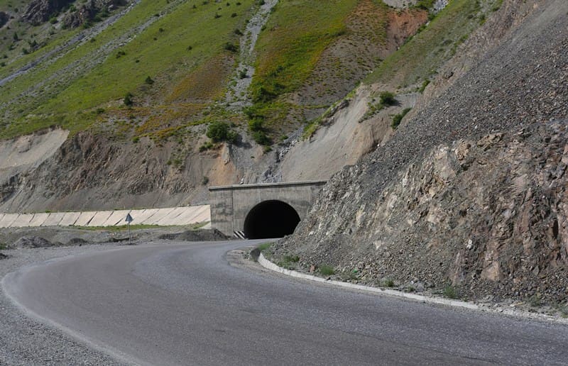
Dusti Tunnel on southern slope of Gissar Range.
Anzob Pass.
The Anzob Pass is located at an altitude of 3,373 m. a. s. l. The Anzob Pass, located on the main ridge of the Hissar Range, straddles two administrative-territorial units of Tajikistan: the northern slope of the pass belongs to the Ayni District of the Sughd Region, and the southern slope belongs to the Varzob District of the District of Republican Subordination.
Geographical coordinates of Anzob Pass: N39°04'57 E68°51'57
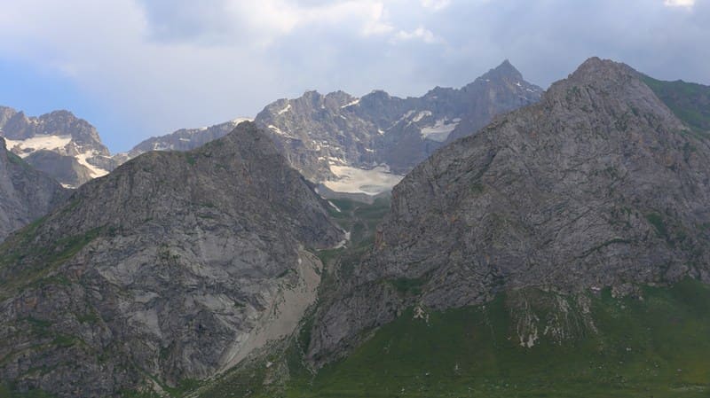
The Hissar Range is one of the largest mountain formations in the western Pamir-Alay. It extends in latitudinal and sublatitudinal directions, forming a powerful natural barrier between the northern and southern regions of Tajikistan. High ridges, deep river gorges, steep slopes, and significant elevation changes create a complex terrain, harsh climate, and extremely diverse natural landscapes.
The Anzob Pass is one of the most famous passes through the Hissar Range. For many decades, it was of significant not only for transportation but also for geographic importance, providing a natural link between the Yaghnob Valley and the central regions of Tajikistan.
Natural location and physical and geographical features of Anzob Pass.
The name of the pass is associated with the Anzob River, which is approximately 12.3 km long. The river originates on the northern slope of the Hissar Range at an altitude of 4,038.3 m. a. s. l., in a high-mountain zone, and is a left tributary of the Yaghnob River.
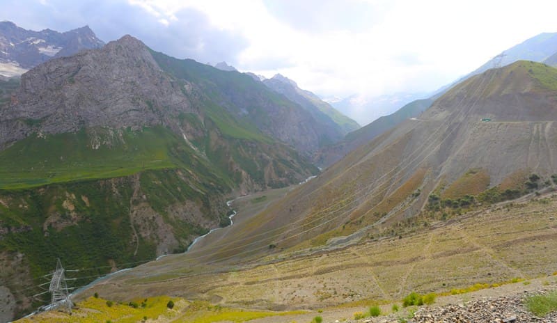
The river's mouth is located at an altitude of 2,087 meters above sea level. The mountainous terrain in the area of the pass is characterized by significant ruggedness. The main ridge is formed by high peaks and saddles, and the slopes are deeply cut by side gorges.
The elevation difference between valleys and watersheds reaches several kilometers, resulting in a succession of different natural zones within a relatively short distance. Trees and shrubs are found on the lower slopes, gradually giving way to mountain meadows, rocky slopes, and high-altitude heaths as they rise.
In the highest parts of the terrain, vegetation becomes sparse, and some areas retain snowfields for a significant portion of the warm season. The region is characterized by a significant contrast in natural conditions between the northern and southern slopes.
Slope exposure, differences in moisture content, and solar radiation significantly influence snow distribution, snow cover duration, vegetation development, and the intensity of erosion processes. In winter, the high-altitude sections of the Gissar Range receive significant amounts of snow.
Avalanche-prone areas form on the steep slopes, and deep gorges become natural channels for snowfall. It was this particular mountainous terrain feature that later became one of the main reasons for the construction of the tunnel road.
Anzob River and Gissar Range Watershed.
The pass is located in a major mountain watershed. Here, the Gissar Range plays a particularly important role as a natural barrier, determining the direction of runoff. The rivers originating on the opposite slopes of the range belong to different basins.
On the northern side, their waters flow into the Yagnob system and further to the Zeravshan, while the southern slopes belong to the Kafirnigan and Amu Darya basins. Thus, crossing the Anzob Pass is not simply a transition from one mountain valley to another.
It is the crossing of a major natural boundary formed by the topography of the Tien-Shan and Pamir-Alai.
Old road across Anzob Pass.
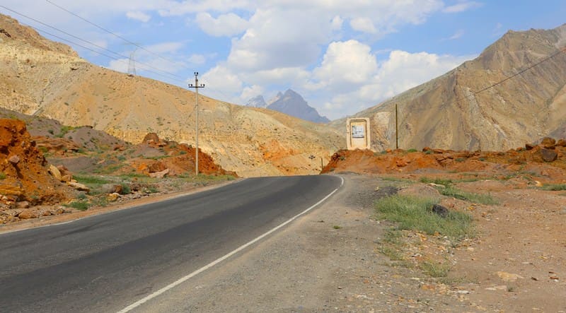
Before the construction of the modern tunnel, the road passed directly through the pass. The old section of the highway was built in the mid-1930s and was a challenging mountain road with numerous turns and switchbacks. The route ran along the steep slopes of the Gissar Range, overcoming significant elevation changes.
Not only was the road technically challenging, but it was also extremely vulnerable to weather conditions. The situation became especially dire during the winter. From November to May, traffic along the old road could be completely stopped due to snowfalls, snowdrifts, and avalanches.
During the harshest winters, the snow cover in some areas reached several meters.Before the construction of the modern tunnel road, the northern regions of Tajikistan were effectively isolated from the central and southern parts of the country during the winter.
This was a particularly serious problem for residents of the Sughd region and Khujand. The old route through the pass was later removed from the main highway. Today, it retains primarily local significance and is of interest to mountain travel enthusiasts and those interested in historical roads.
Istiklol Tunnel (Russian for "Independence") through Gissar Range.
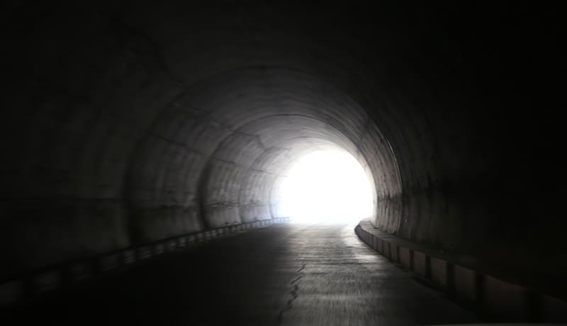
The main engineering structure of the modern transport route through the Gissar Range is the deep-level, two-gallery Istiklol Tunnel, also known as the Anzob Tunnel. The tunnel is approximately 5 km long. It runs directly through the mountain range and crosses the main ridge of the Gissar Range.
Thus, the modern road no longer directly crosses the high-mountain saddle of the Anzob Pass, but instead runs inside the mountain, connecting the opposite slopes of the range. The southern portal of the tunnel is located at approximately 2,679 m. a. s. l., while the northern portal is approximately 2,725 m. a. s. l.
This difference in altitude is explained by the terrain and the location of the transport route on opposite slopes of the mountain range. The construction of the tunnel was of great importance for the country's transportation system. Vehicle communication between Dushanbe and the northern regions of Tajikistan no longer relied directly on crossing a high mountain pass.
This became especially important in winter, when the old road became virtually impassable. The modern transport corridor has significantly reduced the dependence of traffic on snowdrifts on the highest part of the old road. However, even the new route is not completely free from natural hazards: heavy snowfalls and avalanche danger on the approaches to the tunnel can temporarily restrict traffic.
History of Istiklol Tunnel Construction.
The tunnel was designed by specialists from the Moscow-based Gidrospetsproekt Institute and the Tajikgiprotransstroy Design and Survey Institute in the 1980s. Construction began in 1988 but was suspended in 1993 following the collapse of the USSR.
Tajikistan resumed tunneling in 1999, and Iranian construction companies were brought in in 2003. In 2003, Iran and Tajikistan signed an agreement on the construction of the Istiklol Tunnel, with funding totaling $39 million. Of this, $10 million was a grant from the Iranian government, $7.8 million was the Tajik government's share, and $21.2 million was a loan from the Iranian side.
The official opening ceremony for the tunnel took place on July 26, 2006, with the participation of Tajik President Emomali Rahmon and Iranian President Mahmoud Ahmadinejad. Although the commissioning ceremony for this facility took place back in 2006, it remained under construction for over a decade.
For several years, repairs were carried out inside the tunnel to strengthen the permeability of the walls and partially repair the highway. In 2015, Tajikistan and Iran each allocated an additional $3 million to complete the washed-out and damaged highway inside the tunnel.
During the repairs, traffic was temporarily carried out along the old highway through the Anzob Pass. The tunnel was officially opened on August 30, 2017. The planned completion of the tunnel includes the installation of ventilation, lighting, safety supervision, and fire suppression systems.
Financing for the completion of the tunnel is planned at $11 million, of which $5.5 million will be provided by the government. The Iranian government will provide $5.5 million and the Tajik government will install the systems. The Iranian company Farab will install the systems.
Authority:
https://ru.wikipedia.org/wiki/%D0%90%D0%BD%D0%
Geographical coordinates of southern entrance to Istiklol Tunnel: N39°03'52 E68°41'57
Geographical coordinates of northern entrance to Istiklol Tunnel: N39°06'30 E68°41'14
Road across Hissar Range from Dushanbe to Panjakent and Khujand.
This modern highway is of both national and international significance. It connects Dushanbe with Khujand and further into the Central Asian transport network. Historically, this route has been the most important link between the north and south of the region.
The modern highway essentially follows an ancient geographical pattern: the most convenient transport routes are inevitably concentrated where mountain ranges allow for relatively easy crossing of watersheds. At the same time, the old Anzob Road and the new tunnel highway represent two different stages of development of the same mountainous area.
The former was designed with the road construction capabilities of its time in mind and was forced to follow the slopes' topography. The latter utilizes modern engineering technology and allows for crossing the mountain range by the shortest route - directly within it.
Dusti Tunnel on southern slope of Gissar Range.
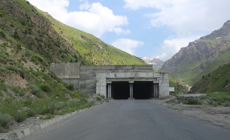
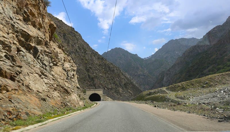
Another engineering structure on the southern approach to the Istiklol Tunnel - the Dusti Tunnel - deserves special attention. Its primary purpose is not to cross the Gissar Range, but to protect the highway on a dangerous section of the southern slope.
The Dusti Tunnel has a total length of approximately 1,047 meters and is a system of several separate slope tunnel sections. In total, the structure comprises 25 sections, the longest of which reaches approximately 484 meters. This design is dictated by the terrain.
The road here runs along steep slopes, where there is a risk of avalanches, rockfalls, and rock falls. In fact, the modern transport complex on the southern approach to the Gissar Range is a series of engineering structures: the road passes through protected tunnel sections of the Dusti Tunnel, after which it enters the main Istiklol Tunnel, which crosses the mountain range.
This significantly improves traffic safety on the most difficult sections of the route.
Mineral resources in vicinity of Varzob Gorge and Yagnob River Valley.
The Gissar Range and adjacent territories are distinguished by their complex geological structure and a significant diversity of mineral resources. Deposits and sites associated with coal, tungsten, and gold mining are known in the area of transport routes through the ridge.
The presence of minerals was one of the reasons for the economic development of certain mountainous regions. Moreover, the geological structure of the area is of interest not only from an industrial perspective. High-mountain valleys, rock outcrops, scree slopes, and outcrops allow us to trace the complex history of the mountain system's formation.
Historical Significance of Anzob Route.
The significance of the Anzob Pass is not limited to modern automobile transportation. The mountain passes through the Gissar Range have long been used by people to travel between the northern and southern regions. Shepherds, hunters, traders, and travelers traveled along the high-mountain trails.
In summer, the passes became part of seasonal routes connecting the mountain valleys and high-altitude pastures. The old routes particularly clearly demonstrate how dependent the population's lives were on the natural terrain. Where today a car passes through a tunnel in a relatively short time, the traveler of the past had to negotiate steep slopes, scree, snowfields, and rocky saddles.
Legend of Anzob Mountain Pass.
The passes of the Gissar Range are associated with a common motif in mountain legends - the legend of a traveler attempting to cross the pass in the depths of winter. Old people said that the mountains refuse passage to those who set out without respect for their character.
A lone traveler, despite warnings from valley dwellers, ascended the pass in late autumn. A snowstorm began overnight, and the traces of the road disappeared under the snow. The next morning, the villagers set out to search. They found his tracks leading to the saddle, but from there they suddenly ended.
The traveler was found alive in a small stone niche where he had waited out the storm. He later recounted hearing a loud roar during the night and realizing he couldn't continue. He then took refuge among the rocks and waited for dawn.
Since then, a saying has been heard in the valleys:
- "The mountain itself shows the way to those who know how to listen."
Of course, this is a folk tale, not historical fact. But such stories aptly convey the mountain dwellers' attitude toward passes - as living natural barriers that should not be underestimated.
Tourism through Istiklol Tunnel in Gissar Range.
Today, the Anzob Pass area is of interest primarily to lovers of mountain nature, historic roads, high-altitude landscapes, and engineering structures. The pass itself is located significantly above the modern highway, so the journey to it should be considered a separate mountain route.
Of particular interest is the old road, which has preserved its characteristic serpentines, sections of the old roadbed, and traces of the pass's former development system.
This area is interesting for tourists because it offers several completely different landmarks within a relatively small space:
the high-mountain saddle of the Anzob Pass;
an old road from the 1930s;
modern road structures;
the Dusti Tunnel Complex;
the five-kilometer Istiklol Tunnel;
deep mountain gorges and steep slopes of the Gissar Range;
areas of high-mountain meadows, scree, and snowfields.
However, the old road cannot be considered a typical tourist route. The condition of the road surface, rockfalls, avalanches, snowfields, and the risk of avalanches require caution. Visiting the high-mountain area is especially dangerous in winter.
When traveling to this area, it is important to take into account rapidly changing weather conditions. Even in summer, temperatures above 3,000 meters can change dramatically, and rain in the valley can be accompanied by snow and strong winds near the pass.
Anzob is a natural and historical boundary.
Today, it's hard to imagine just how serious an obstacle the Gissar Range was for humans before the advent of modern transportation infrastructure. For a car of the old days, the pass represented a complex system of switchbacks; for a traveler, it was a multi-hour trek through harsh high-altitude terrain.
The modern Istiklol Tunnel has changed this situation. People can now cross this powerful mountain barrier not on its surface, but directly within the massif. But the Anzob Pass itself hasn't disappeared. It still exists off the tunnel, as a natural saddle formed by the forces of mountain building and thousands of years of snow, ice, and water.
This is what makes Anzob so special: two completely different routes exist side by side across the same mountain - the old one, carved by humans along the surface, and the new one, carved within its rocky massif. The pass preserves the memory of former roads, and the tunnel testifies to another stage of mountain development.
Together, they form a unique historical and geographical ensemble, in which the constant interaction between man and the mountains is particularly clearly evident.
Road through Anzob Pass from Stalinabad to Tashkent. 1935.
"In the harsh gorges of Tajikistan, extensive and extremely difficult work was carried out for two years. Here, mountain ridges were blasted with ammonal and semi-tunnels were dug in the sheer walls of the gorge; here, people often worked over the abyss, descending on ropes.
Over two years of heroic labor, 1,200,000 cubic meters of rock were removed. And now the road connecting Tashkent and Stalinabad is complete. August 20, 1935. Road builders joined the northern and southern sections. The meeting took place on the northern slope of the Anzob Pass, at an altitude of 3,600 meters, and the highway's ceremonial opening took place on August 21.
At 3:00 a.m., 18 vehicles arrived in Stalinabad along the new road, making the first through-pass. These vehicles carried 300 of the best construction workers. Despite the late hour, a huge crowd of workers gathered at the meeting place. The economic significance of the new road was enormous. It connected the southern and northern parts of Tajikistan, separated by three mountain ranges, linking the capitals of the Tajik and Uzbek SSRs.
While previously it took two and a half days to travel from Stalinabad to Tashkent or to the northern regions of Tajikistan (for example, to Leninabad), now the journey can be completed in 12-15 hours on the new road.
"Behind the Wheel" Magazine, No. 18, 1935.
History of Anzob Pass.
The history of the Anzob Pass (elevation 3,372 m) is incredibly rich. For centuries, it was the main mountain gateway between the Zeravshan and Hissar valleys, linking the northern and southern regions of modern-day Tajikistan. Before the construction of the modern highway and tunnels, this was a difficult trail.
In winter, it froze completely, and in summer, it was accessible only to foot guides and pack caravans.
First explorers and travelers who passed through Anzob Pass.
Scientific exploration of the pass and the surrounding ridges began in the second half of the 19th century, after the region came under the control of the Russian Empire. Geographers, geologists, botanists, and military topographers flocked to the area:
Iskanderkul Expedition (spring 1870):
This was the first large-scale and organized exploration of this region. Led by Major General Alexander Abramov, the expedition was of a military and scientific nature. Military topographers and engineers (such as Dmitry Myshenkov and Nikolai Skassi) were the first to accurately map these harsh highland regions and survey the Gissar Range from the Anzob Pass in detail.
Alexei Fedchenko (1870-1871):
A distinguished Russian naturalist and explorer, he participated in the Iskanderkul expedition as a civilian scientist. He was the first European to provide a detailed description of the nature, flora, and fauna of the Fann Mountains and the Yagnob River basin.
In June 1870, Fedchenko ascended the Yagnob Valley to the village of Anzob at the foot of the pass. It was then that his group made a historic discovery, encountering the local inhabitants - the Yagnobis, direct descendants of the ancient Sogdians, who had preserved their unique language.
Vladimir Lipsky (1896-1899):
The renowned Russian botanist and geographer made a significant contribution to the study of the Anzob Narrows. He explored the adjacent valleys (including the Ziddy River on the southern slope), studied the glaciers of the Gissar Range, and documented the pass's features in his seminal three-volume work, "Mountainous Bukhara."
From Caravan Trail to Highway through Anzob pass.
For a long time, the pass remained accessible only to horses and donkeys. Everything changed during the Soviet era:
From 1932 to 1935, the legendary Tajik-Pamir Expedition of the USSR Academy of Sciences conducted a detailed study of the area, determining the optimal route for a future road.
In 1936, a true labor revolution took place: a full-fledged highway was built through the pass, linking Stalinabad (now Dushanbe) and Ura-Tyube (now Istaravshan).
That same year, 1936, the Anzob high-altitude weather station opened at the pass. It still operates at the summit, recording severe weather conditions.
The route through the pass was the second-highest road in the USSR after the Pamir Highway. In winter, it was buried under meters of snow, cutting off northern Tajikistan from the south for six months of the year, which later led to the idea of building the Istiklol Tunnel.
Authority and photos by:
Alexander Petrov.