







Вы здесь
Glaciers of Sredniy Talgar River basin.
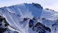
Morphology of Sredniy Talgar glaciers.
"When one first sees glaciers with their firn fields - blindingly brilliant in the sunlight - one is struck by the profound silence and stillness of their cold landscape. We now know that this silence conceals an intense struggle for life. Their stillness is merely an illusion. On warm summer days, the glacier surfaces are covered with meltwater that gathers into streams flowing through icy canyons. At such times, while the plains below parch under the hot sun, glacial rivers swell and grow more turbulent. The heat-cracked earth greedily drinks in the life-giving moisture of these rivers. A collective farmer gazes lovingly at the snowy ridges - the source of salvation for the crops he has sown. Glaciers play a vital role in replenishing the rivers during the summer."
Nikolai Nikitich Palgov. “The Nature of Kazakhstan in Sketches and Pictures”. 1950.
Trekking in Sredniy Talgar Valley.
The rear (southern) and eastern boundaries of this basin - which forms part of the greater Talgar basin - follow the line of the main mountain ridge; here, the ridge initially runs from west to east before turning northward. Nineteen glaciers, with a total area of 38 square kilometers, have been recorded in the headwaters of the Sredny Talgar and its tributaries.
Shokalsky Glacier in headwaters of Sredniy Talgar River.
This glacier is situated at the head of the Sredniy Talgar valley, occupying a rather broad and branching basin; it can be classified as a semi-basin glacier. The total length of the glacier is approximately 5-6 km, and its area is 16-18 sq. km. The positive vertical range of glaciation is 540 m, and the negative range is 588 m.
The estimated glacier coefficient is 1.8. The glacier comprises three branches. In the area of the cirques, the combined width of the three branches reaches 4 km or more, whereas at the point where they merge into a single tongue, the width is about 1 km.
The right and left branches lie within deep, long gorges, while the middle branch occupies a short one. On the southwest-facing mountain slope to the right of the Shokalsky Glacier's right branch, deep, narrow couloirs contain additional glacial formations - specifically cirque, hanging, and semi-hanging glaciers.
Two of these - the highest ones - merge with the right branch. Another, situated lower down at an elevation of 80-100 m above the base of the slope, protrudes from its couloir as a high wall of white, bubbly ice. Others, located further down the valley, have retreated, with their termini pulled back toward the upper reaches of their respective basins.
All the glaciers that do not reach the right branch of the Shokalsky Glacier have spread their frontal moraines across the slope in a fan-like pattern, with their debris aprons resting upon the lateral moraine of the right branch (N.N. Palgov, 1948).
TEU (Tourist and Excursion Administration) Glacier in upper reaches of Sredniy Talgar River.
Opposite the lower section of the Shokalsky Glacier's left branch, two wide, fairly long basins with steep slopes descend toward the main river valley. The northeast-facing sections of these slopes rise to an altitude of 4,000 meters and are covered with perennial snow.
Two glaciers extend eastward from this area toward the left branch of the Shokalsky Glacier. Both are hanging-valley glaciers. The lower one (downstream) is known as TEU North (Tourist and Excursion Administration North), while the upper one is called TEU South.
Neither exceeds 2 km in length. The area of the North glacier is no more than 2 sq. km, and that of the South glacier is no more than 2.5 sq. km. At a distance of 1–2 km from the Shokalsky Glacier's left branch, both glaciers disappear beneath their own moraine deposits; closer to the base, these deposits are overgrown with grass in places.
Two streams flow down the fresh moraines of the upper glacier, while a single stream flows from the lower one. In addition to the aforementioned TEU North and South glaciers, the eastern slope of the Stalsky Spur hosts several other small hanging and cirque glaciers.
V. G. Gorbunov identifies six of them, though only three are of significant size. Proceeding down the Sredniy Talgar Valley, these are the Zhamalak (Dzhamalak), Solnechny, and Strelok glaciers. All three are cirque glaciers. Their areas are 2.5, 1, and 0.5 sq. km, respectively. Long tongues of moraine deposits extend downslope from the termini of all the aforementioned glaciers.
To the north of the Strelok Glacier, beyond a fairly broad mountain spur, lies Yubileynaya Peak with its spacious cirque. The latter is filled with moraine deposits, beneath which the small Yubileyny Glacier persists. The total glaciated area on the eastern slope of the Stalsky Spur is estimated at approximately 8 sq. km.
Glaciers of eastern part of Sredniy Talgar River basin.
On the western slope of the main ridge, glaciation is far more extensive than on the eastern slope of the Stalsky Spur, despite the unfavorable aspect; here, it covers at least 13-14 sq. km. The glaciation on the western slope is fostered by the altitude of the mountains and the presence of numerous narrow, deep gorges.
A rare type of glacier is found here: an ice ribbon situated within a winding, steeply sloping cleft - or couloir. This couloir glacier lies roughly level with the base of the frontal moraine of the Shokalsky Glacier. Benefiting from exceptionally favorable shading, it features the lowest terminus elevation (2,900-2,950 m) in the entire river basin.
Other glaciers are also known to exist on the western slope of the main ridge, including the Salanov, Kroshka, South Talgar, North Talgar, Kopyr, Ozerny, and Malyutki glaciers, as well as Cirque Glacier No. 17.
References:
Gvozdetsky N. A., Nikolaev V. A. *Kazakhstan*. Moscow: Mysl, 1971.
Gvozdetsky N. A., Mikhailov N. I. *Physical Geography of the USSR*. Moscow: Mysl, 1978.
Zhivago N. V., Piotrovsky V. V. Geomorphology with Fundamentals of Geology. Moscow: Nedra, 1971.
Catalogue of Glaciers of the USSR. Leningrad, 1967, Vol. 13, Issue 2, Part 1.
Catalogue of Glaciers of the USSR. Leningrad, 1967, Vol. 13, Issue 2, Part 2.
Tuyuksu Glaciers (Northern Tien Shan). Leningrad: Gidrometeoizdat, 1984.
Glaciation of the Tien Shan. Ed. N. B. Dyurgerov. Moscow, 1995.
"Glaciation of the Zailiysky Alatau." Moscow: Nauka, 1969.
Palgov N. N. The Bolshaya Almatinka Glaciation Cluster in the Zailiysky Alatau Range. *Izvestiya Vsesoyuznogo geograficheskogo obshchestva* [Proceedings of the All-Union Geographical Society], 1948, Vol. 80, Issue 1.
Palgov N. N. Shokalsky Glacier in the Zailiysky Alatau Range. *Izvestiya Vsesoyuznogo geograficheskogo obshchestva* [Proceedings of the All-Union Geographical Society], 1948, Vol. 80, Issue 1.
Palgov N. N. Trip to the Tuyuksu Glacier in the Summer of 1922 (Offprint from *Izvestiya GRGO*, Vol. LVIII), 1926.
Tokmagambetov G. A. Glaciers of the Zailiysky Alatau. Alma-Ata, 1976.
Tokmagambetov G. A. Secrets of Kazakhstan's Natural Ice. Alma-Ata: Nauka, 1978.
Svarichevskaya Z. A. *Geomorphology of Kazakhstan and Central Asia*. 1965.
Chedaya O. K. *Morphostructures and Recent Tectogenesis of the Tien-Shan*. Frunze: Ilim, 1986.
Material prepared using data from:
Glaciological studies and works by scientists: S. E. Dmitrieva, N. N. Palgova, G. A. Tokmagambetova (*Glaciers of the Zailiysky Alatau*, 1976), K. G. Makarevich, and E. N. Vilesov.
Article: "Glacial Structures of the Northern Tien Shan – Zailiysky Alatau."
http://www.bigmir.net
https://elib.rgo.ru/safe-view/123456789/226999/1/0LPQtdC+0LsuMjRfVGFsZ2FyLCBnbGF2bmF5YSB2ZXJzaGluYSBaYWlsaWlza29nbyBBbGF0YXUsIGJsaXoucGRm
Photos by:
Alexander Petrov.