


Вы здесь
Arkat Mountains in Abai Region.
A trek through Arkat mountain range.
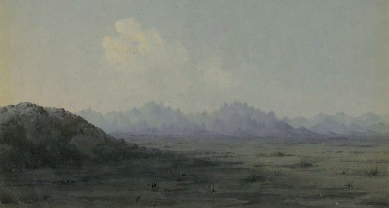
"The road to the Kyzy-Mullinsky outpost a distance of 120 versts is excellent; your carriage rolls along as if on a perfectly constructed highway, while before your eyes stretches an immense, boundless plain, devoid of even a single shrub. Beyond the Kyzy-Mullinsky outpost, the Arkat Mountains begin to appear: low, bare crags of every conceivable shape, weathered by the passage of time. There is no vegetation to be found, save for karagaynik a type of scrubby brush standing about 1½ arshins tall which the local Kyrgyz people use, along with kizya (dried livestock dung), as fuel. “Karagaynik” burns exceptionally well, even when freshly gathered, and produces such intense heat that our soldiers at the outposts use it twisted into bundles to fire their stoves and bake bread."
P. Galitsky, "From Semipalatinsk to the Vernoye Fortification," “Sankt-Peterburg Vedomosti”, 1868, Nos. 150, 151.
"The Arkat outpost was situated to the right of the road, at the foot of a small hill. It was partially encircled by granite mountains not particularly high, yet possessing very sharp, distinct contours which formed two separate groups. One group, lying to the west of the outpost, was called Arkat, while the other, to the southwest, was known as Burkat. The latter consisted of an elongated ridge featuring remarkable granite peaks, which bore a striking resemblance to pointed caps or hats. I ascended the Arkat Mountains on horseback, and climbed the highest crags on foot, pulling myself up by clinging to the shrubs." Their elevation, determined hypsometrically, did not exceed 800 meters. The mountains on the left side of the Kopal road (to the southeast of the picket station) had an entirely different composition. I found their summits to be made of talc schist, uplifted on the northeastern side by a purple-hued porphyry. At the foot of these mountains lay a salt lake that would dry up in the summer; along its muddy margins grew Potamogeton perfoliatus and various halophytes (such as Statice caspia and Statice suffruticosa), though the lake contained no fish. Conversely, about thirty versts to the east of Arkat, there was a lake teeming with fish which is why it was named Balyk-kul. With their sharp, rugged profiles, the granite Arkat and Burkat mountains stood out as an exception along my route into the Semirechye region.”
P. P. Semyonov-Tyan-Shansky, “Journey to the Tien-Shan”, 1856-1857.
A journey from Semey to Arkat Mountains.
The Arkat mountain massif is located in the Abay District of the Abay Region. It lies to the southwest of the Kalba Range, within the eastern part of the Kazakh Uplands - 28 km southeast of the Kokpek-kala valley; 36 km east-northeast of the small Keregetas mountains; 9 km northwest of the Zholdybay and Burkit mountains; 44 km southeast of the Orda mountains; 68 km east-northeast of the district center, the settlement of Karaul; and 149 km south-southwest of the city of Semey. To the west and southwest, the massif borders the Karagaily Mountains.
A tract between them is formed by the semi-dry riverbed of the Kempirla. At the foot of the mountains lies the village of Arkhat, which shares its name with the range. The massif stretches for 16 km, reaches a width of 9.5 km, covers an area of 120.15 sq. km., and has a perimeter of 46.39 km.
Its highest peak, Mount Kuimetas, rises to 914.4 m. a. s. l. Another, unnamed peak reaches an elevation of 896.4 m. a. s. l. The Arkat Mountains are part of the unique landscape of the Kazakh Uplands - a region characterized by low mountains, rocky ridges, and isolated stone massifs that stand out strikingly against the open steppe.
The geological foundation of the mountains consists of ancient granites and volcanogenic-sedimentary rocks. Over long periods, the forces of wind, water, frost, and extreme temperature fluctuations have eroded and reshaped the rock outcrops.
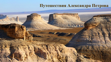
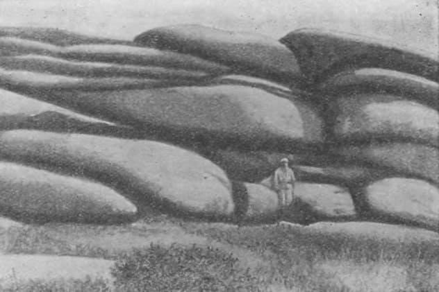
This has resulted in whimsical weathering formations, including natural stone arches, niches, crevices, and freestanding rock pillars. Some of these formations resemble animals, human figures, or fantastical creatures. It is these natural stone sculptures that give the Arkat range its distinctive character.
The vegetation covering the mountains and the surrounding steppe consists of dry-steppe and rocky-terrain plant communities. On the slopes, one can find feather grass, wormwood, caragana, spirea, and wild rose. In the spring, among the rocks and on sun-warmed slopes, ephemeral plants such as wild tulips, irises, pasqueflowers, and others emerge, completing their entire life cycle within a brief, favorable window of time.
Birds of prey may build their nests in rock crevices or on hard-to-reach ledges. The surrounding hills are home to animals typical of steppe and mountain landscapes, including argali, roe deer, marmots, and foxes. Archaeology in the Arkat Mountains.
The surroundings of the Arkat Mountains are also of archaeological interest. The area contains sites from various eras, including burial mounds (kurgans) dating to the Bronze and Early Iron Ages, stone enclosures, petroglyphs, and ancient Turkic stone statues.
Notable burial grounds in the vicinity include Baysal, Yeserkep, Almembek, Barlybay, and Zharas, alongside numerous unnamed graves. These monuments attest to a long history of human habitation and development across the surrounding steppes and mountain valleys.
The Arkat landscape is compelling not only for its natural features; its stone structures and rock art reveal how deeply the lives of the steppe’s ancient inhabitants were intertwined with their environment.
The Arkat Picket.
In the XIXth century, a postal route ran along the foothills, connecting Semipalatinsk to Sergiopol (present-day Ayagoz) and continuing toward Verny. Located along this path was the Arkat Picket a station within the Cossack postal network. Such pickets served as stopping points for changing horses, provided security for the route, and facilitated communication between remote settlements.
Thus, Arkat was more than just a prominent landmark in the vast steppe; it was an integral part of the historical transport network spanning the Semipalatinsk and Semirechye regions. The Arkat Mountains are mentioned in the travel journals of Chokan Valikhanov.
In his 1856 travel diary, he noted their distinctive silhouette standing out against the horizon. This account is particularly valuable, as it offers a glimpse of how these mountains appeared to a traveler in the mid-XIXth century a time when the steppe routes still largely retained their traditional character.
The history of the Semipalatinsk region is also linked to the names of Pyotr Semyonov-Tyan-Shansky, Grigory Potanin, and Fyodor Dostoevsky; however, whether they specifically passed through the Arkat section of the route requires further documentary confirmation.
A particularly detailed description of the Arkhat Mountains was provided by Pyotr Petrovich Semyonov-Tyan-Shansky, who visited the area during his travels in 1856-1857. In his memoirs, he noted that the Arkat picket (outpost) was situated at the foot of a low hill, surrounded by granite mountains divided into two groups: Arkat to the west and Burkat to the southwest.
The latter were characterized by elongated ridges and unusual granite peaks that resembled pointed caps or hats. Semyonov-Tyan-Shansky personally ascended the Arkat Mountains, examined their rock outcrops, and determined the elevation of the highest points.
According to his hypsometric measurements, the altitude did not exceed 800 meters. He also described a small, saline lake at the base of the nearby uplands which would dry up during the summer and mentioned Lake Balyk-kul, located approximately 30 versts to the east of Arkat.
Another vivid account of the area was provided by P. Galitsky in a piece titled "From Semipalatinsk to the Vernoye Fortification," published in the “Sankt-Peterburg Vedomosti” (St. Petersburg Gazette) in 1868. He described the Arkat Mountains as low, barren rock formations with whimsical shapes, sculpted by long-term weathering.
The traveler also took note of the sparse vegetation in the surrounding area, observing small thickets of karagaynik (a type of shrub), which the local inhabitants used for fuel. These accounts allow us to envision Arkat and its environs as they appeared to XIXth-century travelers.
They confirm that the unusual granite formations of the mountains caught the attention of explorers even then, serving as a prominent landmark along the old route that connected Semipalatinsk with Semirechye. Today, Arkat draws visitors primarily for its striking rock formations, natural vistas, and historical-cultural heritage.
Here, the vast steppe meets ridges of granite; individual rocks, shaped over centuries by the elements, have taken on forms in which the human imagination easily discerns familiar shapes. This is the unique charm of Arkat a mountain massif where geological history, the natural world, and folk memory converge to create a singular, inimitable landscape.
A Legend Regarding the Origin of the Arkat Mountains.
A piece of folklore concerning the origin of the name Arkat is associated with these mountains. According to one version, the massif was named after a swift-footed horse called Arkat, which belonged to the batyr (warrior) Aibas a character from the Kazakh lyrical-epic tale “Kozy Korpesh and Bayan Sulu”.
It is said that Aibas was returning from his search for Bayan Sulu when his horse, exhausted by the long journey, came to a halt in this very place. Thus, according to the legend, the animal’s name came to be applied to the mountains. While this is a beautiful explanation rooted in the tradition of folk toponymy, it does not constitute a definitive etymology of the name.
Geographic coordinates of Arkat Mountains: N49°05'09 E80°09'41
Authority:
Alexander Petrov.