Вы здесь
Trip to plateau Asy.
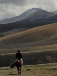
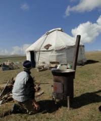
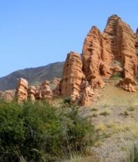
Walk on plateau Asy.
«On the big mountain nothing grows, but from it it is well visible»
M.Prishvin.
The brief description automobile and foot walks on plateau Asy:
Almaty - settlement Issyk - gorge Turgen - forestry establishment Batan - river Shenturgen - plateau Asy - pass Asy of 2510 meters above sea level - Asy-Turgen an observatory - farm Asy - valley Zhaman-Uyi (relic at the river Asy) - mountains Alabaita - Bartogay reservoir - settlement Kokpek - canyon Charyn - Glade of Cloudland - settlement Kokpek - gorge Kokpek - settlement Baiseit - settlement Chilik - Almaty.
Distance route: 434 km.
Season: year round.
The best time for an excursion: from June, 1st till October, 30th.
Duration: 2 days, 1 night.
The advanced order: for 48 hours.
The detailed program of walk in gorge Turgen and on plateau Asy in mountains Zailiiskiy of Ala-Tau:
1 Day. Almaty - valley Zhaman-Ui (relic clay at the river Asy) (90 km).
Transfer: Almaty – burial mounds Issyk (53 km). After we driving Almaty, our way will lay on ancient Kuldzha to a path. After settlement Avat the road turns on the south in a direction of mountains Zailiiskiy Ala-Tau and settlement Issyk.
On a way visiting Issyk Saka barrows in which vicinities in 1962, archeologists, the Gold person of Kazakhstan has been found. Visiting of a museum of a historical and cultural museum «Issyk” exhibits which tell about local barrows and an archeological find of the Kazakhstan archeologists.
Transfer: museum «Issyk» - settlement Issyk - gorge Turgen - valley Batan - plateau Asy (45 km). After visiting a museum our way lays through regional center Issyk through which the river Issyk proceeds. Soon the road goes to gorge Turgen, a stop on ecological to a post of national park "Ile-Ala-Tau".
Before us picturesque kinds on gorge Turgen open. The road is laid along the river of the fast and transparent river Turgen, winds and soon the road leaves gorge and passes in the beginning of plateau Assy. A stop on a height at the river Turgen. Walk on breakage with which opens a kind on neighboring mountains and the river Turgen.
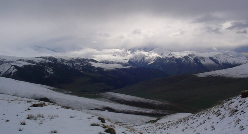
The further transfer: plateau Asy - pass Ass of 2510 meters above sea level (8 km). A stop on pass Asy. From pass opens fine kinds on neighboring mountains and a valley of the river Asy, dzhailyau which were stretched from the West on the east. In the south and the West tower snow mountains Zailiiskiy of Ala-Tau.
Transfer: pass Asy – Assy-Turgen an observatory (3 km). From pass on road we move on a southwest and soon before us a wide plateau in the center which there is observatory Asy-Turgen. On the north and northwest magnificent wide panoramas of plateau Asy open, snow southern crest Zailiiskiy Ala-Tau in the south towers.
Walks in vicinities. Transfer: Asy-Turgen an observatory - pass Asy - river Asy - agricultural farm Asy (21 km). On a way to a farm we shall see the Kazakh nomads who have settled down with the yurts in small gorges and on coast of the small rivers.
Here is Kazakh legendary «dzhailyau» (in translation with Kazakh - highly in the mountains, the open place where graze horses, sheeps, cows). On our way there will be yurts shepherds, and their tents, grazed horses and sheeps. A stop on high breakage above the river Asy, walk in vicinities, photographing, visit of an ancient stone millstone.
The further transfer: Farm Asy - small houses of the forester - valley Zhaman-Ui (clay relic at the river Asy) (19 km). We cross the river fords Asy and further our way will pass on road from the right party of the river, among trees we shall see a deep canyon of the river Asy. Arrival on clay, picturesque relic in natural boundary Zhaman-Ui at the river Asy. Here we will have a lodging for the night. Accommodation in tents, overnight.
2 Day. Valley Zhaman-Ui - Almaty (285 km).
Walk on relic in natural boundary Zhaman-Ui, photographing. The further transfer: valley Zhaman-Ui - mountains Alabaita - Bartogai reservoir (25 km). Further our way after natural boundary Zhaman-Ui will pass in picturesque places, reddish shades of clay ground here prevail. It is gradually dear rises on a mountain height, here there are numerous ancient burial places Saka tribes in the form of small barrows, a stop for photographing. A stop at a well with artesian water.
Descent to Bartogay to a water basin. In Bartogai the reservoir runs the river Chilik, waters of a water basin are used for an agriculture of local population. Stop in front of the bridge at a water basin, photographing of a water basin and vicinities. T
The further transfer: Bartogai reservoir - settlement Kokpek - canyon Charyn (55 km). A stop on ecological to a post of national park "Charyn". Arrival to canyons Charyn, descent in a canyon, walk on a canyon to the river Charyn on the Glade of Cloudland (3 km).
Photographing of vicinities, returning to a parking (3 km). Trip on panorama of canyon Charyn (1,5 km). Photographing of canyon Charyn from panoramic points.
Transfer: canyon Charyn - settlement Kokpek - gorge Kokpek - settlement Baiseit - settlement Chilik - Almaty (200 km).
The additional information for trip to Asy palteau:
1. At will it is possible to visit cave painting on left I protect the rivers Asy.
2. For an additional payment descent in canyon Charyn by the machine is possible.
3. For an additional payment probably visiting of a museum Berkutchi in settlement Nura.
The note:
The author program is Alexander Petrov. Copying and introduction - from the sanction of the author petrovsra@mail.ru
Alexander Petrov
photos.


