


![]()
Вы здесь
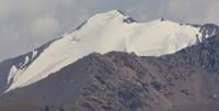
Chilik-Kemin mountain dam.
Ascensions mountaineering on peaks in Tien-Shan mountains.
“We know nothing at all. All our knowledge is but the knowledge of schoolchildren. The real nature of things we shall never know”
Albert Einstein.
Travels in Zailiskyi Alatau and Kungei Ala-Too mountains.
Chiliko-Keminskiy mountain site, that tightenes the ridges of Zailiskyi Alatau and Kungei Alatau, is considered the most interesting area of the Northern Tien Shan. This mountain area comprises the part of Zailiskyi Alatau from Ozernyi pass to Talgarskyi mountain massive and in the south a segment of Kungei Ala-Too limited by Ak-Su and Kugantyr passes.
The ridges come closer in the middle and get connected by the small link in the area of CDKA peak and peak of 4602 m high. Within these boundaries the Mountain site looks like a giant «X» letter.
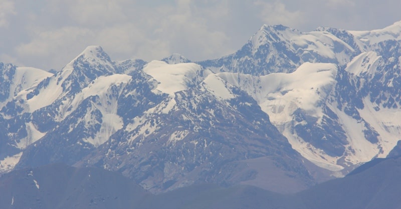
To the east stands a massive peak of Constitution. From this peak, the rear comb at first gradually and then abruptly deflects to the north, then with the new turn to the east and south-east, it bears the highest peaks, led by Talgar peak.
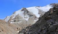
The basin lies at a depth of up to one kilometer or more from the surrounding watersheds. Its top width is up to 11 - 12 kilometers. In some places the basin is blocked by short spurs of the mountains that form the reservoirs of different sizes filled up with glaciers.
The glaciers give the sources for the main river - Tourists, Constitution, Mynzhilki. The first two are the main source of the Left Talgar River and the third - Mynzhilki river. It is considered (N.G. Kassin) that Zailiskyi Alatau and Kungei Alatau originally represented one common rise.
The tectonic fault occured during the era of the Alpine folding created the riverbeds of Chilik and Big Kemin rivres that now separate the two mountain ranges. The original orographic structure of the mountain unit, large glaciers and high peaks had always attracted the attention of scientists and climbers. Intense division of ridges, inaccessible areas, the lack of sufficient experience complicated the study of Chiliko-Kemin mountain site.
The Study was running slow and the resulting information had not been always sufficient and accurate. Thus, S.E. Dmitriev, who collected a lot of valuable material during his numerous trips to the area of the site mistook the two largest glaciers of Zailiskyi Alatau for one, calling it "Bogatyr".
Misconceptions, mechanically transferred on the maps, misled the future researchers. Only in 1936 the local ethnographer and climber V. Gorbunov found out in general the structure of the site.
The beginning of the systematic study of the area was initiated by Talgarsky expedition of the Kazakh branch of the Academy of Sciences and the Institute of Geography of the Academy of Sciences of the USSR.
The expedition worked in the area for some years.
Authority:
«At nine tops Chilik-Kemin mountains» M.E.Grudzinsky.
Photos by:
Alexander Peetrov.