


![]()
Вы здесь
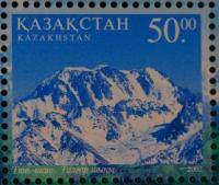
Talgar peak.


Climbing tours to Talgar peak.
“Not all those who wander are lost”
J.R.R. Tolkien.
Mountain climbing in North Tien-Shan.
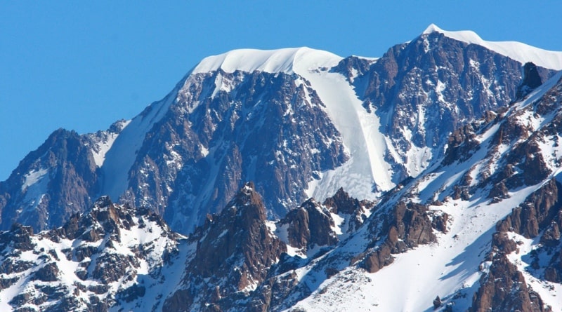
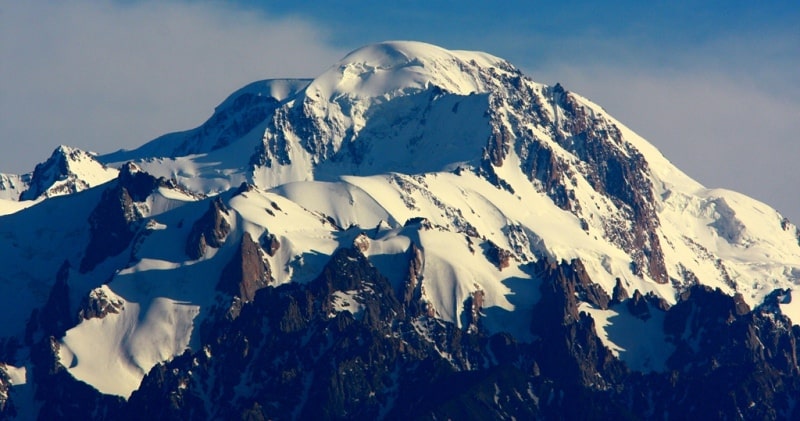
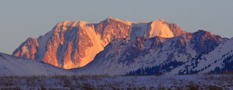
Domed Talgar peak, 4978.9 m. a. s. l., is located in eastern part, in main ridge of Zailiysky Alatau ridge, on territory of Almaty Nature Reserve in Talgar district of Almaty region.
The peaks of the Talgar massif close the upper reaches of the gorge of the Sredny Talgar River. At 3.3 kilometers to the south-west of Talgar is Aktau peak, located in the crest of the Zailiysky Alatau ridge, 4564.3 m. a. s. l. 1.5 kilometers northeast of Talgar Peak is Kopyr Peak, 4612.6 m. a. s. l. 3.4 kilometers northeast of Talgar Peak is Metallurg Peak, 4612.6 m. a. s. l.
From the northeastern slopes of Metallurg Peak, a 3.1 km long glacier of the same name descends.
Peak Metallurg in the northeast, confidently dominates the peaks in the eastern part of the Zailiysky Alatau ridge and is clearly visible from the north. Talgar - similar in shape to a molar. Its steep slopes are covered with eternal glaciers, and the foot of the mountain is covered with a firn field.
The northwestern slope has a trapezoidal shape, on its southwestern slope there is a large glacier, which offers a panorama from the top. Peak Talgar rises with steep rocky cliffs above the firn fields of the Korzhenevsky glacier.
The slopes are steep, especially the western ones, with a height difference of 1500 meters, dissected by buttresses and crevices, which are clogged with snow and ice.
The peak is clearly visible from the eastern part of the city of Talgar. A complete picture of it and the entire mountain junction around it, with many glaciers, opens from the main road Alma-Ata - Baltabay - Chilik - Narynkol east of the village of Baiterek (the former village of Novoalekseevka).
The Gorin glacier descends from the southern slopes of the peak, which after 2.1 kilometers adjoins the left side of the Korzhenevsky glacier. From the southwestern slopes of the summit, the sources of the central part of the Korzhenevsky glacier begin, 10.5 kilometers long.
From the northern slope of the summit, the sources of the Sredny Talgar glacier begin, 3.2 kilometers long. There is a certain paradox in indicating the height for this peak, in fact, it is identical with the determination of the height for the highest peak of Kazakhstan - Khan Tengri, located in the Kazakhstani part of the Central Tien-Shan.
On topographic maps of the USSR and old reference sources, the height of the peak is indicated - 4978.9 meters above sea level. For example, in the encyclopedia Kazakh SSR, published in the early 90s in the section "Nature" on page 498, the height of 5017 meters above sea level is indicated, as edited by Vera Ivanovna Stepanova.
And yet we will adhere to the height for this peak of 4978.9 m. a. s. l., since after 1991 Kazakhstani surveyors and topographers did not make instrumental surveys of the Talgar massif. The paradox with the height of the top is as follows.
At the end of the 80s, they began to build an international, acclimatization, base camp for commercial climbers on the right side of the Karkara river valley.
The organizers of commercial mountaineering had a need to increase the height of the Talgar peak to 5017 m. a. s. l. Peak Khan-Tengri with a height of 6995.2 m. a. s. l., located in the Tengri-Tag ridge in the Central Tien Shan to a height of 7010 meters above sea level.
Thus, the increase in the height of popular peaks immediately guaranteed the attraction of foreign climbers to the climbing areas.
History of first ascents to Talgar Peak.
1930.
In August, V.L. arrived in Alma-Ata. Semenovsky. The mountain section of the Central Council of the OPTE entrusted him with the study of the upper reaches of the Talgar River and the ascent to Talgar Peak. Semenovsky and his wife were brought from the station on a cart directly to the Cathedral, where the local branch of the OPTE, headed by V. Gorbunov, was located.
They organized a small expedition with pack horses. Together with V. Semenovsky, G. Beloglazov, V. Gorbunov, G. Savinov were in the group. Gorbunov proposed to reach the Talgar massif through the Talgar pass, according to the description of S.E. Dmitriev, the Talgar massif was supposed to be on the Bogatyr glacier.
From the Left Talgar, through the Toguzak pass, they climbed the Bogatyr glacier, but did not find the peak there. They made several ascents to peaks above 4500 meters above sea level, one of them, the peak of 4526 meters, was named after the 10th anniversary of the Kazakh SSR, the other was the peak of OPTE.
Having dealt with the location of the Talgar massif, Semenovsky and Beloglazov decided to take the peak by storm from the upper reaches of the Middle Talgar. On the third day of the journey, Beloglazov's shoes fell apart. Semenovsky alone had to continue the journey and make the first ascent to the summit of Talgar.
1935
12 climbers from Alma-Ata under the leadership of V. Zimin climbed the southwestern peak 4860 meters above sea level.
1938
A group from the city of Stalinsk (now the city of Novokuznetsk, Kemerovo region, Russian Federation) made an ascent through the northern peak to Talgar peak, consisting of L. Kutukhtin, G. Makatrov, I. Kropotov. The group climbed over the northern peak.
Geographical coordinates of Talgar peak: N43°07'07 E77°20'18

Authority:
Alexander Petrov.
"Zhetysu is the Land of tourism”. A Tourist Guide-book. Almaty. 2003. 68 p. and the material for this page is taken from the printed edition.
Photos by:
Alexander Petrov.