Вы здесь
Gorge Karkara.

FIT trip in Kyrgyzstan.
“Sweetness shudders through the land
as if, freed from the heat,
nature’d scooped spring waters in her hand
and splashed her burning feet”
Fyodor Ivanovich Tyutchev. “Summer evening”.
Shopping tour in Bishkek.
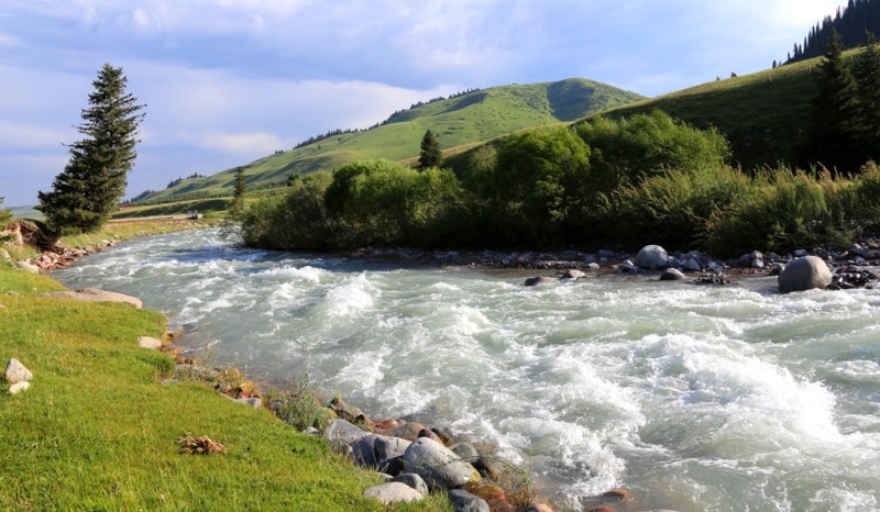
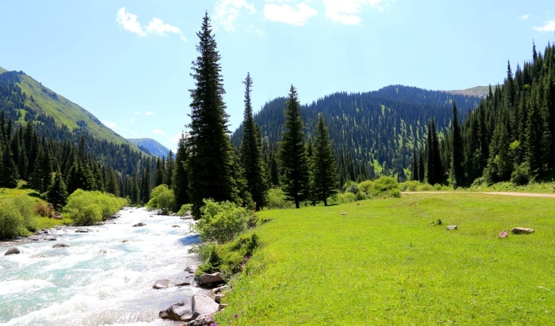
The Karkara gorge is located on the northern slope of the Terskey Ala-Too ridge in the Tyup region in the east of the Issyk-Kul region. The length of the gorge is 26 kilometers from south-east to north. The river Karkara laid its bed along the bottom of the gorge.
The beginning of the southern part of the gorge is considered to be the confluence of the Kokzhar and Turuk rivers, the end of the gorge in the Karakerege tract where it goes from a wide mountain gorge to the foothill plain.
The Dzhak River and the Kokzhar River that follows it give rise to the Karkara River. The length of the Kokzhar River is 35 kilometers. The main channel of the river is formed at an altitude of 3009 meters above sea level by the Jak River, which largely fills the river.
Passing a height of 3009 meters above sea level, the Dzhak river loses its name, and the river waters get a new name - Kokzhar. Throughout its course until the confluence with the Turuk River, Kokzhar will receive 28 tributaries on the right, most of them small and only some significant
The state border between the Republic of Kazakhstan and the Kyrgyz Republic runs along the bed of the Karkara River. The length of the Karkara River through the territory of Kyrgyzstan is 32 kilometers, through the territory of Kazakhstan is 68 kilometers.
The Karkara River flows into the Kegen River on the territory of Kazakhstan in the vicinity of the Shyrganak (Karkara) settlement as a left tributary and after that it loses its name. In the lower part, the gorge is 700 meters wide.
The Kazakh camp "MAL Khan-Tengri" is located 9 kilometers from the beginning of the gorge on the right bank of the river of the same name. A motor road is laid to it on the right side of the river from the village of Mynzhylki.
At the end of the 80s of the last century, the Council of Ministers of the USSR made a decision to build acclimatization international mountaineering camps in the Tien Shan mountains. One camp was planned to be built on the right bank of the Karkara River, at an altitude of 2210 meters above sea level on the territory of the Kazakh SSR.
Another, seasonal camp, on the right bank of the Inylchek River in the Maidaadyr tract, east of the Maidaadyr frontier post, at an altitude of 2596 meters above sea level in the Kyrgyz SSR. The task of the camps was to acclimatize foreign climbers for further transfer by helicopter to the base camp on the North Inylchek glacier, under the northern wall of Khan Tengri peak.
The second, seasonal camp of climbers was located at the confluence of the South Inylchek and Zvezdochka glaciers, in the immediate vicinity of the Khan-Tengri peak, 6995 meters above sea level, located in the Tengri tau ridge and Pobeda peak, 7439 meters above sea level, located in the eastern part of the Kokshaal-Too ridge. in the mountains of the Central Tien Shan.
The flight time by helicopter was: from MAL “Karkar” - MAL “South Inylchek” - 40 minutes, MAL “Maidaadyr” - MAL “South Inylchek” - 20 minutes.
A large terrace over the river valley was chosen for the Kazakh camp. On the territory of the Kazakh camp, modules of a dining room, baths, utility rooms, a helipad, toilets were built, a tank for kerosene was installed, wooden podiums for camping were erected, and a concrete bridge was built across the Karkara River 1 kilometer east of the camp.
At this time, the bridge is not in operation, since there is no border service checkpoint at this place. A grader road led to the camp across the bridge on the Karkara River from the Kyrgyz village of Tyup and the Kazakh village of Kegen.
The first director of the IAL "Khan-Tengri" was a Kazakh climber B, A. Studenin. On the opposite side of the river there is a seasonal acclimatization camp for climbers and tourists of the Kyrgyz travel agency Aksai Travel.
To the west of the mouth of the Zapadnaya Ushkashka river there is a picturesque tract Charkuduk. On the left side of the gorge, along the river there is a road, along which you can get to the upper reaches of the Saryjaz gorge.
After the confluence of the Turuk and Kokzhar rivers, the road passes into the gorge of the Turuk river, bypassing the Turuk tract and passes through the Turuk pass with a height of 3354 meters above sea level. From here the road begins to descend into the valley of the Saryjaz River.
A magnificent view of the mountains of the Central Tien Shan opens from the pass, and in good weather you can observe the highest peak of the Tengri tau ridge - Khan Tengri. In 1856, the Russian traveler Pyotr Petrovich Semyonov watched from this place at dawn, after a stormy night under the pass, the Khan-Tengri peak. “Directly to the south of us rose the most magnificent ridges I have ever seen. It all, from top to bottom, consisted of snow giants."
These are his recollections (“Travel to the Tien-Shan in 1856 - 1857 by P.P. Semenov-Tyan-Shanskiy).
Geographic coordinates of the Karkara gorge: N42 ° 38'43.97 "E79 ° 13'58.02"
Authority and by photos
Alexander Petrov.


