


![]()
Вы здесь
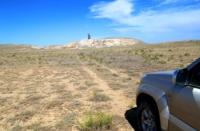
Inder Mountains in Atyrau region.
Alternative tours in Kazakhstan.
“This mountain range (Inder) consists of... deliberately high, rocky on the Yaitskaya side, and then gradually rising stone mountains.” He noted that “salt water is gushing out of them everywhere.”
Peter Simon Pallas. 1769.
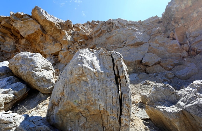
Walking in Inder Mountains in Atyrau region.
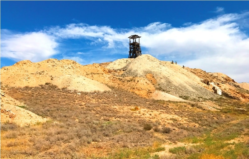
For 300 kilometers of water before the Urals flow into the Caspian Sea, the Inder Mountains rise on its left bank - the only mountains on the entire river from Uralsk to the Caspian. The Inder Mountains, with a maximum height of 54 meters above sea level, are a large uplift, in the core of which there is a salt dome.
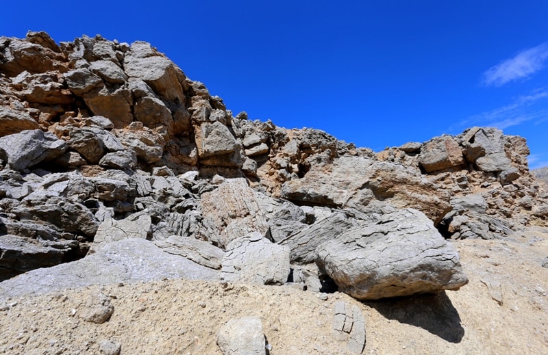
In its foundation at a depth of 10 kilometers lies a stock of rock salt. From above, it is covered with red-colored gypsum clays, which in some places come to the surface. But most of the red color is buried under a huge plaster hat.
Gypsum is developed on an area of about 250 km, having an oval shape, which corresponds to the configuration of a salt body lying close to the surface. The thickness of the gypsum does not exceed 50 - 60 m. On the surface of the Inder uplift, small domed hills of Yshtau, Albaytau, Kugantau, Kyzyltau are scattered.
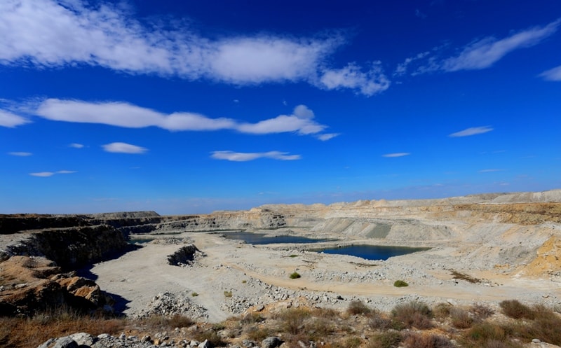
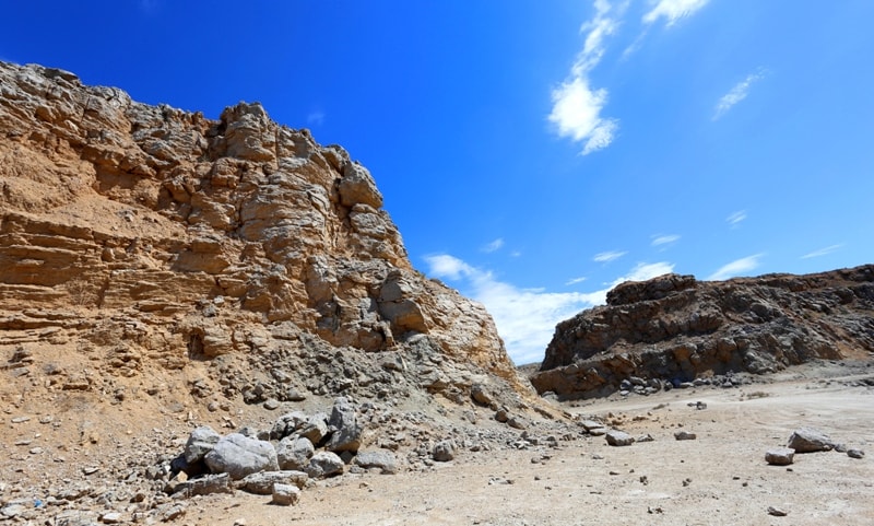
The surface of the Inder Upland has the form of a shallow bowl framed by hilly ridges, so atmospheric precipitation does not flow down from the hill, but is absorbed by the clay-gypsum rocks. Closed basins, which correspond to places of subsidence of the surface above the underground voids, developed inside the hill. In the central part of the hill, individual hills stand out sharply.
The Inder Rise is characterized by the development of karst processes, leading to the development of underground voids and dips. According to the classification of the famous Soviet physicist-geographer N. A. Gvozdetsky, Karl Inder belongs to the Mediterranean type.
This is due to the f
As a result of the chemical, physical, and mechanical weathering of the gypsum strata, furrows are formed, called carrots, which corrode the surface with a dense network. The karst landforms of the Inder Upland are extremely diverse.
Among them, we note karst funnels, ponors, wells, mines, ravines, depressions, caves. There are three types of karst funnels: saucer-shaped, cone-shaped and formations. Saucer-like funnels have a diameter of 15 – 20 m and a depth of 3 – 4 m.
Cone-shaped funnels have a depth of 10 – 15 m and reach 40 – 50 m across. Funnels are widespread, that is, • karst dips rounded with a hole in the form of a hole in the lower part. Ponora - a kind of canals that serve to drain surface water.
Most often they go deep vertically or at a steep angle. Distinguish between slot-shaped and well-shaped ponors. Their depth reaches 20 m. In some places, vertical channels of cylindrical shape with a diameter of 1 – 2 m and a depth of 10 m, called karst wells, are found in Inder.
The walls of the wells are corroded by furrows, which give them a ribbed character. One-eyed well is very peculiar. Its depth is 18 m, diameter is 6 - 9 m. The firn snow and ice lie at the bottom of the well throughout the summer, therefore, local residents use such wells as refrigerators.
At the very bottom of the well, it passes into a large grotto with a height of 4 m, a width of 10 m and a length of 20 m. The ceiling and walls of the grotto in many places are lined with beautiful optical gypsum. In the central part and in the northwest of the Inder uplift, mines are common - karst relief forms resembling wells with a diameter of 5 m or more.
Their depth does not exceed 8 - 1 m. The bottom of the karst wells is dotted with holes. Karst ravines with no surface exit are developed on Inder in places with steep and steep slopes. They are characterized by gorges or a trough-like form.
Their length reaches 250 – 300 m, and their width is 10 m. Above large underground karst channels, as a result of subsidence of their ceiling, depressions are formed on the earth's surface up to 200 m long and 10 – 15 m deep.
The caves on the Inder Upland are few, their sizes usually do not exceed 20 m. Most caves lie at a depth of 2.5 - 5 m from the surface, sometimes connecting with it through dips, ponora or wells. At the southern foot of the Inder Mountains there is an extensive karst basin of Inder Lake, with an area of about 110 km.
It feeds on numerous salt springs wedging from the Inder Upland. Inder Lake is closed and composed of a salt layer with a thickness of 10 - 15 m. It is a huge snow-white plain. It produces high quality salt containing potassium, bromine and boron.
The northern coast of the lake is replete with salt and sulfur springs. The most famous of them is the healing key Ashchebulak on the northeastern shore of the Inder. The water in this spring is clean, tastes good. The landscapes of the Inder Mountains are sharply isolated on the background of the surrounding desert landscapes.
Among the prevailing white wormwort, the hill stands out with thickets of black wormwood, biyurun, blackberry. But the vegetation of karst dips is especially unusual for these places. They find refuge spirea, dogrose, astragalus and other plants unusual for the desert.
And at the same time, several typically Asian species live here, not found anywhere west and north. In some karst funnels, even an apple tree grows. On the plains adjacent to the lake, well-preserved tulips, formed by Schrenk, Bieberstein, Greig tulips, attract attention.
The wildlife of the Inder Mountains is no less interesting. A number of relict animals live in the Indera region. Of the snakes, it is an ordinary muzzle, living in crevices of rocks, and hiding in caves for the winter, the muzzle is a nocturnal predator, feeding on large insects and bird eggs.
Also relics for Inder are some types of arthropods, such as the many-legged scolopendra predator from the millipede class and the masking stick insect master. An eagle owl nests in karst wells, mines, and caves. With the onset of darkness, bats fly out of the underground voids.
There are several types of them: ginger evening, bat, ordinary two-tone leather. In the underground kingdom of the Inder Mountains, such night predators as a fox and a bandage take refuge.


Authority:
A.A. Chibilev. "The Ural River." Leningrad. Hydrometeoizdat, 1987.
Photos
Alexander Petrov.