Вы здесь
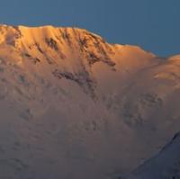
Mazorsky Glacier.

Coach trip in Tajikistan.
"Night. Beyond the distant pass
He got the bloody eye of Mars
And watch the rocks anxiously
Into the silence of the ice masses"
Yuri Vizbor. September 1954.
Packaged tour in Tajikistan.
Mazorskiy glacier is located at an altitude: upper limit is 5963 (Terkharv peak) and 5670 (Small Arnavad peak) meters above sea level, end of glacier is 3256 meters above sea level, glacier is located between southern and western slopes of Mazorskiy ridge and western slopes of Darvaz ridge, in territory Tajik National Park, in Sangvor district, Republic of Tajikistan.
The Mazorskiy Glacier is located at the headwaters of the 35-kilometer-long Obimazor River, a large left tributary of the Obihingou. The Obimazor River, 35 kilometers long, originates from the end of the Mazorsky glacier at an altitude of 3256 meters above sea level.
The river receives its sources from the southern slopes of the Mazorskiy ridge, from the eastern slopes of the meridional ridge Darkharvak and the western slopes of the Darvaz ridge. The length of the glacier is 18.6 kilometers, the area of the Mazorskiy glacier is 23.0 square kilometers, it originates from the firn plateau in the ridge part of the Darvaz ridge, common with the Sed glacier.
The glacier is located in a narrow deep valley stretched along the Mazorskiy ridge. Most of the surface of the tongue is covered with moraine. The glacier ends at an altitude of 3256 meters above sea level, wedging into a zone of tree and shrub vegetation.
Several large complex valley glaciers lie in the upper reaches of the Bohud River - the Burs, Sytargi and Zordi-Birauso glaciers. They have extensive multi-chamber feeding areas and wide moraine parts with hilly karst relief at the ends of the glacier.
Geographic coordinates of Mazorskiy Glacier: N38°37'15 E71°35'10
Authority:
"Glaciers." L.D. Dolgushin, G.B. Osipova. Series "Nature of the world." Moscow, the publishing house "Thought". 1989.
Photos by
Alexander Petrov.


