


![]()
You are here
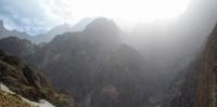
Darvaz Range.
Tour and Trips Tajikistan.
“I am happy if I could make my modest contribution to the study of this wonderful unforgettable country - Turkestan, which I consider my second homeland. Even loess dust of Turkestan is sweet and pleasant to me.”
Academician L.S. Berg.
Natural Wonders Adventure Holidays in Tajikistan.
Regular research of the Pamirs began in the 1860s and 1880s of the XIXth century after the annexation of Central Asia to Russia. The first information on the Darvaz Range was collected by expeditions of the Russian Geographical Society.
The name Darvaz Range was received in 1878 by the researcher of the Pamir V.F. Oshanin by the common name of the mountainous country of Darvaz among the local population. In 1884, Darvaz visited the expedition of V.I. Lipsky, who received the first information about the Ob-Hingou and Ob-Mazar river basins.
In 1916, the expedition of Y.I. Belyaeva discovered the three sources of the Garmo Glacier, subsequently called the glaciers of Lipsky, Belyaev and Vavilov. The expedition members passed the Pulkovsky I Pass, connecting the Garmo Glacier with the Vancha Valley.
The most comprehensive studies and topographic surveys were carried out in 1928.1930.1931 and 1932. expeditions of the USSR Academy of Sciences under the leadership of N.V. Krylenko. Darvaz Range belongs to the Northwest Pamir.
The basis of this part of the Pamirs is the ridge of the Academy of Sciences, from which the ridges of Peter I, Darvaz, Vanch and Yazgulemsky branch in the south-west direction. The Darvaz ridge branches off from the ridge of the Academy of Sciences at the peak of Garmo (6595 m) and stretches for almost 200 kilometers between the rivers Vancha and Ob-Hingou.
The main river of the Pamir - Pyanj closes the river triangle. According to the course of the Pyanj River, the Darvaz Range in its western part abruptly turns to the northwest and, making a wide arc, returns to the southwest direction, gradually lowering to the last significant peak of Khamtarg (4484 m) near the village of Nulvand.
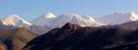
The snow line on the Darvaz Range runs at an altitude of about 4200 meters above sea level. In the upper reaches on its slopes, glaciers Garmo (30.4 km) and the Russian Geographical Society (24.2 km) are formed.
The largest glaciers of the middle part of the ridge: Mazarsky (16.8 km) and Darvaz (16.2 km) are located on the northwestern slopes. The same applies to the Mazarsky ridge: Skogach glaciers (12.7 km) and Batrut (12.4 km).
On the southwestern slopes there are significant glaciers only near the peak of Arnavad: Sed (11.6 km) and Arnavad (5.5 km).
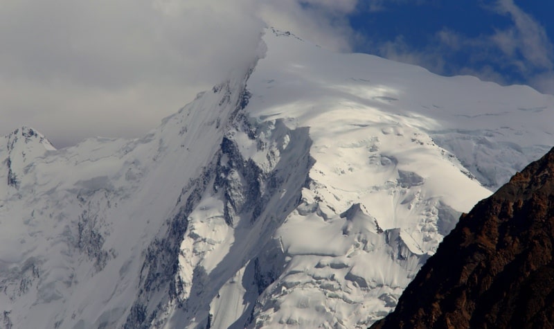
The Darvaz Range can be conditionally divided into three parts.
The eastern part Darvaz Range - from Garmo peak to Pulkovo spur, has a significant height (5500 - 6000 m), powerful glaciation and passes of the highest difficulty.
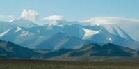
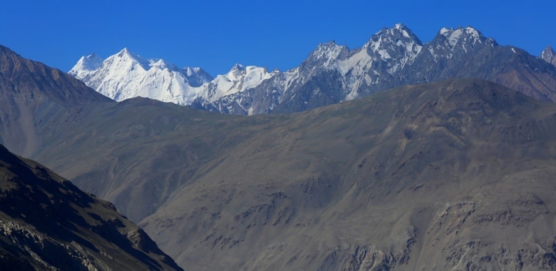
The middle part Darvaz Range - (Mazarsky mountain junction), ending at the Kukhi-Ruzan spur by turning the ridge to the northwest, is significantly lower (4500 - 5000 m). The rocky relief and talus prevail here, the complexity of the passes varies widely, but most of them belong to the middle (second) category of difficulty.
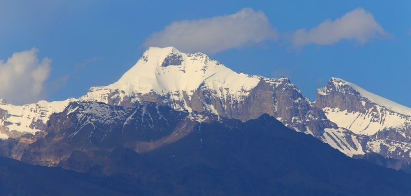
The western part Darvaz Range of the ridge rarely rises above 4,500 m and resembles the midlands in character. The valleys are wide, overgrown with lush vegetation, glaciers are mostly kar valleys. In the middle part of the Darvaz Range, arrays of Arnavad Peak (6038 m) stand out, near which the largest north-western spurs branch: Pashimgar (30 km) and Mazarsky (about 40 km) ridges.
The largest glaciers of the middle part of the Darvaz Range are connected with the Arnavad massif: Mazarsky. Darvaz and Sed. After turning the Darvaz Range to the north-west, the main, south-western direction continues the Kuchi-Ruzan Range.
The Darvaz Range, like the entire Northwest Pamir, belongs to the young mountains of the Alpine type. It is characterized by active weathering processes. The difference in height from the bottom of the valleys to the surrounding ridges ranges from 800 to 2000 meters.
Moreover, the horizontal state of the slopes does not exceed 1.5 - 3 km, and the length of the tributaries of the main rivers is 10 - 12 km. The formation of a deeply dissected relief is facilitated by the main rocks that make up the ridge: shales from soft clay to hard crystalline, gneisses.
A powerful serpentinite vein stretches along the Darvaz ridge, forming simple passes at the intersection with the southeastern spurs and the ridge itself, where collectors can find samples of translucent black-green serpentinite and grayish, fibrous asbestos.
The Mazar Range, where marble outlets are found, looks somewhat different. It is characterized by high sheer walls and angular shapes of peaks. Due to the high clay content, river and glacial deposits are represented by strong conglomerates, in which rivers lay deep channels with steep banks.
The slopes of the ranges, facing south, are steep and short, the opposite - long and relatively flat, dissected by numerous branched valleys. The western and northwestern slopes facing the wet winds also carry more powerful glaciation.
Often firn glacier basins approach the crest ridges. From the south talus slopes and sheltered glaciers prevail. The rivers of the Darvaz Range belong to the Amu-Darya basin. The Panj with its tributaries Vanch, Darai-Pshiharv and others forms the left source of Amu-Daria, and Obi-Hingou, merging with Surkhob, the right source is Vakhsh.
Such large ones as Vanch, Obi-Hingou, Obi-Mazar, Bohud are almost irresistible fording. Small rivers, although the water flow in them is small, are characterized by a steep fall of the channel (about 100 m per kilometer).
Therefore, even with a width of 5 - 10 m, fording at the end of summer becomes a difficult task.
Flora and fauna of the Darvaz Range.
The foothills of Darvaz at heights of 800 - 1700 meters are located in the semi-desert zone. Above, instead of the forest zone, a tree and shrub belt is developed. Turkestan maple, plane tree, walnut, and almonds are common here.
The gardens are dominated by apricot and mulberry. In the floodplains of the river there are thickets of willow, poplar, sea buckthorn, and birch. On the upper border of the tree belt, juniper and rosehip grow. In moist places, St. John's wort, thyme, wild onions and garlic are found.
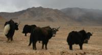
Rocky slopes are occupied by ephedra. In flood meadows among dense greens there are primroses. The fauna of the area is rather poor. In the foothills there are reptiles, among them - poisonous snakes. Of the mammals, it is worth noting the groundhog and the bear; higher in the mountains are ibex and snow leopard.
The most significant spurs of the Darvaz Range.
The Mazarsky spur, with a length of 45 kilometers, is located at an altitude of 4100, the maximum height of the peaks is 5765 meters above sea level.
The spur Pashimgar, with a length of 40 kilometers, is located at an altitude of 4650, the maximum height of the peaks is 5139 meters above sea level.
The spur Kukhiruzan, with a length of 26 kilometers, is located at an altitude of 4700, the maximum height of the peaks is 5500 meters above sea level.
The spur Darharvak, with a length of 24 kilometers, is located at an altitude of 4700, the maximum height of the peaks is 5416 meters above sea level.
The spur Zotkin, with a length of 19 kilometers, is located at an altitude of 4700, the maximum height of the peaks is 4935 meters above sea level.
The spur Kukhikurgovat, with a length of 19 kilometers, is located at an altitude of 4700, the maximum height of the peaks is 4495 meters above sea level.
Authority:
Alekseev Alexey Alexandrovich. http://poxod.ru/guidebook/darvaz/index.html
Photos by
Alexander Petrov.