


![]()
Вы здесь
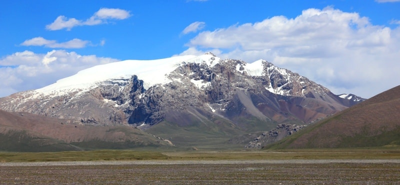
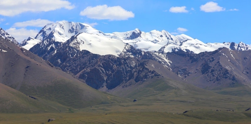
Glaciers in ridge of Kuily-Too.
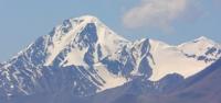
Nature of Kyrgyzstan mountains.
“What is that feeling when you're driving away from people and they recede on the plain till you see their specks dispersing? - it's the too-huge world vaulting us, and it's good-bye. But we lean forward to the next crazy venture beneath the skies”
Jack Kerouac, «On the Road».
Sights of Terskey Ala-Too mountains.
Kuylu-Too ridge is located between the Akshyirak ridge in the west, Terskey Ala-Too in the north, the Uch-Kel valley in the south and the western spurs of the Saryjaz ridge in the east in the Djety-Oguz and Ak-Suu districts of the Issyk-Kul region.
To the southeast from the Terskey-Ala-Too ridge, separated from it by the longitudinal valley of the Köoluu river, the Kuylu-Too ridge stretches. Its average height is 4700 meters above sea level, the highest point, 5203 meters above sea level.
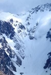
The main watershed ridge differs from the surrounding mountains in its alpine appearance. The flatter northern slope is cut by transverse valleys 5 - 7 kilometers long. The dismemberment of the southern slope is more complex and deeper.
There are 147 glaciers on the Kuylu-Too ridge with a total area of 228.2 square kilometers. Of these, 52 glaciers on the northern slope 88.3 square kilometers, in the south - 95 glaciers with an area of 139.9 square kilometers.
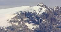
In quantitative terms, hanging glaciers slightly prevail (58%), located on the slopes of the lateral spurs, but 78% of the glaciation area falls on the glaciers of the valleys. On the northern slope, the glaciers of the valleys occupying the upper reaches of the transverse spurs have extensive feeding areas.
The largest glacier with an area of 14.1 kilometers square is located in the upper right tributary of the Ashu-Tor river. It begins in a circus, which reaches 7 kilometers across. Between 1943 and 1956 the glacier was stationary, but by August 1964, its length increased by 250 meters, and the edges became convex and steep.
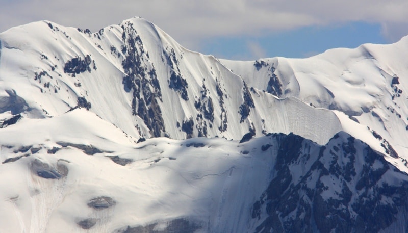
Many glaciers of the northern slope recede, but not as much as the glaciers of the southern slope. Small and medium glaciers are stationary. The largest glaciers of the southern slope of the Köoluu-Too ridge are confined to the headwaters and to the joints of the ridge with its spurs.
Snow transport from the western and northern slopes through the saddles on the ridge plays an important role in the nutrition of glaciers.
Aylam Glacier. The largest on the southern slope of the Kuily-Too ridge is the complex Ailam valley glacier, 5.1 kilometers long, 15.3 square kilometers in the upper Terekty River. It consists of four ice flows merged with the ends.
Recently separated from him a large right tributary with an area of 8.9 kilometers square, but part of it is not connected with the Aylam glacier with a common moraine with buried ice. It is planned to separate another left tributary.
The ends of the valley glaciers on the northern slope of Kuily-Too descend on average to an altitude of 3770 meters above sea level, on the southern - to an altitude of 3800 meters above sea level. The height of the firn line is 4,000 and 4,160 meters above sea level, respectively.
Total area of glaciation of the Kuily-Too ridge is over 250 square kilometers, over 150 glaciers.
Largest glaciers of the Köoluu-Too ridge.
Karator Glacier, with a length of 7.6 kilometers, an area of 9.7 square kilometers, is located at an altitude of 3600 to 5200 meters above sea level, belongs to the Keoluu river basin.
7.4 km long KuilyGlacier, an area of 8.5 square kilometers, located at an altitude of 3960 to 4900 meters above sea level, belongs to the Uch-Kel River Basin.
Glacier No. 99, with a length of 6.5 kilometers, an area of 14.1 square kilometers, located at an altitude of 3780 to 5200 meters above sea level, belongs to the Keoluu river basin.
5.6 km West Bordu Glacier, an area of 5.7 square kilometers, located at an altitude of 3660 to 5000 meters above sea level, belongs to the Keoluu River Basin.
5.5 km long Sary-Echki Glacier, an area of 8.0 square kilometers, is located at an altitude of 3640 to 4150 meters above sea level, belongs to the Uch-Kel River Basin.
Glacier No. 97, with a length of 5.4 kilometers, an area of 4.9 square kilometers, located at an altitude of 3840 to 4700 meters above sea level, belongs to the Keoluu River Basin.
Glacier No. 194, 195, 196, with a length of 5.1 kilometers, an area of 8.4 square kilometers, located at an altitude of 3640 to 5000 meters above sea level, belongs to the basin of the Uch-Kel River.
Glacier Oroy. No. 135, 136, 137, with a length of 4.4 kilometers, an area of 8.2 square kilometers, located at an altitude of 3770 to 4460 meters above sea level, belongs to the Keoluu river basin.
Ailama Glacier, 4.4 km long, covering an area of 6.9 square kilometers, located at an altitude of 3,750 to 4,800 meters above sea level, belongs to the Uch-Kel River Basin.
Glacier No. 245, with a length of 4.3 kilometers, an area of 3.4 square kilometers, located at an altitude of 3,780 to 4,700 meters above sea level, belongs to the Uch-Kel River Basin.
Glacier No. 225, with a length of 4.3 kilometers, an area of 3.3 square kilometers, located at an altitude of 3660 to 4700 meters above sea level, belongs to the Uch-Kel River Basin.
Glacier No. 197, with a length of 4.2 kilometers, an area of 8.9 square kilometers, located at an altitude of 3690 to 4900 meters above sea level, belongs to the Uch-Kel River Basin.
Ekichat glacier, with a length of 4.1 kilometers, an area of 10.4 square kilometers, is located at an altitude of 3,500 to 4,900 meters above sea level, belongs to the Uch-Kel River Basin.
Geographic coordinates of the Kuilu-Too ridge: N42 ° 03'14.93 "E78 ° 46'38.71"
Authority:
Alexander Petrov.
"Glaciers." L.D. Dolgushin, G.B. Osipova. Series "Nature of the world." Moscow, the publishing house "Thought". 1989.
Photos by
Alexander Petrov.