Вы здесь
History of opening of peak Pobeda.


Climbing tours in Central Tien-Shan mountains.
“If you are faced with a mountain, you have several options.
You can climb it and cross to the other side.
You can go around it.
You can dig under it.
You can fly over it.
You can blow it up.
You can ignore it and pretend it’s not there.
You can turn around and go back the way you came.
Or you can stay on the mountain and make it your home”
Vera Nazarian. «The Perpetual Calendar of Inspiration».
Pobeda Peak Climbing, Hiking & Mountaineering.
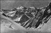
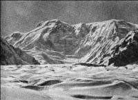
The highest point of the Tien-Shan - Pobeda Peak is located at the headwaters of the Zvezdochka glacier (the left tributary of the South Inylchek glacier) located in the Kokshaltau ridge. For the first time about a peak arguing in height with the famous Khan-Tengri (6995 meters above sea level), which was long considered the highest in the Tien-Shan, they started talking in 1937 when, from the peaks of the Soviet Constitution (5280 meters above sea level) ) and Karpinsky (5068 meters above sea level) in the Kuilu ridge by the expedition members of the All-Union Committee of Physical Culture and Sports at the Council of People's Commissars of the USSR, headed by Professor A.A. Letavet.
Nowadays, the Honored Master of Sports of the USSR, a full member of the Academy of Medical Sciences, laureate of the Lenin and State Prizes, on the fine days of the beginning of September saw a panorama of the majestic Tengri-Tag vertices.
Even then, without special instruments, it could be firmly said that the peak lying to the south of Khan Tengri is superior in height to the famous Lord of the sky. In 1938, A.A. Letavet again led an expedition to the Central Tien-Shan with the task of climbing the nameless peak, conditionally called by us then the peak "Asterisk".
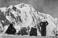
Three climbers from the expedition A.A. Letaveta - A. Gutman, E. Ivanov and A. Sidorenko - on September 19, 1938 climbed the crest of the Kokshaltau ridge, in the region of the current eastern shoulder of Victory Peak, and called the peak they reached, “The XXth Anniversary of the Komsomol.”
They wrote (On land, at sea magazine, November 1938):
“... September 19, 1938 ... the peak is very close. We approached the summit rocks at about 3 o’clock, took off our cats. The ridge is less than 100 meters. We try to pass the summit rocks as quickly as possible. And here is a wide snow ridge.
This is the top of the wall. Altitude 6930 meters above sea level. To the southeast, fading, go mountain chains. Their harmony is violated, and then this sea of small peaks disappears completely. From the southwest the front of thick clouds advanced.
Everything is closed, only one unknown peak with a sharp knife, breaking through the thick of the clouds, sticks out over this troubled sea. Apparently, this is a very high peak."
Thus, the climbers were on the ridge leading to the peak, which lay from them at a distance of 3-5 kilometers and about 500 meters higher, in the south-west direction. These data now, after many ascents to Victory Peak, are in very good agreement.
According to M.T. Pogrebetsky, while climbing the famous Khan Tengri in 1931, the future peak of Victory attracted their attention, but they did not consider it the highest point of the Tien Shan, since at that time there was an assertion that the Khan Tengri peak was is the main peak of the mountain system.
In those years, in the materials of the expedition, the peak was called the peak of Sacco and Vanzetti, in honor of the American revolutionary workers executed by the American imperialists in 1927. The summit is clearly visible on the famous Tengri-Tag panorama, donated by the famous mountaineer-geographer Gottfried Merzbacher to the Russian Geographical Society and still located in the library of the company in Leningrad.
In 1940, I, the head of the expedition to the Central Tien-Shan to shoot a film about Kyrgyzstan (cameraman A. Samgin, assistant P. Opryshko), had to observe this peak more than once from the panoramic points of the Terskey Alatau ridge (Berkut pass) and Saryjas (Achik-Tash pass).
In all cases, using a television camera lens mounted on a tripod, it was possible to draw a horizontal line from Khan Tengri to the Nameless peak. These observations made it possible to quite clearly imagine that in the Central Tien Shan lies a peak, arguing with Khan-Tengri in height.
We were already convinced that it was about 500 meters higher than Khan-Tengri. In 1943, I was included in the expedition of topographers as the head of a group of climbers and a guide-consultant in the Khan Tengri region.
A special alpine group led by engineer P.N. Rapasov, was divided into separate teams of 8 to 10 people. A group of climbers and instructors, consisting of Kuzmenko and Chaadaev, was attached to them. I also belonged to this group.
Before leaving for field work, topographers were oriented to especially careful observations south of the Khan-Tengri in the Kokshaltau ridge, where the peak already known by that time was hiding. In August 1943, returning from another aerial photography flight in the Khan-Tengri region, the pilot of the Central Asian aero geodetic enterprise Bogomolov and the navigator Harutyunyants told me at the airport in Przhevalsk that they clearly saw a huge a peak significantly superior to the last in height.
They passed over the peak of Khan-Tengri, with the altimeter showing a height of about 8,000 meters. Thus, already in 1943, Soviet geographical science was on the verge of an outstanding discovery - determining the height and geographical coordinates of the highest peaks of the Tien-Shan.
In the period when the height of the peak was finally determined and the calculations were mutually checked, the head of the topographic department of SAVO (later TurkVO), lieutenant colonel A.S. Shapkin created an authoritative commission, which finally established that, 16 kilometers south of the Khan-Tengri, in the upper reaches of the Zvezdochka glacier, there is a mountain range, towering a huge icy wall, in the middle of which a cone rises, exceeding the wall by another 440 - 480 meters.
This is the highest point of the Tien-Shan, previously bearing conventional names - the peak of Sacco and Vanzetti, Zvezdochka, the twentieth anniversary of the Komsomol. The name of the peak - Pobeda Peak was established on my proposal, first expressed in 1944 (Racek, “Komsomolskaya Pravda”, 11.18. 1944).
On the map, the name “Peak of Pobeda” first appeared in 1946 when a large-scale map compiled from field work in 1943 was published. Until 1943, no one dared to shake the priority of Khan-Tengri as the highest point of the Tien-Shan, established by a number of well-known domestic and foreign researchers.
At one of the first reports on the opening of Pobeda Peak at the anniversary session of SAGU (December 1945), SAGU professor, a great expert on the history and geography of the region, N.G. Malitsky expressed an interesting idea: "Is the current peak of Pobeda a real Khan-Tengri, which was known from ancient times."
For all thirty years, the question of Professor N.G. Malitsky did not give me rest. Is the Khan-Tengri mystery hidden in it?
And now we answer him: - Yes. The Tashkent professor was right: the modern Khan-Tengri is Kan-too, and the peak of Pobeda is Khan-Tengri. How could this happen?
By the time of the trip P.P. Semenov on the Central Tien-Shan (1857), two prominent peaks were known: Khan-Tengri and Kan-Too. Moreover, the first of them was known P.P. Semenov according to historical documents, and the second was called the Kyrgyz - the guides of the Russian expedition.
It was then that P.P. Semenov, not having a description of the location of Khan-Tengri, calls him a prominent peak Khan-Tengri peak, although his guides call it in their own way: "Kan-Too" - "Mountain of blood" translated from Kyrgyz.
Thus, to put an equal sign between Khan-Tengri and Kan-Too, as P.P. did Semenov, you can’t. These are different peaks. The Kyrgyz folk epos "Manas" (part 2 of the Semetei) says that the highest mountain in Kyrgyz possessions lies at the source of the Iron River, the Temirsu River, flowing down from the southern slopes of the Kok-Saltau ridge.
On one of the first maps of this region - the map of Colonel Venyukov, it is clearly visible that Mount Khan-Tengri lies in the dividing ridge, from which the sources of the Sarydjas River (below called Aksu or Kum aryk) originate in the north, including river ”- Temirsu.
From the southeast, the sources of another river, Muzart, approach the Khan-Tengri node. The location of these rivers exactly determines the place where Pobeda Peak is now located. As research was being conducted on this highly remote region, new orographic values appeared that divided the Khan-Tengri node into a series of mountain ranges.
The first such differentiated, and quite accurate map, was proposed by a researcher of the Central Tien-Shan, a German mountaineer - geographer Gottfried Merzbacher, after his successful expeditions in 1902 - 1903 and 1907 - 1908 In this diagram, Khan-Tengri is located where P.P. Semenov.
However, extensive topogeodesic work in the Khan-Tengri site was not carried out until 1943, and therefore researchers of the forties and fifties of our century had the opportunity to rediscover the highest point of the mountain site and the entire Tien-Shan and give it the proud name of Pobeda Peak.
Work on a topographic map, for which the expedition of 1943 collected materials, was completed in Tashkent. The Red Army soldier Rashid Zabirov, now he is a venerable scientist, a famous Soviet glaciologist, head of the physical-geographical station of the Academy of Sciences of the Kyrgyz SSR, in Pokrovka, on the shore of Issyk-Kul, plotted the final line with the help of a stereo-autograph.
The map is ready, but it was a map with almost no geographical name. Only elevations were inflicted on it. Perhaps this was the last region of our country, where peaks, glaciers, passes, and even entire ranges did not have their own names.
The compilers of the map faced the task of giving the appropriate names that would suit the objects. The first name was given to the open ridge. It extended strictly along the meridian from south to north. Head of the expedition P.N. Rapasov proposed to call him "Meridional".
The situation was more complicated with the peak, the height of which was a record for the Tien-Shan. Topographers wanted to call it the peak of Military Topographers. We insisted on the previously proposed name - Pobeda Peak.
In addition to this peak, not yet named, there was one very high (6873 meters above sea level). Its existence became known only after the mapping. She lay in the southern part of the Meridian ridge at the junction with the Kokshaltau ridge.
In connection with the opening of the highest point of the Tien-Shan in 1946, we had to speak a lot in the Moscow House of Scientists, in the Large Auditorium of the old building of Moscow University, in the editorial office of the newspaper Pravda, the magazine Around the World, and finally, in a strict person Geographical Society of the USSR in Leningrad.
The listeners were very different - scientists, journalists, climbers, many of them were participants in the just ended Great Patriotic War. They warmly supported the idea of naming the highest point of the Tien-Shan peak of Pobeda.
In 1946, after completing my speeches in Moscow and Leningrad, I had a visit to General Mark Karpovich Kudryavtsev, the arbiter of topographical destinies. The conversation was slightly verbose and looked something like this:
The people, the lieutenant from Tashkent reported, asks for your consent to name the peak "7439" in the Tien-Shan peak of Pobeda.
- Good, ”the general answered,“ I do not mind.”
Upon returning to Tashkent, it turned out that the map had already been printed in the established circulation and in the southeastern corner of the sheet, near the very frame next to the “7439.3” mark, there was a name - “Peak of Military Topographers”.
However, the head of the department, Lieutenant Colonel Sergey Alexandrovich Shapkin, took the matter very seriously and said:
- Since there is an order from the higher authorities, we will fulfill it.
So on the topographic map sheet, and then on the map of the Soviet Union and geographical maps of the world, the name appeared - " Pobeda Peak". Even now, on the surviving sheets of the first edition of the map, you can see how “Pobeda Peak” is printed in red at the “7439.3” mark, and its original name “Peak of Military Topographers” is transferred to the highest point of the Meridional Range.
So the peak seen by various expeditions, beginning in 1931, and bearing different names - Sacco and Vanzetti, Zvezdochka, the peak of the XXth anniversary of the Komsomol, the peak of the military topographers, began to be called the peak of Pobeda, which was a symbol of the victory of the Soviet people Yes, his Armed Forces over Nazi Germany.
The essence of the discovery and research of 1943 in the Tien-Shan is not only to determine the height and geographic coordinates of the highest peak, but also to establish that the Tien-Shan node is not the Khan-Tengri peak, but a whole ridge, called the Meridian located east of the debunked Khan-Tengri.
The discovery of the peak of Victory, the highest point of the Heavenly Mountains, has been provoking heated discussions and sometimes misunderstandings for thirty years. - Who was the first to see, win? - Climbers speak in their favor, topographers in their own. So who?
Pobeda Peak was discovered by the efforts of many researchers and expeditions working in the eastern part of the Central Tien-Shan, at the Tengri-Tag site in the first half of the XXth century. But the priority, apparently, should be given to those who measured its height, determined geographic coordinates, and finally gave the name.
It was this team in 1947 that was awarded the gold medal of the Geographical Society of the USSR named after P.P. Semenov, the first explorer of the great mountain country of the Tien-Shan. Routes to the peak of Pobeda.
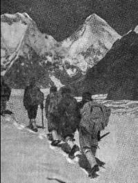
During the period from 1956 to 1973, 211 groups with a total number of 152 people on five routes successfully climbed Pobeda Peak. The entire history of conquering the peak of Victory suggests that the successful ascent must be preceded by the creation of a strong, close-knit team that is able to deal with the extremely difficult natural conditions mentioned above.
Tashkent climbers (group of V.A. Elchibekov, 1969) believe that the technical complexity of the classical route is much greater than it seemed to them before the ascent. First of all, this concerns the general steepness of the route and its individual sections.
The entire upper section of the route, starting from the icefall (6,600 m), is more complicated than can be judged from the photographs and the description of the previous groups, due to steep firn ups, with areas of clear ice and rock walls clogged with firn and ice.
The whole ascent is complicated due to the constant strong, sometimes hurricane, side (west) wind and frequent bad weather. It is known that all routes traveled to Pobeda Peak are avalanche hazardous in one part or another.
Pa to the observations of Tashkent climbers, the most avalanche-hazardous is climbing to the trough, less is going out from the trough of the trough to the “triangle” and practically safe is the entire route along the Northern ridge from the “triangle” to the very top.
The avalanche danger of climbing the trough requires special attention to the state of the snow cover on its slopes and careful selection of the route. In no case is it unacceptable to climb the slopes of the trough of a large group. Overloading its slope, as it was in 1960, leads to tragic consequences.
The successful ascent to Pobeda Peak along the Northern ridge, carried out by Tashkent climbers on August 20, 1969, was facilitated by:
A well-equipped camp on a trough, a sufficient supply of food and gas in Camp IV (6600 meters above sea level).
Thanks to this, the group successfully suffered bad weather here, and they still had unexpended emergency reserves of food and fuel.
The accepted climbing schedule and the location of the intermediate camps are optimal from the point of view of load distribution by day.
The success of the ascent was largely facilitated by the attention given to the equipment of the camps, which in the harsh conditions of Tengri-Tag plays a decisive role in restoring the moral and physical strength of climbers.
Tashkent climbers equipped the Zvezdochka glacier and camp trough in large special tents in which the whole group was accommodated. In the upper camps, a device was provided around the tents for windproof walls.
For cutting firn bricks in advance made special saws from ordinary carpentry hacksaws, on the panel of which deep teeth were cut with a sparse pitch. For digging trenches, digging up tents and installing wind-shelter walls, lightweight shovels with duralumin handles were made, more convenient than avalanches mounted on an ice ax.
Much attention was paid to high-altitude shoes. The group abandoned the cats and knocked out the Shekelton with shepherds. In addition, on top of the Shekelton there were covers made of thin tarpaulin, completely covering the shaft. Ahead of the covers had lacing, they could be removed for drying.
They perfectly protected the Shekelton from moisture, additionally insulated their shoes and allowed Shekelton to be used immediately after the “5300” assault camp without fear that they would get wet. In 1970, Leningrad climbers (B. Kletsko) reached the trough on its eastern edge.
Authority:
V. I. Racek, “The Five Highest Peaks of the USSR”, Uzbekistan Publishing House, Tashkent, 1975.


