


![]()
Вы здесь
Peak Pogranichnik.

Meridional ridge in Bayankol gorge.
"Either sparkling, joyful, calling, now formidable and angry, calling for single combat, now a mysterious, elusive curtain hiding itself and only for a moment opening with wonderful fantastic visions of a special world, a harsh, beautiful, ever-calling element of mountain peaks."
Evgeny Abalakov.
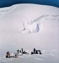
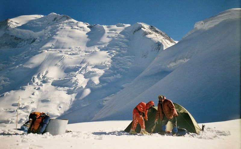
Climbing to Pogranichnik peak in Bayankol gorge.
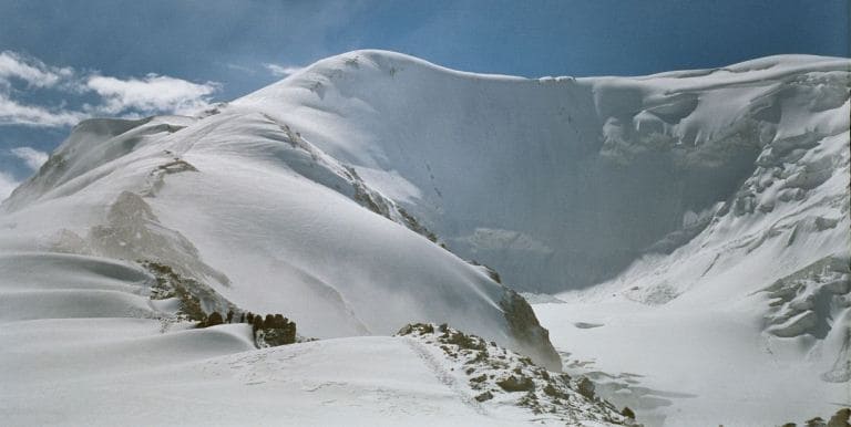
Peak Pogranichnik is located at an altitude of 5100 meters above sea level, located in the northern part of the main ridge of the Meridional ridge in the Narynkol district of the Almaty region. The summit is located in the south-west at a distance of 1.3 kilometers (in a straight line) from the Uzlovaya summit, also located in the crest of the Meridional ridge, in the north and slightly east of the Plato summit 5850 meters above sea level and at a distance of 3.5 kilometers.
The summit is snowy, domed. A ridge covered with glacier departs from the summit to the northwest. After 940 meters, the glacier slides to the left and joins the East Bayankol glacier, exposing the western rocky slope of the ridge and continuing to descend to an altitude of 3570 meters above sea level.
The length of the Bayankol Vostochny glacier from the Pogranichnik peak is 4.5 kilometers. The state border between the Republic of China and the Republic of Kazakhstan passes through the top. The summit is intermediate for climbing the ridge to the Marble Wall peak along the classic route.
From the history of conquering the Pogranichnik peak.
The first attempt to climb the Marble Wall peak was made in 1935 by Soviet climbers under the leadership of E.S. Levin. The group reached an altitude of 5000 - 5300 meters above sea level, but the avalanche, which partially covered the tents on the slope, forced the climbers to retreat.
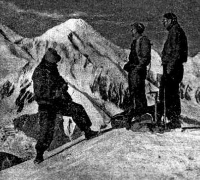
On August 28, at 15:00 1946, a group of climbers consisting of seven Soviet climbers: V.S. Naumenko, E.V. Timashev, V.F. Gusev and V.I. Nikolsky, A.S. Mukhin and A.I. Ivanov and I.S. Daibog made their first ascent to the top of the Marble Wall.
Ascent route: Lower camp 3950 meters above sea level - Uzlovaya peak 5070 meters above sea level - Pogranichnik peak 5250 meters above sea level - Marble wall peak 6150 meters above sea level. The expedition was organized by the All-Union Committee for Physical Culture and Sports under the Council of Ministers of the USSR.
The expedition was also attended by: the head of the expedition - corresponding member of the Academy of Medical Sciences prof. A.A. Letavet, engineer S.G. Uspensky and the expedition doctor - professor N.A. Fedorov.
Geographic coordinates of Pogranichnik peak: N42 ° 18'48.62 "E80 ° 16'18.96"
Authority:
Alexander Petrov.
Photos by
Sergei Mikhalkov, Almaty city.