Вы здесь
Small Almaty Gorge.
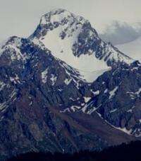
Gorges Northern Tien-Shan.
"You say that I should stay,
So that I don't wander again,
So that I could watch sunrises and sunsets
From the window,
And I would like distant roads
And difficult routes,
And a song on the road,
Like air, I need"
Yuri Kukin. "You say that I should stay..."
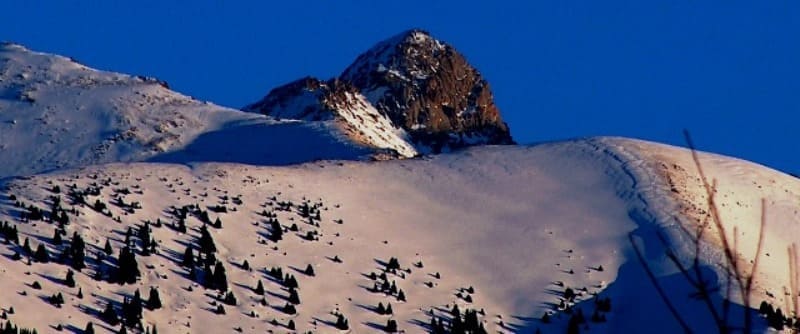
Maloye Almatinskoye Gorge in Zailiyskiy Alatau ridge.
Maloye Almatinskoye Gorge is located at an altitude of 4230 to 1150 meters above sea level, is located on northern slope of Zailiyskiy Alatau ridge, in Medeu district of Almaty and Talgar district of Almaty region.
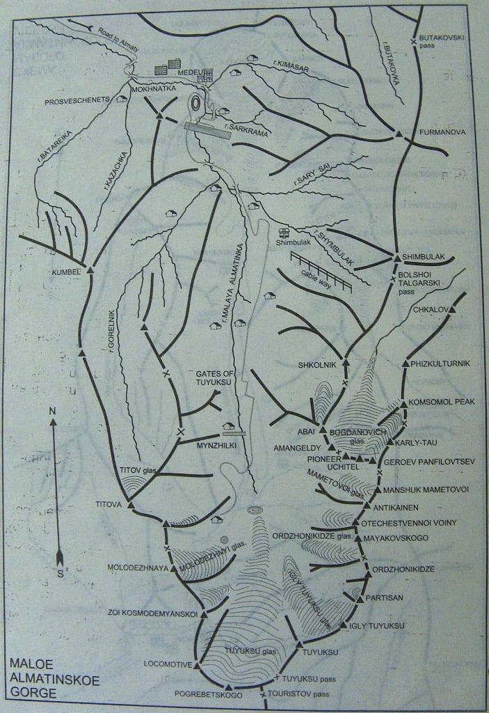
Of all the gorges of the Zailiyskiy Alatau, Maloye Alma-Atinskoye is the most branched, consisting of many cracks, gaps and tracts. The largest of them are Remezovka, Observatorskoye and Kamenskoye plateau, Batareinoye, Gorelnik, Koturbulak, Komissarovka, Chimbulak and Mynzhilki.
They are adjoined to the east by Shiroka and Pryamaya shcheli and the Gornogo Sadovoda gorges. Each of them is a fairly large, deep gorge with steep and gentle slopes, a unique wild and cultural landscape. All of them are part of the Malaya Almatinka River basin or directly adjoin it.
The main axis of the gorge passes through the world-famous Medeo sports complex, the Chimbulak ski resort, the Mynzhilki high-mountain weather station and the Tuyuksu glacier. The gorge begins with a wide cone of debris flows from the Malaya Almatinka River and the large Kok-Tyube mountain towering above it.
The Malaya Alma-Ata gorge is the most fully developed. The eastern half of Almaty is located on the cone of mudflows formed in the mountains of this region. At the beginning of the gorge, at the intersection of the main thoroughfares of the city - Abay and Lenin Avenues, is the most beautiful area of the city.
The grandiose high-rise hotel "Kazakhstan", the Palace of the Republic, the cable car to Mount Kok-Tyube, the majestic monument to the Kazakh national poet Abay Kunanbayev. From there, from a height of 870 meters above sea level, the road to the gorge goes along Lenin Avenue past multi-story buildings, the beautiful hotel "Alatau" and one-story country-type mansions, successfully integrated into numerous gardens.
Everything around is green, there is enough irrigation water, a mild climate and clean air. Therefore, this foothill area of the city is one of the most favorable for people to live and relax. Immediately outside the city, along a beautiful, well-maintained, wide highway, on both sides there are numerous gardens, sanatoriums, holiday homes, cafes and restaurants, successfully integrated into the terrain.
Three kilometers from the southern outskirts of the city, at an altitude of 1000 meters above sea level, on the left there is a well-maintained cafe, to the right from the main highway an excellent asphalt road turns in the direction of the Kamenskoye plateau, the Kazakh Scientific Research Institute of Fruit Growing and Viticulture and the observatory.
A little higher there is a beautiful reinforced concrete bridge across the Malaya Almatinka River. Above the bridge, a belt of hilly "counters" surrounds the road on both sides and after 4 kilometers of travel, at an altitude of 1200 meters above sea level, on the right bank of the river, on the edge of a birch grove, among the poplars, a fabulously beautiful restaurant with sharp spires, "Zhailyau", is nestled.
Next to it, an original arched pedestrian bridge is thrown across the river for passage into the birch grove. To the west of this grove begins a very steep slope, completely occupied by a dense forest of birch, aspen, apple, hawthorn and apricot.
This forest is located at a relatively low altitude (1200 - 1300 meters above sea level). In the western and eastern parts of the Zailiysky Alatau at these altitudes, even on the shaded slopes, only typical Asian dry-steppe grassy vegetation grows.
To the east of the Zhailau restaurant, on a gentle and long slope, gardens, rest homes and sanatoriums, clumps of wild apple and apricot trees and pyramidal poplars along the mountain roads are visible. Higher in the mountains, the climb becomes steeper, and soon on the right side of the road in the river floodplain and on the gentle slope of the above-floodplain terrace an oak grove appears, where a pioneer camp is located.
Slender oaks, up to 20 - 23 meters high, have already begun to dry out in some places - this is the result of constant soil compaction and the collection of fallen leaves. The situation can still be corrected - the oaks are still relatively young, they are only 60 - 80 years old.
To do this, it is necessary to dig up the fallen leaves or bury them in small holes on the periphery of the tree crowns. Then the road goes along a birch grove and comes to a fork in the road 1330 meters above sea level, straight ahead is Medeo, to the left is the rest home of the Council of Ministers and the sanatorium "Alatau", to the right and down is the office of the Prigorodny forestry enterprise.
To the left of A stream of pure spring water gushes from a steep cliff and a recreation area for people is equipped. To the west of the spring, across the river on a gentle slope, there is a large garden. Above it and in the wide floodplain of the river, the main one already passes to wild plants.
The fruit crop zone remained below. Dense thickets of wild Sievers apple trees, in places, ennobled by cultivated varieties, wild apricot, hawthorn, willows and poplars decorate the river floodplain, floodplain terraces and lower parts of the slopes.
A little higher begins a belt of deciduous forests of aspen groves with an admixture of single Schrenk spruce trees growing on the shaded slopes of the northern, north-eastern and north-western exposures. In the area of the spring at an altitude of 1330 meters above sea level, a belt of "counters" composed of loess-like loams passes into the main stone massif of the Zailiysky Alatau.
The border of the transition is clearly visible: on the slope formed by loess, there is an aspen grove and thick tall grass, and nearby, among the outcrops of rocks and stones, there are only single apricot trees. In other gorges of the Zailiyskiy Alatau, this border is not so easy to trace: everything is hidden by the soil cover and vegetation.
Higher up, the road becomes steeper, but the river floodplain is still quite wide, and the slopes overgrown with forest are not so steep. A little higher than the metal mudflow catchers, a restaurant of an original shape in the form of a semicircle with a sharp spire was recently built at an altitude of 1450 meters above sea level. "Samal".
The place for its construction was chosen very well. It is pleasant here in the summer - a light mountain breeze in the heat brings invigorating coolness from the mountains, and in winter at this altitude in the mountains the air is always clean, the sun is clear and it is several degrees warmer than in the city, for every 100 meters of ascent in winter the air temperature here rises by 0.36'.
There is a beautiful mountain landscape all around. To the east there is a view of a very steep rocky slope with rock outcrops, in the crevices of which solitary wild apricot trees have found refuge. A more interesting and extensive panorama stretches out to the west.
The wide floodplain of the Almatinka River, on which mountain meadows alternate with clumps of wild apple trees, apricots, willows, barberries, hawthorns and rose hips. Huge and steep, and more gentle mountain slopes allow you to take in all the forest belts at a glance, from wild fruit thickets, aspen and birch groves to moss, juniper and rocky spruce forests.
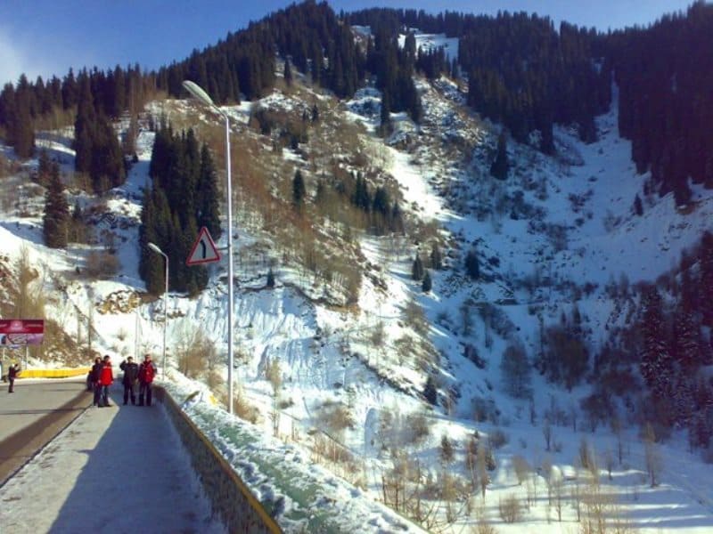
Above the Samal restaurant, the road becomes steeper, and it winds among a steep and deep gorge with rocky and in places steep slopes. The main background of vegetation changes to spruce forests, although here and there, on more illuminated and better warmed slopes, there are still apple-hawthorn thickets and small aspen groves.
Behind the bridge over the Almatinka River to the west in the Batareiny otselka at an altitude of 1500 - 1580 m above sea level, next to the Prosveshchenets holiday home, there is a ski trail to the high-mountain dzhailau, where deep snow lasts until the end of April.
Then the ski track goes along relatively flat high-mountain syrts and steeply descends into the Big Almaty Gorge. This ski track, about 18 km long, is jokingly called "around the world" by young people. From Prosveshchenets the road becomes steeper and passes next to steep cliffs where young mountaineers and rock climbers train.
Above this very narrow place the gorge widens and a breathtaking panorama of the Medeo sports complex with its famous high-mountain skating rink and a top-class hotel opens up before your eyes. This entire sports complex with parking lots, cafes, restaurants, shops, swimming pools and recreation areas is located at an altitude of 1700 - 1750 meters above sea level.
A little higher up the gorge is blocked by the famous mudflow protection dam. The dam is over 200 meters high, and a wide asphalt road runs along its crest at an altitude of 1900 m, from which a wonderful panorama opens up down the gorge, combining original light-shaped engineering structures that fit well into the terrain and mountain vegetation.
A round settling tank for the water coming to fill the skating rink, a sports stadium with an ice field, the village of Medeo with a water pool and an extensive network of asphalt roads. All this against a wide background of mountain slopes with a successful alternation of wild rocks, meadows, aspen and wild fruit groves, slender pyramidal spruce forests with cultural landscapes of gardens, birch and pine groves.
This is one of the best examples of a modern mountain landscape, combining the charm of wild nature and the originality of the thoughts of artists, architects, engineers and foresters. Above the dam, a completely different view opens up. The mountains become steeper, the gorges - deeper, the rocks - larger and steeper.
There are no apple trees, birches, aspens or pines here. Only spruce with rowan, mountain willow and honeysuckle are able to live in the cold climate of the highlands. Moss, rocky and juniper spruce forests predominate. This is how everything in nature is already arranged.
Where there is a lot of moisture, warmth and rich soils, there is a variety of vegetation and mixed forests of many tree and shrub species; there, On the slopes, outcrops of light-gray coarse-grained granite are visible. To protect people from falling stones, rock catchers have been installed on the mountain slope.
Above the dam, a couple of kilometers along a good dirt road, the Gorelnik sports base is visible on the slope of the upper floodplain terrace. Around it, at an altitude of 2100 m, there is a spruce forest on an ancient moraine and on slopes 25 - 35 meters high.
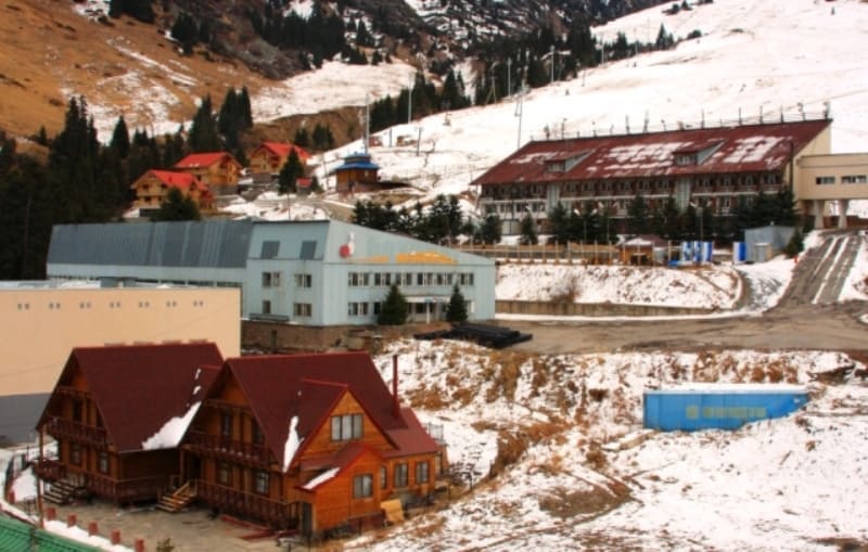
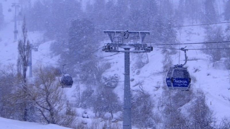
In the floodplain of the river and along the edges of the forest, there is a fairly tall bush of Tien-Shan rowan. Another three kilometers along a very steep road, winding sometimes along the valley, sometimes along steep slopes, and in front of us is the Chimbulak tourist and ski resort with its world-famous giant slalom.
A well-equipped cable car lifts skiers from an altitude of 2200 to 2860 meters above sea level. The length of the descent is about 2.9 kilometers. There are not many such long and steep ski slopes in our country. All-Union competitions in downhill skiing and giant slalom are held here.
This is facilitated by the abundance of snow and the long winter in the highlands. In March and April, there are often warm days in Alma-Ata, and real winter still lingers in Chimbulak. A capital road is being built to this ski resort. After its completion and the reconstruction of the Chimbulak tourist center, it may be ready to host international competitions in alpine skiing.
In the area of the cable car, the upper boundary of the spruce forest ends at an altitude of 2400 - 2500 m. In other gorges of the Zailiysky Alatau, the spruce rises higher, almost 2700 m, and single spruce trees are found at an altitude of 2800 - 2900 meters above sea level.
The relief of the area and the microclimate often determine the upper limit of the spruce forest. If the northern slope is shorter, and beyond the pass begins a sunlit slope facing south, then only meadow-steppe vegetation can survive on it in the Tien Shan Mountains.
Usually, athletes and vacationers finish their hikes along the Small Alma-Ata Gorge at the Chimbulak tract. For stronger and healthier people, an asphalt road runs from the Chimbulak tourist base to the right to the southwest and then straight up the gorge to the south, and then a dirt road through the Mynzhilki weather station to the Tuyuk-Su glacier.
Above Chimbulak, the road becomes even steeper, with an ascent of about 150 - 200 meters per kilometer. At first, there are rocky spruce and juniper forests with low-growing trees around. At an altitude of 2700 - 2800 meters above sea level, spruce sparse forests give way to a strip of thickets of creeping juniper.
However, unlike other places in the Zailiyskiy Alatau, it is very narrow (the width of this belt is only 50 - 100 meters). Alpine meadows usually follow the spruce and juniper belt. But in the valley and on the slopes of the Maly Alma-Ata Gorge there are almost none.
Around there are rocks, scree, moraines - a typical glacial high-mountain landscape. And finally, after five kilometers of steep ascent among rocks, scree, along a rocky road we rise to an altitude of 3036 meters above sea level to the well-known high-mountain meteorological station Mynzhilki. It is always cold here.
The average annual air temperature is minus 2.4 ', the average monthly temperature in July is 6 ', the maximum is minus 40 '. For example, on October 19, 1979 in Almaty it was warm during the day, but in the Mynzhilki area it was cold, in shaded places the snow and ice were bound by frost, and only in the sun did it melt a little. In the valley of the gorge on the moraine, among the debris of rocks and stones, several houses and a platform with instruments have been built.
Only strong and courageous people can live and work among this stony silence in the Arctic climate. Above the Mynzhilki weather station, the road continues steeply for another 5-7 km to the Tuyuksu glacier. But it is only open to all-terrain vehicles in the summer, when the snow line is at the level of the glaciers.
In October, it is covered with snow, and, of course, no car can move on such a steep climb. Mountaineers, a strong and hardy people, cover the last 3 - 5 km on foot with huge backpacks on their backs. And yet, for healthy and courageous people, the hike to the Mynzhilki weather station and further to the glaciers of the Malay Almaty gorge will bring the greatest pleasure.
Enormous red granite cliffs, a road over which vertical, fabulously beautiful cliffs hang, glacial cirques, numerous screes and moraines. All this against the backdrop of eternal snows, glaciers and the highest mountain peaks: a sense of wild, pristine nature, the limit of human survival, thin air in which car engines choke and lose power, cold under the blinding sun and colossal ultraviolet radiation.
The Small Almaty Gorge is, of course, one of the most beautiful, well-maintained and accessible places for recreation and sports for residents of Almaty. It is not for nothing that more than a hundred years ago our ancestors built the capital of Semirechye at its base.
Geographic coordinates of Small Almaty Gorge: N43°07'37 E77°04'30



Authority:
Books: “Nature of the Zailiyskiy Alatau”, M.Zh. Zhandaev, published by Kazakhstan, Alma-Ata, 1978 “Along the Northern Tien Shan”, V.N. Vukolov, Moscow, Profizdat, 1991.
Photos by:
Alexander Petrov.


