Вы здесь
Titov Peak in Zailiskiy Alatau.

Ascents to peaks of northern slope of Zailiysky Alatau Range.
"You walk along the edge of the glacier,
without taking your eyes off the summit.
The mountains are sleeping, breathing in clouds,
breathing out snow avalanches."
V. Vysotsky.
Peaks in Kumbel Tau Range.
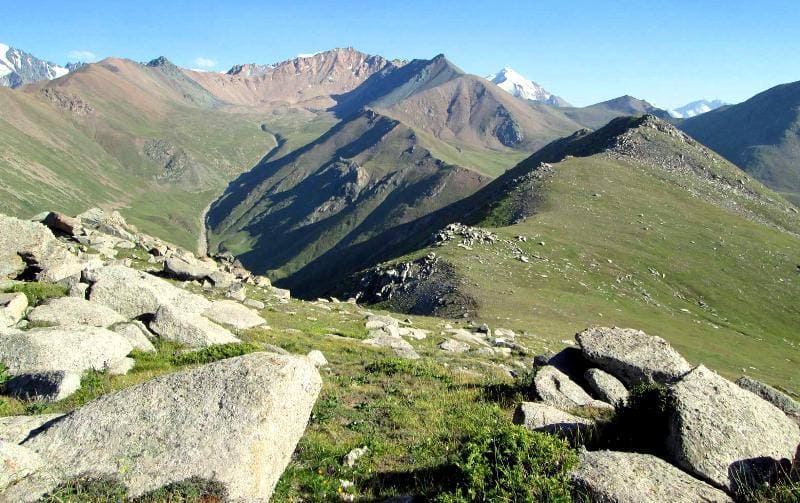
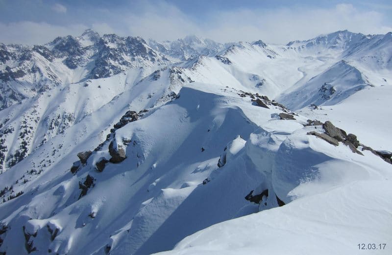
Titov Peak, 3820 meters above sea level, is located in southern spur of Kumbel Tau Range, on northern slope of Zailiysky Alatau Range, in upper reaches of Gorelnik Gorge in Medeu District of Almaty.
The top of the peak is rocky, the classic route begins from the Titov Pass, from where a magnificent view of the upper reaches of the Gorelnik Gorge opens up with three Titov Lakes and Lake Gorelnik. From the pass, you can plan the route to the peak, since it is clearly visible from here.
From Titov Peak, you can see almost the entire western part of the Zailiyskiy Alatau ridge, including the Big Almaty Lake and the gorge of the same name. The ancient moraine of the eastern part of the Big Almaty gorge, where the Astrophysical Institute (according to the old abbreviation - GAISh) of the Academy of Sciences of the Republic of Kazakhstan named after V. G. Fesenkov is located, is visible as if on the palm of your hand, as is the Zhosaly-Kezen Pass, 3336.8 m. a. s. l.
From the southern side of the peak, you can see most of the Zailiyskiy Alatau ridge, from Sovetov Peak to Talgar Peak. The closest peak to Titov Peak in the south is Molodezhnaya.
Here is what Alexander Lukhtanov, a local historian from city of Altai (former Zyryanovsk) in East Kazakhstan region, writes in his “Essays on History of Kazakhstan Semirechye”:
“In the mountain spur dividing the basins of the Bolshaya and Malaya Almatinka rivers, there is a peak that is quite well-known among Almaty tourists. To be more precise, it is located between the Kumbel Tau and Molodezhnaya ridges, right in the upper reaches of the Gorelnik River.
A tiny glacier hangs from its top, and at its foot there is a small moraine lake. On the other hand, on its eastern side there is the widely known Mynzhylky tract with a meteorological station. The relatively low (and not at all difficult) peak (3820 meters above sea level) is of no interest to climbers, but is popular among mountain hikers.
Tourists visiting this mountain, without thinking, associate its name with the name of the second cosmonaut of the planet German Titov, which, it would seem, is quite logical. But here's the problem: this mountain has had this name since the 1930s, when German Titov was not yet born.
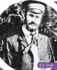
So who was it named after? It turns out that there was such a now forgotten botanist: Valerian Semenovich Titov. Not a genius or a hero at all, let's say, a mediocre researcher. In this regard, it would be interesting to know how and under what circumstances the mountain got his name.
Little is known about Titov.
He was born in 1884 in Altai, in the village of Suzunsky Zavod, Barnaul district, Tomsk province. A graduate of Tomsk University, a student of a very famous botanist, researcher of Siberian flora P.N. Krylov. From 1914, Titov worked in the Semirechensk resettlement department in the city of Verny.
As part of the soil-botanical expedition in 1914 - 1921, he conducted botanical surveys in vast areas of the region. The route of his expeditions covered Pishpek, Vernensky, Kopalsky, and Jarkent districts: the lower reaches of the Chu River, the Chu-Ili Mountains, the Kyrgyz Range, the Susamyr highland plateau, the environs of Tokmak, areas adjacent to the lakes Balkhash and Alakul, etc.
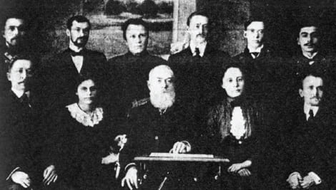
He studied local varieties of wheat, being especially interested in plant formations depending on various geographical zones. The region with its rich and diverse nature captivated the young researcher. Not content with his main job, he participated in many public events in the city, soon joining the intellectual elite of Verny, and later Alma-Ata. In 1916, Titov, along with such well-known public figures as E. Baum, V. Nedzvetsky, N. Khludov and others, was already a co-founder of the Semirechye branch of the Russian Geographical Society.
At that time, due to the difficulties of wartime, the branch did not open, but with its formation in 1920, he became an active participant. Since 1921, he was elected assistant to the chairman of the newly formed "Society for the Study of Dzhetysu" (Semirechye).
One of the tasks of this society, in addition to local history work, was the promotion of knowledge among the people. Titov's irrepressible character, thirst for activity and inexhaustible enthusiasm were also manifested in the fact that he undertook to organize a circle of young naturalists among schoolchildren.
With some stretch, it could also be called a circle of amateur tourists. And this happened even before the “Society of Proletarian Tourism and Excursions” (OPTE, in 1928) was created in the USSR, much earlier than the first ascent of Maloalmatinsky Peak (later Komsomol Peak) in Zailiysky Ala-Tau was made (July 17, 1930).
In the area of the Kok-Zhailyau valley, in the outskirts of Alma-Ata, under the summit of Mount Kumbel, a light stationary base was built by schoolchildren under the guidance of Valerian Semenovich for conducting field observations. Various excursions were made from this station, and it is highly likely that the young naturalists also visited the mountain, which now bears the name of the leader of the circle of young Almaty naturalists and tourists, one of the first of its kind in Kazakhstan.
The path from Kok-Zhailau here is simple: through the Kumbel peak along a gravelly ridge covered with edelweiss and high-mountain steppe grasses, turning into a rocky ridge with destroyed rocks right up to the stone top of the mountain.
From here, a beautiful view opens up of many peaks of the Maloalmatinsky mountain cirque and the upper reaches of the Bolshaya Almatinka with the giant standing opposite - the Soviet peak. In 1925, Titov organized an expedition to study the rarest plant nedzvetskya, as a result of which he discovered several places where this unique plant grows.
Later, V. S. Titov was a research associate at the Central Asian Institute of Soil Science and Geobotany in Tashkent. He is the author of scientific works on botany and agricultural engineering. A modest botanist and enthusiast of the local history movement, he left his memory in the name of the peak, and this monument is such that its grandeur will eclipse any monument erected by human hands.
It is a pity that the mountain is not visible from the city, although it is, as they say, within easy reach. "
Geographical coordinates of Titov Peak: N43°04'29 E77°02'55


Authority:
Alexander Petrov.
"Essays on the History of Kazakhstan's Semirechye". Alexander Lukhtanov.
http://old.veters.kz/vershina-issledovatelya/
Photos by:
Sergey Mikhalkov.


