


![]()
Вы здесь
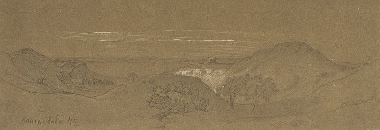
Khanga Baba valley.
Trip to Khanga Baba in Mangyshlak.
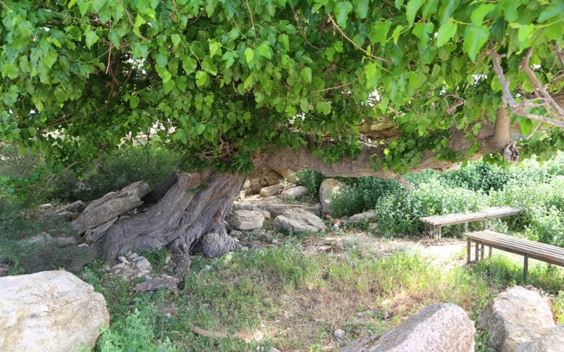
“The Hanga Baba place is charming, but I have only been there once: mountains are located on 3 sides, mulberry trees grow in the gorges. At the foot of the mountains there is a beautiful, green meadow, on which there is a huge mulberry tree, 2 sazhens in size... They made a camp under this tree, the youth settled down and Shevchenko was among them.”
Wife of commandant of fort Agata A. Uskov. 1852.
“Yesterday I was at Hanga Baba, walked around all the ravines, bowed, as to old friends, to the trees from which we once drew...”.
In a letter to Br. Zalesky from 25.IX. 1855 Shevchenko recalled their joint visit to this area.
Interesting tours in Mangyshlak.
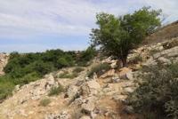
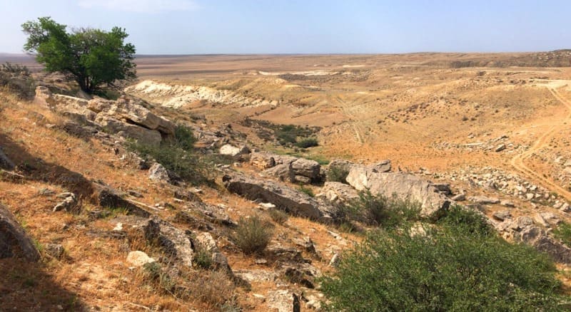
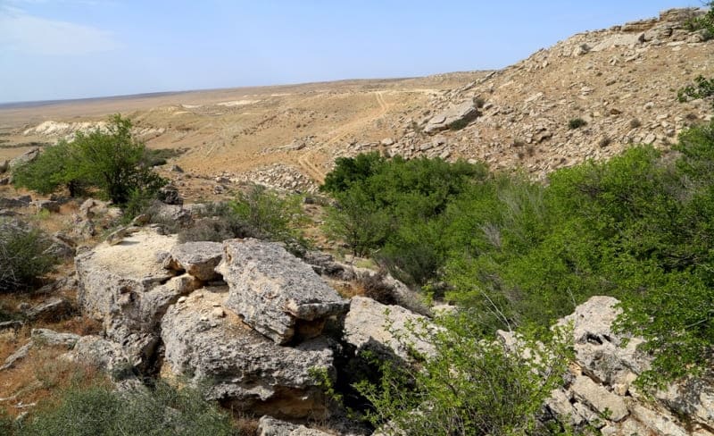
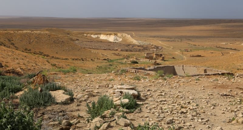
Khanga Baba valley is located at an altitude of 57.6 to 106.9 meters above sea level, is located in vicinity of Khanga Baba necropolis, north of Oy valley, 2.1 kilometers south of Fort-Shevchenko - Zhangyldy road, 19 kilometers northeast of village of Kyzylozen, 26.8 kilometers east and a little south of city of Fort-Shevchenko, in Tupkaragan district, Mangistau region.
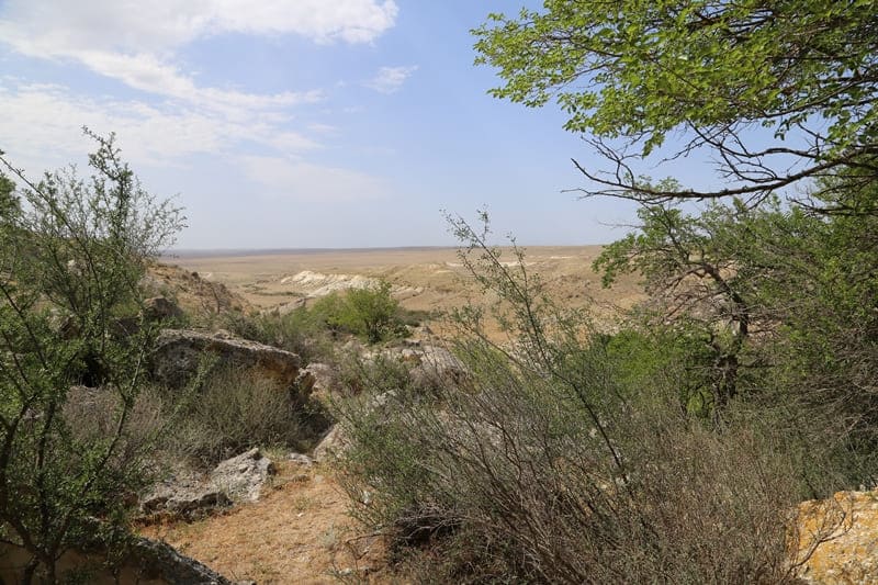
Khanga Baba valley is limited from the north, east, west by a cliff, which closes the area; in the south there is a small salt marsh. The valley is located at the foot of the Khanga ridge, or Kanga (local name), which stretches for 15 kilometers from east to west.
The southern slope of the ridge, at the base of which the Khanga Valley begins, is cut by deep, often quite steep ravines, of which there are about ten. They all begin on the mountainous part of the ridge, that is, from the north, and after 500 - 1000 meters end in the Khanga Valley with a wide branching.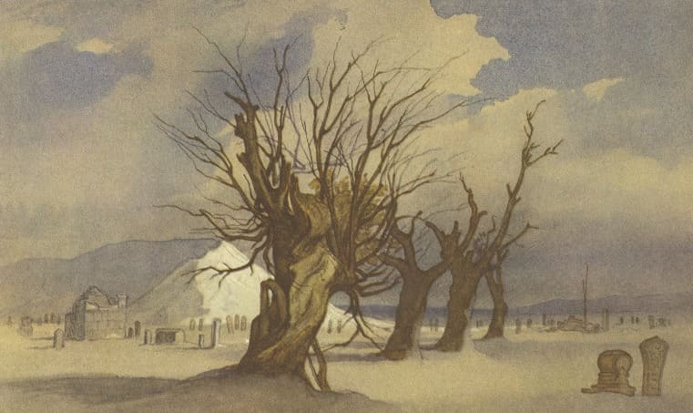
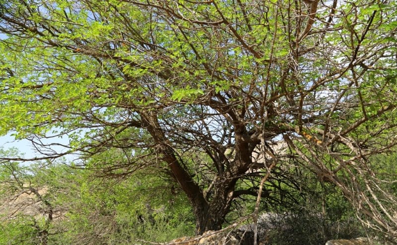
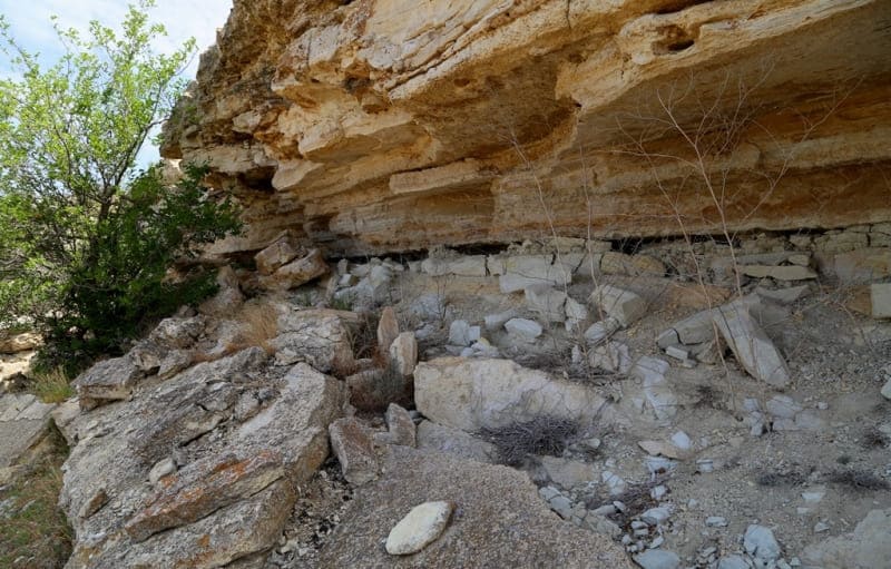
The difference in these ravines reaches 100 - 120 meters and creates a rather steep and wide bottom, covered with a variety of grasses, mulberry trees, and sometimes elms. The soil here is almost always damp, since at the foot of the rocky cliff, barely noticeable but numerous springs seep out, which immediately disappear.
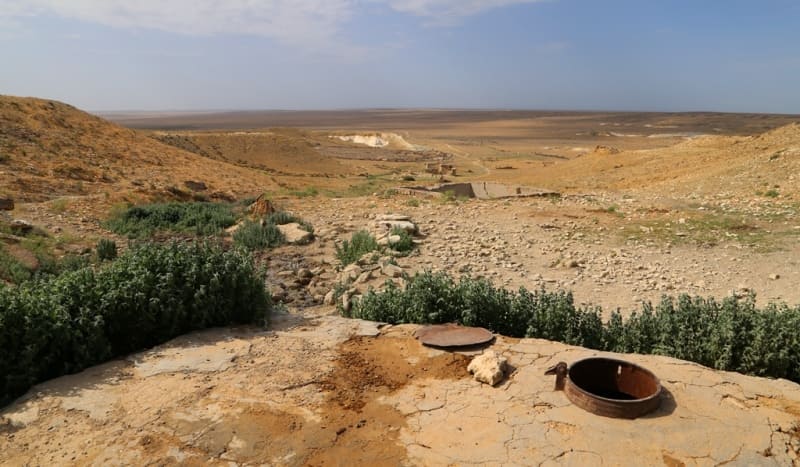
Below, the ravine becomes deeper, steeper and wider towards the mouth, in some areas tiny swamps are formed, densely overgrown with juicy weeds. On the plain where the ravine ends, the water disappears again and now forever - there is too little of it to turn into a stream on the dried-up soil.
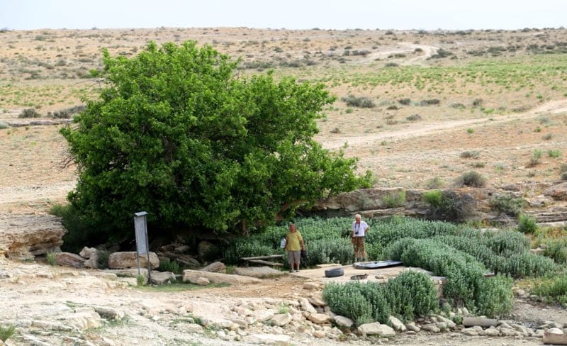
Due to such features, the entire Khanga valley is covered with small oases. In ancient times, the inhabitants of these places were engaged in gardening, melon growing, horticulture, and livestock breeding. In almost every one of the ten ravines, there are dams in which water was stored for irrigation of cultivated areas.
Sericulture was very widely cultivated - local residents grew mulberry trees wherever possible. There are various versions about the origin of the name of the ridge and the depression at its foot, but it is possible that the word Kanga is related to the name of the once famous Kangly people.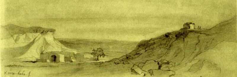
The Turkic-speaking tribes of the Kangly lived in the Vth - XIIth centuries in the south and west of the Aral Sea. In the 13th century they were defeated by the Mongols and scattered throughout the world. The Kangly who survived the Mongol invasion mixed with some Central Asian peoples, in particular with the Oghuz.
Historians have determined that the Oghuz were the ancestors of the Turkmens, in particular one of the largest tribes of the Tekse, or Tekins, who are now part of the socialist Turkmen nation. On the territory of Turkmenistan, near today's Ashgabat, the first groups of the Teke tribe began to appear as early as the XIIth century; they came from Mangyshlak, where they had previously settled mainly in oasis corners.
At the beginning of the XIXth century they finally migrated to the south - to the Caspian Gulf of Kara-Bogaz.
The difference in the spelling of the ending of the word (kangly, kanga) does not contradict the identity of these terms. We decided to use the name Khanga baba, that is, as it is traditionally pronounced in Mangyshlak. Thus, the name Kanga is very ancient. Over time, this word acquired a territorial-political meaning - defining the boundaries of possessions.
Trading posts, fortifications, guard posts created on the borders of the Khorezm state were called kanga. The valley in question was a real oasis at that time and had a reliable fortress with military garrison guarding the Khiva road, which is why it was called Kanga (Kangly).
Taras Shevchenko, who was in Mangyshlak during his exile, probably dedicated more than ten works to the Khanga Baba valley, but only eight or ten have reached us. Taras Shevchenko visited the Khanga Baba tract twice during the Karatau expedition, and also several times in the following years.
One landscape is a watercolor, the rest are made with pencil on different tone paper. However, it cannot be claimed that all these drawings were made during the expedition in the summer of 1851, since the artist visited here more than once later. There are no author's notes on the drawings.
Of all the known images of the Kanga Valley by Shevchenko, the most complete idea of it is given by the watercolor "Khanga Baba", reproduced in Volume IX of the Complete Works of Taras Shevchenko in Ten Volumes. In the foreground of the landscape there are four thick dried-up trees in a row.
Only on one of them, which is closer to the viewer, a living branch with yellow leaves is barely noticeable. Behind the trees one can see stone tombstones of a forgotten cemetery. Knotty trunks, blackened broken branches create an image of a desert, bloodless living nature. The impression is completed by the forgotten tombstones scattered across the deserted expanse.
Geographical coordinates of Khanga Baba valley: N44°27'33 E50°35'21
Authority:
"Steppes Will Come to Life". Anatoly Kostenko, Esbol Umirbaev. Alma-Ata. "Oner". 1984.
Photographs by:
Alexander Petrov.