







Вы здесь
Glaciers of Kazakhstan.
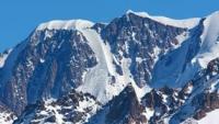
Morphology of Kazakhstan's glaciers.
"The area covered by glaciers and snow amounts to approximately 500 square kilometers. Two-thirds of this area lies on the northern half of the mountain range, while one-third lies on the southern half. About twenty mountain rivers originate from these glaciers; during the glacier-melting season alone, their waters could form a lake approximately 12 km in diameter and over 10 m deep. The largest glacial rivers of the Zailiysky Alatau are the Chilik and the Issyk."
N.N. Palgov. «The Nature of Kazakhstan in Sketches and Pictures». 1950.
Early information on glaciers of Zailiysky Alatau.
Early information on the glaciers of the Zailiskiy Alatau. Kazakhstan's glaciers have long attracted the attention of scientists. The history of glacier research is inextricably linked to the study of nature and natural resources as a whole and is characterized by five stages.
The first stage is the pre-revolutionary period. At that time, the glaciers were studied primarily by the Russian Geographical Society. The main focus was on the geography and morphology of the glaciers. This was a stage of general familiarization with the glaciation of Kazakhstan's mountains.
The first information regarding the glaciers of the Zailiskiy Alatau appeared in the literature relatively late. It dates back to 1899 and concerns the Chiliko-Kemin mountain cluster, one of the areas most remote from human settlements. A more thorough study of the Trans-Ili Alatau glaciers began in 1902 at the initiative of S.E. Dmitriev.
The first glaciers he discovered and described were the Tuyuksu glaciers, located in the headwaters of the Small Almaty River. S.E. Dmitriev studied them between 1902 and 1908. He observed ice flow velocities and spatial characteristics, and visited and described a number of glaciers in the headwaters of the Issyk, Chilik, and Sredniy Talgar rivers.
In 1916, V. D. Gorodetsky studied the glaciers in the headwaters of the Big and Small Almatyrivers. Following the 1917 Revolution, the pace of glaciological development in Kazakhstan accelerated rapidly in response to new objectives regarding natural resource utilization.
At the same time, the scope of glacial phenomena under study expanded, and the research itself became more in-depth. The second stage of glacier study began in 1922 and lasted until 1936. N. N. Palgov is considered the founder of glaciological science in Kazakhstan.
By the 1930s, alongside the geological-geomorphological approach, a new method - which could be termed hydrometeorological - emerged in Kazakhstan's glaciological research. In 1930, the *Catalogue of Glaciers of Central Asia*, compiled by N. L. Korzhenevsky, was published.
In 1937, S. V. Kalesnik’s monograph *Mountain Glacial Regions of the USSR* was released. It incorporated the key data on Kazakhstan's glaciers available to glaciology at the time. The period from 1937 to 1957 saw a further deepening and expansion of glaciological research in Kazakhstan.
Studies on glacier morphology were complemented by investigations into glacier regimes and their role in river feeding. Major glaciation centers were covered by topographic surveys. Long-term observations have revealed numerous patterns regarding the interaction between glaciers and the geographical components of mountain regions.
The role of glaciers in the runoff of the mountain systems they feed was further clarified. The fourth stage of glaciological research in Kazakhstan was initiated by the Geography Sector of the Academy of Sciences of the Kazakh SSR in 1957, in conjunction with the International Geophysical Year (IGY).
During the IGY and subsequent years, glaciological research - conducted primarily in the Zailiysky and Dzhungarsky Alatau ranges - focused on the processes of ice accumulation, transformation, and ablation in relation to energy exchange.
Based on this, studies were conducted on the interactions between glaciation and climate, as well as on the current state, spatial distribution, thickness, and contemporary evolution of the glaciers. The fifth stage of glaciology development in Kazakhstan.
Current key areas of glaciological research include the establishment of a service for the continuous monitoring of glacier fluctuations; the study of the mechanisms and roles of rapid glacier advances - both past and present; the analysis of glacier dynamics and contemporary evolution; the investigation of models for calculating and forecasting glacial climate parameters and the heat and water balances of the nival-glacial zone; and the development of methods for analyzing and calculating snow accumulation in areas with complex topography, based on landscape indicators, satellite data, and physical modeling; and the refinement of techniques for reconstructing past terrain and glacier thickness.
Alongside scientific challenges, glaciology currently faces a number of purely practical tasks. Key among these are: developing the scientific basis for regulating glacial runoff for irrigation purposes (encompassing both artificial glacier melting and ice preservation/conservation); investigating avalanches and glacial mudflows to devise forecasting methods; studying the spatial distribution and geographical conditions of permafrost, as well as its impact on natural landscapes and human economic activity in the high-mountain regions of Kazakhstan; and utilizing mountain-valley areas for recreation, tourism, and alpine skiing.
Glaciological science in Kazakhstan currently possesses extensive data for addressing questions regarding the dynamics of both modern and ancient glaciers. The Zailiysky Alatau Range constitutes one of the northernmost arcs of the Tien-Shan mountain system.
On geographical maps, the Zailiysky Alatau Range is delineated as extending from the Chilik River in the east to the Chu River in the west, spanning a total distance of approximately 280 km. Its northern slopes face the plains, where the piedmont zone forms a fertile oasis.
Stretching out like a colossal barrier - its crest serrated with sharp peaks and flattened summits - the mountain chain fades into the blue haze of the distant horizon. A significant portion of the range, situated centrally, is covered by "eternal" snow. An area of modern glaciation extends here for approximately 150 km.
Rising prominently within this zone is the range's highest summit - Talgar Peak (4,973 m) - which appears as three blunt cones set upon a broad, precipitous massif. Several peaks reaching heights of 4,500 m cluster around Talgar Peak. This central section of the Zailiysky Alatau is known as the Talgar Mountain Knot ("Glaciation of the Tien-Shan", 1995).
Stretching primarily from northeast to southwest for a distance of 20 km, the Talgar Knot abuts at its southern end against a ridge - narrow like itself but shorter - that connects the Zailiysky Alatau to the Kungey Alatau (Kazakh for "Sun-facing Sandy Mountains"), a parallel range lying to the south.
Talgar Peak, the highest point of the Zailiysky Alatau, divides the entire range lengthwise into two unequal sections. The eastern section, bounded by the Chilik River, extends for about 130 km, while the western section, bordering the Chu River valley, stretches for nearly 150 km.
The absolute elevation of the range decreases as one approaches its extremities. Near the Chilik River valley, the elevation drops to 2,300 m, while at the western end, it falls to 2,000 m or lower. The mountain base at the edge of the plain lies at an elevation of 700–900 m above sea level, while the crest of the central part of the range rises an average of 3,500 m above it.
As one moves away from the highest uplift, the relative height of the mountains decreases to 1,500-2,000 m. The significant variation in the elevation of the main range is accompanied by an asymmetry in its transverse profile: the northern slopes are considerably wider and gentler than the southern ones.
The average surface gradient in the central part of the range is 6-8° on the northern side and 18° or more on the southern side (Tokmagambetov, 1976). The orography and morphological features of the Zailiysky Alatau mountains are not particularly conducive to contemporary glaciation.
Branching secondary ridges extend from the range's main watershed - predominantly in a meridional direction - separating major river basins. Like many ranges in the Tien-Shan, the Zailiysky Alatau is characterized by flat-topped watershed areas.
The edges of the watershed plateaus are dissected by ancient glacial spurs and cirques, as well as by the headwaters of mountain valleys, where conditions are most favorable for snow accumulation. This dissection is most pronounced in the central section of the main range, where elevations are greatest.
The most significant glaciation here is concentrated around the highest peak - Talgar Peak - and its neighbors. The river network of the Zailiysky Alatau belongs primarily to the basin of the Ili River, which flows into Lake Balkhash, and only partially to the endorheic basin of the Chu River.
Based on the location of their headwaters, feeding patterns, and water regimes, all rivers in this territory are clearly classified into three types: mountain, foothill, and plain. Rivers of the latter two types are small and play a minor role in the water balance of the Zailiskiy Alatau.
These mountain rivers are the largest and most voluminous, possessing extensive drainage basins. They originate at elevations exceeding 3,000 meters; while primarily fed by glaciers, their flow regimes are also significantly influenced by atmospheric precipitation and groundwater.
With the exception of the Asy River, all these glacier-fed rivers flow through transverse, meridionally oriented valleys. On the northern slope of the mountain range, the Uzunkargaly River is the westernmost of the glacier-fed rivers. Flowing to the east of it are the Chemolgan, Kaskelen, and Issyk rivers, as well as the Asy River, all of which are fed by glacial waters. In their upper reaches, the valleys of all these rivers have a V-shaped profile, while in their lower reaches they take on the appearance of broad gorges - and in places, narrow canyons - flanked by rocky walls a kilometer high.
The southern slope of the Zailiysky Alatau, descending toward the valleys of the Chon-Kemin and Chilik rivers, is dissected by transverse river valleys just as frequently as the northern slope; indeed, almost every river on the northern slope has a counterpart on the southern slope, often bearing the same name.
Examples of these southern rivers include the Kaskelen, Aksai, Almaty, Talgar, and Issyk. Most of them are also fed by glaciers; in the western section, they serve as tributaries to the Chilik River. The southern Talgar and Issyk rivers, which originate from the range's largest glaciers, rival their northern counterparts in terms of water volume.
The Chilik River, which cuts through the main watershed to the northern side, is the largest river in the Zailiysky Alatau (N.N. Palgov, 1969). The geological history of the Zailiysky Alatau is highly complex. Prior to and during the early Paleozoic era, the site of the current mountain range was a crustal depression submerged beneath the sea.
Sediments deposited in this basin were uplifted to the surface during the Caledonian orogeny. In the early Carboniferous period, a sea formed once again over the area (leaving behind fossil-rich limestone deposits); this was subsequently replaced by land - bearing traces of extensive volcanic activity - during the Variscan diastrophism of the mid-Carboniferous.
The majority of the granitic intrusions in the range date back to this period. During the Jurassic period, the relief of the mountain structure was leveled into a peneplain, though it was simultaneously complicated in places by faulting associated with Neo-Cimmerian tectonic activity.
In the Cretaceous period, denudation transformed the mountains into smoothed, gently rolling uplands. During this time and subsequently, significant masses of clastic material accumulated in specific sections of the range under continental conditions.
At the end of the Tertiary and the beginning of the Quaternary periods, the formation of faults led to the block uplift of the central part of the Zailiysky Alatau, which is bounded to the north by a tectonic line. This process transformed the previously peneplained surface back into a high-mountain region.
Thus, the structural characteristics of the Zailiysky Alatau originated as early as the Precambrian, manifesting as distinct blocks defined by regional faults trending northeast. Morphologically, the faults formed between the late Devonian and early Carboniferous periods mirrored the pre-existing rhombic framework but developed against the backdrop of the relative uplift of the North Tien-Shan (Chedaya O.K., 1986).
During the late Paleozoic - the final phase of the Hercynian cycle - tectonic movements occurred alongside peneplanation and the active formation of weathering crusts. However, Mesozoic–Cenozoic tectonic movements associated with the development of the reactivated North Tien-Shan fold belt played the decisive role in shaping the modern surface of the Zailiysky Alatau.
The central part of the range developed upon the site of a Late Paleozoic, low-relief arch-like uplift and served as a source area for the Upper Permian-Mesozoic troughs of the Kulja sedimentary basin. Consequently, under the influence of Late Paleozoic and – especially - Mesozoic–Cenozoic tectonic movements, the ancient peneplain of the Zailiysky Alatau underwent significant rejuvenation.
Its central section experienced the most intense deformation; here, a high-mountain glacial zone emerged during the Pleistocene, replacing the ancient peneplain. At present, alongside high-curvature arch-folding movements, faults and block movements play a dominant role in shaping the modern morphostructure of the Zailiysky Alatau.
To the north and south, the boundaries of the anticlinoria coincide with fault systems grouped into two main zones: the North Zailiysky and the Kameno-Chilik zones. These features are expressed in the topography and serve as morphostructural boundaries (G.A. Tokmagambetov, 1976). During the Quaternary period, a shift toward a colder climate led to the range's first episode of ice-sheet glaciation.
In the ensuing interglacial epoch, the mountains - freed from snow and ice yet still subject to tectonic forces - underwent gradual transformation. Denudation agents carved deep valleys and gorges into the terrain, disrupting the plateau-like character of the elevated uplands.
The foothills became mantled with loess deposits, which buried the earlier accumulations of boulders, pebbles, and outwash (sandur) sediments. The morphological features of the mountains had come to resemble their present-day form. It was in this state that the second glacial epoch found them; due to the specific relief of the mountain range, this glaciation was predominantly of the valley type.
During this period, glacier tongues descended to an elevation of 2,200 meters - or even lower, according to some researchers (based on modern hypsometric levels). Fluvioglacial deposits covered the higher sections of the foothills. Rivers, deeply eroding their valleys, have created massive alluvial fans at the foot of the mountains.
The second glaciation was followed by a third, less extensive one, of which modern glaciers are the remnants. The areas they occupy constitute the highest tier of the terrain, bounded at the lower edge by the 3,300-meter contour line on northern slopes and by elevations of 3,600–3,700 meters on southern slopes.
This glacial zone - composed predominantly of granites, locally overlain by metamorphic schists - is characterized by rugged, highly dissected topography. Part of the territory is covered by active glaciers, while other areas have only recently been exposed following glacial retreat.
In the latter areas, the snow-free mountains display extraordinarily diverse and "wild" forms. Their ridges are dissected into distinct spires, towers, columns, and the like - features shaped primarily by frost weathering. Gorges and valleys lie between the spurs branching off the main ridge; many of these contain glaciers.
Their headwaters extend into the mountain slopes as broad cirques, into which massive bodies of firn snow descend. Transporting falling rock debris, the glaciers have filled the valleys with moraine deposits consisting of boulders, rubble, and fine, loose material.
These deposits dam the valleys and gorges and line the slopes alongside the glacier tongues (N. N. Palgov, 1958). In the section extending from the River From Kaskelen to Talgar Peak, the ridge is dominated by sharp - and less frequently, blunt - summits with broad bases.
Further east from Talgar Peak, the ridge takes on the character of smooth surfaces; here, most summits resemble narrow, horizontal crests stretching for hundreds of meters. Some transform into flat, single-slope, gently inclined surfaces. Above the snow line, large amounts of snow accumulate on them.
Vertical faces and horizontal surfaces represent the two extremes of terrain within the glacial zone. Between them lies a wide variety of transitional forms, ranging from the gentle slopes of cirque basins - recently abandoned by glaciers - to gorge slopes with gradients of 30 to 40 degrees. Snow does not linger long on the steepest of these.
At the slightest disturbance, it slides off in sheets or plunges down rapidly as avalanches. In this way, glaciers receive part of the nourishment that later transforms into ice. The zone of active glaciation in the Trans-Ili Alatau spans a distance of up to 140 km.
On the northern slope, it lies between the meridians of 76°18′ and 78°00′. Its westernmost extent here is the headwaters of the Uzunkargaly River, while its easternmost point is the headwaters of the Asy River. On the southern slope, active glaciation is bounded by the meridians of 76°16′ and 77°40′.
Here, the glaciers at the western end of the range lie at the headwaters of the Tegirmentysu River (a tributary of the Chong-Kemin River), while those at the eastern end are found at the headwaters of the... Odensay, a tributary of the Chilik River.
Most researchers believe that the Zailiysky Alatau experienced three glaciations: the first was semi-ice-sheet in nature, while the second and third were valley-type glaciations (N. N. Palgov, 1958). The present-day glaciation of the Zailiysky Alatau is the product of glaciers from the Fernau stage of the last (Holocene) glaciation; traces of this stage remain on valley floors and slopes in the form of erosional and depositional landforms.
Currently, glaciers occupy only the uppermost sections of valleys and mountain slopes. The distribution of modern glaciers is determined not only by high-mountain climatic conditions but also by hypsometry, orography, and aspect, as well as by mechanical factors such as wind-driven snow migration, avalanches, and rockfalls.
Snow migration occurs through the selective movement of cyclonic air masses, which transport snow from mountain watersheds and the adjacent upper western slopes over to the eastern slopes. Consequently, the nourishment of glaciers situated to the west is reduced, while that of glaciers located to the east is enhanced.
The long-term westerly transport of air masses over the range created specific conditions within the meridionally oriented spurs of the axial ridge, facilitating the continuous redistribution of precipitation and the formation of glaciers. Ancient glaciers primarily protected the eastern slopes of the spurs - rather than the western ones - from erosion, resulting in uneven dissection of the terrain.
The western slopes, lacking abundant snow cover, were subjected to active linear erosion; consequently, they are now deeply dissected and quite steep. Glacial erosional landforms are scarce on these slopes. The eastern slopes of the spurs were long covered by a thick ice sheet that protected them from the effects of physical weathering and linear erosion.
The dissection of the slopes is primarily due to glacial exaration. The eastern slopes of the spurs are gentler than the western ones and abound in glacial landforms - predominantly cirques - most of which are occupied by glaciers (G. A. Tokmagambetov, 1976).
Avalanche nourishment plays a significant role for the glaciers of the Zailiysky Alatau, particularly where continuous firn fields are absent. Rockfalls serve to protect buried sections of the glacier from melting, thereby enabling the glacier to advance and increase in both length and surface area.
An analysis of glaciation in the Zailiysky Alatau reveals that as glacier size decreases, the number of glaciers rises sharply:
- valley glaciers (complex valley, simple valley, basin, hanging, and cirque-valley types);
- cirque and slope-foot glaciers (cirque, cirque-hanging, hanging-cirque, and apron types);
- hanging glaciers and glaciers on flat summits.
Glaciers in the first group are the largest in size, yet they are few in number. Clearly, in any mountain system, there are far fewer suitable basins capable of hosting large glaciers than there are small or medium-sized depressions. Modern valley glaciers feature well-defined, broad firn basins, often subdivided into several trough-like expansions.
These glaciers are characterized by a distinct tongue and a complete suite of moraine deposits. Complex valley glaciers occupy a unique position among the identified types; in the Zailiysky Alatau, this type is represented by a single glacier - the Korzhenevsky Glacier - located in the Chilik River basin.
This glacier is formed by the confluence of several ice streams, each with its own accumulation basin. These streams are typically separated by medial moraines. The glacier covers an area of 38 sq. km. The total length of its longest right branch is 11.5 km, while the left branch - the shortest - measures 8 km (G. A. Tamgambetov, 1976).
Simple valley glaciers account for more than 32% of the total glaciated area. There are 53 such glaciers in the range, representing 13.5% of the total number. The size of valley glaciers depends primarily on the dimensions of their basins and the absolute elevation of the lower limit of the accumulation zone.
The greater the portion of the valley situated above this limit, and the higher the snow accumulation on the glacier, the larger the glacier will be. Basin glaciers in the Zailiysky Alatau typically cover large areas; some are nearly as wide as they are long.
Basin glaciers occupy broad, multi-chambered cirques, within which the greater part of the glacier tongue also remains. As a rule, these glaciers are thicker than other types. Others, however, feature a fairly long tongue in addition to a broad firn field.
Such glaciers are classified as semi-basin glaciers. There are few large, typical basin glaciers in the Zailiysky Alatau - only seven in total. These include the Tangyryk and Bogatyr glaciers (at the headwaters of the Chilik River), the Dmitriev glacier (at the headwaters of the Levyi Talgar River), the Shnitnikov glacier (at the headwaters of the Aksay River), and others.
They constitute 1.8% of the total number of glaciers, yet their area amounts to 91.1 km², or 19.8% of the total glaciated area. The firn fields of valley, complex valley, and cirque glaciers have gentle slopes, which facilitates snow accumulation. Cracks, small normal faults, and thrust faults are frequently observed in the ice along the headwalls of cirques.
The surface of such glacier tongues is relatively smooth and contains little debris; their longitudinal profile is determined by the profile of the glacier bed (the formation of which is, in turn, influenced by the glaciers themselves). Where the glacier bed features rock bars (riegels), the surface slope increases, often leading to the formation of crevasses or even icefalls within the ice.
Between these rock bars, the glacier gradient flattens out. The longitudinal profile of a small glacier typically exhibits a stepped character. Glaciers in hanging valleys - as defined by S. V. Kalesnik - "almost invariably occupy lateral hanging valleys rather than the main valley (which is often ice-free); relative to these lateral valleys, the main valley is overdeepened."
These glaciers form when tributary glaciers become detached from the main valley or cirque glaciers. In this scenario, the main valley is overdeepened relative to the lateral hanging valleys. Within this category, a distinction must be made between glaciers situated in the upper reaches of hanging valleys - whose termini do not reach the valley mouths - and those that extend all the way to the valley mouth.
Both varieties are distributed more or less evenly across the Trans-Ili Alatau. These glaciers are characterized by narrow widths (200-400 m) and the presence of extensive moraine deposits near their termini. In the case of glaciers protruding onto the slope of the main valley, these moraine mantles have a steeper gradient than the main body of the glaciers themselves.
They almost invariably reach the floor of the main valley, which sometimes lies 500 meters or more below the terminus of the glacier tongue. The mountain range contains 29 valley glaciers with a total area of 40.6 km² (representing 8.6% of the total glaciated area).
Gorge glaciers are similar in type to hanging-valley glaciers; the distinction lies in the fact that the former occupy only gorges, which may or may not be elevated above the main valley at the point of confluence. In the Zailiysky Alatau, many hanging-valley glaciers can be classified as gorge glaciers, as their basins consist of narrow, deep valleys that fit the definition of a gorge.
Small glaciers account for approximately 50% of the total glaciated area in the Zailiysky Alatau. Among these small glaciers, cirque glaciers are the most common; they either lie entirely within a cirque or extend partially onto the mountain slope as hanging tongues.
There are seven cirque-valley glaciers, covering an area of 8.6 sq. km. (1.8% of the total glaciated area). Cirque-valley glaciers are often situated at the heads of narrow tributary valleys, occupying small cirques from which relatively gentle tongues extend.
All glacier varieties are found in the highest sections of the mountains. The average elevation at the head of these glaciers is 4,350 m, while their termini descend to 3,580 m. For these types of valley glaciers, the positive vertical extent averages 250 m and the negative extent 290 m, resulting in a glacier coefficient of 1.36.
The classification of valley glaciers into specific types is determined primarily by the topography and aspect of the valleys they occupy. Cirque and piedmont-style glaciers are situated in cirques and in sections of valleys abandoned by the first group of glaciers.
While these glaciers are more numerous, their total surface area is several times smaller than that of the first group. The largest among the cirque and piedmont-style glaciers are the "apron-type" glaciers, which occupy an intermediate position between valley glaciers and cirque-hanging glaciers.
This glacier form arises when a glacier shrinks and retreats upslope toward the more shaded side of the valley. Consequently, the lower - and sometimes middle - section of its tongue occupies only one half (or even less) of the valley's width along its longitudinal axis.
The glacier tongue lies predominantly along the base of the slope that provides its primary nourishment, appearing as an apron extending from the mountain's snow-and-ice-covered slope. Meanwhile, the glacier's firn line rises above the slope's base onto the slope itself, where the remainder - and larger portion - of the glacier, including its firn fields, is located.
The section of the tongue lying at the base has a dual slope: one gradient inclines toward the opposite side of the valley, while the other follows the valley's longitudinal axis. The small glacier's frontal moraine resembles a lateral moraine, typically rising steeply and to a considerable height (up to 40-100 meters) above the valley floor.
Beneath it lies a buried mass of ice that remains connected to the glacier. Such formations can be termed "slope apron glaciers," distinguishing them from simple slope glaciers that do not reach the valley floor. belonging to the hanging glacier type. Their buried sections descend to an elevation of 3,400-3,500 m.
There are 43 glaciers of this type, accounting for 11.0% of the total number of glaciers; their combined area is 70.3 sq. km., or 14.9% of the total glaciated area. The largest among them reach lengths of up to 2 km or more and areas of up to 3 sq. km. (e.g., the Timofeev Glacier in the Big Almaty River basin).
Small glaciers (up to 1 km² in area) make up more than 60% of all glaciers in the Zailiskiy Alatau. The most common types among these are cirque, cirque-hanging, and hanging glaciers. Cirque glaciers are situated entirely on the floor of a cirque or extend partially onto the mountain slope as hanging tongues.
The firn fields of such glaciers lie on the steep back walls of the cirque, while their tongues have gentler gradients and appear convex near the terminus. Cirque glaciers often appear as waning forms, where the ice extends only to the middle of the cirque or even terminates on one of its walls, effectively becoming a hanging glacier.
In the latter case, the glacier’s shape resembles a leaf tapering downwards or a patch of ice split into small fragments at the end. In the Trans-Ili Alatau, cirque glaciers are most frequently found on slopes with sunny aspects (south, west, and east).
Their termini lie at significant elevations - approximately 3,800-3,900 m above sea level. There are about 60 cirque glaciers in the region, representing more than 15% of the total glacier count. The total area of these glaciers is 30.1 km², or 6.4% of the total glaciated area.
Cirque-hanging glaciers are situated on mountain slopes. They have carved out a depression - a nival niche - that does not yet exhibit the section of reverse bed slope along its longitudinal profile characteristic of true cirques. In their accumulation zones, such glaciers have a concave profile, and their termini are outlined by moraine ridges.
The body of such a glacier lies entirely within its basin, without protruding beyond the slopes. There are 20 cirque-hanging glaciers within the basins described - that is, 5% of their total number of the total number. The area of these glaciers is 8.9 sq. km., or 1.8% of the total glaciated area.
The average area of glaciers of this type is 0.4 sq. km., and the average length is 1 km. These are the smallest of all varieties of cirque glaciers. The average elevation of the ridges from which all varieties of cirque glaciers originate is 4,000 m, and they terminate at an elevation of 3,630 m a.s.l.
The positive glaciation difference is 270 m, the negative difference is 120 m, and the glacier coefficient is 1.21. Hanging glaciers and flat-summit glaciers - situated in small slope depressions - are the most widespread but cover a very small area.
The hanging glacier type is common in the Zailiskiy Alatau and is observed not only on cirque walls but also on mountain slopes; it presents two main varieties: hanging glaciers in slope hollows or troughs, and hanging glaciers situated directly on flat slope surfaces.
The first of these varieties typically consists of a well-developed, compact ice mass, often characterized at its terminus by a steep ice front and sides. The termini of this variety of glacier do not extend very far from the firn line. The ice at the termini is white and has a firn structure.
The gradient of the glacier tongues is steep. Most often, these glaciers are satellites of a larger valley or basin glacier; if located in the lower or middle part of the glacial basin, they do not reach the main glacier, whereas if situated in the upper part of the basin, they merge with it.
Hanging glaciers situated on relatively flat slope surfaces resemble the patches of ice seen on cirque walls, though their gradient is less steep and they can be significantly larger in size. All hanging glaciers are characterized by an almost total absence of moraine deposits, as their margins are elevated above the mountain slope surface.
Moraine material reaches them only from rocky outcrops that occasionally pierce the ice or from ridges rising above the glacier. These surface deposits are generally insignificant. The termini of hanging glaciers do not descend below 3,500 m. Most hanging glaciers are located either on the eastern slopes of spurs - facing predominantly northeast - or on the northern slopes of cirques.
This distribution pattern is linked to the uneven receipt of solar radiation on slopes of varying orientation and the mechanical redistribution of snow by westerly winds. The average elevation of the ridges where these hanging glaciers originate is 4,100 m, while their termini average 3,710 m.
The positive glaciation difference is 290 m, the negative difference is 150 m, and the glacier coefficient is 1.05. Flat-summit glaciers are occasionally found, primarily in the eastern half of the range. In appearance, they resemble "snow sheets" covering small, horizontal or gently sloping areas, and they are characterized by a lack of crevasses.
They are situated at elevations close to the permanent snow line. They rest in shallow depressions, which help preserve them. Flat-topped glaciers are small in size - 1.7 sq. km - and their ice thickness is also modest, ranging from 20 to 30 meters.
There are 16 flat-topped glaciers located within the mountain range. They account for 4.0% of the total number of glaciers, with a combined area of 6.3 km², representing 2.3% of the total glaciated area. The mountains capable of supporting the formation of flat-topped glaciers today reach an elevation of 4,250 m, and their tongues terminate at elevations no lower than 4,080 m.
The positive glaciation difference is 240 m, the negative difference is 20 m, and the glacier coefficient is 2.67. Couloir glaciers are very rare. These are formations that have extended into narrow mountain clefts (couloirs), where the upper reaches provide sufficient capacity for snow accumulation.
Couloir glaciers have a very steep gradient and resemble the streams that frequently flow down mountain slopes - except that these are frozen streams confined within narrow channels extending from the slope's base (N. N. Palgov, 1958). With the exception of hanging glaciers and flat-topped glaciers, the glaciers of the Zailiskiy Alatau are characterized by abundant moraine deposits. In many cases, the lower sections of the glacier tongues are buried beneath moraines; these buried sections are often longer than the exposed parts of the tongues.
For some glaciers, the tongues are entirely covered by moraine deposits. This condition is most frequently observed in gorge and cirque glaciers. Such glaciers have a distinctive appearance. It originates in a short mountain-slope gorge and, almost from the firn line down, is encased in a mantle of moraine deposits.
Upon descending the slope into the valley, the glacier spreads across the valley floor, unconfined by lateral boundaries. Its ridge-like form stands out in sharp relief against the valley bottom - which is flat, occasionally hummocky from ancient moraines, and carpeted in unbroken green.
Protected by a mantle of moraine, such a glacier - despite lacking substantial accumulation - sometimes descends to elevations typical of valley glaciers in the same region. The Morenny Glacier in the upper reaches of the Bolshaya Almatinka River serves as an example.
Glaciers of this kind are relatively rare in the Trans-Ili Alatau; unlike all others, they do not retreat but instead slowly advance. However, they do not increase in thickness; rather, they thin out, primarily due to surface melting. In the event of significant snowfall, they can build up their thickness more rapidly than other glaciers.
The term "armored glaciers" suggests itself for these distinctive formations. As they continue to recede - with moraine deposits eventually emerging onto the firn field and ultimately covering it completely - these armored glaciers transform into buried glaciers.
Buried glaciers are most frequently found among gorge and cirque glaciers. They are difficult to spot at first glance, but excavating the moraine deposits to a certain depth (20-50 cm or more) reveals genuine glacier ice beneath. The glacier types listed above are the primary ones.
Some glaciers belong to transitional categories, exhibiting characteristics shared equally by two different types. There are glaciers intermediate between cirque and basin types, between valley and gorge glaciers, and so forth. Their diversity defies any single classification system.
The greatest elevations for the sections of the ridge where glaciers originate are found among valley glaciers, followed by apron, hanging, and cirque glaciers. Glaciers situated on flat summits are excluded from this analysis due to the unique conditions of their existence.
The relationship between glaciation size and absolute mountain elevation manifests as follows: for every kilometer of the upper boundary of the firn fields, valley glaciers have an average area of 0.82 km², apron glaciers 0.52 sq. km., and cirque and hanging glaciers 0.31 sq. km.
The highest number of glaciers is found on north-facing slopes, which are characterized by the greatest snow accumulation. Glaciers receive additional nourishment from avalanches throughout the year. On the northern slope of the ridge, most glaciers have a northerly aspect, whereas on the southern slope, they face west or east, and rarely directly south.
Glacier tongues do not always align in direction with the aspect of the upper sections of the firn fields. Glaciers derive their primary nourishment from the most shaded part of the cirque or mountain slope, yet they acquire their shape and direction based on the morphological characteristics of their beds.
This gives rise to a range of specific features regarding their relief, gradients, moraine framing, and so forth. Snow accumulation in glacial cirques is uneven, depending on the aspect of the headwall; headwalls facing north accumulate the most snow.
Eastern and western cirque slopes receive less snow, with one of them (usually the west-facing slope) retaining less snow than the other. In this instance, the glacier is nourished from three sides. This characteristic applies to glaciers with both northern and southern aspects, provided the firn fields of the latter originate at the enclosing summit.
In the case of a cirque headwall with a western or eastern aspect, accumulation occurs from only two sides: the greatest amount comes from the northern slope, and the least from the main slope. The third side - the southern one - remains completely or partially exposed (in the zone between the glacier and the snow line).
However, in these instances, they serve as the primary sources of moraine material. Glaciers with two-sided accumulation are characterized by a slope gradient in two directions, the absence of pronounced bulges along the flow axis, and the uneven development of lateral moraines.
Typically, one of the lateral moraines is poorly developed, and even then, only along the section of the flow where the snow cover from the northern slope disappears. An exception occurs when tributary glaciers transport debris onto the main glacier.
Since three-sided and two-sided accumulation patterns are associated with the presence of a cirque, they characterize valley glaciers (including those in gorges), basin glaciers, semi-basin glaciers, and cirque glaciers. In the Trans-Ili Alatau, valley glaciers are occasionally found with such steep cirque headwalls that snow cannot accumulate on them (it remains in crevices and on ledges only as overhanging cornices).
Such glaciers, when oriented westward or eastward, exhibit one-sided accumulation. Apart from standard pathways, they are supplied with snow largely by avalanches descending from the precipitous headwall. Glaciers situated on flat slopes have a less varied accumulation regime.
In this case, the only source of nourishment is the single slope side where such a glacier is situated. Due to the limited extent of the firn fields, the conditions for its existence are far less favorable than those for glaciers with bilateral or, especially, trilateral nourishment.
The present-day glaciation of the Trans-Ili Alatau is distributed primarily on the northern side of the ridge. However, it is also significant on the southern side, where, alongside numerous cirque glaciers, the largest valley and basin glaciers are found.
This latter circumstance is due to several factors.
The primary ones are:
- an aspect for the main part of the firn fields that receives less sunlight and is notably not south-facing;
- the presence of wide, multi-chambered cirques that allow for the accumulation of massive quantities of snow;
- the great elevation of the main peaks;
- the transport of snow by winds from other basins located to the west.
The extremely uneven distribution of glaciers on the slopes of the Zailiysky Alatau mountains is linked to sharp variations in the intensity of direct solar radiation - the primary heat source - reaching slopes of differing steepness and orientation; this radiation drives changes in the glaciers' thermal regimes and causes them to melt.
The combination of orientation, mountain elevation, the morphology and aspect of the basins, and the mechanical redistribution of snow by prevailing winds creates conditions both for the formation of various glacier types and for their distinctive distribution across the basins in question (Makarevich K. G., 1969).
Relationship between extent of glaciation in Kazakhstan and mountain elevation.
In the vast majority of cases, glaciers in Kazakhstan originate directly from the ridge crests. Based on this, one can infer that the longer and higher the upper boundary of the glaciers' firn fields, the larger the glaciers themselves are likely to be.
As mountain elevation increases, the expansion of glaciated areas varies across specific intervals of the upper firn-field boundary: valley glaciers develop most extensively, followed - under less favorable orographic conditions - by apron glaciers, and then by cirque and hanging glaciers, the latter being restricted to steep ridge slopes where snow accumulation conditions are highly unfavorable.
Hanging and cirque glaciers require the lowest ridge elevations for initiation and at least sporadic existence; an increase in elevation of 100 m allows for the formation of apron glaciers, while valley glaciers can begin to form at elevations 150 m higher than the latter.
Both the absolute elevation at which different glacier types originate and the glaciated area per interval of the upper firn-field boundary vary depending on slope aspect. On southern slopes, valley and apron glaciers originate 100-150 m higher than on northern slopes; the corresponding differences are 80-100 m for apron glaciers, 60-80 m for cirque glaciers, and 50 m for hanging glaciers.
At equal ridge elevations, the glaciated area per kilometer of ridge length is greater on northern slopes than on southern slopes: by 0.23 sq. km. for valley glaciers, 0.08 sq. km. for apron glaciers, and 0.03 sq. km. for cirque glaciers; there is practically no difference for hanging glaciers, as their formation conditions are similar on both aspects (Vilesov, 1973).
Glacial basins are not entirely filled by the glaciers they contain; portions of the basin floor and slopes remain free of ice and snow. The sunnier the basin's aspect, the greater the extent of this ice-free area. An analysis conducted by E. N. Vilesov - covering 210 glaciers in the range with a combined area of 253 sq. km - demonstrated that the degree to which glaciers fill their basins and their "viability" depend on mountain elevation: the higher the mountains, the more completely the glaciers fill their basins and the higher the ratio of accumulation and ablation areas to the total basin area.
Valley and apron glaciers fill their basins more completely than cirque or hanging glaciers. The existence of modern glaciation - both overall and for specific glacier types - at a given elevation in the Trans-Ili Alatau depends more on the depth of mountain dissection (which determines the glacier's morphological type) than on climatic conditions.
This material incorporates data from:
Glaciological studies and the works of scientists such as S. E. Dmitrieva, K. G. Makarevich, and E. N. Vilesov.
N. N. Palgov, “The Nature of Kazakhstan in Sketches and Illustrations”. 1950
Tokmagambetov G. A. "Glaciers of the Zailiskiy Alatau," 1976.
Article: "Glacial Structures of the Northern Tian-Shan - Zailiskiy Alatau"
https://elib.rgo.ru/safe-view/123456789/226999/1/0LPQtdC+0LsuMjRfVGFsZ2FyLCBnbGF2bmF5YSB2ZXJzaGluYSBaYWlsaWlza29nbyBBbGF0YXUsIGJsaXoucGRm