


![]()
Вы здесь
Aktolagai Geopark.

Holiday adventures in Central Asia and Aktobe region.
“We know nothing at all. All our knowledge is but the knowledge of schoolchildren. The real nature of things we shall never know”
Albert Einstein.
Challenging Mountains, Experienced Guides in Aktobe region.
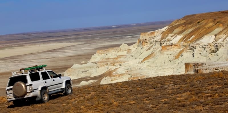
Aktolagai chalk ridge is located at an altitude of 190 to 249 m. a. s. l., located 41.3 kilometers northwest of village of Miyaly, 67.6 kilometers northeast of village of Akkiztogay, most of chalk ridge is located in Baiganinsky district in west of Aktobe region, a small part of western ridge is located in Kzylkoginsky district in eastern part of Atyrau region.
Amazing and unparalleled landscape of the plateau makes it one of the most interesting objects of geotourism. Distance from large settlements and bad roads can not stop the true lovers of the exotic nature - the ones who managed at least once to see pictures of Aktolagay will always seek here.
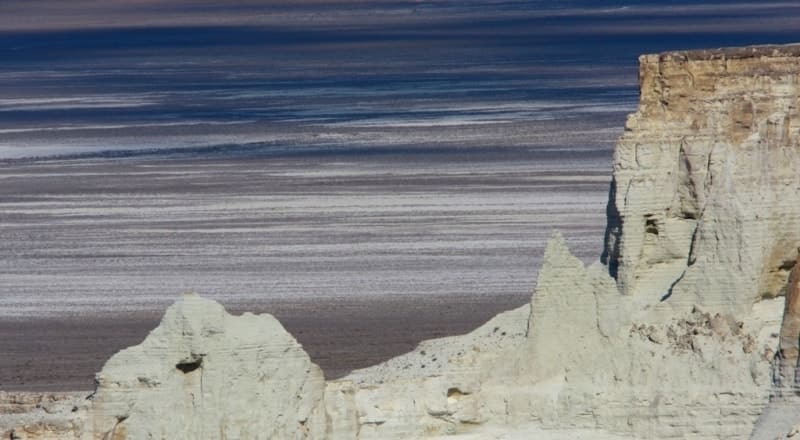
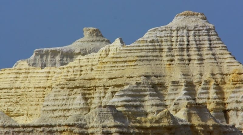
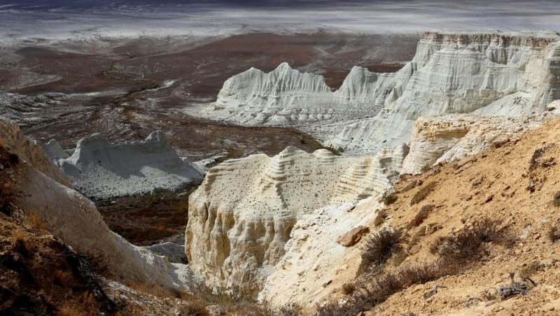
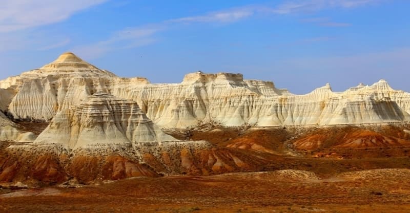
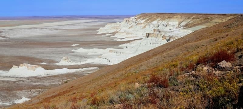
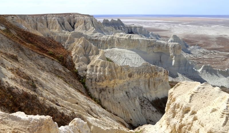
This is a gigantic museum of natural chalk figures. By its nature and morphology Aktolagay represents a plateau, although it is considerably smaller than the huge Ustyurt. On the western side the surface of Aktolagay breaks by a steep, sometimes sheer 140-meter bench, where the section of Upper Cretaceous and Tertiary sediments is studied, serving as the reference one to the whole of the Ural - Emba oil-bearing region.
Geological strata represented in the steeps were formed at the bottom of the warm Late Cretaceous sea, which extended to modern Hungary. Snow-white layers of chalk and chalk-like marl are composed of billions of tiny remnants of ancient organisms.
Often you can find here and the larger fossils: Cretaceous shark teeth, “devil’s fingers” - belemnites, ammonites, molluscs, corals, sea lilies, urchins, etc. The surrounding hills, composed of gypsum clay, also contain paleontological remains and are also quite picturesque, as covered by scattering gleaming in the sun gypsum crystals.
Relief surrounding the plateau represents the alternation of salt domes, apparent on the surface by picturesque groups of hills and ridges with a height of 60 - 80 m with sors and takyrs located in inter-dome spaces. The plateau is adjacent by the four salt domes: Kuldy-Kuduk, Tolagay, Chile-Sai and Alash-Kazgan.
Salt domes represent the raises of various forms, often limited by faults. Located at a depth the layers of rock salt under the pressure of overlying strata acquire plasticity and are squeezed up into heterogeneities and cracks, resulting in a fold formation with a salt core, expressed by a raise on the surface.
This process is called salt tectonics. Many of the salt domes of the Precaspian depression include oil and gas deposits. Unforgettable landscapes, diverse paleontological fossils and visualization of the represented here geological processes that occurred millions of years ago, make the plateau Aktolagay very attractive not only for specialists but also for a wide range of tourists.
Currently plateau Aktolagay is not included in any tourism brochures. It is easy to foresee that the popularity of the plateau as an object of mass tourism will grow in proportion to the dissemination of information. Over time, this will make possible to create the infrastructure, and gradually develop a modern service.
Geographic coordinates of Aktolagai chalk ridge: N47°27'33 E55°05'55


Authority:
Ilya Fishman, Yuliya Kazakova “Millions of years before Silk Road. Geoparks in Kazakhstan”. Printing house “Idan“ Kommunalnaya, 39, Almaty, Kazakhstan
http://yadi.sk/d/4_6z_blyoxnqe
Photos by:
Alexander Petrov.