


![]()
Вы здесь
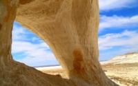
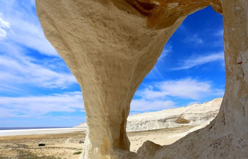
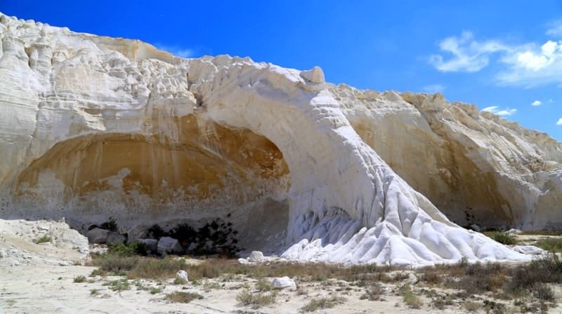
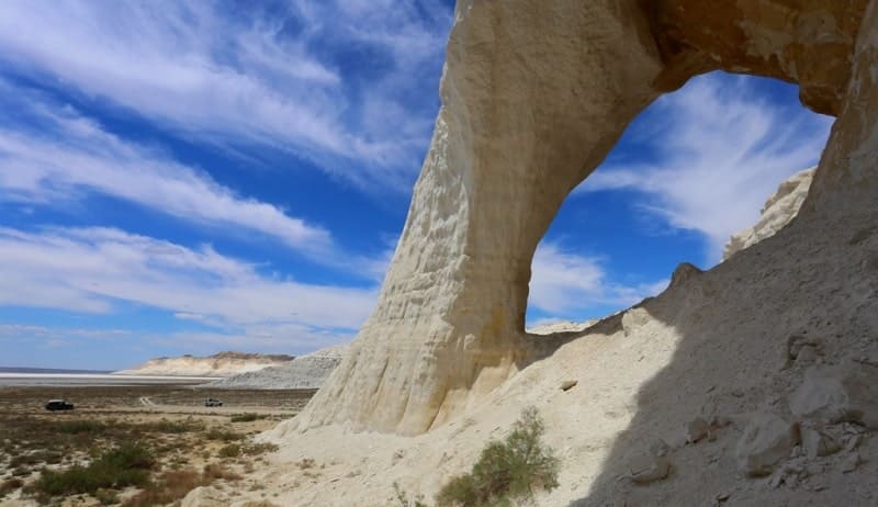
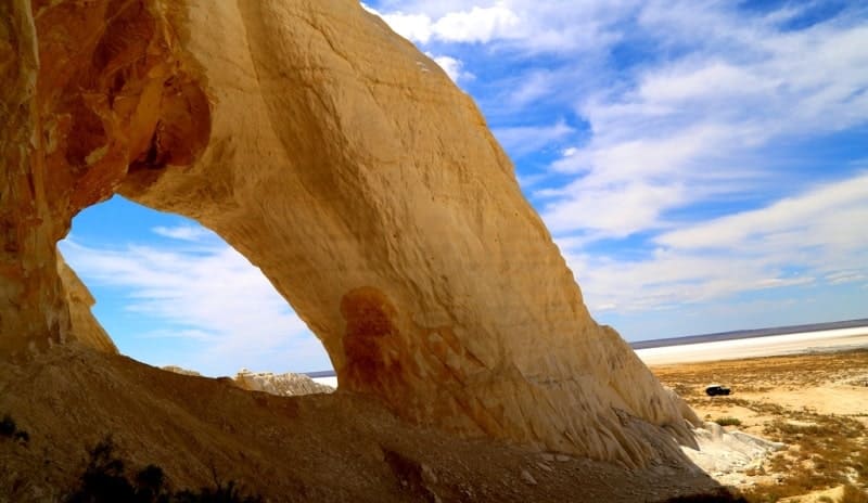
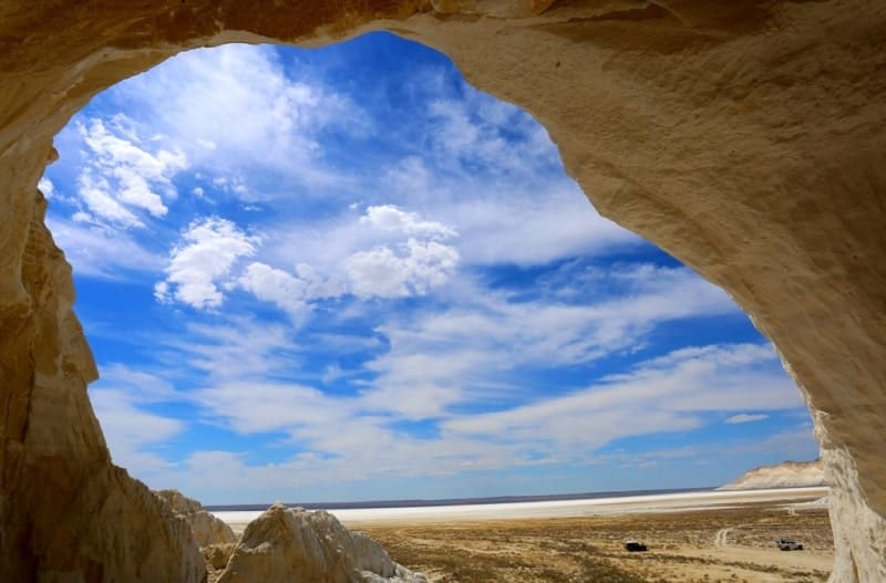
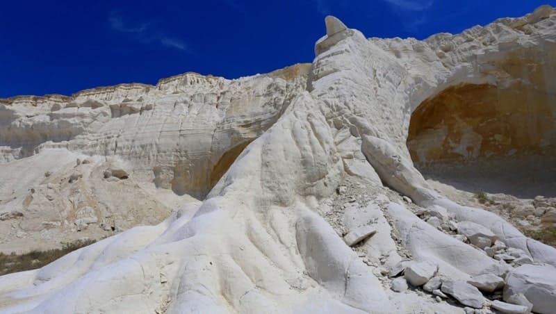
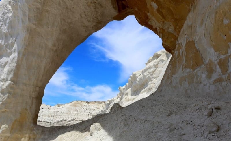
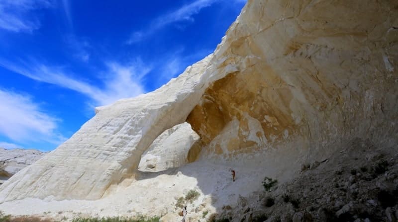
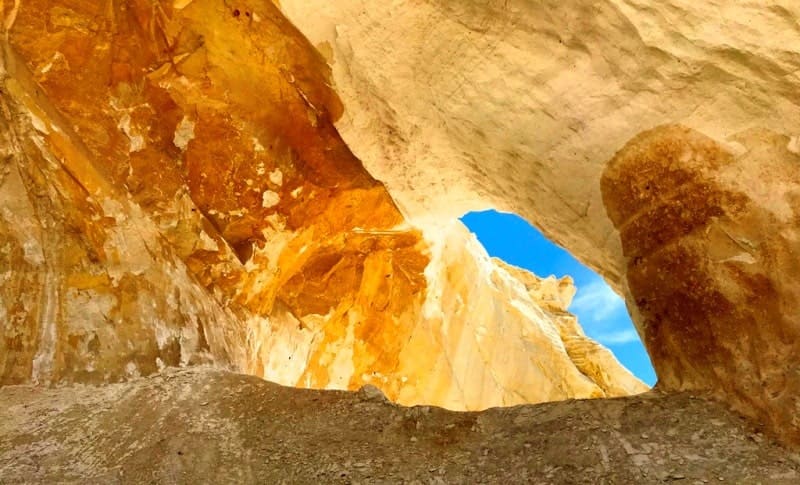
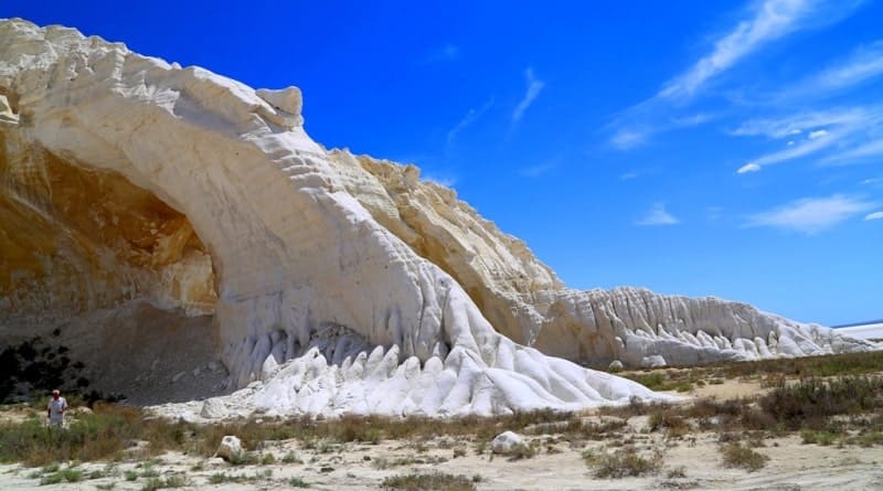
Chalk arch in northern part of Tuzbair Saline land.
Ecotours in Mnagyshlak.
"These layers suffer greatly from atmospheric influences, and therefore from the surface they are cavernous and crumble into rubble. Ridge-shaped and cap-shaped elevations of brown fine clay are visible on the slopes of the valley, especially at its turns, as well as on its bed. These elevations are apparently the result of the action of winds carrying particles of clay and depositing them on the protruding slopes; the clay itself is, in all probability, a product of the weathering of limestones, which are always somewhat clayey."
"Through Mangyshlak and Ustyurt to Turkestan." Barbot de Marni. 1889.
Tours to sights on Ustyurt in Kazakhstan.
Chalk arch is located at an altitude of 28 m. a. s. l., is located in northern part of Tuzbair saline land of Western Ustyurt Cliffs, 6.8 kilometers to south and slightly east of Manata rise, 2.1 kilometers to southeast of Mount Tuzbair, 272.6 m. a. s. l., in Mangistau district of the same name.
Approximately in the middle part of the Western Ustyurt Cliffs at the junction with the Tuzbair saline land is the famous Tuzbair Arch, which resembles one of the chalk pillars in the Baysary valley, which are located between Mount Bokty and the Boszhyra natural landmark.
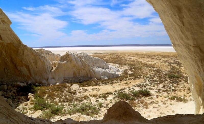
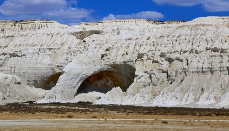
The southern slopes and cliffs of the Western Cliff of the Ustyurt plateau are composed of chalk deposits that are cut and divided by water streams. The inner part of one of these faces collapsed and formed a "rib", which in the upper part touches the upper part of the plateau, and the lower part rests on the bottom of the Tuzbair saline land.
The Tuzbair saline land is located between the slopes of the Western Ustyurt Cliffs, which breaks off in a depression to the sludge. From the northwest, the Tuzbair saline land is limited by the Kaskyrzhol mountain range, from the west by the Sengirkum and Sauskan sands.
The length of the Tuzbair saline land from west to east is 24 kilometers, the greatest width is 6 kilometers from north to south. The dominant height in the vicinity of the Tuzbair saline land is Mount Tuzbair, 272.6 meters above sea level, which is located in the northwestern part of the Western Ustyurt Cliffs.
The Ustyurt Plateau breaks off with jagged gorges washed by water from the east and northeast onto the Tuzbair saline land. The length of the Western Ustyurt cliffs, which breaks off to the Tuzyubair saline land, is 27 kilometers of majestic cliffs.
Geographical coordinates of chalk arch in northern part of Tuzbair saline land: N44°02'24 E53°11'47

Authority and photos by:
Alexander Petrov