Вы здесь
State of karakhanids.

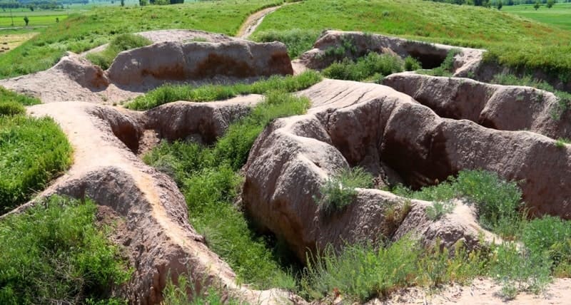
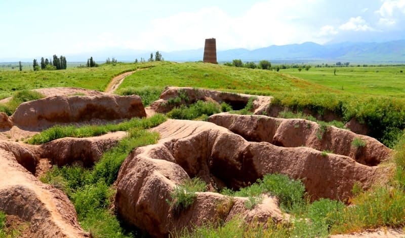
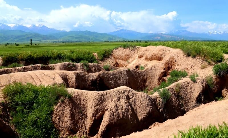
Monuments in Kyrygyzstan.
“These Khakans claimed descent from the Afrasiab family. There were only twenty of them in power. The capital of their kingdom was at first the city of Balasagun, and then the cities of Bukhara and Samarkand... Their native possessions were:
I) Balasagun, which served as their capital, located at the beginning of the seventh climate under 102 degrees longitude and 48 degrees latitude, not far from Kashgar and considered since ancient times a border city of Turkestan;
2) Kashgar, the capital city of Turan, in the sixth climate, under 106 degrees longitude and 45 degrees latitude; also called Ordukend; the birthplace of several famous scientists;
3) Khotan, in the most remote part of Turkestan, under 107 degrees longitude and 42 degrees latitude;
4) Karakorum;
5) Taraz; 6) Farab: all three cities are important"
Muneddjim-bashi.
Informative travel to Kyrgyzstan.
The Turkish people who conquered the Samanid lands did not preserve reliable traditions about how and under what conditions they accepted Islam; about the first sovereign who accepted Islam, Satuq Bograkhan, whose grave is still shown in one village north of Kashgar, there are only legendary news.
These Turks also quickly lost all memories of their pre-Muslim cultural past. For some time, along with the Arabic alphabet, they continued to use the Uighur alphabet inherited from pre-Muslim times; then this alphabet was forgotten; its use was resumed only during the period of Mongol rule, who received it from the non-Muslim population of Eastern Turkestan.
In state terminology, especially in the khan's titles, some traces of steppe and generally pre-Muslim traditions were preserved; Thus, some Muslim khans called themselves Chinese emperors (in Turkish, tabgach-khan, or tamgach-khan), although their possessions did not extend either to China or even to the regions bordering China.
But the literature of the Muslim Turks developed entirely under the influence of Muslim, especially Persian, models; the earlier acquaintance of the Turks with Chinese culture, Buddhism, Manichaeism and Christianity left no traces in this egard.
This explains the dryness, emptiness and weak distribution among the people of Turkish imitations in comparison with their models. It is enough to compare the didactic poem Kudatku (or Kutadgu) bilik, composed in 462 - 1069 - 1070. Yusuf Balasagunsky for the Khan of Kashgar (the author says that his work was the first book in the Turkish language, while the Arabs and Persians had many books), with the didactic work Kabus-name written in 1082, subsequently translated into Turkish three times.
The Persian author presents his teachings in a lively story and supports them with examples from history, which significantly increase the interest of his book; in Kutadgu bilik, the characters are lifeless allegorical figures (justice is personified in the person of the sovereign, happiness in the form of the vizier, intelligence in the form of the vizier's son, contentment in the form of the vizier's brother).
So far, very few copies of Kutadgu bilik have been made known; However, a find made in 1909 in the Saraichikovsky settlement at the mouth of the Ural (a clay jug with inscriptions containing a periphrase of some of the verses of Kutadgu Bilik) suggests that this work was nevertheless somewhat more popular than one might think from the number of copies that have come down to us.
The conquest of the Samanid state by the Muslim Turks began from the northeast; first of all, the Isfidzhaba district was occupied, that is, the present-day Chimkent district; in 992, Turkish troops entered Bukhara for the first time, from where, however, they were forced to leave that same year.
By the treaty of 996, the Samanids were forced to cede to the Turks all their possessions north of the Zeravshan basin; in 999, Samarkand and Bukhara also came under the power of the Turkish khan; The last Samanid pretender died in 1005, after several unsuccessful attempts to restore the power of his dynasty.
How far to the east the dominion of these Turks extended is not stated in the sources. As early as 998, the Kashgar Khan Arslan Khan Ali died a "martyr" in the struggle for the faith; the place of his death is still indicated as north-east of Yangi-Hisar; from this we can conclude that the area of spread of Islam and the dominion of the Muslim Turks at that time ended a short distance to the east of Kashgar.
In the Xth and XIIth centuries, the regions on both sides of the main ridge of the Tien-Shan were united under the rule of one dynasty, "known in history as the Karakhanids, or Ilek Khans, but not under the rule of one ruler. Like all states of nomadic and semi-nomadic peoples, the state of the Karakhanids was divided into appanages, which soon turned into independent possessions, the borders of which were constantly changing and between which frequent wars took place.
Already in the XIth century, all signs of even nominal supreme power of the head of the dynasty disappeared; equally independent rulers with equally loud titles ruled in different cities. In the first period after the conquest, the ruler of Western Turkestan bore the title of Ilek, which was considered, apparently, "lower than the title of Khan.
The first Ilek lived and was buried in Uzgend, a border town of Fergana; then, after the Turkish conquerors had strengthened their power, the Ileks moved their residence to the central city of the region, Samarkand, where they had already adopted the title of Khan in the XIth century.
Uzgend, a relatively small city under the Samanids - it was equal to 2/3 of Osh (now a village in the Andijan district, although not without commercial significance), was, therefore, for some time the residence of the ruler of all Maverannahr; after the Ileks moved to Samarkand, it remained the residence of the ruler of Fergana until the construction of Andijan by the Mongols at the end of the XIIIth century.
The buildings that have survived to this day in Uzgend date back to this best period, including a minaret 9 fathoms high. Near it there is a mazar, i.e. a tomb mausoleum, where, according to local legend, the first Ilek and even the Seljuk Sultan Sanjar (died in 1157) are buried, whose tomb is actually located in Merv.
From the (inscription on the mausoleum it is evident that it was built somewhat later, at the end of the XIIth century; in any case, the Uzgend buildings are of interest in view of the small number of monuments of the pre-Mongol era preserved in Turkestan.
The ruler of Fergana was mostly independent of Samarkand, although the Samarkand khans had a claim to supreme power over the Esem (Maverannahr and at the end of the XIIth century called themselves "sultans of sultans". Bukhara, the capital of the Samanids, was not a khan's city under the Karakhanids, although some khans erected buildings there, the most famous of which is the Arslan Khan minaret (52 meters high), built in 1127.
The conquest of the country by the Turks and the appanage system brought by the conquerors had comparatively little effect on the state of culture; there was no break in cultural development; historical processes that can be traced in Samanid era, were further developed under the Karakhanids.
The fall of the Samanid state briefly raised the importance of the landowning aristocracy, the dikhans; this is evidenced by the appearance of coins of the Ilak dikhan, who did not have ownership rights under the Samanids, and the mention, in stories about the wars of the Karakhanids, of a special detachment of dikhans of Maverannahr.
But soon the dikhans lost even the importance that they still retained under the Samanids; in stories about the political events of the XIIth and XIIIth centuries, the dikhans are no longer mentioned; during the defense of Turkestan from the Mongol invasion, such knightly cavalry, judging by the silence of the sources, no longer existed.
Probably, the dikhans took part in the struggle between the throne and the military aristocracy (the main representatives of the latter were the chiefs of the Turkish guard), which was waged with great more bitter than under their predecessors; the khans enjoyed the support of the masses against the aristocracy, and the aristocracy had the clergy on its side.
Particularly characteristic is the deposition and murder in 1095 by the chiefs of the Turkish guard, by order of the clergy, of the Samarkand Khan Akhmed, popular among the masses. The further successes of urban life, trade and industry must also have had an impact on the disintegration of the dikhnan class.
In the XIth century, under the Karakhanids, the process of transition of life from the old "shahristans" to suburbs, where bazaars were located, which had begun at the time of the conquest, was completed, the conversion of the former "cities" into "suburbs" and "suburbs" into "cities"; the cities received the appearance that they have preserved to the present day, with main streets from the gates to the center, bazaar shops along these streets and a central market dome (charsu) at the point of their intersection.
The same process we we see in those cities of present-day Turkestan that were not part of the Karakhanid dominions, for example in Merv. In Bukhara, a kind of aristocratic city republic was formed, headed by the sadrs, i.e. spiritual dignitaries, from the “house of Burkhan”, representing the interests of the wealthy class.
The power of the sadrs was destroyed at the beginning of the XIIIth century not by the khans, but by a popular movement headed by a man from the artisan class. The events that took place in the Karakhanid state internal strife was used by external enemies, as a result of which the dynasty lost its independence already in the VIth century, although it retained its existence until the beginning of the XIIIth century.
When the Samanid state fell, the part of it located south of the Amu Darya came under the rule of another dynasty, which had previously been in vassal dependence on the Samanids and received in history the name of the "Ghaznavids", after the name of its main city, Ghazna (in present-day Afghanistan, south of Kabul).
The main representative of this dynasty, Sultan Mahmud (998 - 1030), managed to repel the attack of the Karakhanids on the regions south of the Amu Darya, retain Balkh under his rule and, to some extent, subjugate the eastern regions of modern Bukhara, which gravitated towards Balkh; in the same way, he conquered Khorezm, which had previously been subject to the Samanids.
The successors of Mahmud were driven out of Persia and the northern part of Afghanistan by the invasion of another Turkish people, the Turkmens, who had previously lived in the lower reaches of the Syr Darya, from where they had moved south in the 10th century and crossed the Amu Darya in the XIth century.
The Turkmens were "at a lower level of culture than the conquerors of Samanid Turkestan, had no written language before the adoption of Islam and carried out their conquest not under the leadership of the khan dynasty; at first, scattered crowds of the Turkmen people came to Persia, then detachments under the command of beks (princes), descendants of the Turkmen leader Seljuk.
The royal title was adopted by them already in Persia, where they began to call themselves "shahs" and "sultans"; this last title (originally meaning not a sole ruler, but a collective concept of governmental power) was first introduced by them into official use and inscriptions on coins, in which they were later imitated by the Ghaznavids and Karakhanids.
These "Seljuk Turks", or "Seljuk Turks", gradually subjugated all of Muslim Asia. After strengthening their power in Persia and Mesopotamia, they turned to the east, conquered Khorezm and those regions along the lower reaches of the Syr Darya, from which they had once come, and subjugated the Karakhanids, up to and including the Kashgar Khan, to their supreme power.
Authority:
Academician V.V. Bartold. "Karakhanids, Seljuks, Kara-Khitans and Khorezmshahs". Works. Volume II. Publishing House of Eastern Literature. Moscow. 1963.
Photos by:
Alexander Peetrov.


