


![]()
Вы здесь
Climate of Almaty reserve.


Travel to Almaty reserve.
“At his best, man is the noblest of all animals; separated from law and justice he is the worst”
Aristotle.
Visit of Almaty reserve.
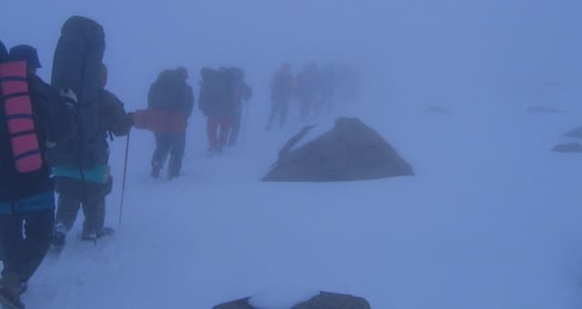
Climate of Almaty Nature Reserve.
The climate of the Almaty Reserve is sharply continental, typical of the Northern Tien-Shan. Its main features are significant solar radiation and the complex seasonal nature of atmospheric circulation. The climate of the mid-mountain zone is generally moderate continental.
The average annual air temperature ranges from 6.8' at the bottom to 0.8' at the top. The minimum average monthly temperatures are observed in January (from - 4.3 degrees in the lower part to - 9.7 in the upper part), the maximum in July (from 18.1 to 10.6 ').
The duration of the frost-free period is 145 days at the bottom (with the sum of average daily temperatures above 10' in 2245) and 90 days at the top (585'). Precipitation per year averages from 830 to 870 mm, including 5 – 70 – 640 mm during the warm period.
The humidification coefficient varies from bottom to top from 1.15 to 1.95. Snow cover lasts 160 - 190 days and reaches 60 - 80 cm. Spring is characterized by a rapid increase in average daily air temperatures and a significant amount of precipitation.
At the beginning of summer (June), the weather is usually cool - there is a lot of sun, but not hot, and moderate precipitation. In July - August there is little precipitation - a period of drought sets in (even at altitudes above 2500 m). At the end of September, the approach of autumn becomes noticeable.
Average daily air temperatures drop sharply. In autumn, clear weather prevails. At the end of October or beginning of November, the first snow falls in the lower part of the zone, and winter weather sets in at altitudes above 2500 m. The climate of the highlands is sharply continental and cold.
There are frequent frosts here even in summer at night. Summer is short, with unstable, variable weather. The average daily temperature in July is 5 - 8', and the maximum daily temperature is 18 - 20'. The summer period accounts for the maximum precipitation - 60% of the annual amount.
Rainfall often turns into snow pellets or small hail. The growing season is short: no more than 53 days. Winter sets in already at the beginning of October. The average air temperature in January is from - 10.2 to - 13.9', and the minimum - to - 34'.
On snowless slopes, the soil freezes to a considerable depth. The height of the snow cover on average reaches 65 - 90 cm. The snow melts in late April - early May. The average annual air temperature is from - 2.4 to - 4'. The average annual precipitation is about 6770 mm, including 450 mm in the warm period.
At altitudes above 3200 m, permafrost is widespread. In the glacial-nival zone the climate is the most severe, close to the Arctic. The average annual air temperature in the lower part of the zone (3600 m) is - 8', and at altitudes above 4000 m - up to - 12' and lower.
There is no usual division of the year into four seasons. Even in June, the average monthly air temperature is negative, and snow falls all year round. The number of days with snowstorms is 15 - 20. Thaws are extremely rare. The sum of positive temperatures ranges from 178 to 443', and in cold summers from 55 to 170'.
Heavy snowfalls are frequent. There is between 800 and 1300 mm of precipitation per year. The duration of sunshine is about 2000 hours per year. The coniferous forest belt is represented by spruce forests (over 2800 hectares). Areas of these forests, interspersed with tall grass meadows, form a kind of mosaic.
Clearings with screes and bedrock outcrops are common. Well-insulated areas are occupied by grass-forb steppes and shrubs. In places of former felling, spruce has been replaced by deciduous species - mountain willow and mountain ash. Spruce clearings are widespread, and in the subalpine zone there are thickets of creeping juniper (over 2000 hectares).
Mountain-meadow and mountain-steppe landscapes of middle and high mountains occupy about 6,400 hectares. Screes, coarse debris deposits and bare, steep slopes devoid of any vegetation are also widespread here. Their total area is about 20,000 hectares, i.e. more than a quarter of the territory.
A large area of the reserve is occupied by landscapes of the glacial-nival zone - rocks (over 13,000 hectares), eternal snow, firn fields and glaciers (about 23,400 hectares). Almost the entire territory of the reserve is difficult to access, and the Talgar massif is accessible only to climbers.
Roads (suitable for all-terrain vehicles) stretch along the boundaries of the reserve in the lower part of Left Talgar for 6 km, Right Talgar for 8 kilometers and Issyk for 7 kilometers. There are few trails, they are badly destroyed and in some places difficult to pass.
Mudflows, snow avalanches, rockfalls, landslides and landslides are common in the reserve. Mudflows destroy slopes, create deep canyons in places where boulders fall and pile up below, dam up rivers and sharply increase the water level in them after the rubble breaks through.
In July 1979, a mudflow destroyed most of the Talgar climbing camp. Sometimes large mudflows occur, several hundred thousand and even millions of cubic meters. Such powerful flows bring catastrophic destruction. Thus, on July 7, 1963, a mudflow with a volume of about 3 million m almost completely filled up the large lake Issyk in four hours.
The occurrence of such mudflows is usually associated with anthropogenic disturbances of mountain landscapes. Avalanches are also dangerous. They descend annually in March - April. Sometimes avalanches of hundreds and thousands of cubic meters are formed, which have enormous destructive power.
Landslides and rockfalls are also common in the reserve, especially in the nival zone in the upper reaches of the Chilik, Issyk rivers and all gorges of the Talgar section. The reserve is located in a zone of high seismic activity. Earthquakes, especially strong ones, almost always lead to catastrophic rockfalls, landslides, mudflows and other natural disasters.
Located at the lower border of the reserve, the Talgar seismic station of the Institute of Physics of the Earth named after. O. Yu. Shmidt of the USSR Academy of Sciences registers several dozen earthquakes a year.


Authority:
"Zhetysu is the Land of tourism”. A Tourist Guide-book. Almaty. 2003. 68 p. and the material for this page is taken from the printed edition."Guide to Kazakhstan" “Central Asia Mountains”. 2009, Almaty,Publishing house “Mektep”. Authos Aldar Gorbunov, Anna Ivachenko, Sharipa Bisarieva.
Photos by:
Alexander Petrov and Sergei Mikhalkov.