







You are here
Sapozhnikov Glacier in Chon-Kemin Valley.
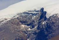
Glaciers in Chon-Kemin Park.
"The firn fields of such glaciers are situated on the steep back walls of the cirque; the glacier tongues have a gentler gradient but become convex near their termini. Cirque glaciers often appear as waning formations, where the ice extends only to the middle of the cirque or even halts against one of its walls, effectively transforming into a hanging glacier."
"Glacial Structures of the Northern Tien Shan – Zailiysky Alatau"
https://elib.rgo.ru
Glaciers southern slope Zailiyskiy Alatau.
Sapozhnikov Glacier is situated at elevations ranging from 3,763 to 4,387.2 (Legostaev Peak), 4,279 m, 4,269.6 m (Askartau Summit), and 4,190.2 m. a. s. l. It lies on the southern slope of the Zailiysky Alatau Range, in the headwaters of the Kashka-Suu River (a right tributary of the Chon-Kemin River). Along the main ridge of the Zailiysky Alatau, it borders the Cherny Glacier - located at the headwaters of the Ozernaya River (Republic of Kazakhstan). The glacier is situated within the Chon-Kemin Nature Park, in the Kemin District of the eastern Chuy Region.
The glacier is named after V. V. Sapozhnikov (1861-1924), a botanist, geographer, and explorer. Sapozhnikov Glacier is located on a south-facing slope in Kyrgyzstan and belongs to the Chon-Kemin River basin. The glacier's northern boundary follows the main ridge of the Zailiysky Alatau, extending from Legostaev Peak - located in the western part of the glacier at an elevation of 4,387.2 m. a. s. l. and continues eastward for 3.8 km. The glacier's southern boundary descends to an elevation of 3,763 m a.s.l.
One of the main channels of the Kashka-Suu River originates from the eastern branch of the Sapozhnikov Glacier. The glacier has a perimeter of 11.08 km and an area of 2.81 sq. km. The eastern branch extends for 2.1 km and the western for 2.4 km; the maximum width in the central section is 3.55 km.
The moraine-covered section of the glacier extends for 3.8 km. Morphologically, it is a cirque glacier belonging to the Chon-Kemin River basin. It lacks a distinct glacier tongue. The lower section of the glacier is covered with rock debris over a distance of 3.8 km.
The moraine deposits consist primarily of schist. Near the exposed part of the glacier, the moraine deposits form a chaotic, hummocky terrain. The moraine deposits covering the lower half of the glacier appear older than those on the upper, debris-covered half.
The highest accumulation point of the glacier is at an elevation of 4,387.2 m a.s.l. The terminus of the exposed section lies at an elevation of 3,763 m a.s.l. The glacier is nourished by the accumulation of snow, firn, and solid precipitation. Numerous transverse crevasses are found in the western branch of the glacier.
The glacier consists of three branches - western, central, and eastern - with the western and central branches being nearly equal in size. The eastern branch is situated separately, connecting to the central section via the ridge of a small spur. The western branch has an eastern and southern aspect; the exposed end of its tongue lies at an absolute elevation of 3,763 m a.s.l., while the end buried beneath moraines lies at 3,375 m a.s.l.
The central branch has a southern aspect. Its exposed section terminates at 3,819 m a.s.l., and the buried section at 3,375 m a.s.l. The eastern branch has an eastern and southern aspect; the exposed end of its tongue lies at an absolute elevation of 3,738 m a.s.l., while the end buried beneath moraines lies at 3,670 m a.s.l.
The western, central, and eastern branches of the Sapozhnikov Glacier border the Cherny Glacier to the north; the latter is located on the northern slope of the Zailiysky Alatau Range within the Ile-Alatau Nature Park in the Republic of Kazakhstan.
Geographic coordinates of Sapozhnikov glacier: N42°57'11 E77°03'10
Authority and photos by:
Alexander Petrov.