


![]()
You are here
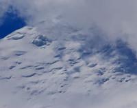
Vali Glacier.
Glacier on southern slope of Zaalayskiy Range.
“The development of glaciers in the upper reaches of the valley is significant: the Saukdara glacier, flowing from Lenin Peak to the south, and then turning west in a large arc, reaches a length of about 20 km. In general, the alpine type of glaciers predominates, but the appearance of their surface, as in the entire region, is strongly influenced by dryness and intense solar radiation.”
Alai-Pamir expedition of 1928. Dr. Richard Finsterwalder, Munich.
Glaciers in valley of Sauksay River.
Upper limit of Vali glacier is located at an altitude of 6361 meters above sea level, end of glacier is located at an altitude of 4273 meters above sea level, located on southern slope of Zaalayskiy Range, in north of Murghab region in northern part of Gorno-Badakhshan Autonomous Region.
The length of the glacier is 7 kilometers; under moraine sediments there are 3.7 kilometers of glacier, with an area of 11.9 square kilometers. The glacier belongs to the group of valley glaciers Saukdara (now Bobak) located on the southern slope of the Zaalayskiy Range at the source of the Sauksay River (now Sardobrud), which merges with the Seldara River to form the Muksu River.
The Saukdara (Bobak) glacier group consists of 4 pulsating glaciers that became active in the 1970s:
Lower Bobak: length - 20.6 kilometers, glacier area 23.5 square kilometers, the end of the glacier is located at an altitude of 3980 meters above sea level, advanced in the mid-1970s.
Upper Bobak: 14.3 kilometers long, glacier area 23.5 square kilometers, the end of the glacier is located at an altitude of 4120 meters above sea level, advanced in 1966 and 1974 -1975.
Nusratullo Makhsuma Glacier: 14.9 kilometers long, the glacier area is 19 square kilometers, advanced in 1973 - 1975.
The Vali glacier advanced in 1975 - 1977.
History of research on Vali glacier.
The glacier began to advance only in 1973. The duration of its offensive was about two years. During this time, the glacier lengthened by 1300 meters. The total increase in area of all glaciers was 3.3 square kilometers, that is, 6% of the original.
In total, almost 220,000,000 cubic kilometers of ice were carried into the Sauksay valley. Unlike Bear and Didal, the period of advance of which did not exceed a year, these glaciers advanced several times longer: from several to tens of years or more.
There is a possibility that, under the influence of global climate change, the pulsation of these glaciers will become more noticeable and intense. Due to the fact that there are no roads or settlements in the upper reaches of Sauksay, the movement of these glaciers in past years did not cause any damage.
Geographic coordinates of Vali glacier: N39°19'20 E72°45'28
Authority:
"Glaciers of Tajikistan". Ministry of Nature Protection of the Republic of Tajikistan. Main Directorate for Hydrometeorology and Natural Environment Observations. Dushanbe. 2003
Photos by:
Alexander Petrov.