You are here
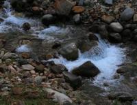
Kim-Asar River.

Walk to Kim Asar River in Zailiyskiy Alatau Mountains.
"Exciting hearts,
You flow into the distance from afar.
Your trembling streams
Slide through the fingers of the reed."
Ilyas Dzhansugurov. "My Aksu".
Right tributaries of Malaya Almatinka River.
Kim Asar River (Kazakh: "Whoever overcomes, will perish") is located: river's sources are at an altitude of 3,260 meters above sea level, mouth is at an altitude of 1,668 meters above sea level, is located on western slope of Malaya Almatinka Gorge, on northern slope of Zailiyskiy Alatau ridge, in Medeu district of Almaty.
The sources of the Kim Asar River are on the northern slope of Mount Panorama, 3,260 meters above sea level, and its mouth is 177 meters northeast of the high-mountain skating rink "Medeu" in the tract of the same name. Kim Asar is a right tributary of the Malaya Almatinka River.
The length of the river is 6 kilometers, the catchment area reaches 7.65 square kilometers. The main tributary of the river is the Left Ortaksai, which originates from the springs of the northern slope of Mount Medeu, 2,861 meters above sea level.
The river poses a mudflow hazard in case of prolonged rains, the riverbed is stabilized. From the cordon of the Kimasarovsky forestry in the riverbed in Soviet times, artificial structures were built to ensure a uniform flow of water in the river. Barrages reach the Almaty Basin Administration for the Operation of Mountain Rivers and the mudflow protection structures of the Medeu valley.
Geographic coordinates of Kim Asar River: N43°09'37 E77°05'16
Authority and photos by:
Alexander Petrov.


