


![]()
You are here
Karaman ata Mosque.
Underground mosque of Karaman Ata and its surroundings.
"Do not let me cross the threshold of God's temple.
I am an atheist. God created me like this.
I am like a harlot whose faith is a vice.
Sinners would be glad to go to heaven - but they don't know the roads"
Omar Khayyam.
Tours to ancient underground mosques of Mangyshlak.
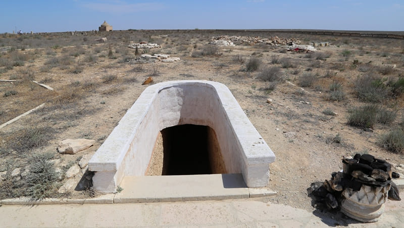
Underground mosque of Karaman ata is located at an altitude of 219 meters above sea level, is located in central part of Mangyshlak Peninsula, in Kandybas valley, 7.5 kilometers northeast of Kabyrga valley, 35 kilometers southwest of village of Shetpe, 38.5 kilometers northwest of village of Zhetybay, 63.5 kilometers northeast of the of Aktau, monument occupies gentle slopes of a low hill in Mangistau district of region of same name.
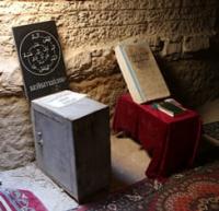
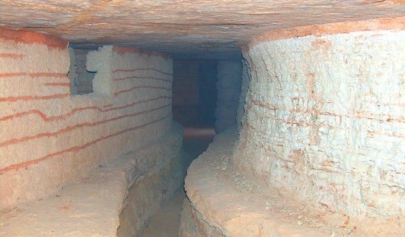
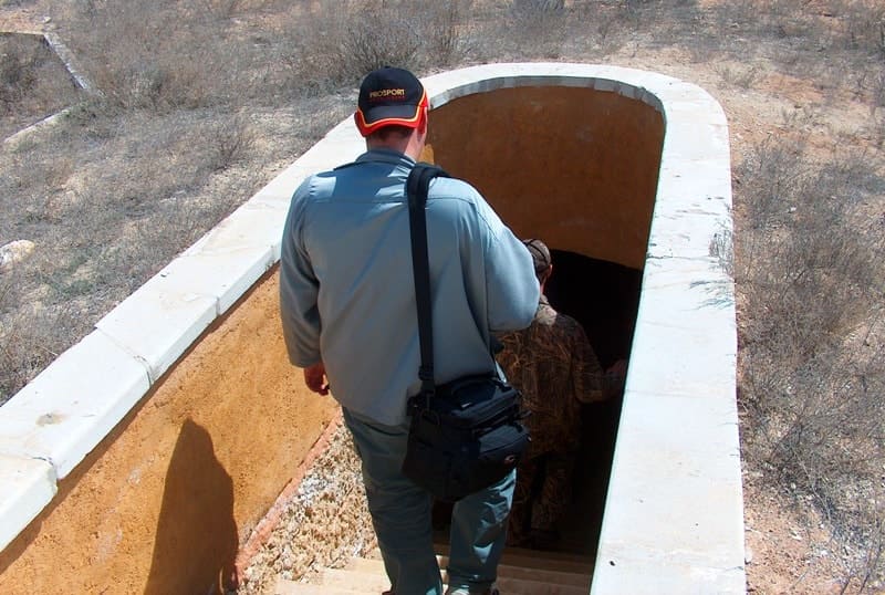
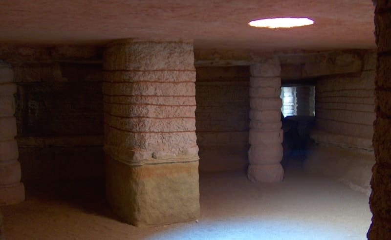
The underground mosque of Karaman Ata is located in the western sector of the necropolis of the same name. The mosque is carved on the gentle slope of a small hill, consisting of marl rock, perhaps the builders used a natural cave here. The underground mosque of Karaman Ata consists of three main rooms.
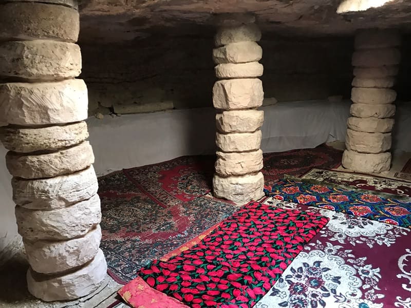
This is the entrance room, the northwestern wall of which collapsed and blocked the corridor, turning it into a gentle ramp, and a long room of the prayer hall, stretching from the southeast to the northwest (23 x 6 meters), the western wall of which is slightly rounded.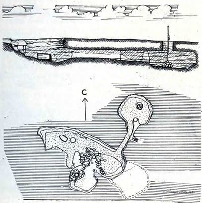
Two pillars were left in the hall and a round column was installed, designed to ensure the strength of the ceiling soil. This was not done in vain, since the middle large pillar together with the ceiling collapsed, blocking a significant part of the prayer hall.
Due to the shallow foundation, all the rooms of the mosque have low walls. The floors are covered with an alluvial mass of clay and sand, which got in with water through the entrances and interlayer cracks in the soil. In the northeastern part of the mosque there is a third room, round in plan, in which, according to legend, the crypt of Karaman ata is located.
A long corridor connects it with the prayer hall. The general neglected state is probably explained by the remoteness of the monument from populated areas.
Research of underground mosque of Karaman Ata.
The monument was first explored by the expedition of M. Mendikulov in 1951-1952. In 2002, the employees of the Scientific Research Institute "KazProektrestavratsiya" carried out restoration work. In 1982, by the decision of the Council of Ministers of the Kazakh SSR, the underground mosque of Karaman Ata was accepted for state registration and protection of republican significance.
Geographic coordinates of underground mosque of Karaman Ata: N43°54'00 E51°52'24


Authority:
M. Mendikulov. "Monuments of folk architecture of Western Kazakhstan". Alma-Ata, Oner, 1987.
Murat Kalmenov. "Underground mosques of Mangistau. Almaty. Orkhon Publishing House. 2009. 160 p.
M. Khashimov. "Monuments of Central Asia". Saga Publishing House, 2001.
Photographs by:
Alexander Petrov