


![]()
You are here
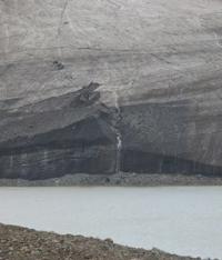
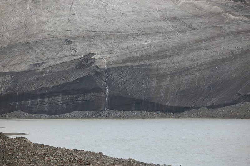
Lake Kyzyl-Asker West.
Walk to Lake Kyzyl-Asker West.
"Such was this strange country of Aksai, where we descended. This entire area no longer belongs to the region of the Syr Darya, but to the Tarim basin. This country resembled another of our high-mountain steppes - Pamir. It is interesting that both Aksai and Pamir lie in the upper reaches of tributaries of the Tarim and, moreover, both are within Russian borders. First of all, the Aksai Tien Shan, bordering Kashgar, was clearly visible in the form of a rocky ridge, covered significantly with snow, sometimes solid, sometimes picturesquely thrown. To the east, another ridge was visible further."
"Across mountainous regions of Russian Turkestan." V. I. Lipsky. 1906.
Lakes in mountain-ice massif of Kyzyl-Asker.
Glacial-dammed, flowing, freshwater lake Kyzyl-Asker West is located at an altitude of 3844 meters above sea level, at end of glacier of same name, in Kyzyl-Asker mountain range, on northern slope of western part of Kakshaal-Too ridge in At-Bashinsky district of Naryn region.
The icefall of the Kyzyl-Asker West glacier dumps ice into the glacial-dammed lake of the same name. The lake is formed by a melting glacier and a snow-firn layer covering the glacier above the feeding line. Since the mid-XIXth century, anthropogenic deglaciation has been occurring, caused by global warming.
The lake is an element of the nival-glacial zone, which determines the size of the glacier in proportion to the size of the lake. The tongue of the Kyzyl-Asker West glacier ends in a flowing, fresh lake. The length of the lake from south to north is 1.5 kilometers, the greatest width reaches 554 meters, the area of the lake is 0.54 square kilometers, the length of the coastline is 3.56 kilometers.
The lake is noticeably elongated from north to south and exceeds the length of the Kyzyl-Asker East Lake by 500 meters. It should be noted that the West Lake is more than 5 meters lower than the Vostochnoye Lake. The lake goes 215 meters deep into the glacier, and because of this, the end of the glacier has a pronounced oval shape.
The Kyzyl-Asker River flows from the northern part of the lake, 11.5 kilometers long, and is a left tributary of the Kyzylunet River. After 1.8 kilometers, the river spills and flows in a wide channel for more than 5 kilometers. The river bypassed the moraine and made a channel for itself between the eastern slope and the moraine itself.
The length of the moraine is 520 meters, the area of the moraine reaches 0.29 square kilometers. In the middle part of the moraine there are two small lakes and several small ones.
Geographic coordinates of Kyzyl-Asker Lake West: N41°05'59 E77°19'41

Authority and photos by:
Alexander Petrov.