




You are here
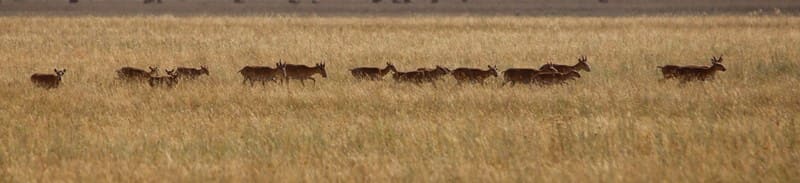
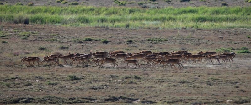
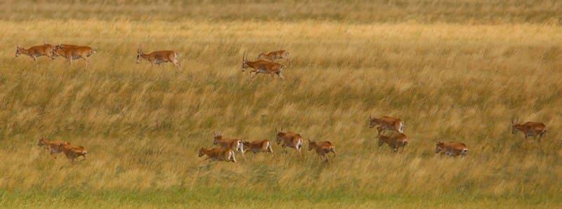
A photo safari for saiga antelopes in Kostanay Region.
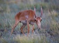
Photographs of saiga antelopes in Kazakhstan.
"The saiga is the swiftest and most alert animal of our steppes. At the slightest sign of danger, the herd takes off, racing with such speed that it appears as though the animals are flying just above the ground, barely touching the grass." He also provided a detailed description of the unique anatomical structure of their trunk-like nose, which helped the animals breathe while running across the dusty steppe.
Eduard Alexandrovich Eversmann, a naturalist, zoologist, and traveler. "Natural History of the Orenburg Region", Part II: "Natural History of the Mammals of Orenburg Region: Their Habits, Methods of Capture, and Economic Significance." Kazan, 1850.
"During the summer months, the intense heat drives the saiga antelopes northward, and the steppe comes alive: thousands of these fleet-footed antelopes move in unbroken streams, kicking up columns of dust that stretch all the way to the horizon."
Grigory Nikolayevich Potanin, a prominent geographer and ethnographer. From ethnographic essay "In Yurt of Last Kyrgyz Prince (From a Journey to Kokshetau District)," published in journal *Russkoye Bogatstvo* ("Russian Wealth"), No. 8, 1896.
Observing saiga antelopes in wild in Kazakhstan.
On traditional Kazakh hunting of saiga antelopes in XIXth century.
Traditional Kazakh hunting of saiga antelopes in the XIXth century - often referred to locally as *kiik aulau* or *saigakshylyk* - differed significantly from the hunting of other ungulates. It required an intimate knowledge of the steppe, the habits of the animals, their migratory routes, and their anatomical characteristics. Key features and methods of hunting during that period:
1. Ambush hunting of saiga antelopes at watering holes (known as "Keruert" or "Bukpa").
Saiga antelopes are highly dependent on water, especially during the arid summer months. Kazakh hunters skillfully exploited this vulnerability: They constructed shelters - either concealed pits or small breastworks made of stone or earth ("tasa") - near steppe lakes, springs, or salt licks.
Camouflage: Hunters would lie in wait long before dawn, as saiga possess an exceptional sense of smell and keen eyesight. They primarily used antique matchlock or flintlock muskets ("bilteli myltyk"), firing at close range.
2. Drive hunting of saiga antelopes, utilizing natural terrain (known as "Karauyl" and "Kagys").
Since the saiga is the fastest animal in the steppe, pursuing it openly on horseback was futile. Instead, a drive-hunting tactic was employed: a group of mounted drivers ("kagushylar") would carefully steer the herd - from a distance - toward narrow ravines, hollows, or steep riverbanks.
Ambushed marksmen: Hidden hunters would wait at the end of these natural corridors. Due to the unique structure of their eyes, saiga have poor vision directly in front of them while running, often noticing the danger too late.
3. Hunting saiga antelopes using birds of prey and sight hounds ("Tazy").
This was the most aristocratic and athletic form of hunting, though less productive than the drive-hunt method:
Using golden eagles - large steppe golden eagles were trained to hunt saiga antelopes. The bird would be released from an elevated position; a saiga can reach speeds of up to 80 km/h, but the golden eagle would dive from above, blinding the animal with strikes from its wings and pinning it down with its talons until the hunter arrived.
Using Tazy dogs - the Kazakh Tazy (a type of sighthound) is one of the few dog breeds in the world capable of matching the speed of a saiga over short distances. Hunters took great care of their Tazy dogs, often carrying them on horseback in special baskets until a herd was spotted, thereby preserving the dog’s energy for the decisive sprint.
Goal of a saiga photo safari in Kazakhstan:
To capture images of this unique, ancient antelope in its natural habitat, combining the personal thrill of a naturalist’s pursuit with a contribution to global conservation efforts. Kazakhstan is home to the vast majority (over 90%) of the world’s saiga population.
As legal sport hunting for these animals - which have existed since the age of the mammoths - is strictly regulated and limited, eco-tourism and photo safaris have become the primary way to "hunt" them.
Brief tour program description for Kostanay Region:
Zhezkazgan – Zhezdy – Ulytau – Korgasyn (Shenber) – the escarpments (chinks) of the Akzhar tract – Ekidin – Urpek – Amangeldy – Mukyr – Bidayyk – Torgay – Shili – Aralkol – Karamendy (Dokuchayevka) – Auliekol – Kostanay.
Route length: 1206 km.
Season: June – September.
Duration: 10 days, 9 nights.
Best time for tour: Early May; late November through late December.
Detailed program for a saiga photo safari in steppes of Kostanay Region:
Day 1. Zhezkazgan.
Arrival in Zhezkazgan. Meet-and-greet at the airport/railway station, transfer to the hotel, check-in, rest, and overnight stay.
Day 2. Zhezkazgan – Akzhar escarpments (275 km).
Breakfast. Transfer: Zhezkazgan - Zhezdy - Ulytau (133 km).
After passing the city, our route leads toward the town of Satpayev, located 21 kilometers from Zhezkazgan. Beyond Satpayev, we pass through an industrial zone, and our path turns northwest toward the settlement of Zhezdy.
Transfer: Ulytau – Korgasyn (91 km).
Our route from the settlement of Ulytau to Korgasyn heads northwest. Korgasyn is situated on the right bank of the Karatorgay River. Also known as Shenber, it serves as the center of the Shenber rural district and is one of the largest settlements in the northern part of the Ulytau District.
The settlement originated in the 19th century near a lead deposit - *korgasyn* being the Kazakh word for "lead." Near the settlement, one can find the shafts of an old mine, as well as several houses built by British geologists and miners. One such house, located in the northern part of the settlement near an abandoned mine, features walls about a meter thick; its overall design is quite unusual for local architecture.
Also in the northern part of the settlement stands the *mazar* (mausoleum) of Dabey Begenuly (Sherapay Mankin). The history of the lead mines near Korgasyn dates back to the early 19th century. A rich lead deposit was discovered here in 1813 (or, according to another account, in 1815) by a mining surveyor named Hermann, who identified the site by the traces of ancient workings.
In the settlement, you can stock up on good drinking water before heading into the waterless steppe. Korgasyn also has internet access and mobile coverage, as well as a shop - though please note that bread is not available there.
Transfer: Korgasyn – Zhakuda Ishan Mosque (19 km).
The mosque, which also housed a madrasa, was built in the second half of the XIXth century. While the walls and the minaret have survived to the present day, the roof is no longer intact. The building has undergone restoration several times. The mosque is situated in a picturesque location by the water in the valley of the Terisbutak River.
An ancient necropolis lies 130 meters to the northwest of the mosque, which is enclosed by a metal fence.
Transfer: from Zhakuda Ishan Mosque to central section of Akzhar escarpments (32 km).
Escarpments and hills of Akzhar tract.
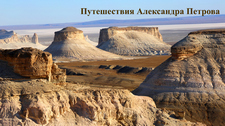
We will set up our tent camp in a scenic spot amidst the multicolored clays of the central part of the Akzhar escarpments. The Akzhar escarpments consist of layers of sedimentary rock, featuring striking geological formations and a diverse range of soil colors.
The escarpments and hills of the Akzhar area serve as a classic example of ancient sedimentary rock formations. Millions of years ago, this territory was covered by an ancient ocean (the eastern remnant of the Tethys Ocean), on the floor of which sediments accumulated over the ages.
Today, the geological structure of this massif is composed of the following primary rock types: Multicolored clays and loams form the foundation of the local landscape. These soft clay layers are easily eroded by infrequent rains and weathered by the wind, creating whimsical, rounded folds, hills, and ravines.
Iron and manganese oxides - chemical metallic impurities - are what give these clay strata such a vibrant palette. Iron oxides produce a spectrum ranging from pale yellow and orange to deep terracotta and crimson red, while the presence of manganese imparts lilac and violet hues to certain layers.
Crystalline gypsum - the rock formations here contain a significant amount of crystalline gypsum. On bright, sunny days, small flecks and veins of gypsum sparkle and shimmer atop the hills, creating a truly fantastical visual effect. Chalk and limestone - although the area is popularly known as the "Chalk Mountains," pure white chalk does not actually predominate; it is less common than the colored loams.
Nevertheless, calcareous and carbonate sedimentary deposits form light-colored (white and cream) layers within the terrain, justifying the name "Akzhar" - which translates to "Red Cliff." At sunrise and sunset, the area offers incredible views of the surrounding landscape.
Dinner and an overnight stay in tents.
Day 3. Akzhar Escarpments – Lake Murat (92 km).
Breakfast. Trasfer: Akzhar Escarpments – Shon Bi Mausoleum – Sary-Torgay River Valley – village of Ekidin (30 km).
From the Akzhar escarpments, we ford the Sary-Torgay River and travel along the river valley toward the village of Ekidin. Not far from the ford, in an old cemetery, stand two mausoleums dating back to the late 19th or early XXth century; one of them is known as Shon Bi.
If necessary, we can stop in the village of Ekidin to replenish our fresh water supplies. From there, our route continues toward Lake Murat. Just past Ekidin, we may begin to spot saiga antelopes - either individually or in small groups.
Transfer: Ekidin village – Lake Murat (62 km).
Upon arrival at the lake, you will find a vast number of waterfowl feeding along the shore - a perfect opportunity for wildlife photography, if you wish. We will set up camp, get settled, and spend the night.
Day 4. Lake Murat – Lake Tulkilikol (107 km).
Breakfast. Transfer: Lake Murat - Urpek village – Torgay River – Amangeldy village (53 km).
From our campsite by the lake, we head northwest across the steppe - an area where encounters with saiga are more likely. In Kazakhstan, the saiga population is divided into three groups: the Ural, Betpak-Dala, and Ustyurt populations. The saiga found in the Ulytau region belong to the Betpak-Dala population.
We will pass Lake Agashtykol and soon reach the village of Urpek, where we will cross the Torgay River via a bridge and continue toward the village of Amangeldy.
Transfer: Amangeldy village – Lake Tulkilikol (54 km).
In the village, we will restock our fresh water, then join the Arkalyk–Torgay highway and travel along it toward the village of from Agaidar, we turn north across the steppe. These are the most likely habitats for the saiga antelope, and we hope to be fortunate enough to spot some.
We travel along the dry riverbed of Karashukyr and cross the channel of the Kultaban River. We pass through the tracts of Uyzylbay and Kuttybay, and soon arrive at the shores of Lake Tulkilikol, where we will set up camp and spend the night.
Day 5. Lake Tulkilikol – Zhaman-Karasu tract (149 km).
Breakfast. The route takes us from Lake Tulkilikol through the Tatimek tract to the village of Mukyr - home to a reservoir of the same name - then past the Sor and Shukyrkopa lakes, the Otemis farm, and the dry riverbed of Otemisozen, finally reaching the village of Amangeldy (64 km).
The saiga antelope has an elongated body supported by slender, relatively short legs. Its nose - a soft, swollen, and mobile proboscis with closely set, rounded nostrils - gives the animal a "hump-nosed" appearance; this structure helps cool the frigid winter air before it enters the lungs and filters out dust during the summer.
We soon arrive in the village of Amangeldy to replenish our fresh water supplies.
Transfer: Amangeldy village – Kumkeshu village (31 km).
We make a brief stop among the sands near the road. Right next to the village lies a remarkable natural landscape known as the Kumkeshu sands (Kazakh: Құмкешу). In Kazakh, the name translates to "wandering sand" or "shifting sand." Due to its striking, distinctive character and resemblance to the deserts of the Middle East, travelers often refer to this location as the "Torgay Sahara" or the "Torgay Emirates."
Nearby lies the village of Kumkeshu - a small settlement situated in the Amangeldi District of the Kostanay Region, on the right bank of the historic Torgay River. The surrounding area is quiet and secluded, perfectly capturing the spirit of the vast Kazakh steppe.
Archaeological finds from the Eneolithic era on the outskirts of the village point to the region’s ancient history. While it may appear to be an ordinary steppe settlement, in recent years, local residents have been actively developing ethno-tourism.
Near the main road, an authentic recreation area - an "ethno-aul" - has been established, featuring Kazakh yurts, *altybakan* (traditional swing sets), and a *kymyzkhana* (a place for serving *kymyz*), where weary travelers can rest and sample the traditional fermented mare's milk.
The Kumkeshu sands themselves form an expanse of golden dunes, stretching out amidst an endless, greenish-brown steppe. It is a geographical anomaly; while deserts typically form near mountain ranges, this particular formation emerged right in the middle of the Turgai Depression.
The sandy ridge extends for nearly 74 kilometers from the southwest to the northeast, reaching a width of 11 kilometers at its center. Most of the area consists of "stabilized sands" covered in steppe grasses, yet there are also zones featuring pristine, soft, undulating dunes.
The height and shape of these dunes are in constant flux, sculpted by the wind. According to local historians, this land was once entirely covered in grass. However, during the Soviet era, the development of a *sovkhoz* (state farm) - involving the movement of heavy machinery and livestock grazing - destroyed the fragile steppe turf, exposing the underlying sands and allowing them to begin "wandering" with the wind.
This pocket of desert is remarkably picturesque, thanks to its drought-resistant vegetation: the slopes of the dunes are dotted with *Calligonum* (zhuzgun) shrubs, rare sand acacias, shrubby *Astragalus*, *Kandym*, and *Halimodendron* (chingil).
The primary draw of Kumkeshu is its incredible photogenicity; the sand is so clean, fine, and golden that, in photographs, it is indistinguishable from the deserts of Dubai. Visitors often come here for atmospheric desert photoshoots at sunset.
Next leg of transfer: Kumkeshu village to the Zhaman-Karasu tract (54 km).
We travel along the highway for about 24 km, then cross the western edge of the Kumkeshu sands and turn northwest into the steppe. Saiga antelopes migrate over long distances and are capable of swimming across rivers, though they tend to avoid steep or rocky slopes.
When moving, saigas employ an ambling gait, reaching speeds of up to 80 km/h. We will stop for the night in the Zhaman-Karasu area, where we will set up a tent camp and settle in.
Day 6. Zhaman-Karasu area – Torgay village (194 km).
Breakfast. The route takes us through the following locations: Zhaman-Karasu, Daira, Askar, the Saryozek River, Uzynkarasu village, the Aramsai ravine, Bidayik village, the Teke River valley, Lake Kishiborly, the Baitemir sands, and the Arkalyk–Torgay highway, finally arriving at Torgay village.
After spending the night, we head north and then northwest, passing the Saryozen River and the small village of Uzynkarasu. We then cross the Aramsai ravine and continue toward the village of Bidayik. We pass through the remote village of Bidayik, which is home to the mausoleum of Myrzhakyp Dulatov - a site of great national significance in Kazakhstan.
More than just an architectural monument, this place serves as a symbol of the restoration of historical justice and national memory. The village of Bidayik is located in the Kyzbel rural district of the Zhangeldin District, in the southwestern part of the Kostanay Region, situated in the very heart of the Torgay Plateau.
This is a remote, harsh, yet historically rich steppe region - a land that gave the Kazakh people an entire constellation of great intellectuals, poets, and political leaders at the beginning of the 20th century. Myrzhakyp Dulatov (1885–1935) was a prominent poet and writer, as well as a key leader and spiritual pillar of the "Alash" national-liberation movement and the Alash-Orda government.
He authored the famous collection of poems *Oyan, Qazaq!* ("Awaken, Kazakh!"), published in 1909, which served as a true political manifesto for the Kazakh intelligentsia of that era. He also wrote the first Kazakh novel, *The Unfortunate Zhamal*, and, together with Akhmet Baitursynov, published the renowned newspaper *Qazaq*.
Like many intellectuals associated with the Alash movement, Dulatov fell victim to Stalinist repressions. In 1930, he was sentenced to death - a sentence later commuted to ten years in a labor camp. He passed away in 1935 in the infirmary of the Solovki Special Purpose Camp (SLON) in Karelia and was laid to rest in a foreign land. In 1988, Myrzhakyp Dulatov was posthumously rehabilitated.
In 1992, following Kazakhstan’s attainment of independence, a state-sponsored expedition to Karelia was organized. The remains of the great writer were located, exhumed, and brought back to his native Torgay region. In October 1992, in the village of Bidayik, the remains of Myrzhakyp Dulatov were committed to his native soil with the highest honors.
At the same time, a majestic mausoleum was ceremoniously erected over his grave. The mausoleum is built in a classic Eastern style. It is a four-sided, domed structure constructed from light-colored brick and fine stone. The architecture of the mausoleum symbolizes purity of intent, strength of spirit, and an enduring memory of a man who gave his life for the freedom of his people.
Adjacent to the mausoleum lies a comprehensive cultural and memorial complex, which includes the M. Dulatov Memorial Museum - a two-story building located just a short walk from the tomb. It houses a collection of unique artifacts, including archival documents, historical photographs from the early XXth century, rare editions of the newspaper *Qazaq*, and personal belongings of Myrzakyp Dulatov - all of which were carefully preserved and donated to the museum by his daughter, Gulnar Dulatova.
Today, this complex in the village of Bidayik serves as a major focal point for historians, literary scholars, pilgrims, and tourists traveling through the sacred sites of the Torgay region. Beyond the village of Bidayik, we pass the small Sharabas hills, located to the east of our route.
We cross the dry riverbed of Beimbetsay, and our path continues through the Teke Valley. Near the tomb of Ospan Kozha Auliye, our route turns south, leading us out of the Teke Valley. Soon, we pass the small lake of Kishiborly and reach a network of numerous lakes - Tatyr, Saryozek, Ayakkamys, Zharkol, Sarykopa, Ushkamys, Kazaly, Tokalsor, Taybagdar, Damylak, and Baldek - all fed by the overflow of the Torgay River.
Saiga antelopes are contemporaries of the mammoth; 90% of this extremely rare species is found almost exclusively within the territory of Kazakhstan. Saigas are highly susceptible to stress, reacting to the slightest sound or movement. Arrival in the village of Torgay, check-in at a hotel, and overnight stay.
Day 7. Torgay Village – Khan Molasy Memorial Complex (106 km).
Breakfast. Transfer: Torgay village – Shukyrkol tract – Zharsor tract – fording the Shortandy River – fording the Olkayek River – Khan Molasy Memorial Complex. After leaving Torgay village, we travel 14 km along the highway before turning right; from there, our route continues toward the west and northwest.
We will cross the dams on the Shortandy and Olkayek rivers and then continue along the left bank of the Olkayek River. Wildlife observation in the hilly terrain: along this stretch of the route from Torgay to Khan Molasy, we are likely to encounter individual saiga antelopes or small herds.
This day will be dedicated to further observing these magnificent animals. Upon arrival at the memorial complex, we will check into a guesthouse for an overnight stay.
Day 8. Travel: Khan Molasy complex – Aralkol (Bestausky) village (175 km).
Breakfast. Travel: Khan Molasy – Lake Kashatay – Talybay tract – Aktam ravine – ford across the Olkayek River – ford across the Shilisay River – Shili village (75 km).
After spending the night at the Khan Molasy complex, we will travel along the right bank of the Olkayek River, cross the river by ford near Shili village, and pass a small settlement. Beyond the village, we will spend some time traveling 30 km across the steppe in search of saiga.
We will set up our tent camp near the village of Aralkol for the night.
Day 9. Travel: Aralkol (Bestausky) – Karamendy (Dokuchayevka) – Auliyekol (252 km).
Breakfast. Arrival in Auliyekol, check-in at a hotel, and overnight stay.
Day 10. Travel: Auliyekol – Kostanay (108 km).
Breakfast. Arrival in Kostanay. End of the tour.
Note:
The duration of the tour can be shortened upon request.




Note:
Author's program by Alexander Petrov. Copying and use of material only with the permission of the author.
Photos by:
Alexander Petrov.