



You are here
Kumkeshu Sands
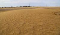
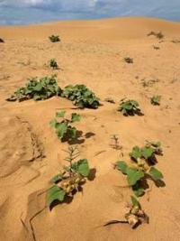
Kumkeshu Sands - Turgay sands amidst boundless steppes.
"By virtue of its geographical position, the Turgay region is the part of Asia closest to the borders of European Russia, occupying the northeastern section of the Aral-Caspian Lowland. To the north, it borders the Orenburg Governorate; to the west, the Ural Oblast; to the south, the Aral Sea and the Syr-Darya Oblast; and to the east, the Akmolinsk Oblast. The Turgay region spans an area of 400,830 sq. versts a size comparable to that of the Caucasus and Transcaucasia combined. The region consists of a vast plain, traversed in its southeastern portion by spurs of the Guberlinsky and Mugodzhar mountains."
Ya. Ya. Polferov, *Hunting in Turgay Region*, 1896.
Ancient history of Kumkeshu.
Kumkeshu Sands are situated at elevations ranging from 156 meters above sea level in the northeast to 128-130 m. a. s. l. in the central section. They stretch for 72 kilometers from the northeast to the southwest, reaching a maximum width of 9 kilometers in their central part. They are located within the Amangeldi District of the Kostanay Region.
For the most part, the sands lie to the north of the Yesenbayev–Tokanay road. They are concentrated in three distinct groups: one in the vicinity of the villages of Yesenbayev and Turbayakkarasu, and another, more extensive area near the villages of Kemer and Kumkeshu. In the south of the Kostanay Region, within the Amangeldi District near the small village of Kumkeshu, lies one of the most unusual natural landscapes of the Torgay Trough: the Kumkeshu sands (Kazakh: Құмкешу).
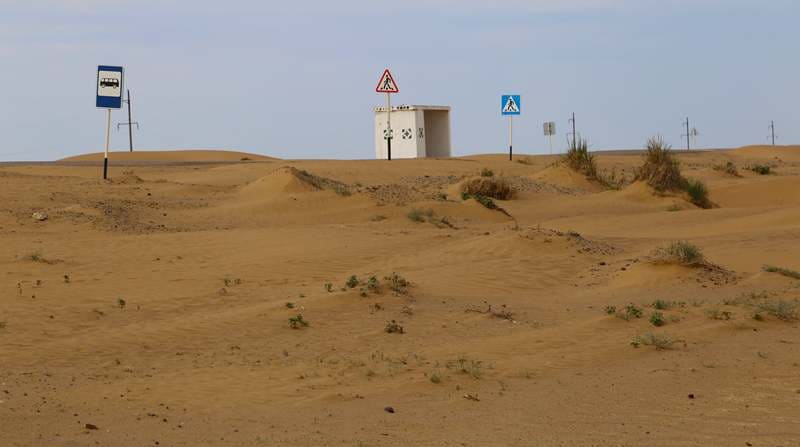
Here, amidst the steppe expanses typical of Central Kazakhstan, golden sandy ridges and small dunes emerge unexpectedly, creating the impression of a true desert. It is no coincidence that this area is sometimes referred to as the "Torgay Sands."
However, this comparison is largely figurative; Kumkeshu is not a desert in the classic geographical sense, but rather a distinct sandy massif set within the steppe landscape of the Torgay Trough. The village of Kumkeshu itself is situated on the right bank of the Torgay River, approximately 28 kilometers from the district center, Amangeldi.
Geographical coordinates of village of Kumkeshu: N50°07'11 E64°47'21
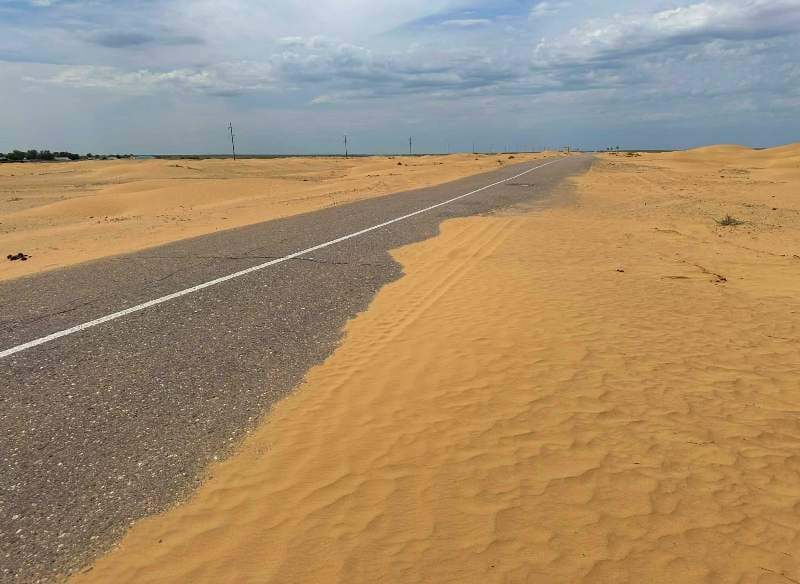
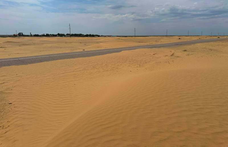
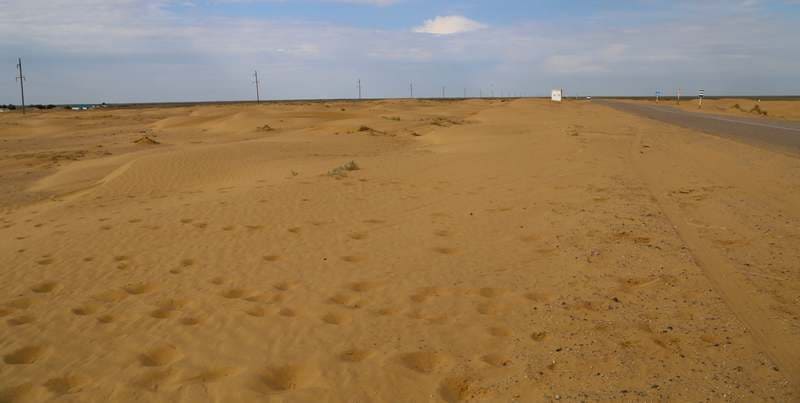
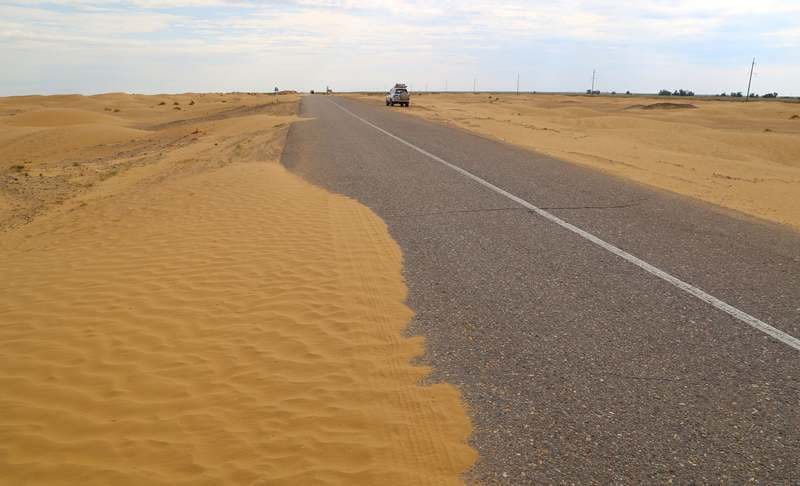
The unique character of Kumkeshu is particularly striking when approaching the village along the Arkalyk–Torgay road. The typical steppe scenery gradually shifts: sandy mounds appear among the grassy plains, followed by individual dunes, and in some places, the road runs right along the edge of the sands.
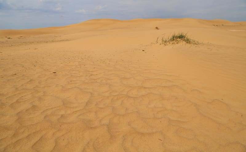
In sunny weather, the surface takes on a golden-yellow hue. The wind constantly reshapes the sand, creating a characteristic rippled pattern on the slopes. Some small ridges are gradually smoothed away, while others emerge in new locations.
It is precisely this capacity of the sand to shift under the influence of the wind that, according to local interpretation, is reflected in the name "Kumkeshu" derived from the words “құм” ("sand") and “кешу” ("crossing" or "movement"). Thus, the toponym can be interpreted as "shifting sand" or "moving sand."
Local residents recount that the sand mounds can indeed change their appearance significantly: the wind transports fine particles from one spot to another, gradually altering the contours of the surface. This explanation aligns well with the very nature of aeolian landforms.
The presence of a sandy expanse within the Turgai Trough may seem unexpected at first glance. The area is surrounded by steppe, whereas the major sandy deserts typically associated with Kazakhstan are generally found in the more arid southern regions and the Aral Sea area.
However, the geological and geomorphological history of the Turgai Trough is far more complex than its present-day steppe landscape suggests. The Turgai Trough is a large, naturally occurring low-lying corridor, stretching between the elevated regions of Kazakhstan.
Throughout the Quaternary period, the conditions for drainage, the accumulation of loose sediments, and the formation of river valleys here underwent repeated changes. The sandy areas of Kumkeshu are part of this complex system of loose deposits.
The wind reworks the sandy material, creating small dunes and ridges. In places where vegetation holds the surface in place, the sands gradually become stabilized; in open areas, by contrast, their aeolian movement continues. Therefore, it is more accurate to view Kumkesh not as a small "patch of a real desert," but as a dynamic sandy landscape existing within a larger steppe ecosystem.
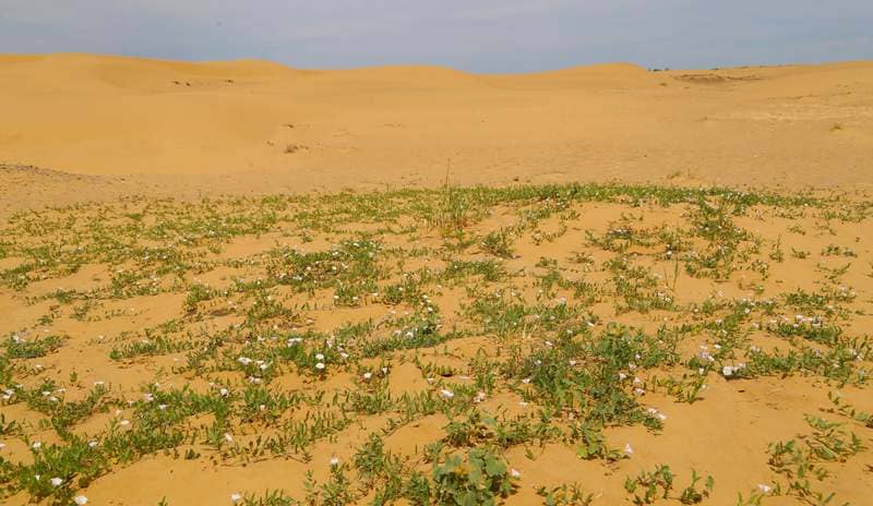
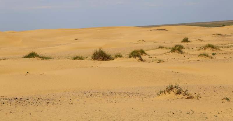
In the vicinity of the village, one can observe various stages in the formation of sandy terrain. A significant portion of the surface is covered by vegetation. The root systems of grasses and shrubs bind the sand particles, meaning these areas no longer exhibit the appearance typical of shifting dunes.
In other areas, the vegetation cover is sparse, and the sand begins to move once again. Here, small barchans (crescent-shaped dunes), sandy ridges, and individual mounds emerge. The effect of the wind is particularly evident following dry, windy weather.
Delicate, undulating patterns form on the surface a kind of natural "graphic art" created by the sands. It is precisely this combination of stabilized sands, open dunes, and the surrounding steppe that gives Kumkesh its distinctive character. Despite the apparent lifelessness of certain parts, the sands of Kumkesh are not devoid of vegetation
On the stabilized sands and along their fringes, a unique plant community develops one adapted to a lack of moisture, high rates of evaporation, and a constantly shifting substrate. In such conditions, plants capable of rapidly regenerating their root systems and anchoring the sand are especially important.
Among the flora typical of these sandy habitats, one can find various types of shrubs and herbaceous plants adapted to an arid climate. The vegetation here holds significance not only in biological terms but also in terms of geomorphology: it plays a key role in stabilizing the sands and preventing them from shifting further.
Thus, the landscape of Kumkesh is shaped by the constant interplay between wind, sand, and vegetation.
Ancient History of Kumkeshu.
The surroundings of Kumkeshu are remarkable for more than just their natural features; the area also holds significant archaeological value. The Kumkeshu-1 settlement was discovered in 1982 by a survey team from the Torgay Archaeological Expedition.
It is located in the southern part of the Torgay Basin, directly along the right bank of the Torgay River. Archaeological findings attest to the ancient human habitation of this territory. The archaeological exploration of the area continues to expand.
Official state documents of Kazakhstan now recognize the archaeological sites of Kumkeshu II dating to the Bronze Age and Kumkeshu III, which spans the Eneolithic to the Bronze Age. Protected zones have been established for both. Thus, the area surrounding this small village serves as a unique historical and natural complex, where traces of the earliest human occupation of the Torgay Basin coexist with a contemporary sandy landscape.
This is particularly compelling: when humans first arrived here, they did not enter a desert, but rather a natural environment that has itself undergone transformations over the course of millennia.
Kumkeshu and Torgay River.
The Torgay River serves as one of the primary geographical landmarks of this region. The village of Kumkeshu is situated on its right bank. The interplay between the river valley, the vast steppes, and sandy deposits creates a distinct mosaic of natural environments.
In the past, the river valley played a far more critical role in human life than it might appear today. Given the arid steppe climate, proximity to water was the decisive factor for establishing settlements, grazing livestock, and developing the land for economic use.
This is precisely why the archaeological sites in the vicinity of Kumkeshu are of particular interest: they allow us to connect the contemporary landscape to the millennia-long history of human habitation in the Torgay Trough. Kumkeshu makes a striking visual impression, primarily due to its contrasts.
Within just a few meters of one another, one can encounter entirely different landscapes: a greenish-brown steppe, a sandy slope, patches of shrubbery, and then, once again, the open steppe stretching toward the horizon. In photographs, this contrast is especially vivid.
The golden sands, set against a backdrop of blue sky and the vast steppe, are truly reminiscent of landscapes found in more southerly desert regions. Scientifically speaking, however, it is more accurate to describe it not as a "Torgay Sands," but as a localized sandy area featuring aeolian landforms within the steppe zone.
It is precisely this unique character that makes Kumkeshu such an intriguing destination for travelers. In recent years, this natural landmark has begun to attract the attention of travelers, photographers, and those who enjoy road trips through lesser-known regions of Kazakhstan.
Local residents are also helping to foster interest in the site; elements of ethno-tourism infrastructure such as yurts, recreation areas, traditional “altybakan” swings, and “kumyskhana” (places to enjoy “kumys”, or fermented mare’s milk) are appearing along the roadside.
Consequently, this natural site is gradually becoming part of a broader tourist route through the Torgay region. At the same time, Kumkeshu retains the key virtue of such places: an absence of mass tourism. It does not feel like a typical resort area; instead, the sands lie adjacent to an ordinary steppe village, a road, and vast, open expanses.
For this reason, a visit to Kumkeshu is best viewed not as a trip to a fully developed tourist attraction, but as an opportunity to discover a little-known natural corner of the Torgay Basin. Kumkeshu is located along the Arkalyk–Torgay road. It is approximately 170 kilometers from Arkalyk to the vicinity of Kumkeshu, and about 28-30 kilometers from the district center of Amangeldy.
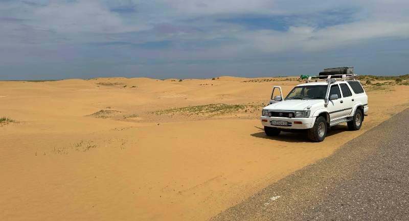
For those traveling by car, the site’s main advantage is its accessibility: the sandy areas are situated right next to the village and the road, meaning no long treks across the steppe are required. When planning your trip, keep in mind that infrastructure outside of populated areas is limited.
It is advisable to carry an ample supply of water and fuel, as well as reliable means of communication, when traveling through the Torgay steppe. The best time to explore the sands is during late spring, summer, or early autumn. Kumkeshu is particularly striking in the morning and evening, when the low sun accentuates the contours of the sand ridges, and small shadows transform the surface of the dunes into a succession of golden and ochre waves.
Sands of Kumkeshu are a small desert within vast Torgay region.
What makes Kumkeshu interesting is not its scale, but its unexpectedness. Amidst the immense expanses of the Torgay steppe, a sandy world suddenly emerges complete with dunes, wind-sculpted patterns, shrubs, and a constantly shifting surface.
Nearby, one finds the Torgay River, ancient archaeological sites, and a small Kazakh *aul* (village) that preserves the traditional way of steppe life. This is the unique appeal of Kumkeshu: natural history, archaeology, and contemporary life exist here literally side by side.
For the traveler, it serves as yet another example of the remarkable diversity of Kazakhstan’s nature and the many extraordinary places hidden far from the well-trodden tourist routes.
Geographic coordinates ofKumkeshu sands: N50°09'26 E64°46'51
Authority and photographs by:
Alexander Petrov.