


![]()
You are here
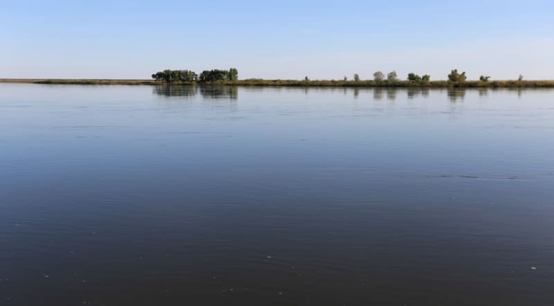
River Irtysh in Kazakhstan

Rafting on Irtysh river in Kazakhstan.
"As for the route to the Kimaks, from Farab they go to Yangykent. On the way from Yangykent to the land of the Kimaks, they encounter a river, cross it, and come to sand; the Turks call this place Uyukman (?). Then they come to the Sokuk River; after crossing it, salt marshes begin. Then they come to Mount Kendir-tagy. (The traveler) continues along the bank of the same river, among greenery, grass, and trees, to the river's source; the mountain is high. After this, they ascend the mountain along a narrow path. From Mount Kendir-tagy they come to the Asus (?) River; along this road, for five days, no sunlight falls on the people at all due to the shade of the trees, right up to the bank of the Asus River. The water in the river is black; It flows from the east and reaches the gates of Tabaristan (?). After that they come to the Irtysh River, where the country of the Kimaks begins. Wild horses graze on both sides of the river; sometimes one can see a thousand or two thousand of them in one place; they are descended from the feral royal horses; they continue to multiply. These horses cannot be caught except with a lasso; having caught them, they mount them and tame them; they yield to taming and get used to people. The Irtysh is a large river, so that if someone stands on this bank of the river, then from the other bank he cannot be recognized ... The water of the river is black. Having crossed the Irtysh River, they come to the tents of the Kimaks. They have no low buildings; they all live in forests, gorges and steppes, they all own herds of cows and sheep; they do not have camels; If any merchant brings a camel here, he does not live here even a year: as soon as the camel eats this grass, it dies. They have no salt; if anyone brings here one exchange of salt, he takes an ermine fur for it. In summer they live on mare's milk, which they call kumiss; for winter they prepare dried meat, ram, horse or cow, each according to his means. In this country there is a lot of snow; it happens that the thickness of the snow cover in the steppe reaches the height of a spear. In winter they take their horses to a distant country, to a place called Oktagh; underground they have ponds made of wood for the winter time; when a lot of snow falls, their horses drink this water during the winter months, since the snow does not allow them to reach the watering hole. The Kimaks hunt sables and ermines; Their leaders bear the title of Bamal-Peigu (or Yamal-Peigu).”
Persian geographer and historian Abu Sa'id Gardizi. “Zain al-Akhbar” (The Ornament of News) (1049-1053)
"The long Irtysh River, which flows from far away in Tataria and flows into the Ob River... a waterway from the Ob River to Hina and the East Indies could be unmistakably discovered."
Johann Philipp Kielburger. 1674.
“Immediately beyond the village, the road turned along the Irtysh
into the sands. What wonderful places! What scope for game!
The Irtysh formed many lakes, backwaters, and channels, abundantly
overgrown with yellow and white water lilies. All around is a sea
of reeds. Only occasionally, at the bends in the road, does the wide ribbon of the Irtysh
glitter in the sun. Flocks of geese and ducks fly over the reeds every now and then.”
“On the Irtysh.” Hunter of Altai. Ust-Kamenogorsk. 1923.
"He wants life
On his banks, the Irtysh
To rise to its full height
And flourish for centuries...
He knows how the earth
Needs its waters:
For forests, for meadows,
For the harvest of virgin lands."
M. Alimbaev. "Irtysh".
Eco tourism tour in Kazakh Altai.
Irtysh River begins its flow in Kazakhstan, crossing border of Republic of Kazakhstan and Republic of China 16.5 kilometers east of village of Zhideli (Ordynka), on northern edge of Bozaigyrkum sands, 11.5 kilometers east of Mount Ashutas, 574.6 m. a. s. l., flows through Lake Zaysan, Bukhtarma Reservoir, through territories of Kurshum, Naryn, Altay, Glubokovsky districts of East Kazakhstan region; Zhanaseimeysky district, territory of city of Semey, city of regional subordination Kurchatov in Abay region; Maysky, Akkulinsky, Aktogay, Zhelezinsky districts, through territory of city of Pavlodar in Pavlodar region.
A version of origin of word Irtysh.
There is a widespread version of the word Irtysh: translated from the Turkic language, the word "Irtysh" means "earth digger" (or "digger"), which refers to the river's turbulent and unsteady flow, eroding its banks.
This is explained by the Turkic roots of the words "ir" (earth) and "tysh" (to dig, to drill). The theory of the Turkic origin of the name ("earth-digger") is widespread and supported by local history sources, linking it to the fickle nature of the river, especially in flat areas where it erodes its banks.
However, an alternative theory also exists:
It is also believed that the name has Iranian roots, where "ir" means "turbulent" or "swift stream," and the Turkic or Ket stem "cis/ses" means "river."
The essence of the name Irtysh:
Regardless of the theory, the name reflects the swift and powerful nature of the Irtysh, especially in its upper reaches and on the plains where it carves its way.
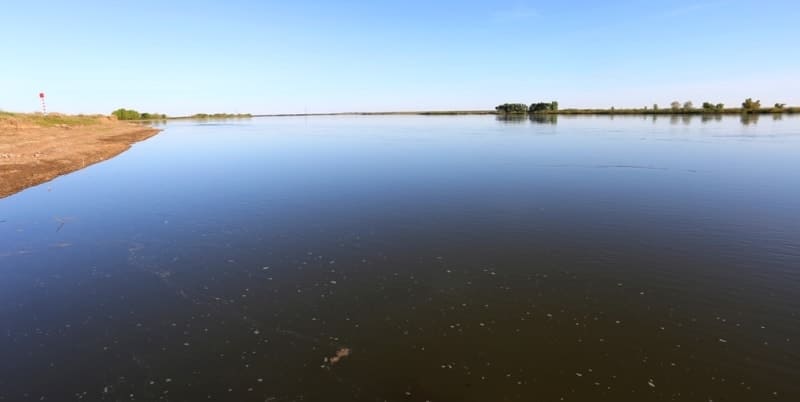
The Irtysh is the main river of the Arctic Ocean basin. Its length is 4,248 km, but only a portion of the 1,700 km river lies within Kazakhstan. The Black Irtysh River originates in China, then flows through Kazakhstan and empties into Lake Zaysan and the Bukhtarma Reservoir.
From the lake, the White Irtysh, or simply the Irtysh, flows into the Ob River. Initially, the Irtysh flows through rolling plains, then the Narym and Kalbinsky ranges and other spurs of the Altai Mountains approach the river. Here, constrained by mountains, the river flows through a narrow gorge to the city of Ust-Kamenogorsk.
Near Ust-Kamenogorsk, the Irtysh receives many tributaries, the largest and most abundant of which is the Bukhtarma. The Bukhtarma Hydroelectric Power Station was built on the Irtysh River, downstream from the mouth of the Bukhtarma. A massive dam (96 m) blocked the Irtysh River and created a reservoir up to 60 km long (upstream).
The Bukhtarma Reservoir can rightfully be called the Great Irtysh Sea. Below the Bukhtarma Reservoir, in a narrow gorge between the mountains, the Irtysh formed a second reservoir - the Little Irtysh Sea. The Irtysh's waters here were raised by the dam of the Ust-Kamenogorsk Hydroelectric Power Station.
The Shulbinskoye Reservoir, whose waters are raised by the dam of the Shulbinskoye Hydroelectric Power Station, is located between the cities of Ust-Kamenogorsk and Semipalatinsk. From Ust-Kamenogorsk, the Irtysh flows down a wide valley, with the spurs of the Altai Mountains on its right side and Saryarka on its left.
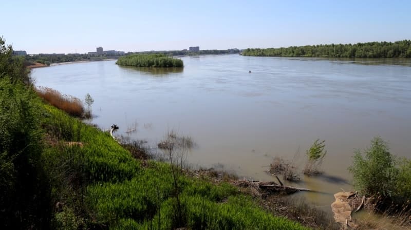
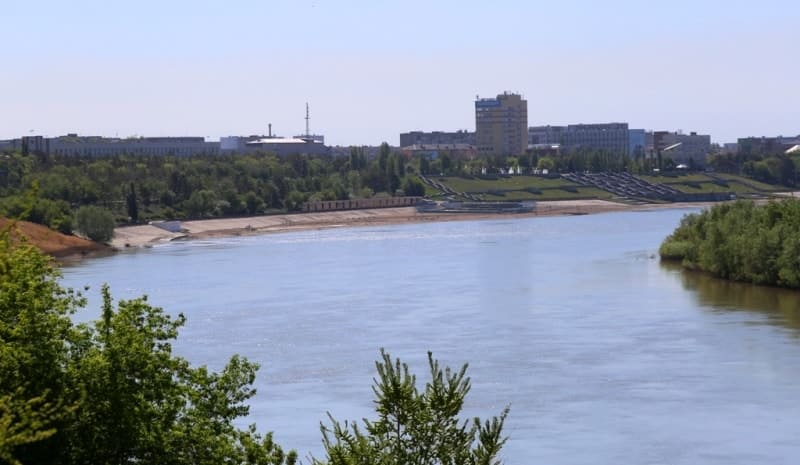
The banks of the valley are high, steep, precipitous, and rocky in places. Near the city of Semipalatinsk, the Irtysh emerges onto a plain and takes on the character of a typical lowland river. Here, the riverbed meanders, and in some places, branches off into branches dotted with numerous islands overgrown with floodplain vegetation.
Between the cities of Semipalatinsk and Ust-Kamenogorsk, several tributaries flow into the Irtysh. The largest of these are the Ulba and Uba rivers on the right side, and the Char and Kyzylsu rivers on the left. The Irtysh is a mixed-feed river, with its tributaries originating in high-altitude areas and fed by meltwater from snow and glaciers.
Other tributaries are fed by groundwater and precipitation. The Irtysh's water level is quite high throughout the year, reaching its fullest levels in April-May and early June. Near the town of Shulba, located between Ust-Kamenogorsk and Semipalatinsk, the average monthly discharge in May is 2,541 m3/s.
The highest annual discharge in the Semey (Semipalatinsk) region is 60 m3/s. The average annual runoff in this region exceeds 28 billion cubic meters. From November to mid-April, the Irtysh River is covered in ice. Ice thickness reaches 125 cm. Ice breakup and drift are rapid, often causing ice jams, often leading to flooding.
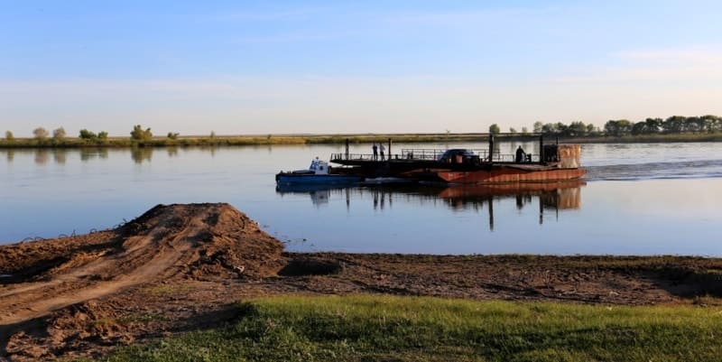
The Irtysh River is navigable throughout its entire length. Passenger tugboats, motor ships, and boats navigate upstream to the Chinese border. The Irtysh's waters are used to generate electricity. Two large hydroelectric power plants - the Ust-Kamenogorsk and Bukhtarma hydroelectric power plants - provide electricity to enterprises in Rudny Altai.
The Shulbinskaya hydroelectric power plant is currently under construction. The Irtysh is rich in fish and is of commercial importance. Sterlet, nelma, stellate sturgeon, sturgeon, pike, perch, and crucian carp are found here. Recently, carp, bream, pike-perch, and Baikal omul have been introduced here.
The Irtysh is of great economic importance to the republic, but is used entirely for agricultural purposes. A large volume of the Irtysh's water flows into the Ob River. Therefore, to ensure its efficient use, part of the Irtysh's water is diverted to Central Kazakhstan via the Irtysh-Karaganda Canal.
Central Kazakhstan is very rich in minerals, but it has very little water. Several small rivers, which practically dry up in the summer, could not meet the growing needs of the population and the economy. Therefore, in 1974, the large Irtysh-Karaganda Canal was built, stretching 458 km.
It is 57 meters deep and 40 meters wide. The canal carries 75 m3/sec of water from the Irtysh. The second phase of the canal will extend to Zhezkazgan. The canal supplies water to the Pavlodar and Karaganda regions. The left tributaries of the Irtysh, the Ishim and Tobol, flow along the northern.
The Irtysh River flows through the regions of Kazakhstan and flows into the Irtysh River outside the republic. For 618 kilometers, the Irtysh flows through Chinese territory. Currently, Chinese authorities are beginning construction in this area of the Black Irtysh-Karamay irrigation canal, which is over 300 kilometers long and 22 meters wide.
First steamship line on Irtysh River.
As with any large river, people have long navigated the Irtysh. And in 1902, the Upper Irtysh Shipping Company was established. Steamships had already begun sailing along the Irtysh, albeit small and dirty at first, and their service was irregular.
The arrival of the steamships was a major event in the city, and crowds flocked to watch. People were wary of traveling on steamships: "I hope I don't sink! Horses take longer, and are more reliable." But soon large, swan-white beauties with deep, deafening horns appeared, and they operated on schedule from two well-equipped docks.
The first steamship of the Upper Irtysh Shipping and Trade Partnership was called "Svyatoy Klyuch." Many events of 1918-1919 are associated with the Irtysh and the ships that navigated it. A voyage on the steamship "Mongol" ended in tragedy for Yakov Vasilyevich Ushakov, the first leader of the Ust-Kamenogorsk Bolsheviks.
In the 1920s, navigation on the upper Irtysh gradually resumed. The waterway along the Irtysh was divided into two parts: from Topolev Mys to Semipalatinsk, the so-called upper reach; and from Semipalatinsk to Semiyarsk – the lower reach. In 1926, 12 ships, including 4 passenger ships, navigated the upper reach of the Irtysh, while 24 ships, including 5 passenger ships, navigated the lower reach.
In 1926, a processing plant was commissioned in Ridder, and in 1927, a lead smelter was built. Tons of zinc concentrate were shipped along the Irtysh.
Geographic coordinates of Irtysh River: N50°03'15 E82°22'18
Geographical coordinates of beginning of Irtysh River on Kazakh-Chinese border: N48°01'26 E85°31'40
Geographical coordinates of end of Irtysh River on Kazakh-Russian border: N53°47'42 E75°01'56
Irtysh. 1927.
The reeds are tall, the sedge is tall,
The she-wolf's taut nipple swells with longing,
A bird flies down from the wild sand,
Beats its wings and settles on a wave.
River of my spacious homeland,
Spacious,
Go through the storm,
Flow, Irtysh, splash out your ide –
Prince of fish and birds, fugitive of the green waters.
Light is your underwater thunderstorm,
Swift are the swaying waves,
And in the depths, the open eyes
of the swimmer, like stars, have turned red.
And in the sandy cellars deep,
With braids down to their heels, rosy lips,
Near unlocked chests at the bottom
Lie the beautiful damselflies with pike tails.
Sparkle, Irtysh, with their golden ring!
Sleep doesn't come, worries don't gnaw at them,
The current carries them to their breasts
And crayfish tickle their tender fingers.
Wave your Turkish brush of reeds,
Flow, Irtysh! I admire, breathless,
Only you, handsome, sharp-cheeked one.
Leaving the colonel's ladle of mead intact,
Summer, living in luxury, drowned. We met. I won't give up the rope,
I'll hand you the blows of my heart again...
Over the foaming crests, over the swans,
The wheels of the "Tovar-para" struck.
He walked, clad in gold and copper,
He walked, busty. Dressed in calico,
Hands to eyebrows, the idle riverside villages flocked to look.
How he lingers, the flow of extortion,
Swaying on the corpulent waves...
Over the boundless distance of the islands,
A welcoming roar reverberates –
The wandering son of the steamship companies.
oll the barrels, pour grain into the holds,
Pour in the salt, with which you are rich.
I would like a handful of a large harvest, I would like
The breast-filled rifts of the great water.
I'd be glad to meet my beloved too –
To recognize again, forgotten in separation,
Her gilded gaze from under her eyelashes,
Her mighty roll of hair
And her hands, kissed by the heat.
So that she would whisper of others: "Don't blame..."
So that she wouldn't tear her lips from mine,
So that the bitter wedding lights
Would sadly light the night on the barges.
So that the Irtysh, a wanderer among other rivers,
Washes away the heavy burden of accumulated guilt,
So that instead of tears on faces there would remain
Only the furious splashes of the waves!
Author: Pavel Vasiliev (1909 – 1937).
Authority:
Books: "The Nature of the Trans-Ili Alatau", M.Zh. Zhandaev, publ. Kazakhstan, Alma-Ata, 1978 "Along the Northern Tien Shan", V.N. Vukolov, Moscow, Profizdat, 1991. Pozdeev-Bashta A. Mountain trails of Almaty. - 2nd ed. - Almaty, 1998. Pospelov E.M. Tourist about geographical names. - M., 1988. Gorbunov A.P. Mountains of Central Asia. Explanatory dictionary of geographical names and terms. - Almaty, 2006. Murzaev E.M. Geography in names. - M., 1982.
Photos by:
Alexander Petrov.