You are here
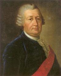
Soymonov explorer of Caspian.

The recommended excursion Mngyshalk tours.
“Nature is an infinite sphere whose center is everywhere”
Ralph Waldo Emerson.
Excursion Mangyshlak tour.
After 53 years after S. G. Gmelin on the Tyub-Karagan arrived Professor Eichwald, who described the geological structure of the Mangyshlak Peninsula. According to the Turkmen, who lived on the Peninsula, Eichwald wrote that "where now the Bay tub-Karagan, once stood a rather famous city that 600 years ago was flooded by the sea".
In March 1726 Admiralty Board, given incomplete maps of the Caspian sea, decided to continue the inventory of the sea. This purpose was organized by the new Caspian expedition, the head of which was appointed Feodor Soymonov.
In may 1726, the expedition of F. I. soymonova on ekbote "Tsar" and the snows "Astrakhan" came from the mouth of the Volga. The ships followed the South-East, to the Tyub-Karagan Cape.
On the third day of the court reached the Kulaly island, the largest in the group of Seal Islands and the second largest on the Caspian sea. The island had an arcuate shape, with the ends bent to the East – northeast. With a length of 31 kilometers island of Cully had a maximum width of 1.5 km.
It was from alluvial sand mixed with silt and sea creature. Here "Tsaritsyn" caught in a storm, had to keep up the repairs. While repairing the ship, F. I. Soymonov mapped and described the southern part of the island.
Then the ships went along the Eastern coast of the Caspian sea, passed the Tyub-Karagan Bay and Alexandri. In these areas, the hydrographs produced only soundings of the sea and identified the various locations.
The researchers were able to make some changes to the map, 1720, compiled by Alexander Bekovich - Cherkassky. From Bay Alexandri ships went South, towards Karabulakskogo Bay, where sand massifs were killed Prince Alexander Bekovich – Cherkassky and his associates.
Sailing past the rugged coast, the fleet of F. I. soymonova triple cannon shots paid tribute to the victims. Ships carefully avoided the islets, lime come and shallows. At the southern end of the Mangyshlak Peninsula F. I. Soymonov described and mapped the conspicuous promontory, called Shelly.
"The soil of the Cape was without sand and silt, one big shell", - wrote F. I. Soymonov. The ships reached the Gulf Karabugazskogo. On the basis of measurements made by F. I. The soymonov wrote: "two versts from the mouth of the Gulf were good sandy soils, then there was rocky and uneven depth of 12 to 7, and then from 16 to 6 fathoms, with a very clear change.
Passing by the Bay Karabulakskogo, F. I. Soymonov determined his latitude. Long time he, like G. S. Karelin – English naturalist and traveler, who led in 1836 expedition to the Caspian sea, were prescribed to celebrate the opening of the Straits.
However, historical documents found that Bay Karabogazsky was first discovered and mapped by Alexander Bekovich – Cherkassky. 6 November 1726 expedition returned to Astrakhan.
In 1731 the Admiralty colleagues published the first magazine F. I. soymonova entitled "Description of the Caspian sea from the mouth of the river Volga, duct from Yaroslavl to the mouth of the river Astrabeds".
This work was produced in 1783. In addition, in 1731, was published the Atlas and the first pilot of the Caspian sea F. I. Soymonova published a General map of the Caspian sea and a few cards (total of 8 sheets) the Western and southern regions.
Atlas was entitled "Description of the Caspian sea from the mouth of the river Astrabeds, the Western and Eastern shores, depth and types of soils and noble mountains." General map of F. I. soymonova favorably map of 1720.
The contours of the coast, the location of the Islands and bays are given it much sooner than the previous. The name F. I. soymonova immortalized on the maps of the Caspian sea. In the area of the Bay of Krasnovodsk in his honor named the Bay and the high, steep mountain.
Authority:
Cultural heritage.


