You are here
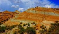
"Tiger Mountains" in Kazakhstan.
Eco tours in Kazakhstan.
"Every person in the world has their own unique place and everyone needs to define it. If you find it and stand on it, then you yourself will feel good, and people will feel as if that is why you are standing in this place and doing everything only for them"
M. Prishvin.
Central Asia Travel.
In eastern part of Atyzhek Mountains are so-called "Tiger Mountains" at an altitude of 1000 to 1505 meters above sea level, located in interfluve of Kaishi and Koibyn rivers, between Dolantau Mountains in northeast and Atyzhek Mountains in east and small Syrt mountain range in southwest, Koktas Mountains in north and Orta-Tau Mountains in northeast, 28 kilometers from right bank of Ili River, 22 kilometers northwest of village of Koktal, in Panfilov district in east of Almaty region.
It should be noted that the name "Tiger Mountains" is a tourist term that has no designation on geographical and topographic maps. This phrase can only be found on tourist maps and guidebooks of the Almaty region. The riverbeds of the Kaishi and Koibyn rivers are seasonal and fill with water during rains and in the spring during the melting of snow, in the summer, these are dry riverbeds, along the bottom of which poplars, willows, elms, saxaul bushes, caraganas, and barberries grow.
The beginning of the rivers is confined to the southern slopes of the small Yrgayly mountains. The mountains stretch from the southwest to the northeast for 6 kilometers, the greatest width reaches 6 kilometers. The area of the "Tiger Mountains" is 13.18 square kilometers, the perimeter reaches 16.25 kilometers.
"Tiger Mountains" are located in the eastern part of the Ili Basin. The modern appearance of the "Tiger Mountains" began to form in the Neogene period. The relief of the mountains has a complex geomorphological structure, which was formed under the influence of tectonic, erosion, denudation and accumulation processes of development.
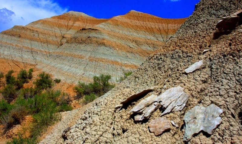
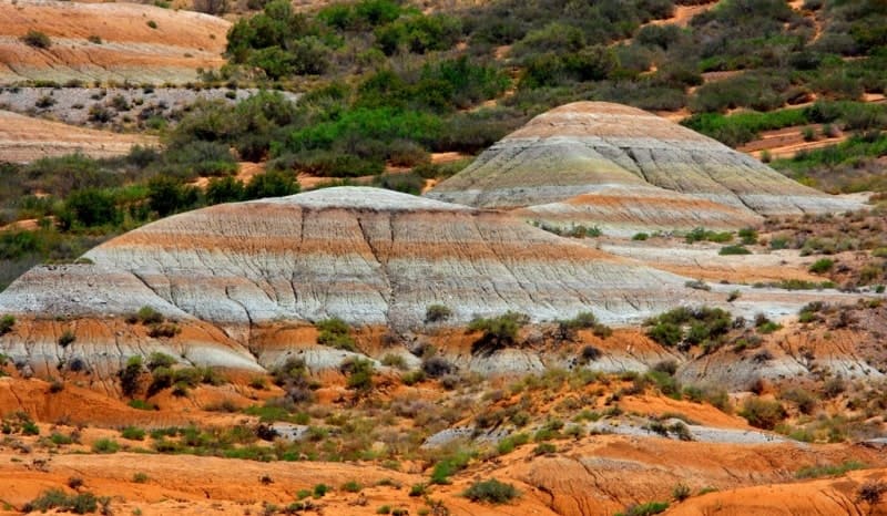
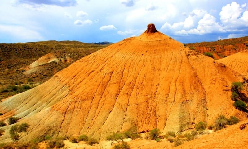
"Tiger Mountains" mountain range is represented by dry gentle ravines and small valleys with steep and smooth slopes. There are indigenous outcrops of weathered rocks that form ridge-like forms cut by numerous small, dry beds of temporary water streams.
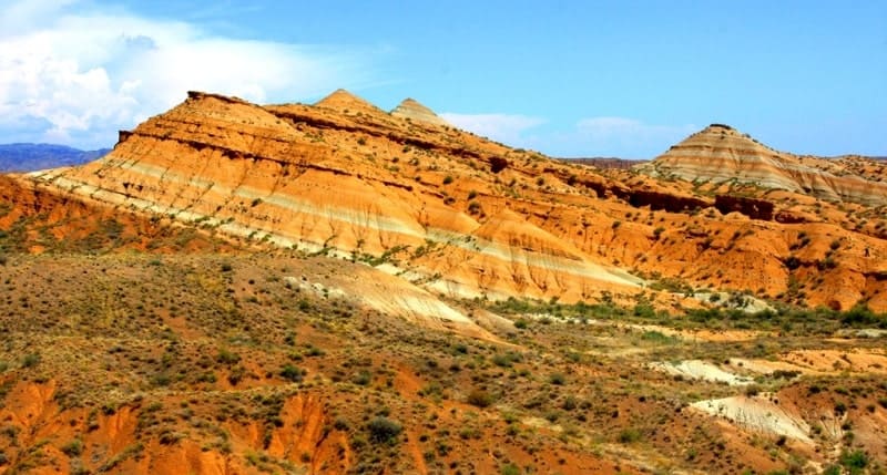
The mountains are composed of chalk deposits with a variety of colors, interesting and picturesque with landscapes of rare beauty. The geological structure of the Tiger Mountains is represented by the following rocks: conglomerates, sandstones and sands, marls, gypsum cement, gypsum rocks.
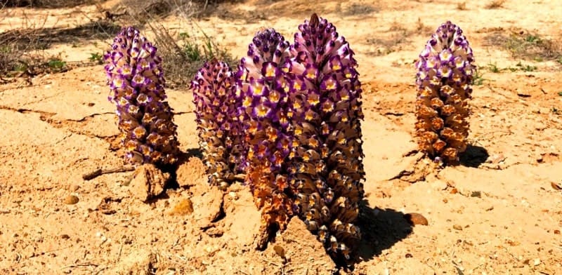
The age of the mountain deposits is 60 - 70 million years. Here you can find fossil flora. The Tiger Mountains are picturesque and got their name from the colors of the constituent rocks, various shades of rocks are represented here: red, orange, green, white.
The mountains are interesting and informative in natural, geological and geomorphological terms. The territory of the Ili Basin was filled with an ancient lake, which gave rise to significant sedimentary deposits. As a result of weathering, tectonic and erosive activity over time, delightful shallow and winding gorges, canyons formed by sedimentary rocks were formed.
The fauna in the "Tiger Mountains" is represented by ungulates: goitered gazelle, Siberian ibex, argali, saiga, roe deer, wild boar. The list of birds in the mountains is small, these are pheasants, very rarely there is a bustard, black-bellied sandgrouse, sadzha, from birds of prey there are golden eagles, short-toed eagles, bearded vultures, saker falcon, osprey, pallid eagle.
From reptiles you can see snakes, lizards (agama, round-eared round-headed) and one species of turtle. Some of the species noted here are listed in the Red Book of the Republic of Kazakhstan. From the southwest side, the mountains are bordered by the Koktal-Saryozek road.
You can get to the "Tiger Mountains" by the road that starts from the Koktal-Saryozek road. The road runs along the left side of the dry bed of the Kaishi River, which leads to winter roads, farms and cattle breeders' camps. The length of this path to the "Tiger Mountains-1" site is 17 kilometers.
You can also get to the "Tiger Mountains" from the Kaishi tract, bypassing the eastern end of the Koytas Mountains and moving along the dry bed of the Kurgaishi, which leads to the "Tiger Mountains-2" site.
Legend of Stone Tigers of Ili Valley.
They say that the entire Ili Basin was once covered by a vast ancient lake. Its waters shimmered in the sun, reflecting the sky and snow-capped peaks, and its shores remained peaceful and quiet. On these shores lived stone tigers—earth spirits who guarded the subterranean depths and the balance of the elements.
They guarded the lake's peace, keeping away storms and dusty winds. But time knows no mercy - the lake dried up, the earth cracked, and the tigers, unwilling to leave their home, lay in it forever. Their bodies turned to stone, and their skins took on the colors of the earth - from ocher and scarlet to gray-green and white.
This is how the Tiger Mountains appeared, and nearby is the deep and picturesque Kendyrly-Sai canyon, where the wind still sounds like the distant roar of ancient guardians.
1.6 kilometers to east of «Tiger Mountains» massif is a canyon with a dry riverbed, Kendyrly-Sai.
Geographic coordinates of "Tiger Mountains - 1": N44 ° 13'45 E79 ° 33'54
Geographic coordinates of "Tiger Mountains - 2": N44 ° 15'22 E79 ° 34'17




Authority and photos by:
Alexander Petrov.


