You are here
Tour to Markakol lake.


Tours to Kazakhstan Altay.
“Wherever you go becomes a part of you somehow”
Anita Desai.
Short description of tour route from Ust-Kamenogorsk to village Urnkhayka:
Ust-Kamenogrsk – Bukhtarma reservoir – Markakol lake – Ust-Kamenogrsk.
Distance of route: 938 km.
Distance of an active part of a tour: 18 km.
Season: June – 30 of September.
Best time for an tour: June, July, August.
Duration of tour: 3 days and 2 nights.
Detailed program day by day sights of nature Kazakhstan Altay:
Travel to Urunkhayka village on Markakol.
Day 1. Ust-Kamenogorsk - lake Markakol (460 km).
Transfer: Ust-Kamenogorsk - the Kaznakovsky crossing (175 km). Arrival on the Kaznakovsky crossing, wait on of the ferry.
Crossing on the opposite coast of the Bukhtarma reservoir (4 km). Further transfer: The Kaznakovsky crossing - the settlement of Kurchum (34 km). A lunch in the settlement of Kurchum.
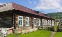
Further transfer: the settlement of Kurchum - the settlement Barack batyr - the settlement of Kalzhyr - the settlement of Markakol (the former name Alekseevka, Terekty) (189 km). Arrival in the settlement of Markakol, visit of shops. Short walk on the settlement, visit and survey of old brick buildings in the settlement, constructions the beginning of the XXth century.
Further transfer: the settlement of Markakol - mountains Derelbiigy - the pass Marble (21 km). In the envirions of the settlement of Moilda there is a boundary post, here verification of documents and permits.
Further transfer on the pass Marble 1317 meters high above sea level. The stop on the pass from the pass opens a majestic panorama of vicinities. In the south, in the territory of China, barkhans and sands of the desert Akkum and Kyzyl-Kum which borders by the northern part on the territory of Kazakhstan are well visible. In the south the mountain Marble consisting of marble breeds 1398,3 meters high above sea level towers.
Transfer: the pass Marble - the anonymous pass 1452,3 meters high above sea level - the settlement of Akzhalau - the river Belezek - the pass 1804,6 meters high Tikkabak above sea level - the settlement of Urunkhayka (lake Markakol) of 1447 meters above sea level (37 km). Arrival in the settlement of Urunkhayka, accommodation in the guest house or in tents, a dinner and overnight.
Day 2. Lake Markakol and hiking environs (2 + 6 = 8 km).
Breakfast. Hiking an excursion in lake Markakol environs. Climbing the mountain which is to the east from the settlement of Urunkhayka opens a magnificent panorama on the lake and surrounding mountains from here (1 + 1 = 2 km). Let's make short walk on the ridge and we will go down to the southern part of the lake Markakol. Return to the settlement of Urunkhayka. After a lunch walk on east coast of the lake Markakol to a lodge of fishermen (3 + 3 = 6 km). Dinner and overnight.
Day 3. The lake Markakol - wlk to Cold Valley (5 + 5 = 10 km).
Breakfast. Walk to the Cold Valley (5 km). The Cold Valley is created by the nature, it is among not high, flat ridges. From the small pass the beautiful view of the lake Markakol which western part is lost in the distance opens. In environs of the Cold Valley there lives an endemic toad who can be seen in boggy places. A lunch in way. Return to the settlement , dinner and overnight.
Day 4. The lake Markakol - Ust-Kamenogorsk (460 km).
Breakfast. Return to Ust-Kamenogorsk. Transfer: the settlement of Urunkhayka - the settlement of Markakol - the settlement of Kalzhyr - the settlement of Kurchum (247 km). A stop in the settlement of Kurchum, a lunch in local cafe.
Further transfer: the settlement of Kurchum - the Kaznakovsky crossing (34 km). Crossing on the opposite coast of the Bukhtarma reservoir (4 km).
Transfer: The Kaznakovsky crossing - Ust-Kamenogorsk (175 km). Arrival in Ust-Kamenogorsk, end of a trip.
Note:
Author program of Alexander Petrov. Copying and introduction - from the sanction of the author petrovsra@mail.ru
Alexander Petrov
photos.


