


![]()
Вы здесь
Ustyurt natural reserve.
Trip Ustyurt reserve on Mangyshlak.
"Ustyurt, a Kirghiz expression (Ust means high, elevated, urt means plain. And in contrast to this, the low steppe going south from Ustyurt is called Astyurt, i.e. a low plain), means a flat elevation (plateau), and since in the western part of the steppe there is no other high plane, then under this name they mean the elevated isthmus between the Caspian and Aral seas, which until now has been unfairly represented on maps as covered with various mountains, of which the main ones were given the name Tumanny. Ustyurt is an elevation that is generally smooth and has a height of more than 600 feet above the surface of the seas it separates. This plane is outlined all around by a steep, precipitous shore, called Chink in Kirghiz, at the foot of which a sloping, low steppe spreads out. Although this shore has collapsed quite a bit over time, and from the side steppe formed various hills, small hills, valleys and ruts, but to this day it is still so steep that in few places it is possible to climb it. The flat top of Ustyurt appears to the eyes in the same form as the low steppe: its soil, like that below, consists of sandy clay, turning into sand and salt marshes, the plants are the same as in the steppe."
Levshin A. I. "Description of the Kyrgyz-Cossack or Kyrgyz-Kaisak mountains and steppes." 1832.
Route on Mangushlak.
Ustyurt Nature Reserve is located in southwestern part of Ustyurt Plateau, on territory of Karakiyansky district in south of Mangistau region, in southwestern part of Republic of Kazakhstan.
The Ustyurt Nature Reserve is located in the southwestern part of the Ustyurt Plateau, on the territory of the Karakiyansky district, which is located in the south of the Mangistau region in the southwestern part of Kazakhstan. Its territory extends in the meridional direction to a maximum width of 4/3 km (between 54.09 and 54.55 east longitude), and in the latitudinal direction - to 95 kilometers (from 42.34 to 43.23 north latitude according to the 1942 coordinate system).
The reserve, like the entire Mangistau region, is located in the IV time zone relative to Greenwich, and the difference with Astana time is minus two hours. The total area of the reserve covers 223,342 hectares. Its highest point is located on the Western cliff of Ustyurt in the area of the Kugusem well and reaches 340 m. a. s. l., and the lowest is located in the northern part of Kenderli-sor at an altitude of - 52 meters.
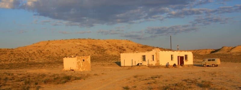
The central estate of the reserve is located in the city of Zhanaozen, 110 kilometers from the nearest border of the reserve and 150 kilometers from the regional center of Aktau. The nearest settlement to the territory of the reserve is the village of Akkuduk, located 15 kilometers from its border.
The road to the reserve from Zhanaozen goes along the asphalt road to the village of Stary Uzen, then along the dirt road through Senek to the village of Akkuduk, from where you can get directly to the reserve. Alternative routes, such as the path through the Kenderli-Kayasan plateau or the Ustyurt plateau, are more difficult and risky options due to the crossing of deserted, arid territories, especially in the summer.
It is worth considering that it was at the Akkudak weather station that the absolute temperature maximum of Kazakhstan was recorded - +47 °C. Zhanaozen itself can be reached by road or rail from Aktau, as well as along the Atyrau-Makat-Beineu-Sai-Utes-Zhanaozen route.
The regional center of Aktau has a seaport, a railway station, a bus station and an international airport that connects it with foreign cities such as Baku, Istanbul and Moscow, as well as with the Kazakh cities of Astana (approximately 3 hours by plane), Almaty (approximately 3 hours), Aktobe, Oral and Atyrau.
Legal status and history of foundation of Ustyurt Reserve.
In the mid-1960s, active development of natural resources in the Aral-Caspian watershed began. During this period, significant oil and gas reserves, uranium deposits, and shell rock deposits were discovered. Large-scale construction of new cities and towns began, roads, oil and gas pipelines were actively laid, and geological exploration was carried out.
In just a few years, the population of the recently formed Mangyshlak region more than doubled. This rapid process was called the "Conquest of Mangyshlak". The need to preserve natural resources was not considered at that time. A special technology was used for accelerated oil and gas production: drilling rigs were assembled on a special site near the city of Shevchenko (now Aktau), and then, using bulldozers, transported for tens and sometimes hundreds of kilometers, destroying vegetation and soil cover.
At the same time, projects were being developed to create huge underground oil storage facilities using nuclear explosions. Under the influence of these man-made processes, the Uzen Depression was completely transformed, and the Karagie Depression was partially destroyed.
As a result:
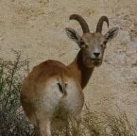
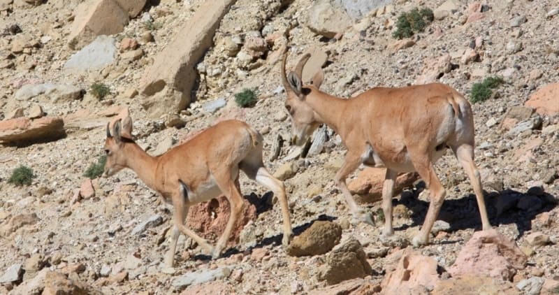
The number of Ustyurt mountain sheep, which in the first half of the 60s was 7-10 thousand individuals, by the end of the 70s had decreased to 2,000 - 3,000.
The population of Ustyurt-Mangyshlak gazelle, which reached 100,000 heads in the 50s, had decreased to 10,000 by the mid-70s.
In the 60s and 70s, the "conquerors of Mangyshlak" completely exterminated the cheetah on the territory of Kazakhstan, since this predator lived exclusively in the Mangyshlak region. During the same period, other species, especially game species, suffered significantly: many of them became rare, including the saiga, caracal, black-bellied sand grouse, houbara bustard and others.
Scientists and the public of Kazakhstan expressed acute concern about this, putting forward an initiative for urgent measures to preserve the unique ecosystem of the Aral-Caspian watershed. In 1972, by decision of the executive committee of the Gurevsky regional Council of Workers' Deputies, the Main Directorate of Nature Reserves and Hunting under the Council of Ministers of the Kazakh SSR approved the creation of the Ustyurt State Hunting Reserve on the Western Cliff of Ustyurt in the area of the Kugusem well.
The reserve with an area of 53 thousand hectares was organized for a period of 20 years. A proposal was also put forward to create two reserves: one on the Western Chinok of Ustyurt, in the area of the Kugusem well, and the second - the inter-republican Kaplankyr, located on the Southern Cliff of Ustyurt, on the border of Kazakhstan, Uzbekistan and Turkmenistan (Red Book of the Kazakh SSR, 1978).
In 1978, the Commission "Scientific Foundations of Nature Reserve Management in Kazakhstan" under the Academy of Sciences of the Kazakh SSR recommended the urgent creation of eleven nature reserves in the country, including the Ustyurt Nature Reserve, the area of which was to be 300,000 hectares.
The main objective of the Ustyurt Nature Reserve was to protect the natural complexes of the southern deserts, as well as the conservation of rare species of flora and fauna, many of which are listed in the Red Books of the USSR and the Kazakh SSR.
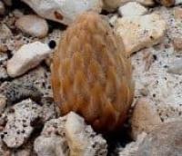
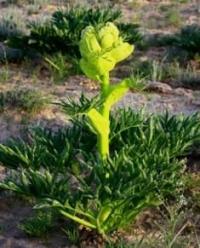
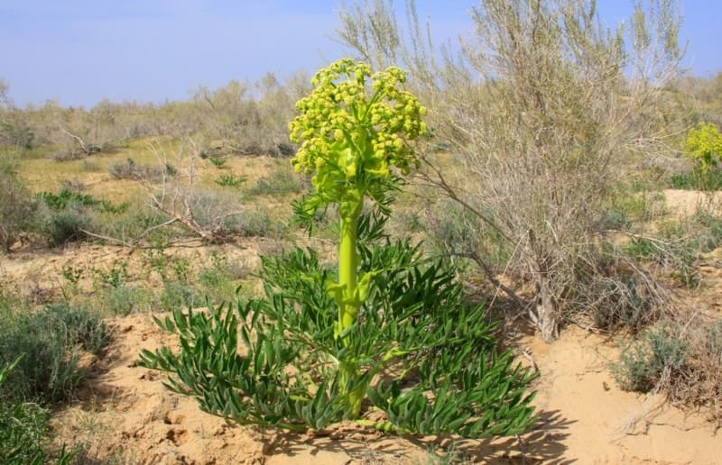
Among the especially valuable plants, it was proposed to take under protection the soft-fruited critmolistny, the toothless kale, the Ustyurt milkvetch and the hard-goblet spurge. Among the animals in need of protection were the Ustyurt mouflon (mountain sheep), goitered gazelle, thick-billed plover, golden eagle, imperial eagle, short-toed eagle, saker falcon, manul, caracal, cheetah, and a number of other representatives of fauna and flora.
This initiative received the support of the Academy of Sciences, the Main Directorate of Nature Reserves and Hunting under the Council of Ministers of the Kazakh SSR, and the State Planning Committee of the Kazakh SSR. As a result, on July 12, 1984, in accordance with the Resolution of the Council of Ministers of the Kazakh SSR No. 294, the Ustyurt State Nature Reserve was established on the territory of the Yeralievskiy district.
Its main goal is to preserve the ecosystems of the southwestern deserts and ensure a strict conservation regime. Given the harsh natural conditions of the region, it was decided to locate the reserve's administrative office in the nearest large settlement, the city of Novy Uzen, which is 120 kilometers from its border.
Water sources in Ustyurt Reserve.
There are no permanent watercourses on territory of Ustyrt reserve. Temporary rivers are fed mainly by melting snow. The Kenderlisor Depression does not have a stable surface runoff, and high evaporation prevents moisture accumulation.
Despite the absence of rivers and lakes, the reserve's water supply is provided by springs and wells.
They are fed mainly by underground (fissure) and surface waters, and their mineralization level varies from 3 to 15 g / l. In the northern part of the reserve, the Karazhar Creek flows into the Kenderlisor, which is fed by meltwater in the spring, and by underground water in other seasons.
Spring sources are found in the area of the Aitmanashi well, as well as in the areas of Karamaya, Karazhar, Sarybulak, Elshibek, Un-Ere, which is quite sufficient for watering wild animals. On the border of the reserve is the Kugusem well, fed by an aquifer in the chalk deposits of the cliff. Unlike most other sources, the water in it is fresh and has minimal mineralization (0.8 g / l). Its flow rate is 1.5 - 2 cubic meters per day.
With a decrease in moisture reserves in the soil, herbaceous vegetation gradually begins to burn out.
Soils of Ustyurt Reserve.
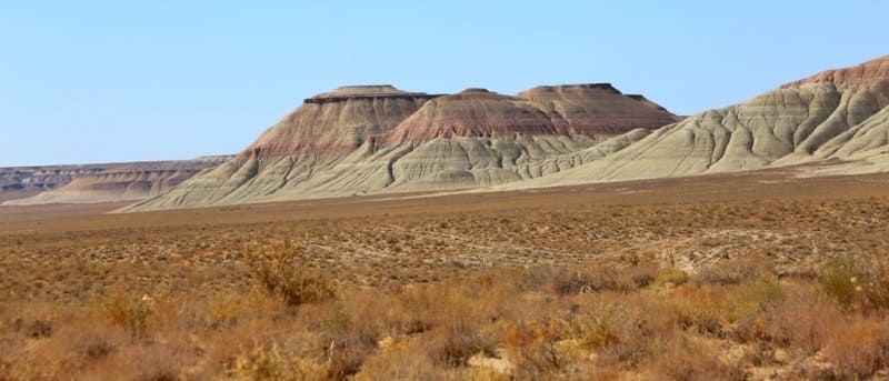
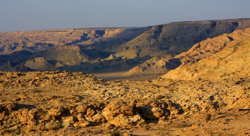
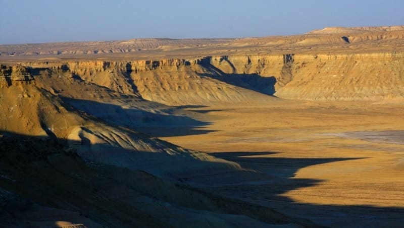
Quaternary deposits are widespread in the lowlands, while Tertiary and Cretaceous layers, mainly of marine origin, predominate on the plateau. Cretaceous rocks are exposed on the steep slopes of the cliffs, forming picturesque cliffs. The endorheic Kenderlisor depression, the bottom of which is below sea level, runs through the reserve from the southwest to the northeast.
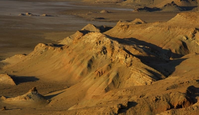
The cliffs, composed of limestone and chalk, have a variety of shapes: in some places they smoothly descend, and sometimes form steep walls with niches, caves and columnar outliers. The height of the cliffs reaches several hundred meters, and their color varies from pale pink and blue to dazzling white.
The predominant soils are gray-brown with saline areas and gypsum layers, which is typical for the causal zone of Ustyurt. Soil formation is associated with Sarmatian limestones. The soil surface is dense, cracked, with a takyr-like structure. Humpy-ridged sands are partially fixed or reinforced by vegetation - psammophytes and saxaul.
Halophytes predominate on the salt marshes. The surface of Kenderlisor, located in the zone of close occurrence of groundwater, is a saline silt deposits with a constantly wet structure. Chlorides and sulfates accumulate in the depressions, the thickness of these deposits reaches 10 meters.
Underground waters at a depth of 0.3 - 0.7 meters have a high mineralization and are bitter-salty "brines".
Archaeological sites of Ustyurt Reserve.
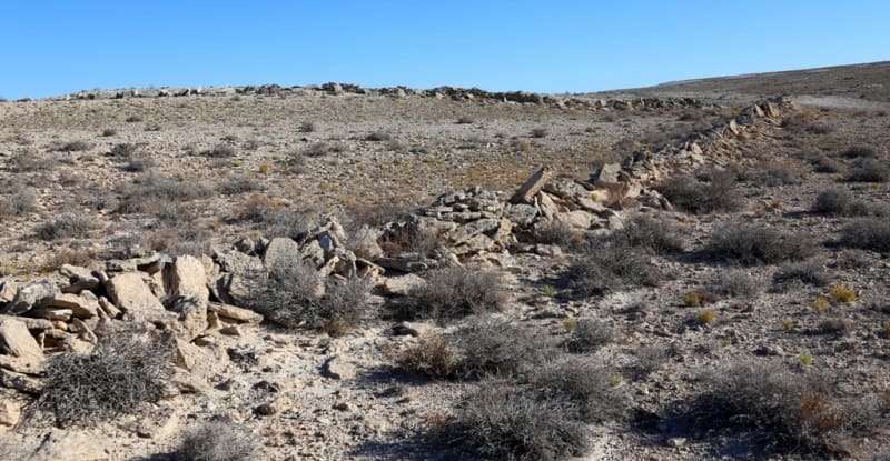
Ustyurt is rich in archaeological sites of significant historical value. In ancient times, caravan routes ran through the plateau, among which the Khorezmshahs' road, connecting Khiva with the lower reaches of the Emba and Volga, is especially famous.
Along this route were such important sites as the ancient city of Shahr-i-Vazir, the Beleuli caravanserai and the Allan fortress. On the plateau territory there are ancient cemeteries with monumental mausoleums-mazars. Some of these structures have already been studied by archaeologists, but many of them remain unexplored.
In addition to medieval buildings, more ancient traces of human activity have been preserved on Ustyurt. About 60 Neolithic sites have been discovered on the plateau territory. There are especially many of them on the western and southwestern cliffs - in the Manat area and the Karynzharyk depression.
Some of these sites are located within the protected area.
Geographic coordinates of Ustyurt Reserve: N43°06'28 E54°37'14
Аthority:
Plakhov Konstantin. Nature reserves of Central Asia and Kazakhstan (under the general editorship of R.V. Yashchenko. Protected natural areas of Central Asia and Kazakhstan, issue 1 - Tethys, Almaty, 2006. 352 p.
Photos by:
Alexander Petrov.