


![]()
You are here
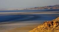
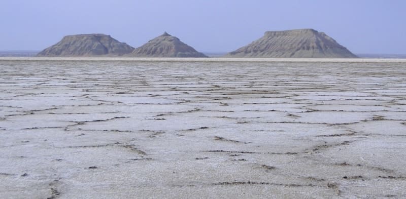
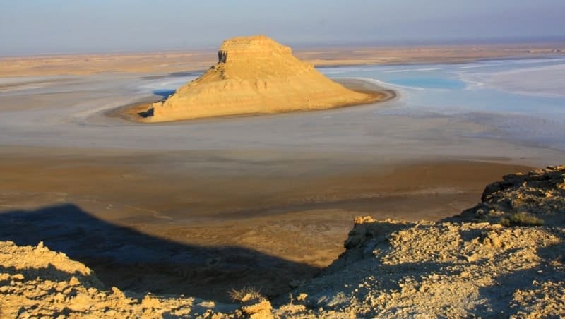
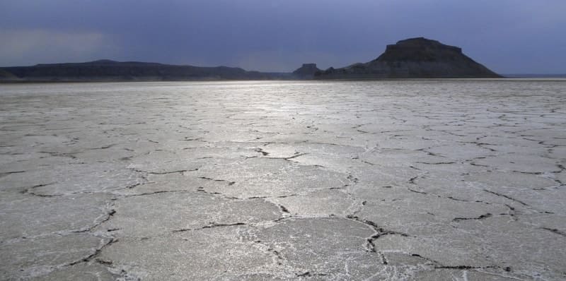
Hollow Karynzharyk on Ustyrt reserve.
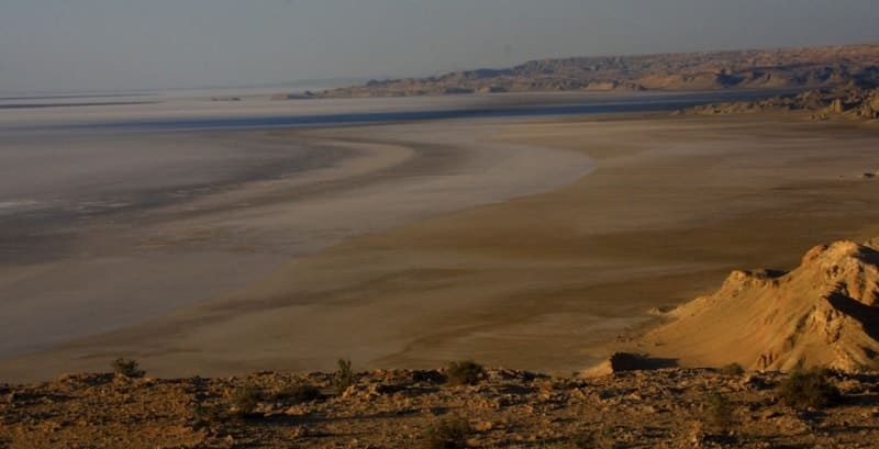
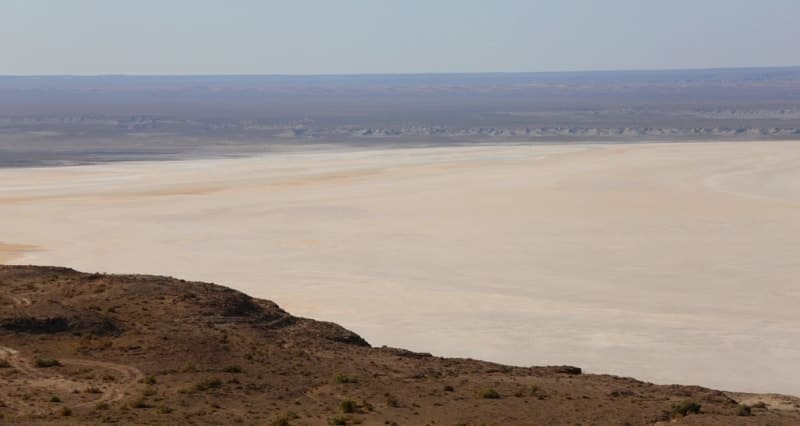
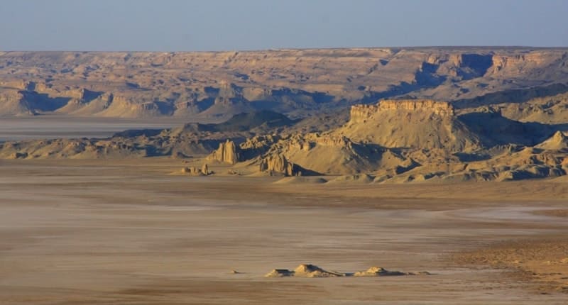
Tours Hollow Karynzharyk in Ustyrt reserve.
"Mangyshlak is located on the eastern shore of the Caspian Sea, in its northern part. Washed from the south and north by bays, it stretches out in the form of a triangle with the apex in the northwest, in the southeast, where its base reaches a length of 200 kilometers, and the area is 25 thousand square kilometers. There is not a single flowing river in Mangystau and in general fresh water is a rare phenomenon. Only in the Karatau mountains are there springs with small streams and swampy puddles. Trees are also very rare and only in mountainous areas - in gullies and ravines - where groundwater comes to the surface"
P.P. Semenov-Tyan Shansky.
Destinations Travel tours Mangyshlak.
Karynzharyk Depression is located at an altitude of - 63.3 meters to - 66.9 below sea level, is located on territory of Ustyurt Nature Reserve, 24.4 kilometers to east of Ak-Kuduk village and 72.2 kilometers to east of Basgurly Depression, in east depression borders on Muzbel ridge, from west from south to north stretch Karynzharyk sands in Karakiya district in southeast of Mangistau region.
The Karynzharyk Depression occupies the southern part of the Kenderlisor saline marsh, which stretches from the south to the north and further to the north-east for 92 kilometers. The Karynzharyk Depression stretches from the south to the northeast for 21 kilometers. In the northeastern part, the depression reaches 13 kilometers, in the central part 10 kilometers, in the southern part 7 kilometers.
The area of the depression is 152.26 square kilometers, the area of the coastline is 54.42 square kilometers. On the eastern side, the depression is limited by the Western Chink of the Ustyurt Plateau, which stretches for 50 kilometers from the Kyzylsay hillock 128.6 meters above sea level located in the southern part of the depression to Cape Shaklakmuryn located in the northern part of the depression.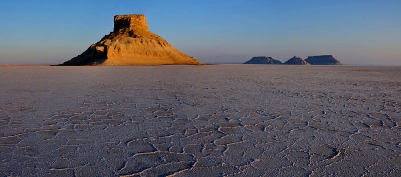
In the southern part of the depression there are five residual mountains, the northernmost of which is 116.7 meters above sea level, a little to the south - the western one is 83 meters above sea level, the eastern one is 79.7 meters above sea level. Next is the southwestern remnant 104.7 meters above sea level and the southernmost remnant 61.4 meters above sea level.
The depression reaches what is typical for the surf zone of the sea coast of the modern Caspian. The eastern side of the depression is steep, precipitous, a cliff with a height of 104 to 197 meters above sea level, the western side is gentle (Karynzharyk sands).
In the center of the depression, 2 gas-bearing structures were identified (Kansu and South Kansu). The Karynzharyk Depression serves as a division between the Ustyurt Plateau and the Mangyshlak Peninsula. This is a large depression, formed by a mantle of highly saline sandy-clayey deposits of the Caspian transgressions.
Ancient and modern reworking of marine sediments led to the formation of a narrow massif of hummocky-ridged sands on its surface, stretching from north to south for more than 100 kilometers. The bottom of the depression in places is represented by ridge-basin sand forms, in places it is occupied by vast massifs of salt marshes and solonetz. In addition, there are typical for Western Kazakhstan salt-sand formations - salt muds, takyrs and khakis.
The transition from them to the lakes are sors, the largest of which on the territory of the reserve is Kenderli-sor. They sometimes occupy areas of hundreds of hectares and are areas of accumulation of liquid and semi-liquid salt mud, which extends to a depth of more than ten meters.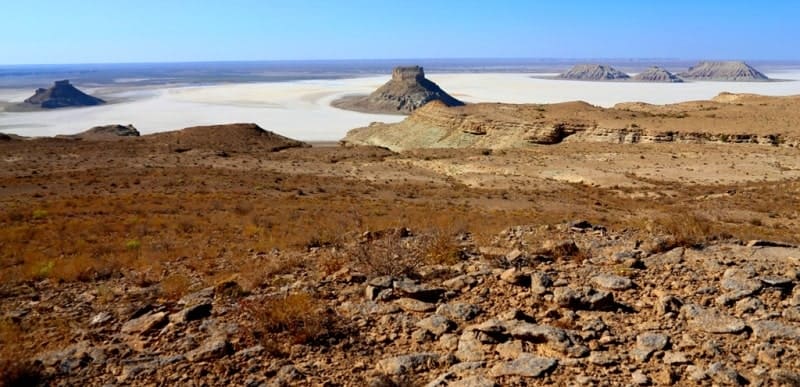
In the northern part of the Karynzharyk depression, on the territory of the Ustyurt Reserve, a unique anticlinal uplift stands out - Mount Karamaya, 209.8 meters above sea level and about 17.3 kilometers long. From time to time, the depressions are filled with rainwater after drying, which leaves vast salt marshes.
On the Ustyurt plateau by the considered epoch there were already deep depressions, to which Upper Pliocene lacustrine, alluvial-proluvial, deluvial-proluvial, and sometimes marine deposits are confined: inequigranular sands, sandstones, pebbles, conglomerates, sandy loams and clays, occasionally limestones.
Their thickness varies, in the Karanzharyk depression it reaches 100 meters. Along the entire length from the east along the depression there are cliffs, which are chosen by mouflons.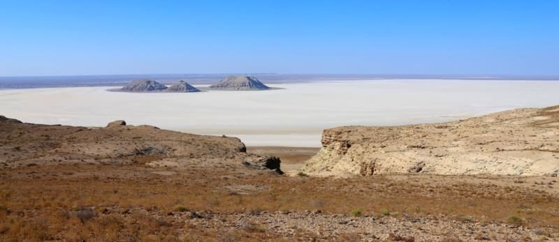
Formation of Karynzharyk depression.
In the southeast, the Eastern Mangyshlak connects with the large Karynzharyk depression, a significant part of which is occupied by sand massifs. The depression is extended in the south-southwest direction approximately in the cross of the Mangyshlak dislocations. Some researchers considered it to be the valley of an ancient river that flowed into the Kara-Bogaz-Gol Bay (Lichkov, 1927; Richter, 1955).
However, due to the fact that there is an increase in the absolute marks of the bottom of the depression in the direction of the Kara-Bogaz-Gol Bay and an anticlinal uplift was found at its southern end, another hypothesis is put forward, according to which the most likely condition for the formation of the depression is regressive erosion, and the subsequent deepening is due to deflation processes (Fedorovich, 1949, 1950; Shlezinger, Pleshcheyev, 1959).
Geographic coordinates of Karynzharyk Depression: N42°41'28 E54°17'32

Authority:
Plahov Konstantin. Reserves of Central Asia and Kazakhstan (under R.V.Jashchenko general edition. Protected natural territories of Central Asia and Kazakhstan, release 1 - Tetis, Almaty, 2006.352 p.
Photos by:
Alexander Petrov.