Вы здесь
Sights gorge of Dzhety-Oguz.

Solo traveller in Kyrgyzstan.
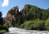
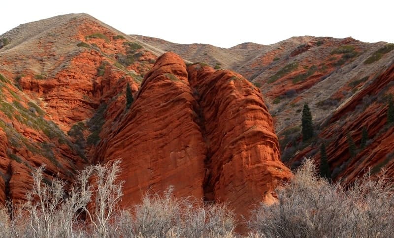
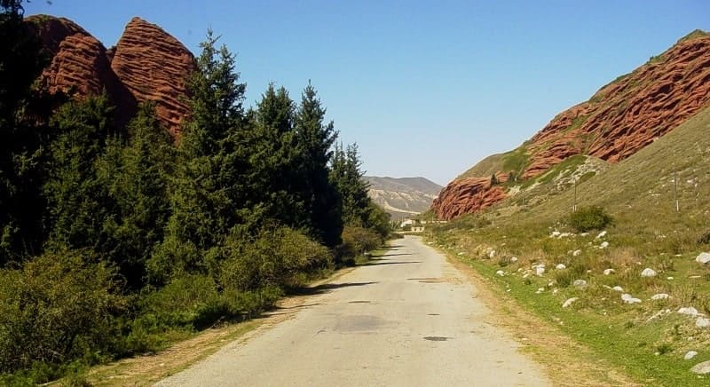
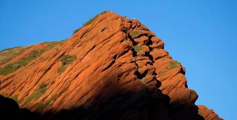
"Seven huge sandstone cliffs of bright red color lie at the entrance to this gorge. As soon as you pass them, a ring of unusually clear tops and rich colors opens up. A greenish stream, foaming, rolls over the rocks past three buildings of the sanatorium. Around it, on the slopes, stand slender Tian Shan firs, and rocks covered with yellow lichens protrude from the ground, between which green lawns with bushes are scattered."
V. Vitkovich. "Kirgizia". 1938.
Travel advice in Bishkek.
Upper boundary of Jety-Oguz gorge is located at an altitude of 3160 meters above sea level, lower boundary is located on southern side of village of same name at an altitude begins at an altitude - second mountain section of Issyk-Kul Nature Reserve. Jety-Oguz gorge is located on northern slope of Terskey Ala-Too mountain range in Jety-Oguz district of Issyk-Kul region.
From the resort to the end of the Ailanysh glacier at the foot of the Jety-Oguz wall, the gorge is about 25 kilometers long, the trail goes along the right bank of the river all the time. Above the resort, for 10.5 kilometers, a bad country road runs through a spruce forest, accessible only to all-terrain vehicles.
4 kilometers above the resort, in the forest, there is a geologists' base - a group of temporary wooden houses. The road ends in a clearing, 1.5 kilometers before the confluence of the right tributary of the Telety River with the Jety-Oguz. Further up the gorge there is only a trail.
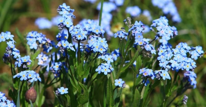
12 km from the resort, near the confluence of the Telety, there is a "Flower Glade". Indeed, there are excellent subalpine meadows with lush herbs and an abundance of all kinds of flowers: edelweiss, small and large white chickweed, forget-me-nots, geraniums, large dark blue and tiny blue gentians, orange "daisies" of small-petaled erygeron.
The path from the Dimitrov, Telety and Gastello passes from the Ontor gorge leads to the "Flower Glade" along the Telety valley. From the glade, the double-headed wall of the Jety-Oguz is clearly visible 17-18 kilometers away. The Jety-Oguz gorge widens greatly, 18 kilometers from the resort there is a large glade in the Belalu-Sai valley, where both sources of the Jetyoguz merge: the right Ailanysh (Turkic "Whirlpool") and the left - Baytor ("Rich tract").
In the clearing there are yurts and shepherds' tents. A herd of mares with foals grazes here, you can try kumiss. You can watch mares being milked. Unlike a cow, a mare does not allow herself to be milked unless she is tricked by letting the foal come near her for a while.
Then one milkmaid takes it away from her teats and holds it by the neck next to her mother so that she can see it, while the second milks the mare, calmed by the foal's proximity. 20 kilometers from the resort there is a bridge (a pair of logs across the Ailanysh River), and 23 kilometers away are the last spruce trees (the altitude here is 2800 meters above sea level) 1.5 - 2 kilometers from the beginning of the Ailanysh glacier.
Further on, to the end of the glacier (above 2800 meters above sea level), only juniper bushes grow on the slopes of the valley. This is a convenient place for a camp. In the south, 4 - 5 kilometers away, rises the magnificent, grandiose rock-ice Jety-Oguz wall, the second highest peak of Terskey Ala-Too, 5168 meters above sea level, category IVb of difficulty.
The first ascent of the Jety-Oguz wall was made in 1958 by four climbers under the leadership of V. N. Naryshkin along the northwestern glacier of Jety-Oguz and the northwestern ridge (the watershed ridge between the Ailanysh River and the Baytor Gorge).
From the camp, you can take several one-day walks to the Ailanysh glacier, a panoramic peak in the right lateral ridge (about 4000 meters above sea level) and to the Baytor Gorge. It is more convenient to climb the Ailanysh glacier along the rampart of the right lateral moraine, clearly visible from afar, from the edge of the forest, along the ridge of the moraine there is a path.
The glacier gradually turns to the east, to the left as it goes. From the moraine far to the north in the gap of the Jety-Oguz gorge, the water surface of Lake Issyk-Kul and the Kungey Ala-Too mountain range are visible. After 1.5 - 2 hours of climbing from the forest line, it is better to go to the right slope, first grassy, and then scree, going around the icefall on the left.
At an altitude of 3300 - 3600 meters above sea level, on the slope of the glacier there are excellent alpine meadows with many large and bright flowers; to the plants found in the Jety-Oguz gorge, here are added crimson primroses (early flowers), pink and purple alpine asters and golden flowers of the cinquefoil bush and alpine poppy.
Along the way, the bulk of the steep Jety-Oguz wall moves closer and closer, dazzlingly shining in the sun with clean ice and snow. From several hanging glaciers on the Jety-Oguz wall, chunks of melted ice fall down onto the Ailanysh glacier.
A good panoramic point is the summit, about 4,000 meters above sea level, in the side ridge extending from the ridge dividing Ontor and Ailanysh. The ascent to it from the edge of the forest lasts 4 - 4.5 hours, and the descent to the camp is about 3 hours.
At first, the ascent goes along the moraine, then along the grassy slope and scree. After 3.5 hours of travel - an exit to the watershed ridge, ahead a rocky summit 4,000 meters above sea level blocks the view of the Karakol peak area.
You need to cross the scree, and then the steep ice slope (here you should cut steps) and go out along the rocks to the top. It offers a panoramic view of the Jety-Oguz wall, in the west in the upper reaches of the Baytor the sharp ridge of the Terskey Ala-Too is crowned with three rocky and snowy peaks, the westernmost of them is Ailama, below in the east is the treeless Archalytor valley, behind it behind the ridge is the Ontor glacier and the Karakol peak.
7 kilometers below the end of the tongue of the Ailanysh glacier, the Baytor tributary flows into the river, above this place the river is called Baytor.
The Baytor gorge, about 7 km long, in the lower part is called At-Dzhailau, here shepherds usually have tents or yurts. The upper part of the Baytor gorge is closed by two pure white glaciers, separated by a spectacular granite pyramid. 1 kilometer south of this peak is the Ailama Pass, leading to the gorge of the Ailama River, a tributary of the Chon-Kzylsu.
Archator Pass (I, B category of difficulty) connects the gorge of the Jety-Oguz and Chon-Kzylsu. 1 kilometer below the confluence of the Ailanysh and Baytor, near the Belalusai glade, the Asan-Tukum tributary flows into the Jety-Oguz on the left.
Going down the Jety-Oguz, it is necessary to cross the end of the watershed ridge at the mouth of the Asan-Tukum River. The Asan-Tukum gorge closes a small glacier. You need to climb along this glacier closer to its left edge, then along a steep (up to 45 °) slope of large stones, and then slate scree.
The ascent to the pass takes 4 - 5 hours. From the saddle behind the Chon-Kzylsu gorge, the Terskey Ala Too section is visible. The descent from the Archator pass into the treeless gorge of the same name is along a steep (up to 40°) slate scree, and then along steep grassy slopes.
After 1 - 1.5 hours of descent from the pass, the gorge narrows, the river flows in a canyon. Only juniper grows on the slopes of the gorge. After another 3/4 hour of walking, the Archator flows into the Karabatkak River on the right. Along the right wooded bank of the Karabatkak, after 3/4 of an hour, the trail leads to the building of the Physical-Geographical Station, located in a large clearing in the Chon-Kzylsu valley.
The descent from the pass to Chon-Kzylsu lasts 2.5 - 3 hours, and the entire transition from the Jetyoguz gorge is 7 - 8 hours. 5 kilometers above the Jetyoguz resort there is another pass - Kokbel (about 2750 meters above sea level), leading to the wide valley of Sutt-Bulak (Turkic: "Milk source"), where a dairy farm is located.
Geographical coordinates of Jety-Oguz gorge: N42°19'13 E78°15'02

Authority:
B.I. Rukavishnikov. "Lake Issyk-Kul and the Terskey-Alatau Ridge". Moscow, "Physical Education and Sport", 1970.
Photos by:
Alexander Petrov.


