You are here
Airakty mountains.

Travel on cretaceous mountains Mangistau of province.
“It is untrue that equality is a law of nature. Nature has no equality; its sovereign law is subordination and dependence”
Luc de Clapiers de Vauvenargues.
Mangyshlak Silk Road and Active Tours.
The vast, ancient massif of the Airakty cliff, which borrowed strong rocks from the Ustyurt plateau, is located in the central part, 8.4 kilometers from the southwestern tip of the North Aktau ridge of the Zhalshy mountain, 312.7 meters high above sea level, and 10 kilometers to the northeast from the northern slopes of the Western Karatau ridge, the southern slopes of the massif are located in the Kurturmas valley, 6 kilometers to the east and slightly south of Mount Sherkala, 11.7 kilometers to the north-west of the village of Shetpe in the Mangistau district of the region of the same name.
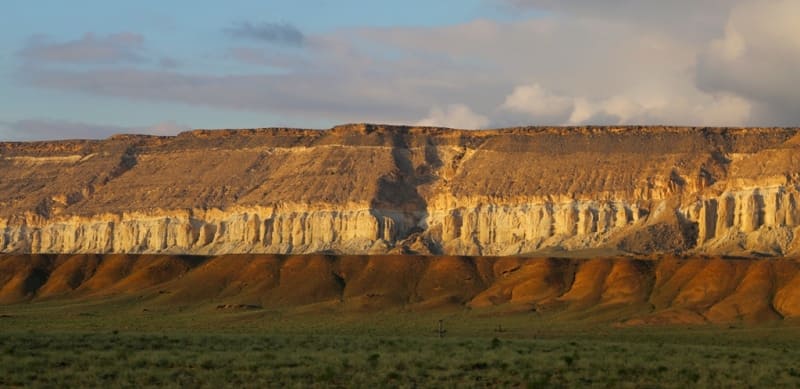
In the southern part, the massif of the Airakty cliff, 2.2 kilometers long from west to east, has one huge massif in the form of a plateau. To the south, the plateau splits into two branches - eastern and western. The western part is elongated from south to north with a length of 3.5 kilometers, in the southern part the cliff is elongated by a narrow strip, which breaks up into several spurs.
The eastern part of the cliffs looks more massive towards the south, 2.8 kilometers long. From a bird's eye view, the cliffs array looks like an irregular letter P. From above, the external forms of the cliffs are similar to Mount Sherkala.
In the southern part, the Airakty massif ends with the dominant Zhairakty elevation 351.5 meters above sea level. It is the highest mountain in this area. From the ethnographic yurt village "Kogez" to the Airakty massif from the western side, it is best to drive along the road leading to the small village of Tigen.
In 1850, the Airakty mountains were described by Bronislav Zalessky, who was in exile on Mangyshlak together with Taras Shevchenko. In 1851, while in exile in the fortification of Aleksandrovskoe, the great Ukrainian poet and artist Taras Shevchenko visited the vicinity of the cliffs.
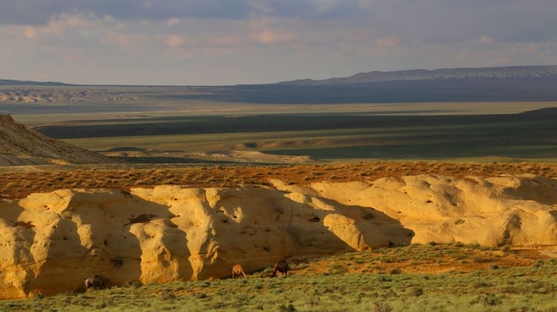
These mountains made such an impression on him, and he made a series of drawings here under the poetic name "Valley of Castles". The Airakty mountains really look like fairy-tale castles with spiers, towers, colonnades and fortress walls.
A wild winding path, pierced by semi-wild horses, leads to a small observation deck on one of the mountains, from which a panoramic view of the distant Northern Aktau mountains and many castles of the Airakty cliffs opens.
In damp spring the valley is covered with small but gently fragrant Sogdian tulips. If you are lucky, then you will come across a couple of cautious Ustyurt mouflons - mountain sheep. Along the sides of Mount Airakty, on blocks of chalk, you can see scratched drawings, called by one of the researchers “Steppe symphonies”.
They are not very ancient, but reflect the vision of the surrounding world by Kazakh hunters and shepherds. Here there are images of camels, horses, dogs, but the main imprinted animal is always the stag mouflon, which has gained respect and holiness among the local population.
Often there is a scene of a hunter's bullet hitting the mouflon, capturing either a magical action before the hunt, or the joyful emotions of a successful hunt. An inconspicuous path leads to the top of the large table mountain Airakty (Broken) from the south side.
The local shepherd said that there is a deep cave in the mountain, which he is afraid to go into. Despite its visual appeal, the "Valley of Castles" is waterless and practically devoid of vegetation of any tree-like vegetation. As they say about the Mangyshlak Peninsula, the Earth is bare here to the bone.
Geographic coordinates of Airakty mountain-cliff: N44 ° 14'31.60 "E52 ° 05'22.51"


Authority:
Alexander Petrov (Almaty), Andrey Astafyev, the town of Aktau.
Photos by
Alexander Petrov.


