You are here
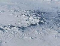
Akshatau ridge.


A trip from Almaty to Urjar.
“In a white fur coat, a shoulder coat, all covered with snow white hair,
Blind and dumb, with a silvery big beard,
The enemy of everything that lives, with a clouded brow,
He creaks, walking in the snowy winter"
Abay Kunanbayev. "Winter". Translation Sun Christmas.
Car tours on the mountain ranges of East Kazakhstan.
The Akshatau mountain range is located in the system of the eastern Chingiztau mountains located in the southeastern part of Saryarka, in the territory of the East Kazakhstan region. They border the Tarbagatai mountains in the southeast and the Zaysan depression in the east and the Balkhash Upland in the south.
Extends from southwest to southeast. The length of the Akshatau ridge is about 150 kilometers, the width reaches 30 kilometers. Maximum heights Mount Kosoba is located at an altitude of 1305 meters above sea level. It is composed of Paleozoic sandstones, ridges, conglomerates, effusive rocks, and porphyrites.
The southwestern slopes are steep and steep, with sharp changes in altitude from 1000 to 1100 to 500 - 600 meters above sea level. The relief of the Akshatau mountains is mountain hills. The flat peaks and slopes of the mountains are covered with steppe vegetation in combination with mountain shrubs and small birch-aspen forests.
From the northern slopes of the Akshatau ridge, the Shagan and Aschysu rivers begin; from the southern side, Bakanas, Dagandely, Kurubakanas, Koksala and other rivers.
Authority:
Brief Encyclopedia “Kazakh SSR”, Volume Two “Nature”. T.I. Budnikova.
Photos:
Alexander Petrov.


