


![]()
You are here
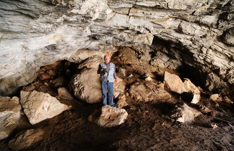
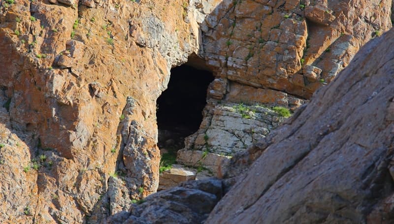
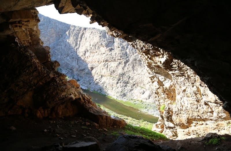
Aktogay Cave in mountains of Syrdarya Karatau.


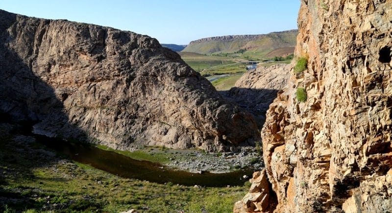
Caves in mountains of Syrdarya Karatau.
"In essence, the entire history of Central Asia represents a millennia-long struggle between the nomadic populations inhabiting the steppes and the sedentary populations living at the foot of the mountains and along river valleys. The vastness of the steppes, their dependence on livestock raising, which requires vast pastures, and other conditions of the nomad's way of life have made them, from time immemorial, the enemy of the sedentary inhabitants and instilled in them a passion for the destruction of all obstacles that impede free movement. The nomad's ideal is a boundless steppe covered with herds of fat cattle, and therefore, at the first opportunity, he will sweep away from the face of the earth anything that prevents it from becoming a pasture. Gardens, houses, magnificent buildings, and works of art are unnecessary and incomprehensible to the nomad, just as the entire sedentary culture is incomprehensible and unnecessary. If nomads could, they would turn the entire world into pasture."
V. I. Masalsky "Turkestan Region". 1913.
Caves in Zhambyl region of Kazakhstan.
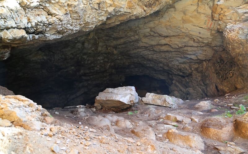
Aktogay Cave is located at an altitude of 450 m above sea level, on the right side of the Aktogay gorge, 248 meters from the river of the same name, 1.6 kilometers west of the Aktogay village, in the western part of the Ulken-Aktau mountains, 787 meters from the Zhanatas-Karatau road, in the Sarysu district of the Zhambyl region.
The rock mass in which the cavity is formed is part of the Ulken Aktau ridge. The mountains are composed of gray marble limestone. The cave is a western exposure, located at an altitude of 24 meters above the edge of the Aktogay river.
The cave is easily accessible, the ascent to it passes along a scree cone of removal from the adjacent rocky gully.
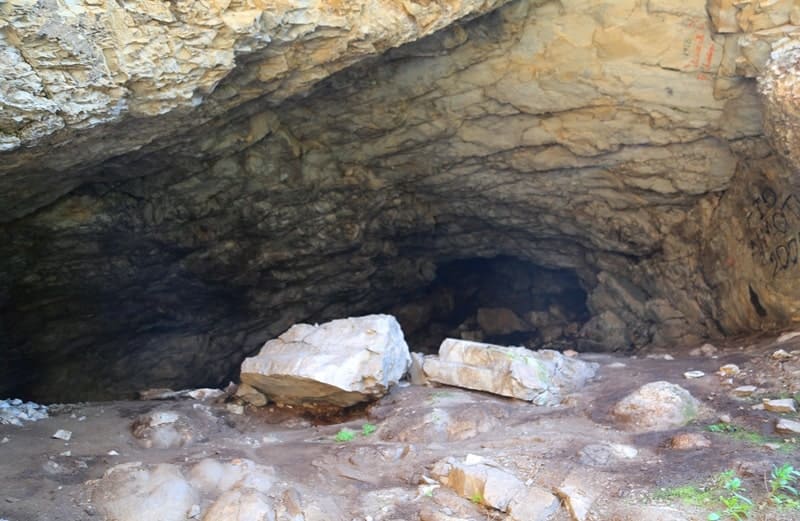
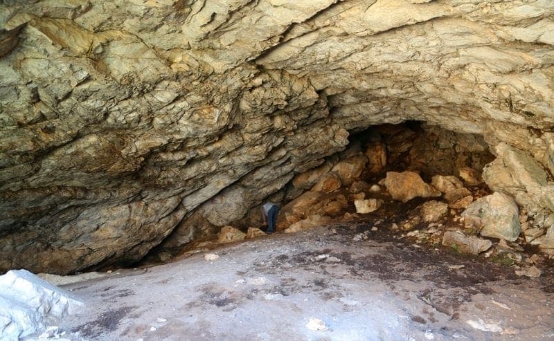
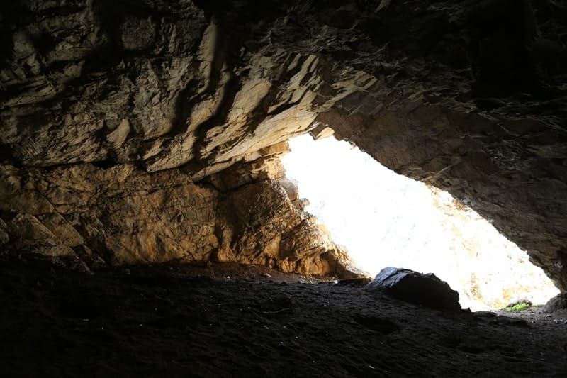
Before the entrance to the cave there is practically no platform, right at the drop line a steep rocky ledge of the valley board begins. The width of the cave entrance along the drip line is about 12 meters, the maximum height is about 5 meters. The vast cave hall goes deep into the rocky massif approximately 35 meters.
The hall in the central part expands to 16 meters. The height of the arch gradually decreases into the depths of the cave while simultaneously raising the level of the floor in the form of a hollow oblique fan. Further, the cavity narrows and rises deep into the rock.
The entrance to the far hall or gallery is blocked by large blocks of the collapsed vault (blocks larger than 1 meter in diameter). A hole of 1.5 × 1.5 meters in size was laid 15 meters from the drip line and 2 meters from the southern wall of the cave, revealing deposits of 3.3 meters in thickness.
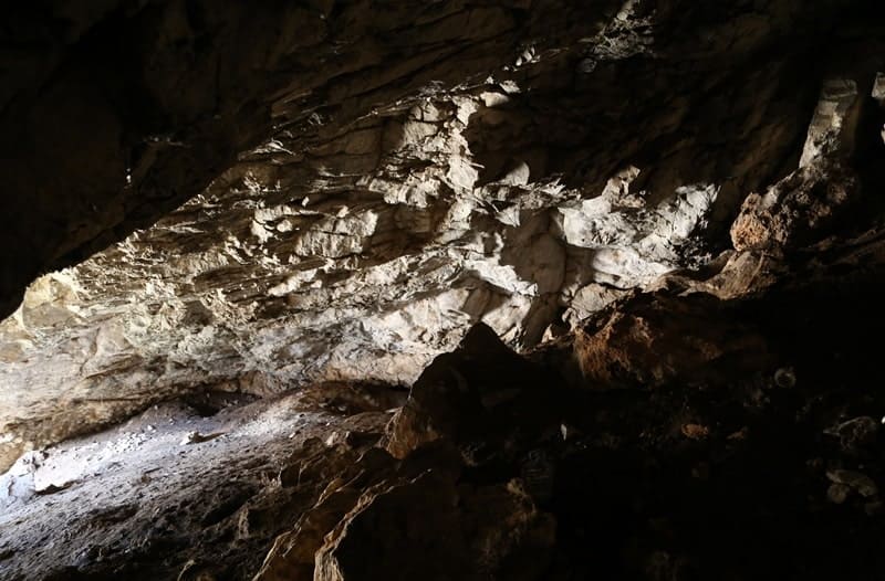
In a section, eight stratigraphic subdivisions of the soil are distinguished. Several layers of humus deposits have been found - dry, silty, with admixture of small cattle manure. Power 0.1 meter. These materials, in all likelihood, date from the early Iron Age.
In the underlying sediments, which formed, judging by their lithologic and stratigraphic characteristics, during the Pleistocene epoch, no finds were found. At the same time, Paleolithic complexes can be opened in the cave, since only a small area was investigated.
The distance from the city of Taraz to the cave Aktogay 157 km.
Geographic coordinates of Aktogay cave: N43°26'52 E69°51'55
Enlightener:
Mv Shunkov, J.K.Taimagambetov, M.B. Kozlikin. Institute of Archeology and Ethnography of the SB RAS National Museum of the Republic of Kazakhstan.
Alexander Petrov
photos by: