


![]()
You are here
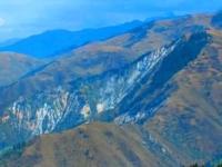
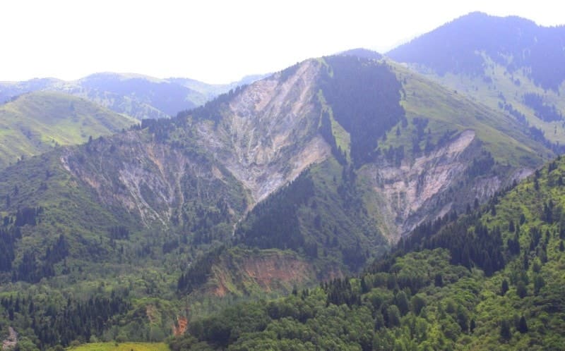
Akzhar collapse.
Excursions to places of natural disasters in mountains of Northern Tien-Shan.
“Cuzco has been shaking since evening!
The month in the sky is like a seal.
Incomprehensible art -
Take the earth and shake it"
Robert Rozhdestvensky.
Sights Aksai gorge around Almaty.
Foot of Akzhar collapse is located at an altitude of 1736 meters above sea level, upper part from where collapse occurred is located at an altitude of 2126 meters above sea level, located in Aksai gorge, in bed of right tributary of Akzhar stream, on northern slope of Zailiysky Alatau ridge, in Karasai region, Almaty region.
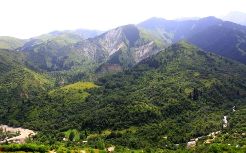
The area of the Akzhar landslide is 0.48 square kilometers, the perimeter reaches 4.21 kilometers. The length of the right (eastern) part of the collapse is 600 meters. The length of the Akzhar stream is 2.2 kilometers. 500 meters before the mouth, in the bed of the stream there is a small lake 50 meters long.
The watershed between the valleys of the Aksai and Kargalinka rivers is Mount Akzhar, 2163 meters above sea level. Mount Akzhar is composed mainly of granites, diorites, and shales. As a result of the earthquake on May 28, 1887, a collapse occurred from the western and northeastern slopes of the peak.
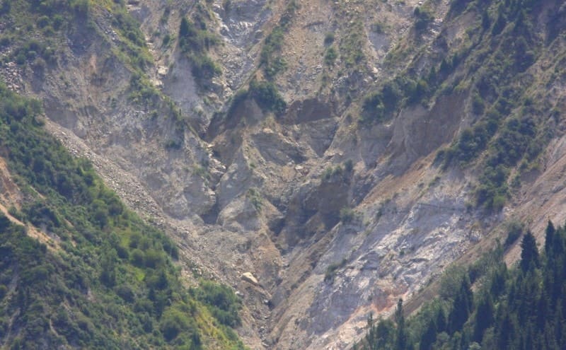
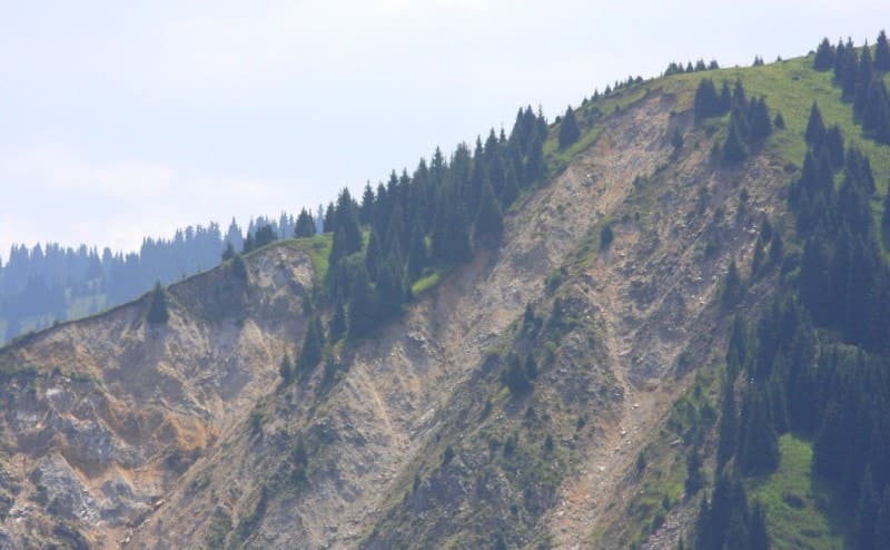
Rock fragments reaching 30 - 50 tons formed a stone scree. Of all the collapses that occurred during the Vernensky earthquake of 1887, the most grandiose was the Akzharsky one in the Aksai River basin. The Akzhar collapse arose on the slope of the peak of the same name in a weakened zone of contact between crystalline schists and granites and diorites at an altitude of 1800 meters.
Acute-angled blocks of these rocks with a volume of up to 20 cubic meters and a weight of up to 50 tons prevailed in the landslide cone up to 100 meters thick. They were mixed with loose sediments, which were the first to fall off the slopes and fill up Lake Akzhar, which was located below the collapse.
Following them, multi-ton blocks of rocks flew, crushing and making huge jumps. A terrible force, a rapid stone stream up to 325 meters wide along the front, collapsed into the Aksai gorge. And, repeating its bends, it turned sharply to the northeast, soaring up a steep, up to 30 degrees opposite slope to a height of 40 to 80 meters.
The force of the impact of the landslide on the left side of the valley was such that cracks and pressure shafts appeared in the soil, and fresh blocks of granite were driven into the loose sediments. The volume of the Akzhar collapse reached 40,000,000 cubic meters of rock material.
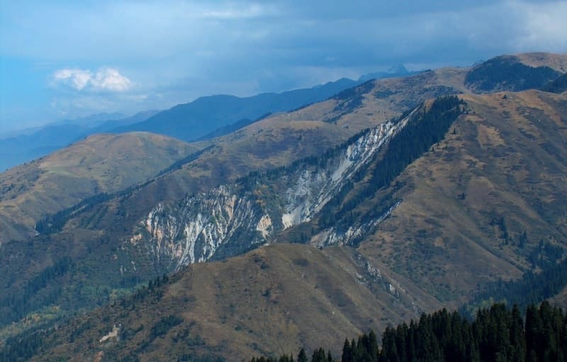
Over a distance of 2 kilometers, he filled up the Aksai Gorge with a 60-meter layer of rock blocks. According to calculations by I.V. Mushketov, during the earthquake of May 28, 1887 on the northern slope of the Trans-Ili Alatau, about 440,000,000 meters of cubic rocks, the weight of which exceeded 1 billion tons, were destroyed and moved.
In the area of the grandiose Akzhar landslide that occurred during the earthquake of 1887, the underground impact of the 1911 earthquake not only failed to destroy the overhanging rock walls of its circus-shaped separation bowl, but did not even displace loose loess deposits from the neighboring slopes.
The intensity of the shaking here was high, because the body of the old Akzhar collapse was “torn and disheveled.” Apparently, the 24 years that have elapsed since the earthquake of 1887 turned out to be too short a period for sufficient compaction of landslide deposits to occur.
The perimeter of the collapse is more than one kilometer; the height of the slopes, devoid of vegetation, reaches 200 meters. The collapse is clearly visible from the western slope of the Aksai gorge from the Zvezdochka dacha area and the Koklay-Sai valley.
You can get to the site of the collapse through the village of Verkhnyaya Kamenka, to the bridge over the Aksai River and immediately after the bridge behind the gas station, turn left and drive along the gorge up to the Aksai forestry. On the left side of the Aksai gorge is the Aksai monastery.
Geographic coordinates of Akzhar collapse: N43°05'59 E76°48'32
Authority:
The book “Stone Dragon”, author V.S. Khromovskikh, Moscow, “Thought”, 1984.
Photos by:
Alexander Petrov.